Last updated: October 6, 2021
Article
Formation of the Stockton Island Tombolo: A 6,000 Year Process

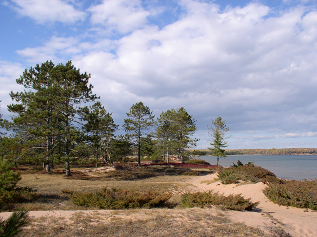
NPS Photo
A tombolo is a landform that develops over time between two formerly separated islands due to specific conditions. Subsequently, tombolos are quite rare. At Apostle Islands, the largest tombolo extends between the previously separate Stockton and Presque Isle Islands. The location and orientation of these islands, and the direction of prevailing storms and winds, contributed significantly to the tombolo formation. In the park, prevailing winds are from the east (in May, June, and August) and from the west (September through April and most of July; Coffin, 1977). These conditions dictate that sand accumulated on the quieter, southern side of the islands and extended in that same direction. Only islands that had enough eroding glacial drift over time could supply the sand required to produce this kind of landform.
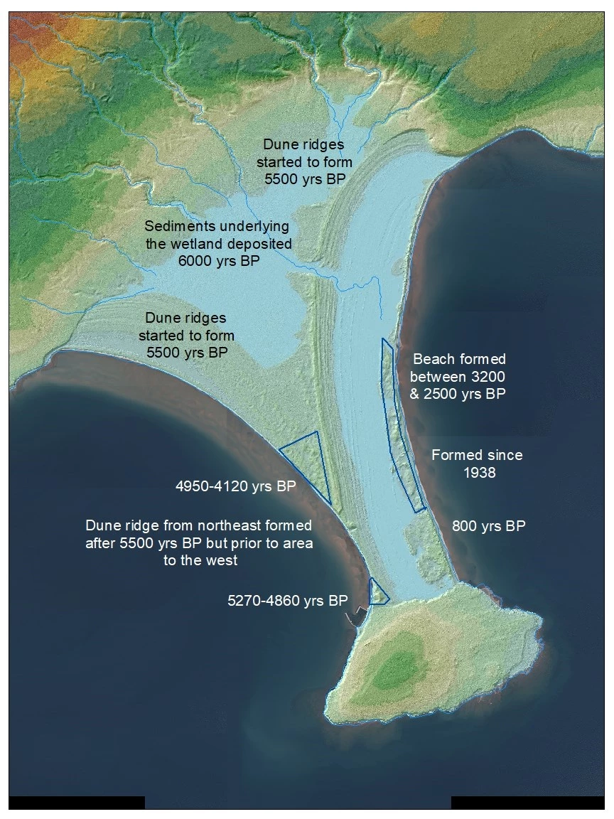
Around 6000 years Before Present (BP) enough sands had accumulated on the south side of Stockton Island (visible in the map below and described here) that a shallow wetland started to form (Swain and Winkler, 1983). Around 5500 years BP Lake Nipissing, which had covered the overall area, began to retreat. This transition allowed dunes to start forming around the wetland. Eventually, a dune ridge evolved to the east due to the better dune building capacity on that side (Coffin). The fetch, or distance that wind travels over open water, is 200 miles on the east side. These conditions allow for the development of larger waves, which can push more sand onshore. This dune ridge extended south between the two islands and constrained lands from the west. Evidence of human occupations (NPS files) near the southern end of the ridge (4950-4120 years BP) and the northwest side of Presque Isle Island (5270-4860) raise questions about when lands between them evolved (see star on map). The older age of the southern site suggests that the area could have arisen from Presque Isle Island and stretched towards Stockton rather than evolving from that direction. In this case, land from the two islands would have met between the two early human occupation sites.
After 5500 years BP and before 3200-2500 years BP, sand accumulated to the east of the dune ridge, followed by the development of a large lagoon, and then beach habitat (Coffin). Recent work (Booth, 2020) indicates the< youngest landform (800 years BP) is the 9-acre pine barrens on the east side. North of this area, beach habitat continued to accumulate as recently as the last century (since 1938).
This summary includes data from multiple sources recorded over time using various techniques. Sediment cores were carbon-dated (Coffin 1977, Swain and Winkler 1983, NPS files, Booth, 2020) along with pollen and charcoal (Swain, Booth). Testate amoebae were collected and used to determine water-table depth history (Booth). Sediments were collected (Lepper, 2020) for aging using Optically Stimulated Luminescence in several locations to refine information gaps on the south and east sides of the bog and around the pine barrens. Finally, park staff compared 1938 and 2010 park aerial photos and identified the most recent habitat formation north of the pine barrens community.
The information provided by these various efforts is invaluable for several reasons. First, it allows a clearer understanding of how this unique landform evolved over a 6,000 year period. It also highlights the recency of some of these changes. In addition to this spatial information, the data provides an understanding of the paleoenvironmental records of interactions between surface moisture, vegetation, and fire. Knowing when and where landforms evolved provides cues to archaeologists searching for artifacts from historical people in the area.

NPS Map
