Last updated: October 3, 2024
Article
Forest Health Along the Upper Mississippi, 2011–2022

NPS photo
In 2011, we set up 33 long-term forest monitoring plots within the approximately 84 square miles of public and private land encompassed by Mississippi National River and Recreation area (MISS). In 2022, we revisited those original sites and established 17 more, bringing the total to 50 monitoring sites.
Our monitoring program documents the density and basal area of live trees (those measuring ≥1 inch/2.5 cm diameter at breast height [DBH]), seedlings, and snags (i.e., standing dead trees); herb and shrub frequency; browse (bite marks on woody species and presence and height of herbaceous species); and taxa richness. Sites are classified into four broad forest types, two in uplands and two in lowlands: upland rich, upland disturbed, box elder-dominated, and silver maple-dominated.
High water levels in 2011 prevented us from getting to many of our planned sites, while on others, water levels had only recently subsided, delaying the emergence of herbs in the groundlayer. Because of these difficulties, we are only able to compare tree, sapling, and snag data between the two sample years.
What We Found
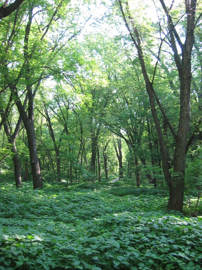
Our three upland rich sites are all in Spring Lake Park Reserve, where we found elm (Ulmus), basswood (Tilia americana), and hackberry (Celtis occidentalis) to be common, but experiencing some degree of impaired recruitment. In 2022, we found lower densities of elm measuring 6 inches/15 cm DBH and below and basswood 4 in/10 cm DBH and below. Bitternut hickory (Carya cordiformis) is also showing declines for individuals smaller than 6 in/15 cm DBH. Overall tree density declined 22%, while the small sapling component fell 41%. (Saplings are trees with DBH ≥1 in/2.5 cm but <2 in/5 cm.) White-tailed deer exert a high degree of browse pressure in Spring Lake Park.
We sampled seven sites in upland disturbed forests, where overall tree density fell 17%. Bitternut hickory dominated the overstory at these sites, but it, along with other common species in this forest type are also experiencing recruitment problems. In the two smallest size classes, densities of elm, ash (Fraxinus), and bitternut hickory all declined since our first visit in 2011. Black cherry (Prunus serotina) trees >2 in/5 cm in diameter also declined, but the density of saplings increased 12-fold, largely due to a growth spurt at one site that was likely the result of invasive buckthorn (Rhamnus cathartica) being removed.
In the nine box elder-dominated sites, overall tree density declined, mainly due to declines in box elder (Acer negundo), elm, and silver maple (Acer saccharinum). The density of large, standing, dead trees (≥12 in/30 cm DBH) increased at these sites.
In silver maple-dominated floodplain forests, overall tree density fell, with declines observed in all five dominant species. Sapling density was also lower at these sites than it was in 2011.
Across all sites, we found no cottonwood trees smaller than 7 in/17.5 cm DBH in 2011 and 9 in/22.5 cm DBH in 2022. American elm is reported by others to be the second or third most abundant species in some floodplains on the upper river, which is consistent with our findings. Along with box elder, hackberry, and green ash, American elm was one of the most common species we encountered, but we did see a notable drop in abundance of trees larger than 6 in/15 cm DBH.

NPS photo
What It Means
Our work largely aligns with what other studies have found, which is impaired regeneration on large river floodplains. Indeed, none of the dominant tree species on our monitoring sites are successfully regenerating. These observations likely reflect both the effect of deer browse and alteration of the river flow regime resulting from impoundment. At upland sites, deer browse is impeding regeneration of all major upland species: red oak, bitternut hickory, basswood, and elm. While browse is also occurring in floodplain sites, prolonged inundation may play a larger role in regeneration failure here. Saplings of silver maple, box elder, cottonwood, elm, and hackberry all have some degree of susceptibility to inundation, ranging from moderate tolerance to completely intolerant. The Mississippi River experienced flooding in 2014, 2017, and again in 2019 when flood stage was exceeded for a record number of days in St. Paul. Sapling decline at floodplain sites is likely a direct result of this.

NPS photo.
What Can Be Done?
Forest management within the park should focus both on invasive species control and floodplain reforestation.
Floodplain reforestation requires a dual approach of research and active management. Research is needed to determine the most effective ways to control invasives, especially reed canarygrass (Phalaris arundinacea), and to identify what is best to plant in place of the invasives once they are removed. Active floodplain reforestation can alleviate many of the issues we found here, although this is expensive, limited in scope, and carries with it a great deal of uncertainty. Nonetheless, projects undertaken at a small scale can provide lessons about which aspects are successful and which are not.
The river system through the Twin Cities metro area provides numerous services, both ecological and otherwise. Many of the park forests at MISS are nearing an inflection point and are at risk of becoming irreversibly altered if countermeasures are not undertaken in the near future. At this point, steps taken to promote ecosystem integrity are likely to be less costly and more effective than those which may be needed after further ecosystem decline.
