Part of a series of articles titled The Oneida Carry.
Article
Early New York State Waterways & the Inland Lock & Navigation Company

New York State Library
The Erie Canal was simply the last “technological update” to an already existing water route linking eastern and western NY. A series of waterways (Hudson River, Mohawk River, Wood Creek, Oneida Lake, Oswego River) served to link Albany with the Great Lakes region prior to the coming of the Erie Canal. The Six Nations Indians had used this series of waterways centuries before any white people were in this area. It would be the interaction between the Indians and the whites however, that would bring about the first large scale use of these water routes for the same sort of trade, business and political purposes that made the later Erie Canal so successful.
In 1624, the Dutch established Fort Orange as a western outpost from New Amsterdam to encourage trade with the Six Nations Indians. After a bloodless takeover by the English in 1624, New Amsterdam became New York City and the Dutch settlement near Fort Orange became Albany, the easternmost point of the future Erie Canal. Despite the benefits of this waterway, the passage was not always easy. On the Mohawk River, first between Albany and Schenectady, and then near the modern village of Little Falls, the natural obstacles of falls and rapids forced travelers to take their boats and cargo out of the river and carry them overland around that dangerous area. Various sections of the river also contained shallow rapids that often forced travelers to move overland as well. Due to the need to carry everything over and around various breaks in the waterways the English called these areas “Carrys.” At the site of Fort Stanwix, a land break between the Mohawk River and Wood Creek forced travelers to move 1 to 6 miles overland. Since this area sat in traditional Oneida Indian land, the English named the site the “Oneida Carry.”
Even though the English established a fortified trading post at the juncture of Lake Ontario and the Oswego River in 1727, some Indians preferred to continue further east to trade and attend church. Combination trading posts and taverns sprang up all along the Mohawk River between modern day Rome and Albany, just as canal towns would spring up along the later Erie Canal. This situation brought the Oneida Carry into a prominent position as people used the area to conduct trade, offer overland transportation, or conduct treaty negotiations.
As with the Dutch, the main trade item between the English and the Indians was fur. While the most often heard complaints came from the Indians claiming unfair treatment at the hands of the traders, things sometimes ran both ways. In the 1720s British colonial officials dealt with 47 separate complaints from merchants claiming that the Oneidas were taking advantage of their control of the Carry. In one case, the Oneida were basically forcing the White traders to employ the Oneida to carry their goods across the carry and charging twice the amount (or more) of the German Palatines in the area. This was to be the predecessor of the tolls that would be charged for the use of the locks in the later canals.

National Park Service
Inland Lock and Navigation Company
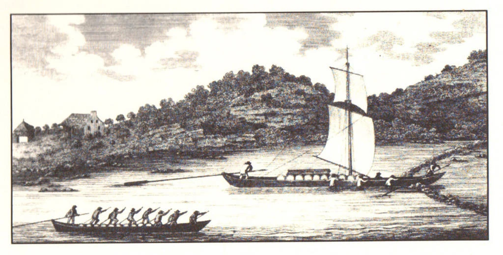
The need to make at least three portages severally limited the size of the boats that could be used and the amounts of cargo that could be carried on the waterways connected to the Oneida Carry. It was the desire to allow passage for larger craft that led to the idea of canals being introduced into the already existing water routes. In 1792, A private company was formed as the “Inland Lock and Navigation Company. With the former New York Continental Army Officer Gen. Philip Schuyler as president, the company began the work necessary to create a continuous deep-water route between Schenectady and the Oneida Carry area. Small scale improvements while money was being raised set the stage for major work beginning in 1793.1793- A combination of deep cut channels and small rock dams allowed travelers to more easily pass through the 57 rifts and rapids on the Mohawk River. 13 short canals cut across the twists and turns of wood Creek shortened the passageway between wood Creek and Oneida Lake by 6 miles.
1795- A one-mile canal with 5 locks eliminated the portage around Little Falls.
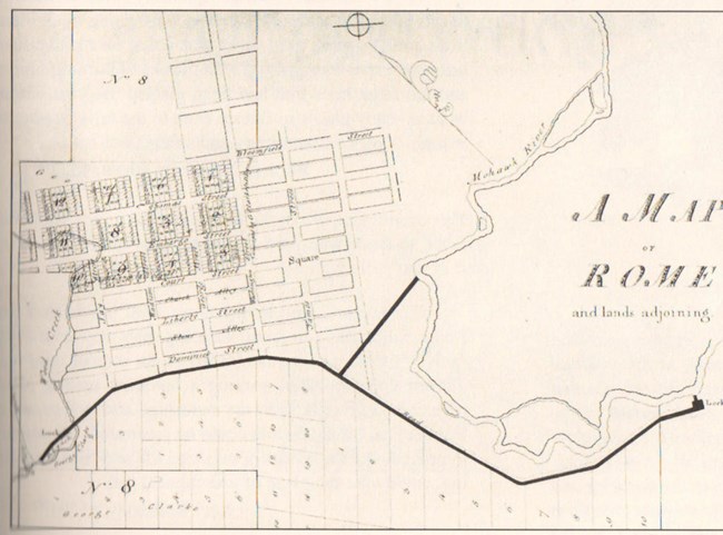
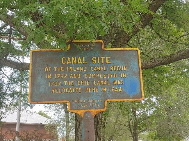
1797- A 1.7-mile canal with two locks near Rome finally allowed travelers to bypass the centuries old “Oneida Carry.”
1798- The one mile and two lock “German Flatts Canal” near modern day Herkimer, allowed boats to travel around two more troublesome rapids in the Mohawk River.
1802-1803- Four locks in Wood Creek turned the last low water areas in Wood Creek into a series of pools that could be easily traveled over.
Despite removing the need for “carrys” and making the water routes useable for larger boats, the Inland Lock Company did not prove to be a very profitable venture, and only survived up to 1820 due to government support. It also did not bring about the sort of economic growth that might be expected to the city of Rome, which began to grow up around the old Oneida Carry in 1792. In 1807, traveler Christian Schultz had this to say about Rome:
“Rome, formerly known as Fort Stanwix, is delightfully situated in an elevated and level country…This village consists of about 80 houses but it seems quite destitute of every kind of trade, and rather upon the decline. The only spirit which I perceived stirring among them was that of money digging, and the old fort betrayed evident signs of the prevalence of this mania, as it had literally been turned inside out for the purpose of discovering concealed treasures."
Begun in 1817 in Rome, the Erie Canal would eventually change Rome from the non-descript town mentioned in 1807 to a successful and small, thriving city.

Christian Schultz’s “Travels on an Inland Voyage” (1810)
Last updated: June 4, 2023
