Part of a series of articles titled Transportation During the Cherokee Removal 1837 - 1839.
Article
Early 19th Century Roads and Turnpikes: Transportation During the Cherokee Removal 1837 - 1839

Image/Courtesy of MTSU Center for Historic Preservation
“After crossing the river, our road ran on a side hill, and was scarcely wide enough for a waggon to pass…the road, in the narrowest place, was eight feet wide, though by actual measurement, it was about 5 ½ feet, of firm ground. One loaded waggon ran off, but was caught, & propped up, till unloaded, & then got onto the road: another turned over entirely, through nothing was broken. At length, all the waggons which had crossed the river, got over this dangerous place and camped, having about a quarter of a mile to go for water.”
- Rev. Daniel S. Butrick, traveling with the Richard Taylor Detachment, November 1, 1838
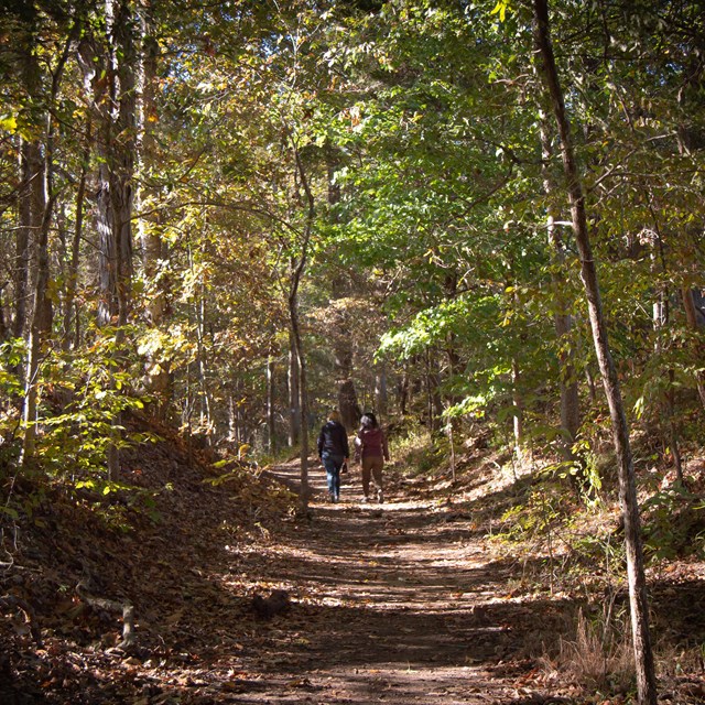
The majority of Cherokee traveled overland on foot during their forced removal to Indian Territory, with some traveling on horses and in wagons. The detachments used a network of well-known, established roads that linked major towns and settlements. These roads, however, varied in width, quality, and condition. Some roads at the time were only passable by horseback or on foot, while others were significantly wider, allowing enough room for wagons and stagecoaches to pass one another. Since all Cherokee detachments that traveled overland contained wagons, carriages, or carryalls to transport both people and supplies, the wider wagon roads were predominantly used to reach Indian Territory; however, detachments occasionally found themselves on hard-to-navigate, narrow roads.
Some states created a system to identify types of roads to help travelers better plan their journeys. Beginning in 1821, Tennessee, for example, created a three-tier system to classify roads. First-class roads were typically stage roads and were generally between 20 feet and 30 feet wide, contained mile markers, were bridged, and usually well-maintained. Second-class roads were 12 feet in width, mile-marked, and “cleared of obstructions so as to afford loaded wagons safe passage.” Third-class roads were only wide enough for a horse and rider. Trees along the roads were notched, so individuals knew the class of road they were traveling on. Alabama had a similar classification or “grading” system in place: First-grade roads had to be at least 30 feet wide, second-grade roads could not be less than 20 feet wide, and third-grade roads could not be less than 15 feet wide. During the Trail of Tears, the Cherokee traveled primarily on first- and second-class roads.

in order to collect tolls.
Image/Courtesy of MTSU Center for Historic Preservation
By the time of the Trail of Tears, road construction in the Southeast had begun to evolve with the introduction of turnpikes. These turnpikes, or toll roads, served as the highways of the era. They helped to better facilitate movement and trade between major towns and cities and were utilized by Cherokee detachments on the Trail of Tears. The number and location of tollgates were unique to each turnpike; however, tollgates could typically not be erected within two miles of the boundary of a town or less than 4–5 miles apart. Tolls also varied from turnpike to turnpike. For example, the Memphis, Somerville, and Bolivar Turnpike, incorporated in January 1838, planned to have 10 tollgates and charge the following fares:
| Item | Cost |
|---|---|
| 20 head of sheep or hogs | $.30 |
| 20 head of horned or neat cattle | $.50 |
| Horse or mule not in a drove | $.06 ¼ , if in a drove $.03 |
| Pleasure carriage | $.18 ¾ |
| Loaded wagon | $.18 ¾ |
| Empty wagon | $.12 ½ |
| Cart | $.12 ½ |
| Foot passenger | $.06 ¼ |
“We paid Forty dollars at the Walerns [sic] Ridge gate, and the man agreed to let the other Detachments pass at half price viz 37 ½ for four wheeled Carriages & 6 ¼ for a horse. On the Cumberland Mountain they fleeced us: 75 Cents a wagon & 12 ½ Cents a horse without the least abatement of thanks. We will avoid several gates on the road to Nashville.”
- Evan Jones, traveling with the Situwakee detachment, to Principal Chief John Ross, October 27, 1838

Image/Courtesy of MTSU Center for Historic Preservation.
During the Trail of Tears, there were reports that some tollgate operators in Tennessee charged exorbitant amounts to the detachments, thus leading four detachments to take alternate routes to Nashville to avoid tolls. Despite the inconvenience of tolls, turnpikes were among the best roads in an area. They were also built with specific construction requirements to ensure their designation as first-class roads, often requiring drainage ditches and culverts, as well as specifying surface materials.

Image/Courtesy of MTSU Center for Historic Preservation.
Research indicates that most of the roads used for removal likely had dirt or gravel surfaces, while some may have been macadamized, a process named for Scottish engineer John Loudon McAdam in which single-sized crushed stone layers are compacted, with a slope from the center to the drainage ditches on the sides, to create a durable road surface. Regardless, conditions varied greatly, and there were numerous reports that detachments, at one time or another, faced poor road conditions along their journeys. Evan Jones, for example, reported to Principal Chief John Ross on October 27, 1838, at McMinnville, Tennessee, that the detachment was “somewhat fatigued with passing so rapidly over the bad roads.” On the same day, U.S. Army Lt. Edward Deas reported the following near Winchester, Tennessee: “[O]ur progress has been necessarily slow, in consequence of the obstructions in the roads over which we have passed.” A week later, on November 3, 1838, Deas continued to complain about the condition of the roads, reporting, “[W]e have pursued the direct road thro’ Fayetville [sic] and Pulaski leading to Memphis part of which we found very rough.” Two days later, Butrick reported in his journal that while passing a particularly “narrow & dangerous part of the road” in the Walden’s Ridge area, a wagon overturned, causing fatal injuries to a member of the detachment. As the journey progressed through the winter months, rain, ice, and snow caused the roads to deteriorate further.

Image/Courtesy of MTSU Center for Historic Preservation.
In the early 19th century, regular maintenance of public roads was a necessity and was typically performed through community efforts and under the direction of an appointed overseer. Just as the quality and condition of roads varied from state to state and from road to road, the process of maintaining the roads varied, as well. A number of states made it a general requirement for all able-bodied men of a certain age, both white, black, free, and enslaved, to work on the road, with few exceptions. The number of days required to work on the roads varied, and some states instituted fines for those individuals who failed to carry out their duties. Despite all the rules in place to maintain roads, early 19th century overland travel was often slow-going and hazardous during inclement weather and in rough terrain.
The invention of the steamboat and railroads, along with vast improvements in the construction, design, and maintenance of roads and turnpikes, marked the beginning of a transportation revolution in the United States during the early 1800s. The Cherokee removal occurred as this revolution began to unfold. While the Cherokee utilized these transformative modes of transportation during their forced removal, it is important to remember that the majority traveled by foot on roads over rough terrain.
This publication was made possible by the Cooperative Ecosystem Studies Unit (CESU) Task Agreement P18AC01316 with National Trails– National Park Service and the Center for Historic Preservation at Middle Tennessee State University.
Read the Full Report
Last updated: December 21, 2021