Last updated: September 10, 2025
Article
Eagle Lake Loop


Overview
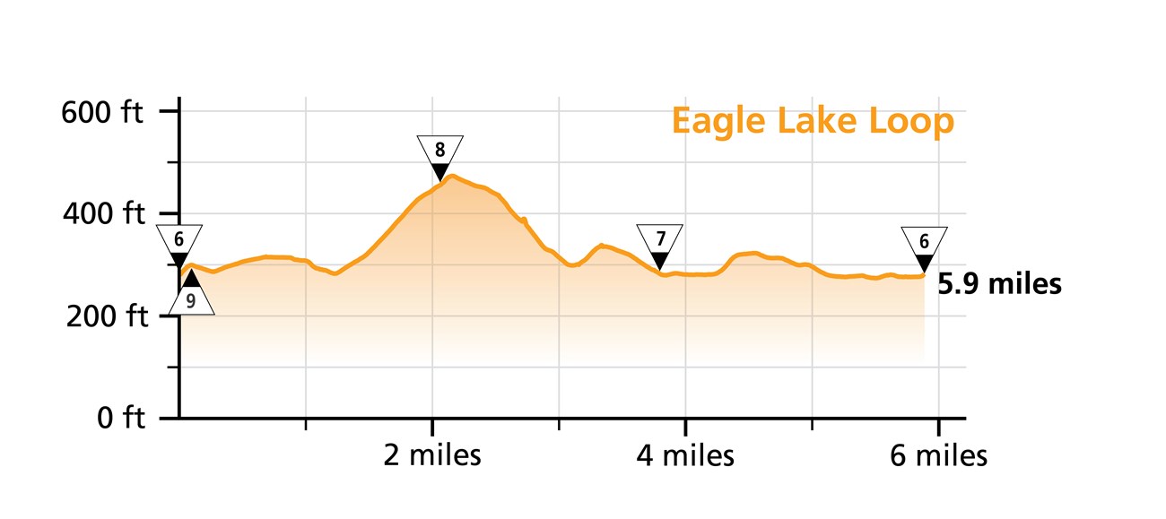
Length: 5.9 miles
Traveling Intersection Numbers: 6-9-8-7-6
The Eagle Lake Loop crosses this carriage road bridge:
-
Eagle Lake Bridge (B)
Experience and Expectations
The Eagle Lake Loop goes around the entirety of Eagle Lake, branching off slightly from the lake itself along its southern and southwestern sides. Bikers typically start this route at either the carriage road parking lot on the north side of route 233 or the boat ramp nearby on the south side.
The eastern and northern sides of the loop between intersections 7 and 9 are mostly level, while the western and southern sides involve a significant incline and decline, marked by a high point at intersection 8. At intersection 8, bikers can either choose to connect with the Around the Mountain and Jordan Pond Loops or continue to follow along the Eagle Lake Loop.
On a manual bike, this loop is estimated to take around 30-40 minutes.
