Last updated: January 14, 2022
Article
Defensible Space at the historic Munising Coast Guard Station

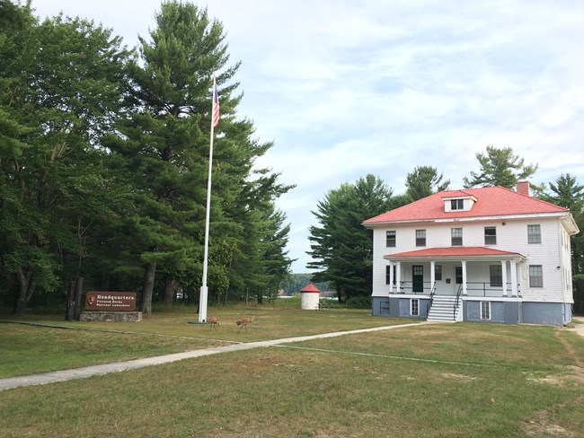
The Park Headquarters for Pictured Rocks National Lakeshore is in the historic Munising Coast Guard Station, located approximately 3 miles northeast of Munising at Sand Point, on the Lake Superior shoreline. The Munising Coast Guard station was staffed as an active life saving station from 1934 until 1964. Shortly after being deactivated, the property was transferred to the National Park Service.
The work conducted by Zone fire staff and the Lakeshore’s Trail Crew focused on removing potential wildland fuels that could threaten the historic structures, while at the same time maintaining the historic landscape around the Park Headquarters complex. This project also served to open views to the lake that were recommended in the site's Cultural Landscape Plan which was an added high-value. Based on the types of potential wildland fuels in the area, mostly low pines and grasses, the majority of the work done consisted of limbing trees (the removal of the lower limbs of the tree so that they cannot serve as a ladder fuel to move a fire from the ground, up into the trees) and removing low brush. This is an important part of creating defensible space around buildings in the wildland urban interface. In this case, removal of lower tree limbs, select areas of brush and some smaller trees also provided to maintain the historical cultural landscape of the retired Coast Guard Station.
Decisions on what treatments a structure needs in order to protect it from wildland fires is based on the NPS Wildland Fire Risk Assessment program (https://wildfire-risk-assessments-nifc.hub.arcgis.com/). Structural hazard assessments are based on the structure’s construction type and materials, Accessibility by fire apparatus as well as availability of water supply, amount of hazardous fuels around the structure, go into a mathematical model based on the NFPA Firewise evaluations.
As part of the National Park Service’s mission to preserve natural and cultural resources, the hazard fuel reduction around the Pictured Rocks National Lakeshore’s Headquarters provides for protection from wildland fires, while also maintaining the area’s cultural historic landscape. The Pictured Rocks National Lakeshore staff and the Great Lakes Fire Management Zone staff collaborated together on this project from planning, to compliance, and finally implementation Davis Horne, Park Superintendent, said “ the project made a lasting difference and the park was absolutely thrilled with the results.”
More information on Defensible Space and Historic Landscapes can be found here (https://mylearning.nps.gov/library-resources/defensible-space-in-cultural-landscapes/).
Information on what homeowners should do to create Defensible Space around their properties can be found at www.firewise.org.
