Last updated: September 24, 2025
Article
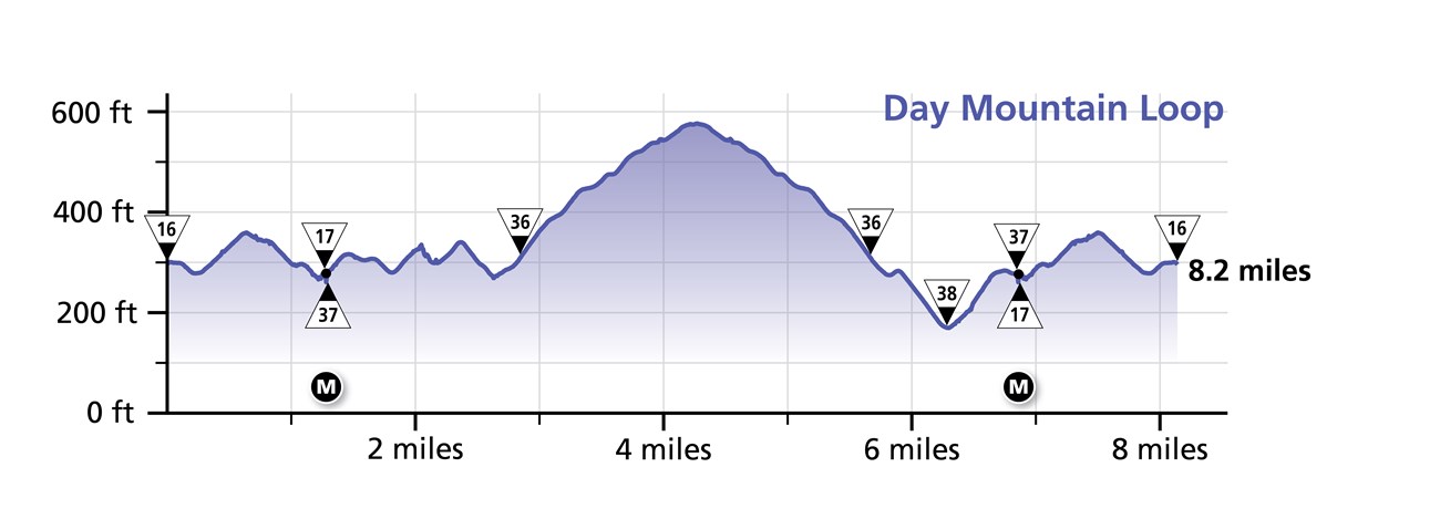
Day Mountain Loop


Overview
Length: 5.3 miles
Traveling Intersection Numbers: 16-17-37-36-38-37-17-16
Up the mountain is an additional 3 miles round trip.
The Day Mountain Loop crosses this carriage road bridge:
-
Triad-Day Mountain Bridge (M)
Experience and Expectations
Special Note: Horse-drawn carriages frequent this loop. Yield and use extreme caution.
The closest of the eight named loops to the Wildwood Stables, the Day Mountain Loop is the one where visitors are most likely to come across horse-drawn carriages. Bikers should be careful on roads made uneven by hoof prints and wheel ruts. The loop has a low point at intersection 38 with a similar grade on either side to either intersection 36 or 37.
On a manual bike, this loop is estimated to take around 30-40 minutes, not including the path up and down Day Mountain.
