Last updated: October 24, 2024
Article
Colonial Maps of the Chesapeake
European colonies were first and foremost economic ventures. Searching for economic opportunity in uncharted lands, mapmaking was a critical first step in the establishment of colonies. In the early 1600s, Spain and Portugal had explored and colonized lands in Central and South America. However, much of North America remained unknown to Europeans.
In 1608, John Smith's mission was to explore the Chesapeake region, find riches such as gold and silver, and locate a navigable route to the Pacific Ocean. Making maps and claiming land for England was a fundamental goal for Smith and his employer, the Virginia Company of London.
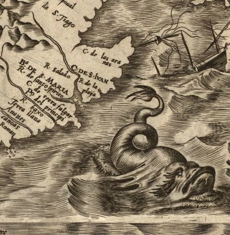
Library of Congress
Early Maps
In 1562, the Spanish cartographer Diego Gutierrez recorded the Chesapeake on a map, calling it "Bahia de Santa Maria," or Bay of Saint Mary.
In 1585, Englishman John White traveled to North America as the artist and cartographer for the first English attempt at an American colony. Their settlement was located on today's Roanoke Island, North Carolina. White went at least twice to the Carolina coast in the 1580s, serving as governor of the ill-fated "Lost Colony." In addition to his maps, White produced drawings and watercolors of the everyday life of American Indians and of the flora and fauna of the Carolina coast.
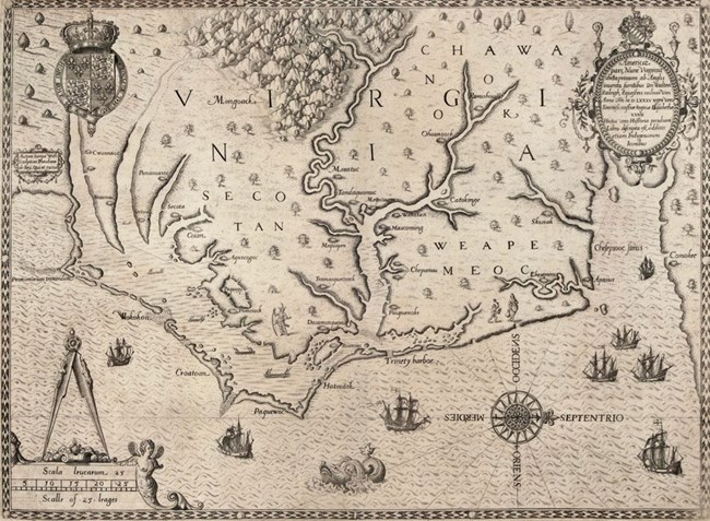
In 1585, White worked with fellow colonist Thomas Harriot to publish a map that they called “La Virginea Pars.” Harriot had studied astronomy at Oxford, and is known for his contributions to maritime navigation.
White revised his original 1585 map by adding names and coastal detail gained from trips to the region in 1587 and 1588. The 1590 version of the map was published in Harriot's A Briefe and True Report of the New Found Land of Virginia and was widely distributed in Theodore DeBry's Les Grands Voyages (The Great Travels), printed in French, English, and German.
The 1590 map was the first printed map that showed the Chesapeake Bay in detail. In this version, the name Chesapeake Bay appears for the first time and the map's orientation has changed to show west at the top.
John Smith's Maps
In 1607, the English established another colony at Jamestown, Virginia. Unlike Roanoke, this colony would survive. One of the colony’s leaders was Captain John Smith, who in 1608 sailed the Chesapeake Bay with a small crew.
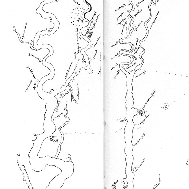
He sketched a map of the Chesapeake Bay which he sent to England ahead of his return in 1609. In England, it fell into the hands of Spanish ambassador Don Pedro de Zuñiga. Known as the "Zuñiga map," it documents Indian settlements and includes travels to the south and west in search of the Lost Colony of Roanoke.
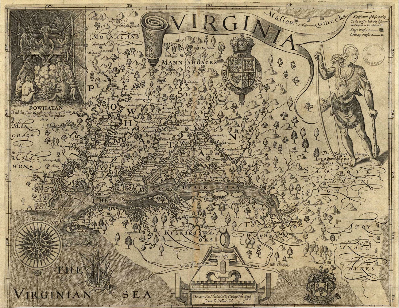
Smith’s complete map was published in 1612 in London and separately in Oxford as A Map of Virginia: with a Description of the Countrey, the Commodities, People, Government and Religion. The map, with slight variations, appeared in other works by Smith and by other commentators on Virginia over the next several years.
Smith's was the most detailed map of Virginia and the Chesapeake region for the next 60 years, until the publication of Augustine Herman's map of Virginia and Maryland in 1673. Altered reproductions of Smith's 1612 map stayed in print for most of the 17th and 18th centuries. All in all, his map influenced colonization of the region for nearly a century and, together with his writings, provide the most comprehensive written descriptions of the Native peoples and environment of the Chesapeake Bay prior to European invasion.
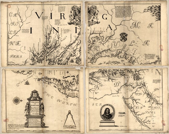
Augustine Herrman's Map (1673)
Who was the next person to map the Chesapeake Bay after John Smith? In 1673, Augustine Herrman's map was published in London, titled "Virginia and Maryland As it is Planted and Inhabited this present Year 1670."
Born in Prague and raised in the Netherlands, Herrman had first come to Maryland as an ambassador of the New Netherland colony. He spent ten years creating the map, which aided him in his work negotiating boundaries with Maryland and Virginia.
Herrman's map was an improvement on John Smith's work. It included rivers and other features that John Smith had missed. Herrman also shows the Delaware Bay and the southern portion of New Jersey. His rendering served as the primary map of the region for the next century.
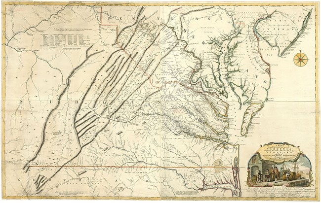
Fry-Jefferson Map (1753)
The next comprehensive map of the Chesapeake Bay was produced by none other than the father of Thomas Jefferson. In 1750, the acting governor of Virginia, Lewis Burwell, comissioned a map that would show the region in more detail. To complete this project, he comissioned two surveyors, Joshua Fry and Peter Jefferson.Notably, the Fry-Jefferson map provides a more precise view of the Appalachian Mountains and the Chesapeake Bay's coastline than previous maps. Also, the map is finally drawn in the more familiar North-upwards orientation.
