Last updated: August 19, 2023
Article
Climate and Ste. Genevieve

NPS Photo/C. Casey
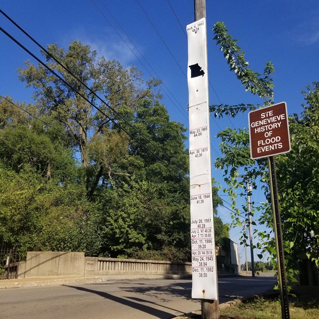
Ste. Genevieve’s location near the Mississippi River means that it has always been threatened by floods, but over time the frequency of severe flooding has grown. In 1785, the flooding became so severe at the town's original settlement that the whole village relocated to its present spot. The new location was adjacent to the edge of the Mississippi River floodplain but on higher ground. Extreme flooding became less frequent with the movement of town until the middle of the 1900s. The town flood gauge started to record floods in the 1940s. The gauge measures floods of at least 38 feet all the way to the largest flood in 1993 at 49.5 feet of water over the course of five decades.
What the flood gauge does not show is the addition of the town levee and the numerous close calls in the recent years. The severity of the 1993 flood and the fact that it reached town in several spots pushed the town to create a 50-foot modern levee to help prevent flooding. In as recent as 2019, the levee was threatened by more flooding.
Flooding is not the only concern with the Mississippi River as droughts are also more frequent. In recent years, the Mississippi River has gone from a steady flow to dry enough to walk half a mile across. The river has experienced extreme shifts that effect the safety and industries of town that rely on the floodplain for farming and river for shipping.
