Last updated: January 14, 2025
Article
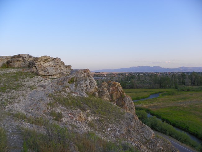
Clark’s Lookout

Flickr, https://www.flickr.com/photos/jstephenconn/3864355847/, CC BY-NC 2.0
From the top of this limestone outcrop, known as Clark’s Lookout, Captain William Clark took compass readings of the course of the Big Hole and Beaverhead Rivers on August 13, 1805. Clark remarked in his journal that the expedition members had difficulty hauling their canoes over shoals in the cold water.24
Water is valuable in this area, with high demand for irrigated crops, livestock pasture, and fish habitat. In 2016, as part of a National Drought Resilience Partnership, the Beaverhead Watershed Committee conducted streamflow studies and worked with stakeholders to draft a Beaverhead Watershed Drought Resiliency Plan. They documented effects of climate change in the watershed, including earlier spring runoff, lower peak runoff, decreased summer streamflow, and warmer water temperatures. Conflict among users for limited water resources is one result of these changes.25
Citations:
24 NPS, “Clark’s Lookout,” Pittsburgh to the Pacific: High Potential Historic Sites of the Lewis and Clark National Historical Trail, 2022, 75, https://www.nps.gov/lecl/getinvolved/upload/2022_LCNHT_HPHS_Report_508compliantUPDATE-2.pdf; William Clark, August 13, 1805 entry, in Gary E. Moulton, Journals of the Lewis and Clark Expedition, https://lewisandclarkjournals.unl.edu/item/lc.jrn.1805-08-13.
25 Crystal J. Stiles and Eliot Wickham, “Drought Resiliency Planning Prepares Stakeholders for New Conditions,” U.S. Climate Resilience Toolkit, last updated May 10, 2024, https://toolkit.climate.gov/case-studies/drought-resiliencyplanning-prepares-stakeholders-new-conditions; Chris Carparelli, “Beaverhead Watershed Drought Resiliency Plan,” (n.p.: Beaverhead Conservation District and Beaverhead Watershed Committee, 2016), https://www.beaverheadwatershed.org/wp-content/uploads/2017/08/Beaverhead-Drought-Resiliency-Plan-2016.pdf.
