Last updated: January 31, 2024
Article
The Rapidly Changing Sit’ Tlein (Malaspina Glacier)

NPS/Anna Thompson
Glaciers in Alaska, and across the globe, are changing—with very few exceptions, retreating. To learn more about how Sit’ Tlein is changing, we mapped the surfacial geology and compared with previous mapping completed in 1958. The primary difference was in lake area—proglacial and supraglacial lakes near the terminus. These lakes (and lagoons) are mostly located between the glacier and the small strip of land that acts as a barrier between the glacier and the ocean. One of them, Sitkagi Lagoon, is receiving occasional saltwater inputs from the ocean, which is predicted to accelerate glacial retreat.

The terminal lobe of Sít’ Tlein is protected from the Pacific Ocean by a narrow, vegetated strip of land dotted with proglacial lakes. Ice of the lower piedmont lobe is largely covered with debris and vegetation. Both the lakes and vegetated areas impact the rates of melt and calving and, therefore, impact ongoing evolution of the glacier itself.
This mapping project was initially conceived, in part, as a follow-up to surficial mapping done by George Plafker and Don Miller, completed in 1958. That project mapped a comparable portion of Sít’ Tlein and similarly focused on both the glacier foreland and the glacier ablation zone. Given that the 1958 publication was based upon interpretation of aerial photographs collected in 1948, the present work provides an opportunity to assess well over a half-century of change.
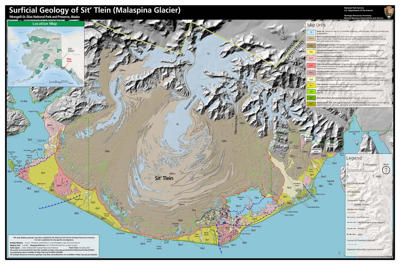
The Geologic Map of the Surface
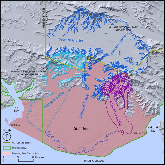
Most of the mapping area is dominated by the ice of the piedmont lobe itself. Glacier ice collectively covers nearly 80% of the mapping area and well over half of that is debris covered–mostly with thick, supraglacial debris. Except in the vicinity of Malaspina Lake, the modern ice boundary we mapped does not vary more than 1 km from the boundary mapped in 1958. Our contemporary ice margin is both more and less advanced than Plafker and Miller’s, depending on location along the foreland, suggesting that most of these relatively small differences are more attributable to mapping errors than actual marginal retreat.

Full-size digital copy available at https://irma.nps.gov/DataStore/Reference/Profile/2301821
The Proliferation of Lakes
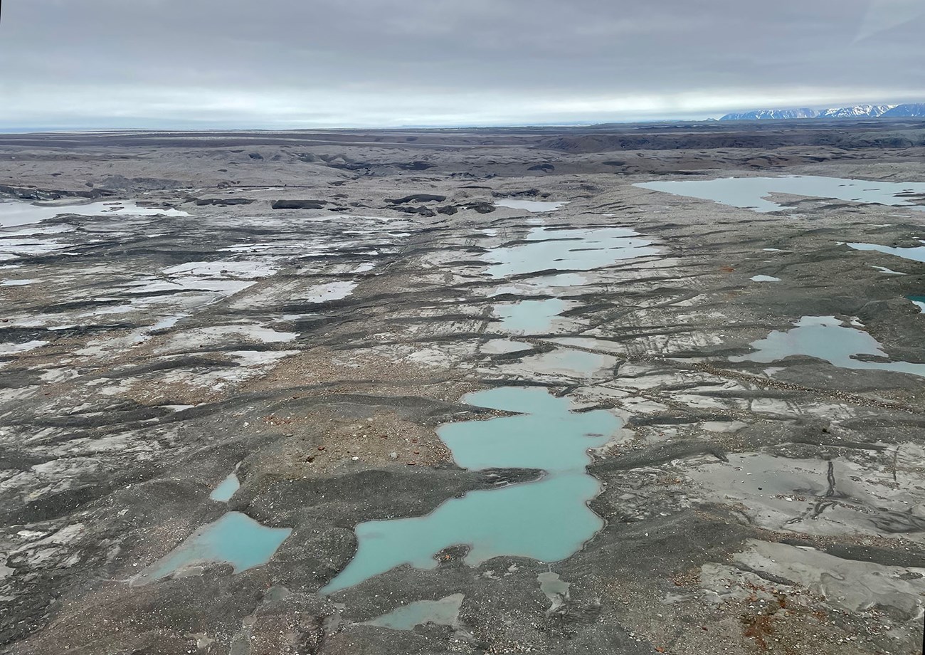
Our maps reveal one significant progressive change in the Sít’ Tlein foreland: the growth of proglacial and minor supraglacial lakes. In the vicinity of Malaspina Lake, the more substantial change (retreat) of the ice margin can be attributed to the substantial growth of Malaspina Lake since 1958. Numerous other lakes have also appeared or grown since then. Some of the lakes are not technically proglacial, but lie within the glacier margin and are more appropriately termed supraglacial. These generally occur within areas of substantial thermokarst development and are often ringed by steep debris-covered ice cliffs mantled by alders and sometimes other vegetation. In any case, the collective amount of impounded water along the glacier foreland is large and substantially growing.

We recognized that rapid and consequential changes in the sizes, locations, and shapes of lakes within the mapping area deserved special attention. Perhaps surprisingly, given significant changes in the glacier itself over the last half-century, supraglacial deposits have not changed dramatically since 1958; the most significant changes we found were related to lake development.
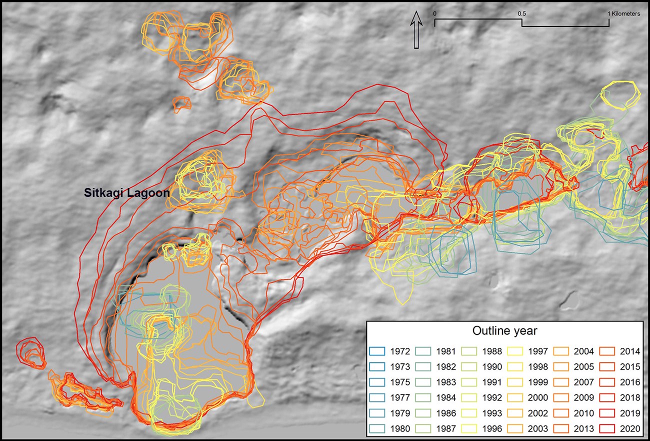
Other than Malaspina Lake, the largest and most persistent lake, proglacial lakes were uncommon in the foreland in 1958. Our mapping shows that lake numbers on the Seward Lobe increased from 5 to more than 200 between 1972 and 2020. Most of the new thermokarst lakes (lakes caused by melting of ice and consequent subsidence of the land surface) are small, compared to Malaspina Lake, but may be having strong impacts on the future evolution of Sít’ Tlein. One of these new lakes, Sitkagi Lagoon, is ice-walled and receives input from the Pacific Ocean, portending the possible initiation of catastrophic tidewater glacier retreat.

Sitkagi Lagoon provides a good example of how small lakes can merge into larger bodies of water over time. Numerous small thermokarst lakes formed independently between 1972 and about 2013. Around 2013, many of these smaller lakes began to coalesce. Analogous joining events contributed at various times and places toward minor reductions in lake numbers. Coalescence of independent thermokarst lakes also explains the pattern, in some areas, of progressive lake margin retreat—a process that seems at first to contradict the broader pattern of lake growth and development. Despite overall growth of the lake, the shoreline of that particular arm clearly retreats into deeper water between the 1970s and ‘80s and the present. Sitkagi Lagoon, is immediately adjacent to, and receiving sporadic saltwater inputs from, the Pacific Ocean, potentially enhancing opportunities for melt, calving, and initiation of catastrophic tidewater glacier retreat. Our mapping, in other words, documents a recent period of relative stability but depicts trends in lake development that might portend a more dynamic future.
