Last updated: July 20, 2021
Article
Bridges of the Niobrara
Bobbie Roshone
The Bridges of the Niobrara
Fifteen bridges span the Niobrara National Scenic River in north-central Nebraska. Of these, five are on the National Register of Historic Places. Two other spans, the Bryan Bridge and the Cowboy Trail Bridge lying just upstream of the western boundary of the scenic river, are also included in this narrative.
Federal Highway Administration.
Bryan Bridge
Located just upriver of the Niobrara NSR boundary, an elegant arched bridge graces the river. The historic Bryan Bridge was completed in 1932 and named after then-Governor Charles W. Bryan. In the same year it also won the American Institute of Steel Construction Annual Award of Merit as the “most beautiful bridge constructed in 1932 costing less than $250,000.” The bridge was designed by Russian immigrant Josef Sorkin, a graduate of the University of Nebraska’s College of Engineering. It is the only bridge of its kind in Nebraska, with a three-span arched cantilever truss, with a central pin. This design allows the bridge to span most of the river without support. When asked why he choose the style, Sorkin responded, “With its steep banks and beautiful streambed, the Niobrara River lent itself well to a dramatic structural statement, and the Nebraska Highway Department took full advantage of this rare opportunity to flex its engineering muscles.” In 1988 Bryan Bridge was added to the National Register of Historic Places. Today, you may drive over the elegant bridge and stop to read the historical marker found along it.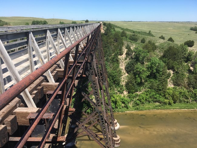
Bobbie Roshone
Cowboy Trail Bridge
Off of Highway 20 on the north side (upriver of the Niobrara NSR boundary)
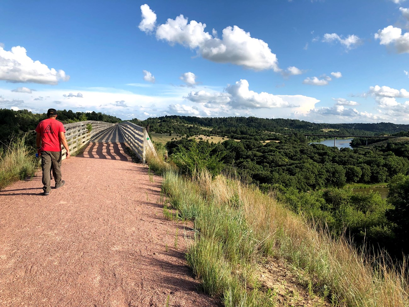
Dominating the landscape along Highway 20 is the Cowboy Trail Bridge. It is the tallest bridge in Cherry County at 148 feet and spans a quarter mile across the Niobrara River. Originally completed as a railroad bridge in 1910, the Chicago & North Western Railway Company called the route the “Cowboy Line.” When the route was later abandoned in 1992, the State Game and Parks Commission memorialized this route as a multiuse trail. In partnership with Rails-to-Trails, the old railroad bridge was converted into a footpath that gives grand views of the natural scenery and slower moving section of the Niobrara River. To walk on the bridge, park in a lot east of Valentine on Highway 20 and go west for about a quarter mile.
NPS Photo
Borman Bridge
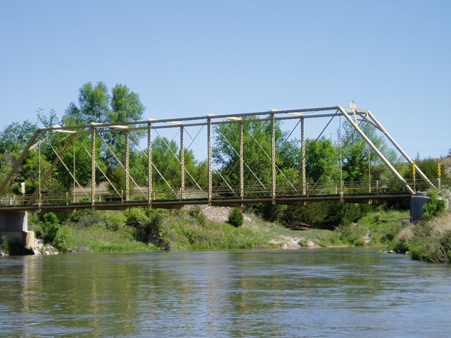
Borman Bridge marks the western boundary of the National Scenic River. It is located 2.3 miles southeast of Valentine. On February 16, 1916 an ice jam swept away the original bridge. Once the county commissioners ordered a replacement span, the Canton Bridge Company had a new bridge built within a month. It was built using a pin-connected Pratt through truss, which was the bridge of choice for a medium-scale river crossing in Nebraska at the time. Borman Bridge is a one lane, wooden-decked bridge that is still operational. With its old school design, it is history in use. In 1992 Borman Bridge was added to the National Register of Historic Places. For closer views or to explore the river bank, park in the Borman Bridge State Wildlife Management Area lot immediately south of the bridge.
NPS Photo
Cornell Bridge
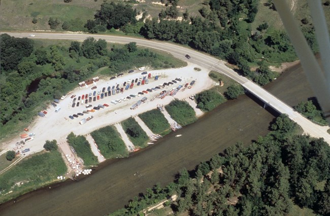
Cornell Bridge, was named after a prominent pioneer of Valentine, Charles H. Cornell, who founded First National Bank. He built a dam upstream of the bridge in 1915 that provided electricity for Valentine and also bears his name.Just upstream of Cornell Bridge is the Fort Niobrara Launch Site, the first launch in the scenic river section.

NPS/ Argentine Productions
Buffalo Bridge (Bison Bridge)
About two miles downstream of Cornell Bridge is Buffalo Bridge. This bridge is not open to vehicle traffic and is a part of the Fort Niobrara National Wildlife Refuge's wilderness section.The bridge is also part of the Wilderness Access Foot Trail connecting the north and south sides of the river. In the spring and fall the staff at Fort Niobrara Refuge use the bridge to move the bison herd back and forth between wilderness pastures on the north bank and grassland prairies on the south side.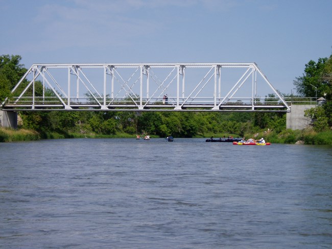
NPS Photo
Berry Bridge (Berry State Aid Bridge)
Berry Bridge is a charming, one-lane, wooden-decked bridge that provides a beautiful view of the river and nearby Berry Falls. Completed in 1921 by the Pioneer Construction Company, the bridge is one of the few surviving bridges built under the State Aid Bridge System. The bridge was added to the National Register of Historic Places in 1992 as “a well-preserved, long-span example of the riveted Pratt through truss.” Berry Bridge is heavily used in the summer. Both the bridge and the nearby falls are named Berry. Likely named after Susan J. Berry, a widowed homesteader who settled nearby in 1883 with eight children. The original Berry Bridge (1899) was one of only four bridges intact after the previously mentioned 1916 ice-jam flood. You can also see the two rusted bases of an older bridge just upstream. That bridge was moved in 1921 to become Brewer Bridge.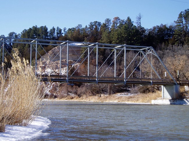
NPS Photo
Allen Bridge (Bell Bridge)
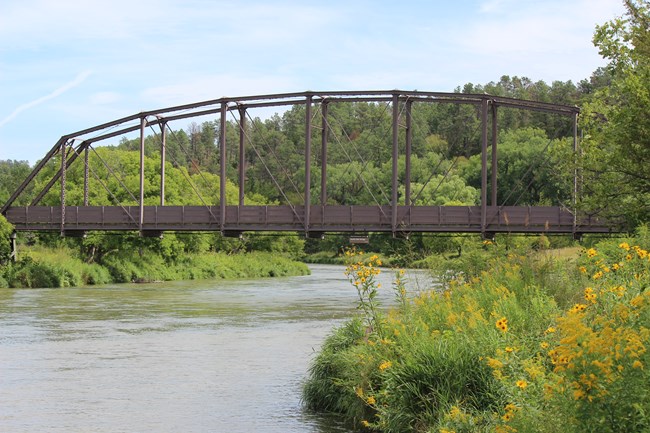
When a river crossing called “Bell” became very popular with the local community, the Cherry County Commissioners decided to have a bridge built there. The pin-connected Pratt through truss bridge was built by the Canton Bridge Company in 1903. Spanning 188 feet, it was the longest single-span bridge on the Niobrara River at the time. It withstood the 1916 ice jam flood and continues to serve the public today, now called Allen Bridge.Allen Bridge was added to the National Register of Historic Places in 1992, “distinguished as one of the handful of pre-1916 trusses remaining intact in the county and one of the oldest intact through trusses in Nebraska.” You can see a series of small waterfalls from the bridge; the tallest is around 20 feet. The road after this bridge is the property of a private outfitter.
NPS/ Roshone
Verdigre Bridge (Smith Falls Foot Bridge)
The bridge at Smith Falls has moved twice in its lifetime. Verdigre Bridge was built in 1910 on the mouth of Verdigre Creek near the town of Niobrara, NE. The bridge is 160 feet long, has nine panels and is pin- connected. Several years later it was dissembled and, from 1922-1993, used as the Highway 14 bridge near the town of Verdigre. In 1996 it was moved once more, this time nearly 155 miles, to its present location at Smith Falls State Park. After narrowing the bridge to 10 feet, it became a foot bridge that connects the north side of the river, where the park office and campground is located, to the splendor that is Smith Falls. The bridge is a wonderful place to get great views of the river.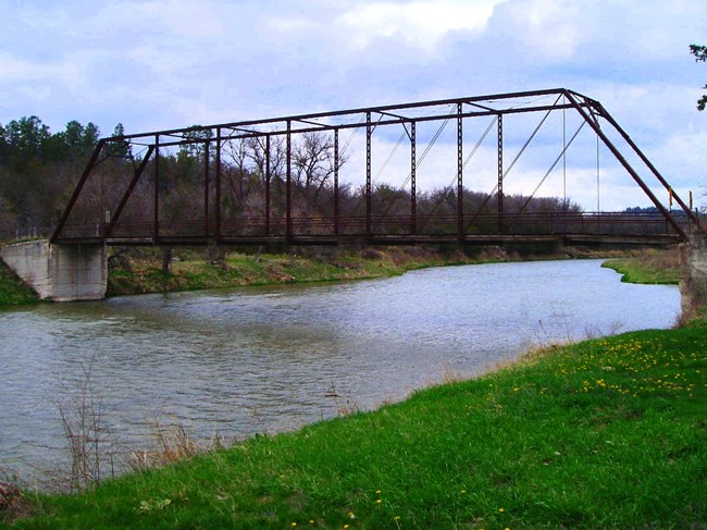
NPS Photo
Brewer Bridge
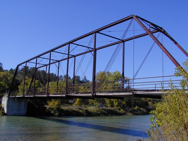
When the 1916 ice jam flood washed away the old Brewer Bridge, it needed to be replaced.When the County Commissioners received news that “Berry Bridge [located upriver] is to be removed for the reason that the government will not accept it on a federal state aid road,” an answer appeared. The old Berry Bridge, which only sustained minimal damage in the flood, would be moved five miles east to its present location at Brewer Landing in 1921. The bridge was built by the Wrought Iron Bridge Company of Canton, Ohio, in the familiar pin-connected Pratt through truss style, which seemed to hold up better during the flood.
Now called Brewer Bridge, it is the oldest bridge still in use in Cherry County. However, today there is no public vehicle or foot access. Considering its age, beauty, and usability, it is a prime example of this style of bridge; it joined the National Register of Historic Places in 1992. The Middle Niobrara Natural Resources District’s Brewer Bridge Landing is a lovely place to sit, eat lunch, and take in a scenic view of the bridge and the river.
NPS Photo
County-Line Bridge
County-Line Bridge is privately-owned and no longer carries vehicle traffic. Some local historians feel that the old “rocky ford” was actually nearer to this vicinity rather than at the Bruce Mill Site at present-day Rocky Ford.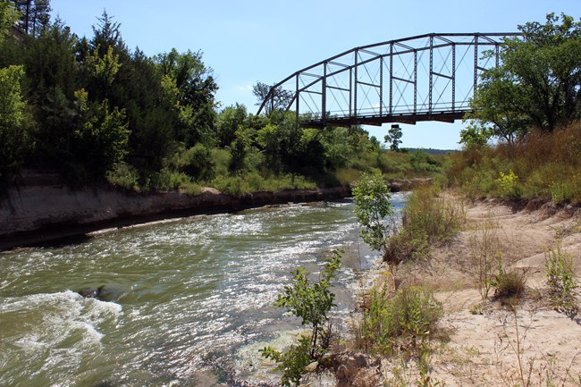
Bobbie Roshone, 2014
Norden Bridge
In 2016, a new bridge was put in south of Norden, Nebraska that replaced the span that was built in 1964. The bridge installed in 1964 replaced the old span destroyed by a spring flood that occurred in May of that year. The concrete supports from the bridge built before 1964 can still be seen just downstream. Of interest is the Norden Chute and falls. In 1960 the falls were located at the east end of the chute; forty years later they have migrated to the far west end. It is not recommended that boaters attempt to canoe the falls. The water is reputed to be over 20 feet deep in the chute and is fast and turbulent, with large boulders and unseen objects beneath the surface. On summer weekends local anglers often try their luck here for channel catfish.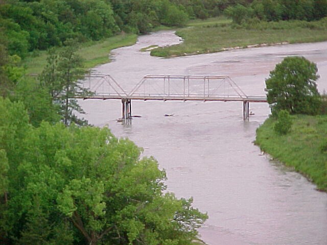
NPS Photo
Meadville Bridge
Meadville Bridge crosses the Niobrara River about 14.5 miles north of Ainsworth, Nebraska. Just before reaching the river from the south, an arched-opening in a cliff face provides a scenic vista of the rural valley below. Plum Creek flows into the Niobrara just upstream of the bridge. The village of Meadville is located on the north bank. Downstream of the bridge is river access for boaters. In 2019, during the Bomb Cyclone the landing access point on the north bank was was washed away. Floaters can still launch from the state right of way on the south bank.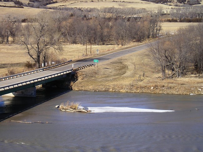
NPS Photo
Highway 183 and 7 Bridges
Today, modern concrete and steel bridges provide important river crossings for highways 183 and 7. There is decent boat access to the river on the north bank, downstream side of the Highway 7 Bridge.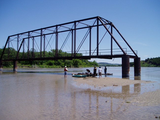
NPS Photo
McLain Bridge
This is an abandoned bridge between Highways 183 and 7 about three miles upstream of Long Pine Creek. This bridge to nowhere toppled in the 2019 Bomb Cyclone, there are no plans to replace or repair it at this time.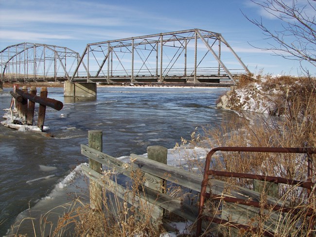
NPS Photo
Carns Bridge
Persistent winter ice finally wrecked the original wooden bridge at Carns in 1910. In the following year Brown and Keya Paha counties received financial aid to replace it with a 6-span concrete bridge (each 54 feet long) in 1913. By 1962 the river had widened and washed out one of the bridge’s spans and a long portion of the county road. Two salvaged trusses were added to complete repairs. Although the original integrity of the bridge was altered, it is still the oldest state aid bridge in Nebraska. In 2019, the south approached washed away in the Bomb Cyclone. Currently, Nebraska Department of Transportation is working to competely replace the bridge.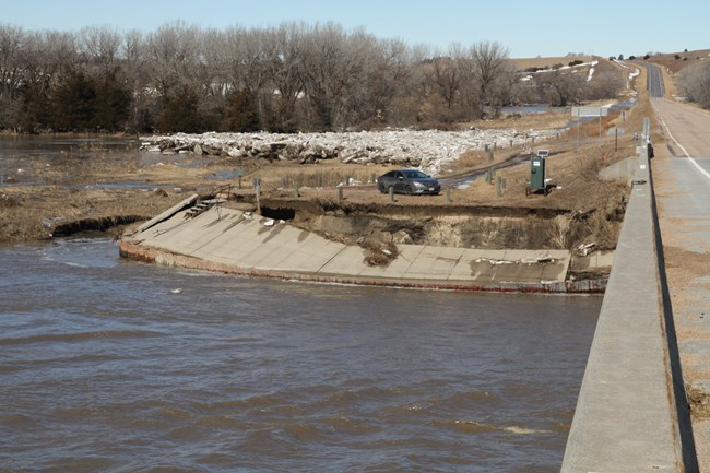
NPS/ Warrick
