Part of a series of articles titled Water Resources Monitoring in the Bighorn River at Kane, Wyoming, 2019.
Article
Bighorn River at Kane, Wyoming

NPS
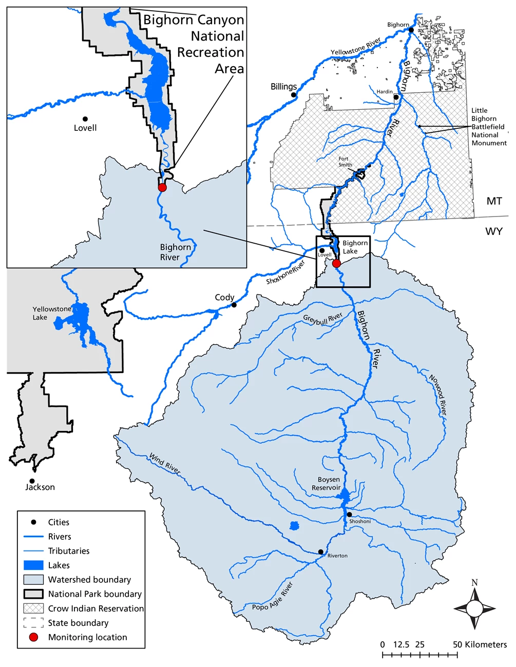
The Bighorn River is the largest tributary of the Yellowstone River. The river flows from central Wyoming north into Montana and receives water from west central Wyoming and a small area of south-central Montana. It is formed by the confluence of the Wind River and the Popo Agie River in west central Wyoming. Upper reaches of the river are impounded as part of the Boysen Reservoir project near Shoshoni, Wyoming. Major tributaries to the Bighorn River include the Greybull and Shoshone rivers.
In 1967, construction of Yellowtail Dam was completed downstream of the confluence with the Shoshone River and Montana-Wyoming border forming Bighorn Lake. An afterbay pool is formed by a smaller dam, the Yellowtail Afterbay Dam, that was constructed on the Bighorn River 2.2 miles (3.5 km) downstream from the larger Yellowtail Dam.
The Bighorn River downstream of the Yellowtail Dam travels approximately 90 miles (145 km) before emptying into the Yellowstone River near Bighorn, Montana. In total, the Bighorn River travels a length of 236 miles (380 km) from the Boysen Reservoir to the Yellowstone River. There are major irrigation projects on the river at Riverton, Wyoming, and Bighorn, Montana. In downstream reaches of the river extending from Kane, Wyoming, to Fort Smith, Montana, Bighorn Canyon National Recreation Area (NRA) straddles the Bighorn River and its impounded section, Bighorn Lake. From that point to Hardin, Montana, the Bighorn River flows through Crow Reservation lands. At Hardin, Montana, the Little Bighorn River (site of the Little Bighorn Battlefield National Monument), joins the Bighorn River.
The Bighorn River watershed contains 16 impaired stream segments downstream of Boysen Reservoir and upstream of Bighorn Lake listed on the 2012 303(d) impaired waters list (WYDEQ 2012). For the purpose of this web report, we summarize the listed river segment as the confluence with the Greybull River to a point 10.5 miles (16.9 km) downstream and upstream of Bighorn Lake (WYBH100800100301_01; WYDEQ 2016). The cause of impairment for this section is fecal coliform bacteria. The primary nonpoint sources contributing to the impairment are identified as agricultural runoff, wildlife contributions, and human sources. There are also multiple, permitted Wyoming Pollution Discharge Elimination Systems (WYPDES) in the watershed (Oswald et al 2013).
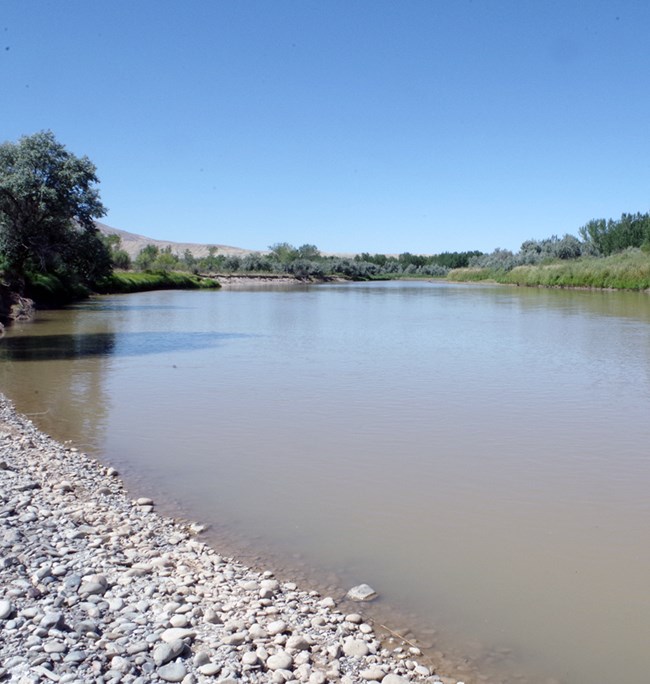
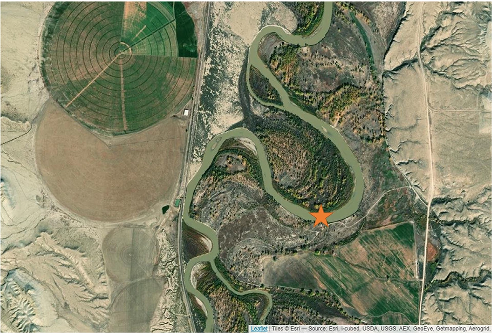
The Bighorn River monitoring site at Kane, Wyoming, is upstream of Bighorn Lake and is within the Yellowtail Wildlife Management Area. The monitoring site is approximately 2.7 miles (4.4 km) downstream of the US Geological Survey Bighorn River at Kane gaging station (USGS 06279500) and just upstream of Bighorn Canyon NRA. This reach of the river can be characterized as having a low gradient, high width-to-depth ratio, and highly weathered materials. Bank sloughing is present in this meandering section and the river exhibits signs (highly eroded banks) of lateral instability.

NPS

NPS
References
Oswald, J. K., C. M. McCutcheon, and C. S. Foreman. 2013. E. coli Total Maximum Daily Loads for the Bighorn River Watershed. Topical Report RSI-2289 prepared for Wyoming Department of Environmental Quality, Cheyenne, WY.
WYDEQ 2012. Wyoming Water Quality Assessment and Impaired Waters List (2012 Integrated 305(b) and 303(d) Report). Document #12-0203. Wyoming Department of Environmental Quality, Cheyenne, Wyoming.
WYDEQ 2016. Wyoming 2014 Integrated 305(b) and 303(d) Report. Document #16-0126. Wyoming Department of Environmental Quality, Cheyenne, Wyoming.
Lists of 305(b) and 303(d) waters are available on the WYDEQ website.
Last updated: September 24, 2022
