
Photo by Josh Helling (used with permission). 
Photo by Scott Stine (used with permission) Even if you’re not a geologist, the mesmerizing relicts that glaciation has left behind on the Yosemite landscape are inescapable. The Yosemite region has been at the forefront of North American glacier research for more than 150 years. This area served as a natural laboratory to legendary geologists like Josiah D. Whitney, Joseph LeConte, John Muir, Francois Matthes, and more. Matthes published the first detailed map showing the extent of glaciers in the park in 1930, and other geologists have been building on this work ever since. To Clyde Wahrhaftig, a geologist with the US Geological Society (USGS) and the University of California, Berkeley, mapping and unraveling the complexities of Yosemite’s past ice ages was a labor of love. From the 1950s until his death in 1994, he worked diligently mapping the extent of the area’s most recent glaciation. Knowing he would not finish the map, Clyde left an allowance in his will for others to do so. Using the funds provided by Clyde’s trust, as well as draft maps and detailed notes he left behind, the National Park Service and USGS collaborated on producing an updated map of the extent of icefields and glaciers during the Last Glacial Maximum. In the Sierra Nevada, the Last Glacial Maximum is referred to as the Tioga glaciation and is the most recent glacial period occurring about 20,000 years ago. Previous, larger glaciations occurred many times over the past 2–3 million years. Geologists used classic geological methods juxtaposed with new techniques to determine the extent, flow direction, and thickness of the major glaciers that used to dominate the park landscape. 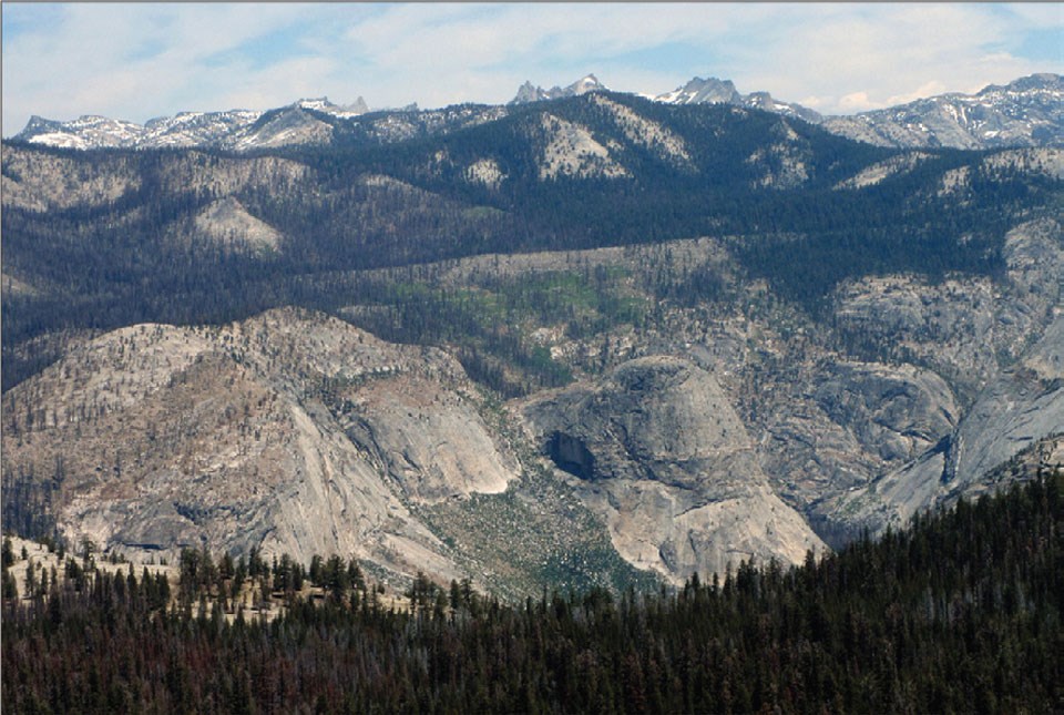
How extensive were the glaciers?During the maximum extent of the Tioga glaciation, glaciers and ice fields covered most areas in and around Yosemite National Park above 8,900 feet (2,700 m) in elevation. Glaciers in the map area occupied six major drainage basins: the Tuolumne, Merced, and San Joaquin River basins on the western slope of the Sierra Nevada, and, on the eastern slope, basins of the Walker and Owens Rivers, and Mono Lake. The largest of these was the Tuolumne glacier, stretching the massive distance of nearly 50 miles(80 km) from Mount Lyell, down the Grand Canyon of the Tuolumne River and through Hetch Hetchy Valley. Smaller valley glaciers flowed down the canyon of the Merced River, near Bridalveil Meadow in Yosemite Valley, as well as down the South Fork Merced River as low as 4,000 feet (1,250 m) elevation near Wawona. Researchers mapped the extent of Tioga-age glaciers by identifying features out in the field indicative of glacial boundaries such as moraines and truncated ridgelines. They also used aerial photographs, shaded-relief maps, as well as lidar (light detection and ranging) data. Lidar is a surveying method that uses a pulsed laser to produce a three-dimensional, high-resolution map of a landscape. In locations where the relative ages of moraines were unclear, researchers determined how long moraine boulders had been exposed by measuring the presence of radioactive isotopes formed as a result of cosmic ray bombardment (cosmogenic beryllium-10 exposure dating). 
What directions did the glaciers flow?In general, glacier flow directions in and around Yosemite National Park followed the major drainages of the Merced and Tuolumne Rivers. The direction of ice flow is steered by the surface slope of the glacier, not necessarily by the ground topography. As ice builds up at higher elevations, it will begin to flow down the existing landscape, generally following river canyons. To determine general directions, the authors identified landscapes that were streamlined by glacier flow. Flow directions and patterns of the glaciers were further established using various geological evidence that glaciers left behind such as striations, streamlined bedforms such as roche moutonnées, and lines of boulders carried from outcrops of distinctive rock types. The photo shows roche moutonnées near Tuolumne Meadows. Roche moutonnées are asymmetrical bedrock domes sculpted by glaciers. Glacial polish, striations, and erratics on Fairview Dome (the tallest dome in the center of the photo) demonstrate that all these domes were overtopped by ice during Tioga glaciation, a fact noted by John Muir: “The summit [of Fairview Dome] is burnished and scored, the scratches and striations indicating that the mighty Tuolumne Glacier swept over it as if it were only a mere boulder in the bottom of the channel” (Muir, 1912). The overall asymmetrical shape of these domes, combined with striation orientations and other ice-flow indicators, show that direction of ice movement was from right to left, as shown by the blue arrows. 

How thick were the glaciers?During the Tioga glaciation, the maximum ice thickness in the region was in the Grand Canyon of the Tuolumne River near Harden Lake, where the glacier was nearly 4,000 feet (1,200 m) thick. A great ice field also occupied the area in and around Tuolumne Meadows, with ice thicknesses exceeding 1,600 feet (500 m). The ice field was sufficiently thick that ice spilled across the drainage divide of the Tuolumne and Merced rivers in many places, for example, near Tenaya Lake, adding to the glaciers that eventually flowed into Yosemite Valley. Only steep, sharp-crested peaks and ridges projected above the massive ice fields. Peaks and ridges surrounded on all sides by ice are called “nunataks” (an Eskimo term meaning “lonely peak”). Examples of nunataks in Yosemite National Park included Cathedral Peak, Matthes Crest, Clouds Rest, and Rancheria Mountain north of Hetch Hetchy Valley. Nunataks often act as refuge for species seeking to escape the advancing ice, and many former nunataks now harbor rare or endemic plant species. The photos above are of a view to south from the summit of Forsyth Peak, showing features mapped in field that were used to help determine Tioga-age ice extent in Yosemite National Park. The glacial arête of Saurian Crest is in the foreground, and Snow Peak is in background. In the top photo, the transition between the serrated arête crest and smoother ridges on either side provides an approximate sense of the height of past glaciers. The glacial trimline, identified by prominent break in slope and abrupt truncation of avalanche chutes, marks the height of the Tioga-age ice surface on the north side of Saurian Crest. The bottom image shows the same view as the top photo, with an overlay showing the approximate extent and direction of flow of Tioga age ice. The transparent blue shading in the lower part of image shows the approximate thickness of ice; height of the trimline on Saurian Crest indicates glacier thickness of about 980 feet (300 m), suggesting that ice completely surrounded it and flowed from the northeast to southwest across pass to west. 
Learn More
Yosemite Observer Dashboard: Geology and Glacier-Related ProjectsVisual, interactive information about current weather, stream flow, fires, and air quality conditions; all on one site! |
Last updated: August 22, 2023