Trip Idea

Circle of Discovery

Multiple Parks

Map showing major roads, cities, and 7 national parks in northern california and southern oregon.
Duration Multiple Days
Topic(s) Coniferous Forests, Geology, Lakes, Scenic Views, Waterfalls, Forests and Woodlands, Geothermal, Hot Springs, Meadows, Mountains, Rock Landscapes and Features, Roads, Routes and Highways, Volcanoes, River and Riparian, Trails, Birds, Elk, Native American Heritage, Natural Sounds, Night Sky, Unique Species, Watersheds, Freshwater Springs, Rainforest, Presidents, Women's History more »
Activities Road Biking, Scenic Driving, Hands-On, Hiking, Self-Guided Tours - Walking
Type Kid Friendly, Active, Relaxed, Educational, Inspirational, Outdoors, Road Trip, Group Friendly more »
Parks Crater Lake National Park, Lassen Volcanic National Park, Redwood National and State Parks, Whiskeytown National Recreation Area

Map of northern ca and southern or with major cities, highways, and national parks marked
Explore northern California and southern Oregon at 7 National Parks. These parks are just hours apart, connecting for one incredible road trip!

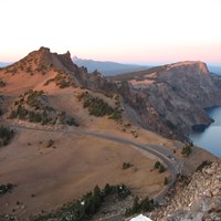
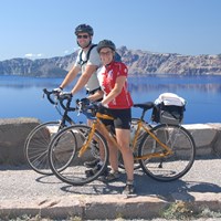
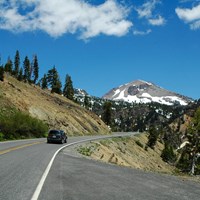
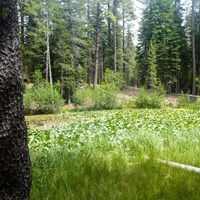
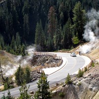
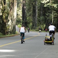
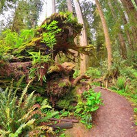
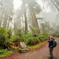
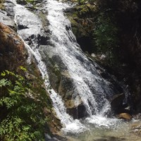
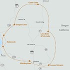
Crater Lake, Lava Beds, Tule Lake, Lassen Volcanic, Whiskeytown, Redwood, and Oregon Caves each offer unique adventures with something for the whole family. From the crashing waves of the Pacific coast near Redwood forests, to lava tunnels winding deep underground, you'll discover stunning views, inspiring landscapes, diverse wildlife, and pivotal moments in U.S. history.

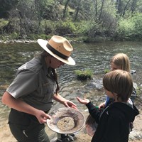
Use our suggested activities to start planning your own journey!

Lava Beds National Monument

Loading results...


    Crater Lake
    • Crater Lake National Park

      Scenic Rim Drive

      • Activity Fee: No (Entrance fees may apply)
      • Reservations: No
      • Activity: Scenic Driving
      • Pets: Yes with Restrictions
      • Duration: 1–3 Hours
      • Season: Summer, Fall
      • Time of Day: Any Time
      View of Rim Drive from Watchman Peak.  Hillman Peak and Crater Lake in the background.

      The historic Rim Drive includes 33-miles (53-km) of lake views, panoramic vistas, forests and meadows. The contours of the road were designed to compliment the natural landscape, and disappear from view as you look across the lake from any point.

      View Details
    • Crater Lake National Park

      Biking at Crater Lake

      • Activity Fee: No (Entrance fees may apply)
      • Reservations: No
      • Activity: Road Biking
      • Pets: Yes with Restrictions
      • Season: Summer, Fall
      • Time of Day: Day
      Two visitors on bikes with Crater Lake in the background.

      Each year, increasing numbers of cyclists come to Crater Lake National Park to ride around the lake on the physically demanding, 33 mile (53 km) Rim Drive. Steep hills at high elevation may encourage even the most fit riders to pause at many of the road's thirty overlooks and pull-outs. The payoff however is spectacular scenery, viewed at a pace that few visitors choose to take enough time for.

      View Details
    Lassen Volcanic National Park
    • Lassen Volcanic National Park

      Drive Lassen Volcanic National Park Highway

      • Activity Fee: Yes
      • Reservations: No
      • Activity: Scenic Driving
      • Pets: Yes with Restrictions
      • Location: Lassen Volcanic National Park Highway
      • Duration: 60 Minutes
      • Season: Summer, Fall
      • Time of Day: Day
      A black vehicle drives on a mountain road toward a large volcanic peak with large patches of snow.

      The 30-mile park highway connects the northwest (Manzanita Lake) and southwest entrances of the park. This scenic route passes through dense forest, winds around alpine lakes and meadow, crests at 8,512 feet near Lassen Peak Trailhead, and descends steep volcanic slopes into the southwest area. Designated turnouts and parking areas provide opportunities to enjoy the highway highlights.

      View Details
    • Lassen Volcanic National Park

      Walk Lily Pond Interpretive Trail

      • Activity Fee: No (Entrance fees may apply)
      • Reservations: No
      • Activity: Self-Guided Tours - Walking
      • Pets: No
      • Location: Lily Pond Trailhead
      • Duration: 15–60 Minutes
      • Season: Spring, Summer, Fall
      • Time of Day: Day, Dawn, Dusk
      A pond covered in green plants lined by grass and surrounded by conifers.

      A half-mile, self-led, interpretive loop explores the rich diversity of plant and animal life in the Manzanita Lake Area.

      View Details
    • Lassen Volcanic National Park

      Visit Sulphur Works

      • Activity Fee: No (Entrance fees may apply)
      • Reservations: No
      • Activity: Self-Guided Tours - Walking
      • Pets: Yes with Restrictions
      • Location: Sulphur Works hydrothermal area
      • Duration: 10 Minutes
      • Season: Winter, Spring, Summer, Fall
      • Time of Day: Day
      A road lined by wooden guardrails curves through a hydrothermal area of barren, steaming ground.

      This steamy spot is accessible via a short walk along Lassen Volcanic National Park Highway. Sulphur Works is the easiest to access of the park's seven hydrothermal areas.

      View Details
    Redwood National and State Parks
    • Redwood National and State Parks

      Drive the Newton B. Drury Scenic Parkway

      • Activity Fee: No (Entrance fees may apply)
      • Reservations: No
      • Activity: Scenic Driving
      • Pets: Yes with Restrictions
      • Location: Newton B. Drury Scenic Parkway
      • Duration: 30–60 Minutes
      • Season: Winter, Spring, Summer, Fall
      • Time of Day: Any Time
      Made Sure You See This Parkway

      A ten mile drive through the heart of the redwoods. You have to exit HWY 101 to see the big redwoods.

      View Details
    • Redwood National and State Parks

      Stroll the Simpson-Reed Trail

      • Activity Fee: No (Entrance fees may apply)
      • Reservations: No
      • Activity: Hiking
      • Pets: No
      • Location: Simpson-Reed Trail
      • Duration: 30–60 Minutes
      • Season: Winter, Spring, Summer, Fall
      • Time of Day: Day
      A Short Walk in the Northern Part of the Redwoods

      An easy walk through beautiful old-growth redwood forests in the northern part of the parks. Limited parking, RV's and trailers not permitted.

      View Details
    • Redwood National and State Parks

      Walk the Lady Bird Johnson Grove

      • Activity Fee: No (Entrance fees may apply)
      • Reservations: No
      • Activity: Hiking
      • Pets: No
      • Location: Lady Bird Johnson Grove Trailhead
      • Duration: 45–60 Minutes
      • Season: Winter, Spring, Summer, Fall
      A Famous Grove That Is Easy To Walk

      An iconic redwood grove in the southern end of the parks that is easy to walk. RVs and trailers are not advised on the narrow mountain road leading to this trailhead.

      View Details
    Whiskeytown National Recreation Area
    • Whiskeytown National Recreation Area

      Hike to Whiskeytown Falls

      • Activity Fee: No (Entrance fees may apply)
      • Reservations: No
      • Activity: Hiking
      • Pets: Yes
      • Location: James K Carr Trailhead
      • Duration: 2–3 Hours
      • Season: Winter, Spring, Summer, Fall
      • Time of Day: Day
      Upper Whiskeytown Falls

      Whiskeytown Falls is a series of cascades which drop 220 feet as the east fork of Crystal Creek winds down the slope of Shasta Bally.  The falls are accessed by the James K. Carr trail, a moderately strenuous 3.4 mile round-trip path which follows old logging routes through shade and sun in a forested area that was only lightly affected by the Carr Fire of 2018.

      View Details
    • Whiskeytown National Recreation Area

      Gold Panning at Whiskeytown NRA

      • Activity Fee: Yes
      • Reservations: No
      • Activity: Hands-On
      • Pets: Yes
      • Season: Winter, Spring, Summer, Fall
      Ranger Lead Gold Panning Program at Whiskeytown NRA

      Become a gold miner for a day! Gold pan along Clear Creek at the Clear Creek picnic area. Gold was first discovered in Clear Creek in 1848 by Pierson B. Reading. The news of the discovery brought a wave of gold rush miners to Shasta County, many of whom set up camp in what is now Whiskeytown National Recreation Area. The former community of Whiskeytown got its start as a mining town as settlers worked along Clear Creek and its tributaries.

      View Details

    Last updated: January 29, 2024