National Park Service LogoU.S. Department of the InteriorNational Park ServiceNational Park Service
National Park Service:  U.S. Department of the InteriorNational Park Service Arrowhead
Pony Express National Historic Trail Mud Spring relay station was located near this historical marker in western Nebraska.
view map
text size: largest larger normal
printer friendly
Pony Express National Historic Trail
Auto Tour Route - Colorado

Below are driving directions to follow the Pony Express National Historic Trail west through Colorado, from Nebraska and back to Nebraska.  A simple map showing the general route is below the directions.

From the Nebraska - Colorado state border:

1. Take U.S. Route 138 west through Julesburg to U.S. Route 385.
2. Turn north onto U.S. Route 385 and follow into Nebraska.

Total original route miles in Colorado: 16
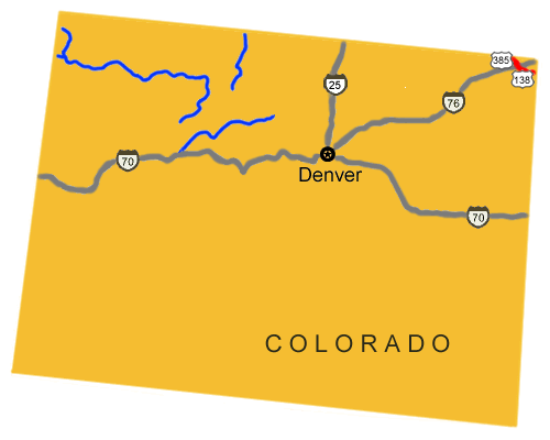
 
Map image showing the auto tour route driving directions across Colorado.
NPS Image
Map image showing the auto tour route driving directions across Colorado.

You are exiting the National Park Service website

Thank you for visiting our site.

You will now be redirected to:

We hope your visit was informative and enjoyable.

Sand Hill relay station on the Pony Express trail in Nevada

Did You Know?
Pony Express riders generally rode their horses at full gallop for 12-15 miles before changing horses at relay stations such as this one at Sand Hill in western Nevada.

Last Updated: December 05, 2011 at 11:31 MST