|
Kenai Fjords
A Stern and Rock-Bound Coast: Historic Resource Study |

|
Chapter 10:
RECREATION AND TOURISM
Early Recreational Trends
Before the Klondike gold rush began, there was little pressure on Alaska or Yukon game resources except in the vicinity of widely dispersed mining camps and cannery sites. The gold rush, however, lured tens of thousands of people northward. By 1900, Alaska had more than twice the population than it had had in 1890; its non-Native population, moreover, grew more than 750 percent during the same ten-year period. [1]
The Lure of the Kenai Peninsula Gamelands
|
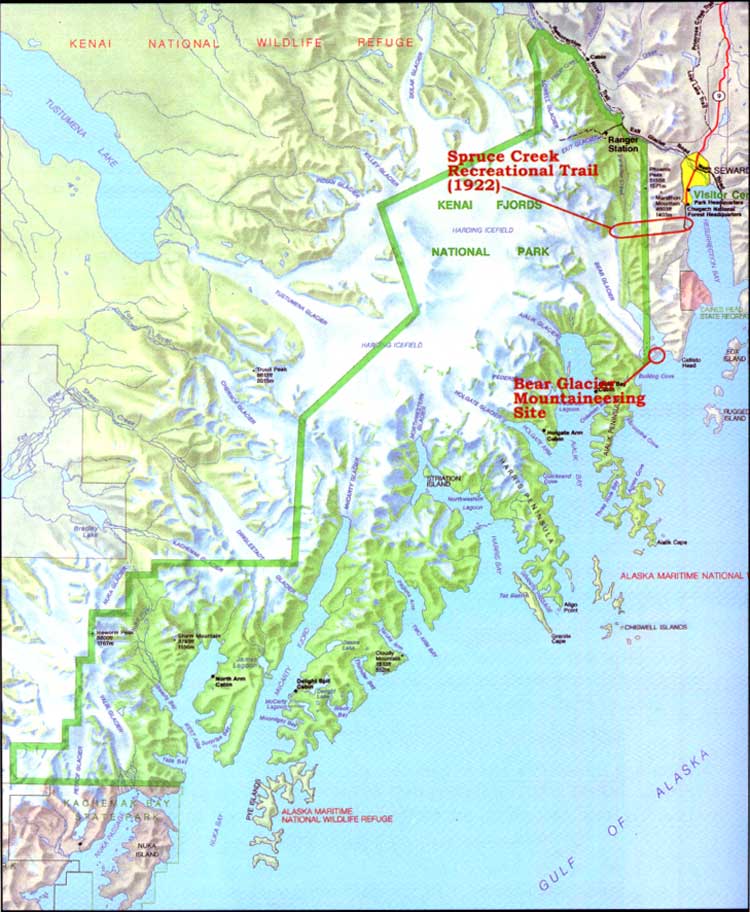
| Map 10-1. Historic Sites-Recreation/Tourism. (click on image for an enlargement in a new window) |
As a direct result of the gold boom, market hunters and individual prospectors fanned out across Alaska in search of game. The publicity that accompanied the gold rush also attracted trophy hunters, few of whom had visited Alaska previously. On the Kenai Peninsula, the Hope-Sunrise area had supported a growing population since 1894, and hunters were active along the Kenai coast during the mid- and late 1890s. As a result, the wildlife inevitably began to suffer. Dall De Weese, a hunter and travel writer, was able to count 500 sheep within six to eight miles of a spot in the Kenai Mountains in 1897; four years later, however, the number of animals had drastically declined. Similarly, hunter Andrew J. Stone noted in 1900 that "the Kenai Peninsula ... has been prolific in animal life but there are so many sportsmen now coming in that the large game is suffering quite a slaughter." (One author felt that non-resident sportsmen were a major culprit; although the game laws "allowed them to kill only two moose, three sheep, three bear, etc., [they] would kill all the animals they could lay their eyes on.") [2] Caribou were particularly vulnerable. Market hunters during the early 1900s exterminated the species in the Kachemak Bay area; in the years that followed, hunters were so successful in their endeavors that the last caribou were eliminated from the Kenai Peninsula about 1913. [3]
By 1905, both the Klondike gold rush and the Hope-Sunrise excitement had passed their peak, and as a result, pressure on the Kenai Peninsula game populations began to diminish. The Kenai, moreover, gained increasing fame as a sport-hunting destination during the years following the gold rush; by 1911, one source noted that it had "come to be regarded as the greatest game country in the possession of the United States." [4] Its popularity stemmed from its accessibility, the variety of local megafauna (specifically moose, sheep, bear, and goat), and the existence of many trophy-size animals. [5]
The gamelands, located in the hills and flatlands of western Kenai Peninsula, were reached via Kenai during the gold rush period. By 1905, however, construction of the Alaska Central Railroad had proceeded to the point that Seward became the primary entrepôt to the gamelands. Thereafter, most hunters who planned a Kenai Peninsula hunt sailed to Seward where they met a guide. They then took the train north to Kenai Lake, after which they sailed the length of the lake and floated down the Kenai River to the gamelands. As noted in a contemporary article, hunters looking for moose headed most often to Skilak Lake, Kenai Lake, Kenai River, [Lower] Russian Lake, the Chickaloon Flats, or "Kusiloff Lake." Sheep hunting areas included Sheep Mountain, False Creek, Stetson Creek, Skilak Lake, and Tustumena Lake. Goat hunters headed to the eastern peninsula, near Spencer and Bartlett glaciers, and both black and brown bears were scattered about the moose and sheep hunting country. [6]
By 1910, hunters throughout the world had heard about the Kenai Peninsula gamelands, and each year thereafter a smattering of hunters arrived in Seward. Some came for the spring bear hunt, while others arrived to take advantage of the fall moose and sheep hunt. The sportsmen hailed from all over the United States and from foreign countries as well, particularly from Europe. [7] The number who arrived each year was fairly small–usually just 10 or 15 parties totaling 25 or 30 hunters–but their wealth, their influence, and their penchant for publicizing their adventures via books and articles played a large role in broadcasting the Kenai's game resources. [8]
The Kenai Peninsula gamelands were essentially unregulated until May 1908, when Congress passed (and President Roosevelt signed) a law providing for major revisions to the Alaska Game Law of June 7, 1902. The 1908 law mandated that all Alaska hunting guides be licensed; in addition, the law recognized both the popularity and the fragility of the Kenai gamelands when it demanded that all Kenai Peninsula sport hunters be accompanied by a licensed guide. No other Alaska hunting grounds were singled out with this requirement. The law helped ensure the continuity of the Kenai game resource.
One beneficial effect of the 1908 law was that it brought forth a small corps of locally based guides, who gained fame (and some fortune) through their guiding efforts. By 1911, ten of Alaska's fifteen guides listed a Seward address. (The other five lived in Kenai.) Well-known guides living in or near Seward included Andrew Simons, Charles Emsweiler, Ben Sweazey, Bill De Witt, and Andrew Berg. Most if not all of these guides earned the respect of men who had hunted trophy animals throughout the world. [9] Another guide, who joined the ranks during the 1920s, was Luke Elwell. The Seward-bred guide lived in town for more than a decade; then, in 1939, he and his wife Mamie built a lodge at Upper Russian Lake and operated it for the next twenty years. The lodge was (and is) the first permanent habitation north of the present-day park boundary; it is also the largest structure between the park boundary and the Kenai River. [10]
One site along the hunters' route became a point of interest for tourists. Roosevelt, a station stop on the east side of Kenai Lake, had long been a transfer point and roadhouse for hunters heading west to the game country. Then, in August 1923, Nellie Neal announced that she had purchased the roadhouse. Neal, a former market hunter and cook in the railroad construction camps, soon married a Seattle electrician named William B. Lawing. The new Ms. Lawing, hoping to cash in on the expected boom in tourist travel on the recently completed railroad, cleaned out a building that was located in the narrow strip between the lake and the railroad right-of-way. Then, according to a local news report, she "placed her entire exhibit of fine Alaskan skins and furs on exhibit." The stop, which was renamed Lawing, became increasingly well-known; thousands of Alaska tourists (and residents) stopped there during the 1920s and 1930s. [11]
Seward Area Land Reservations
During the first quarter of the twentieth century, the federal government–specifically, the Interior and Agriculture departments–reserved land along the Kenai Peninsula's southern coastline. These actions may have prevented a broad range of development actions on the lands in question. Most of these withdrawals were the manifestation of events taking place away from southcentral Alaska. The reservations, however, were temporary, and they had a minor if not insignificant impact on Seward-area land use development. They have been presented in this chapter because the Interior Department has reserved several large blocks of Kenai Peninsula land in recent years; each of these actions, including the reservation that eventually resulted in Kenai Fjords National Park, was made to enhance recreational opportunities and preserve non-economic values.
The first agency to reserve a large area along Alaska's southeastern coastline was the Interior Department's Bureau of Forestry. In August 1902, President Theodore Roosevelt had proclaimed the establishment of the Alexander Archipelago Forest Reserve. The Bureau of Forestry administered this area, which comprised a portion of what is now known as Tongass National Forest. Roosevelt, well known as a conservationist, chose William A. Langille to head the reserve. Langille established a reserve headquarters in Wrangell, although he later moved to Ketchikan.
In 1904 and 1905, Langille made several long trips, at the behest of his Washington superiors, to inspect either recently withdrawn areas or areas proposed for withdrawal. One of those trips, beginning in September 1904, took him to Prince William Sound, where he made an examination the area's forest resources. He continued on to Seward, then headed overland to Kenai. He eventually wound up in Seldovia, where he boarded a coastal steamer and sailed back to Resurrection Bay. [12]
Langille, among his duties, was asked to evaluate the idea of a Kenai Forest Reserve. Those whom he encountered during his sojourn had mixed feelings about the proposal. A few recognized the importance of the forestry movement, and others (particularly along the railroad corridor) were opposed to the proposal, but most were indifferent. Langille himself reflected those sentiments; he noted that "The existing forest reserve law ... is too restricting and in a measure unjust to so new a country...." For that reason, he hoped that land would still be available for settlement in any new reserves. Given that caveat, Langille recommended the creation of a reserve that would encompass most of the northern and central Kenai Peninsula; specifically, he recommended that the reserve include the entire peninsula north of a line that connected Cape Puget (40 miles southeast of Seward) with "Coal Inlet" (Kachemak Bay). [13]
There was no immediate response to Langille's proposal. The Bureau of Forestry, meanwhile, underwent major structural change. In February 1905, the Bureau became part of the Agriculture Department; a month later, the bureau's name changed to the U.S. Forest Service; and in 1907, the agency changed the name of its forest reserves to national forests. [14] Historian Lawrence Rakestraw noted that soon after the establishment of the new agency,
there came a flurry of activity within the Forest Service regarding new reserves.... The Alaska reserves came up for consideration, and by March [1907] the Forest Service had decided to create new reserves, both in southeastern Alaska and in the Prince William Sound area.
President Roosevelt responded to that activity by proclaiming the Chugach National Forest on July 23, 1907. The forest, at this time, comprised just 4,960,000 acres, more than a million acres smaller than today; its western boundary snaked along the peninsula's eastern edge. Kenai Lake, the Quartz and Canyon Creek valleys, and the Hope-Sunrise area–all part of the Chugach today–were omitted from Roosevelt's 1907 proclamation. [15]
Just a few months later, in his 1907 annual report, Langille recommended that additional areas–primarily along Turnagain and Knik arms–be added to the Chugach in order to protect them from Alaska Central Railroad construction crews. That order was sent on to Washington, where it and other proposals lay until the closing days of the Roosevelt administration. On February 23, 1909–less than two weeks before William Howard Taft assumed the presidency–Roosevelt more than doubled the size of the Chugach, to 11,280,640 acres, the largest in the country. The proclamation, which institutionalized the boundaries that Langille had recommended in 1904, spread the previous boundaries of the national forest in several directions. It included all of the Kenai except for the area south of a sinuous line that connected Cape Puget with the head of Kachemak Bay (see Map 10-2). That line, for the most part, followed the drainage divide. Most of the Kenai Peninsula land not included in the Chugach, therefore, drained south into the Gulf of Alaska. The newly expanded forest included several thousand acres that are within the present park boundaries; almost all of that land is on the high-elevation portions of Harding Icefield. [16]

|
| Map 10-2. Seward Area Land Reservations, 1909-1926. (click on image for an enlargement in a new window) |
Sewardites did not hear about Roosevelt's action until several weeks into the new president's term. Local newspaper editor Leo F. Shaw was skeptical about the need for such an action. Shaw noted that "there is apparently little excuse for making a large forest reserve in this part of the territory of Alaska. There are practically no valuable forests in the section of the country included in the reserve." [17]
It is of more than parenthetical importance to note that Kenai's south coast was thrice considered for inclusion in Chugach National Forest. Forest Service historian Lawrence Rakestraw notes that the February 1909 addition had originally been planned to include the south Kenai coast, but commercial interests in Seward objected, so the crest of the range to Kachemak Bay was used. Two years later, in a report on the Chugach, Tongass National Forest head William Langille suggested that "the southern shore of the Kenai Peninsula from near Seward to the head of Kachemak Bay" be added to the forest. Then, in 1913, forester George Cecil visited the area and reported that the timber resources south of Kachemak Bay were superior to those north of the bay. Neither Langille's nor Cecil's observations, however, resulted in boundary modifications. [18]
On December 5, 1911, the federal government declared a land freeze in the Seward area. In anticipation of "future legislation" (which was probably the Congressional act of August 24, 1912, which authorized a commission to study various rail routes to the interior), the General Land Office established Alaska Withdrawal #1. The newly-designated land, which was "withdrawn from settlement, location, sale, or entry," stretched along the coast from Day Harbor to Aialik Bay; it included all land south of the recently expanded Chugach National Forest boundary, and several thousand acres in the present park. That executive order was modified in August 1912 to allow the "use or disposition of timber" within the recently withdrawn land. This latter provision was probably implemented to make the area's wood resource available to government rail construction crews. [19]
The General Land Office continued to be concerned about timber resources. In the summer of 1915, it created the huge Alaska Timber Reserve #1 in the Susitna and Nenana river drainages to ensure an adequate timber supply for the railroad construction crews. In April 1917, that reservation was extended to include a tract five miles on each side of the government railroad from Seward to the Knik River. The latter action included within its scope a few thousand acres currently included within Kenai Fjords National Park. [20]
Even before the three reservations had been created, action to nullify them had begun. In 1913, Alaska Delegate James Wickersham submitted a U.S. House bill to abolish the Chugach National Forest because of its relative lack of timber; a short time later, the newly created Alaska legislature passed a resolution in support of Wickersham's action. The General Land Office, perhaps in response, decided to tailor its boundaries to more closely circumscribe timbered lands. The agency recognized that "the public good will be promoted by adding to the Chugach National Forest ... certain lands, and by excluding certain areas therefrom and restoring the public lands therein." It prepared a proclamation to that effect, and on August 2, 1915, President Woodrow Wilson signed the proclamation that, on the Kenai Peninsula, modified the Chugach's boundaries to resemble their present configuration. (This action added to the forest the large tract of land on the northeast side of the Resurrection River, but eliminated the huge area in the western Kenai north of the coastal drainage divide.) [21] The following year, forester Asher Ireland visited the Seward area and recommended that 8,641 acres on the southwest side of Resurrection River be added to the forest. Ireland considered the parcel, which contained 42 million feet of spruce and hemlock, valuable both for both timber and protective cover; it had, in Ireland's opinion, "the best body of timber in southwestern Alaska." [22] Ireland's recommendation, however, was not enacted into law.
During the 1920s, the other reservations were eliminated, probably at the urging of local authorities. Seward Senator L. V. Ray sponsored a joint memorial in the 1919 Alaska legislature requesting the "restoration or modification" of Alaska Withdrawal #1. The General Land Office, in response, "appreciated that most of the reasons for the withdrawal have ceased to exist," but it was not until May 1921, with construction of the government railroad nearly completed, that Alaska Withdrawal #1 was "vacated and annulled" by President Warren Harding. Five years later, in November 1926, President Calvin Coolidge issued a similar executive order revoking Alaska Timber Reserve #1 on the Kenai Peninsula. Except for land in the newly reduced Chugach National Forest, most if not all of the Kenai Peninsula was now open, once again, to location and entry. [23]
Although the federal government appears to have paid an extraordinary amount of attention to the Seward area's forestry resources during this period, there have been no known attempts or proposals to secure timber for commercial purposes in or near the present park boundaries. Isolation, inaccessibility, the lack of potential board feet, and the lack of markets all help explain the absence of commercial timber operations. [24]
kefj/hrs/hrs10.htm
Last Updated: 26-Oct-2002