
|
Washington Department of Natural Resources Geology and Earth Resources Division Bulletin No. 66 Geology of the Washington Coast between Point Grenville and the Hoh River |
CONTENTS
COVER PHOTO—LOOKING NORTHWARD AT THE HOGSBACK AREA. For nearly 2-1/2 miles, the cliffs and promontories are composed of large resistant blocks of chaotically mixed sandstone and volcanic rocks act in a matrix of intensely broken and sheared siltstone. Little Hogsback, center, and Hogsback, in the distance, are very large resistant blocks of volcanic rocks that were left behind as the sea eroded the coastline eastward.
Introduction
Acknowledgements
PART I-ROCK FORMATIONS AND THEIR GEOLOGIC HISTORY
Volcanic rocks of middle Eocene age
Sedimentary rocks of late Eocene age
The Hoh rock assemblage
General discussion
Turbidites of the Hoh rocks
Sedimentary structures
Tectonic melange of the Hoh rock assemblage
Interpretations of structure in the Hoh rock assemblage
General discussion
How and why
Plate tectonics—sea floor spreading
Piercement structures
The Quinault Formation
General description
Major sections of continuous strata
North of Point Grenville
South of Taholah
Cape Elizabeth
Duck Creek-Pratt Cliff
Tunnel Island area
Late Cenozoic deposits
General description
Origin of sand and gravel deposits
Ancient wave-cut surface
Crustal warping and changes in sea level
Summary of late Cenozoic geologic history
PART II—GEOLOGIC OBSERVATIONS AND INTERPRETATIONS ALONG SEGMENTS OF THE COAST
Older rocks
Younger rock deposits
Ancient sea levels
Grenville Bay area
Between Point Grenville and Taholah
Jumbled rocks
Sandstone strata of the Quinault Formation
Fossils and sedimentary features
Landslide area
Sand and gravel of the ice age
Siltstone of the Quinault Formation
Taholah sandspit
Taholah to Cape Elizabeth
North side of Quinault River at Taholah
Garfield gas mound
Conglomerates of the Quinault Formation
Differential erosion
Recent uplift
Cape Elizabeth to Duck Creek
High cliffs of the Quinault Formation
Jumbled deposits of Hoh rocks
Upwarped Quinault siltstone, south of Duck Creek
Duck Creek to Pratt Cliff
Pratt Cliff
Uplifted wave-cut terrace
North of Pratt Cliff
The Hogsbacks area
Jumbled Hoh rocks
Little Hogsback
Hogsback
Mineralized veins
Coastal erosion
Red beach sands
Tunnel Island
Raft River to Whale Creek
Northernmost outcrops of the Quinault Formation
Older deposits of sand and gravel
Recent warping of the earth's crust
Old wood reveals age of deposits
Whale Creek to the Queets River
Mouth of Queets River valley
Queets River to Kalaloch
Pleistocene deposits
Beach deposits of today
Kalaloch area
Bedrock outcrops
Unconsolidated materials
Browns Point-Starfish Point area
Browns Point-Beach Trail 3 area
Bedrock
Unconsolidated deposits
Beach Trail 4
Starfish Point
Starfish Point to Beach Trail 5
Destruction Island
Bedrock
Sand and gravel deposits
Coastal erosion rate
Beach Trails 5 to 7
Sand and gravel cliffs
Sandstone blocks of Hoh melange
Beach Trail 7 to Ruby Beach
Ruby Beach-Abbey Island
Bedrock
Sand and gravel deposits
Abbey Island to the Hoh River
Hoh River area
ILLUSTRATIONS
Figure
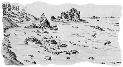
FRONTISPIECE—Looking north from Point Grenville to Cape Elizabeth
1. Looking eastward at Point Grenville
2. Geologic time chart
3. Dipping beds of well-stratified sandstone and siltstone exposed east of Point Grenville
4. Contorted and disarranged materials in the Hogsbacks area
5. Hogsback, as it appears from the air and offshore
6. Looking northeast at the southern part of Browns Point
7. Looking southwest at well-stratified, steeply dipping beds of siltstone and sandstone near Beach Trail 4
8. Overturned sandstone and siltstone beds at Beach Trail 4
9. Flamelike sedimentary structures indicate that strata are overturned
10. Large resistant boulders on the beach at Boulder Point
11. How rocks of the Olympic Mountains and of the west coastal area may have been formed
12. A continuous seismic profile recorded off the coast near Point Grenville
13. Microscopic fossils, "Foraminifera," from the Quinault Formation
14. Correlations of four major sections of the Quinault Formation
15. Contorted bedding in the Quinault Formation
16. Carbonized branches in massive sandstone near Cape Elizabeth
17. Looking northward at the Quinault Formation, exposed between Cape Elizabeth and the Quinault River
18. A contact between Hoh rocks and the overlying Quinault Formation
19. Elongated concretionlike structures in the cliffs north of Pratt Cliff
20. Disrupted bedding in siltstone of the Quinault Formation, Duck Creek area
21. Sandstone beach pebbles contain many fragments of various rock types
22. Two major sand and gravel units exposed in a sea cliff just south of Whale Creek
23. Red beach sands near Hogsback
24. Tunnel Island, off the mouth of the Raft River
25. Seastacks of sandstone north of Tunnel Island
26. Idealized cross section showing relations between major Pleistocene deposits and the land surfaces
27. Modern (piddock) clam borings
28. Fossil (piddock) clam borings in sandstone strata at Beach Trail 4
29. Point Grenville to Pratt Cliff—coastal map
30. Cross section of scour and fill structures, north of Point Grenville
31. Siltstone interbedded with volcanic rocks at Point Grenville
32. Massive siltstone of the Quinault Formation beneath late Pleistocene outwash, south of Taholah
33. A major landslide area about 1 mile north of Point Grenville
34. Willoughby Rock with mainland in the background
35. A landslide immediately north of Point Grenville
36. Pratt Cliff, viewed from the air
37. Jumbled Hoh rocks in fault contact with the Quinault Formation
38. Remains of a boiler used in 1913 for drilling operations, north of Taholah
39. Looking northward at high, nearly vertical cliffs, extending northward from Cape Elizabeth
40. Sandstone and conglomerate cliffs of the Cape Elizabeth area, about 1900
41. Cape Elizabeth, looking northwestward, 1972
42. Contorted Hoh rocks near Duck Creek
43. Looking northward at Cape Elizabeth, 1970
44. A view taken about 1902, looking northward at strata of Cape Elizabeth
45. Pratt Cliff to the Queets River—coastal map
46. Steeply dipping, well-stratified beds, immediately north of Hogsback
47. Looking westward through the tunnel beneath Tunnel Island
48. Split Rock
49. Little Hogsback, a resistant mass from jumbled Hoh rocks
50. Elephant Rock, at the south end of Tunnel Island
51. A pectenlike fossil in the sandstone of Tunnel Island
52. A distorted stump, in carbonaceous clay and silt, exposed in the cliff, north of Whale Creek
53. Piercement structure between Cape Elizabeth and Duck Creek
54. Destruction Island has a foundation of steeply dipping sandstone strata
55. Looking northward at the coastline between Whale Creek and the Queets River
56. Crossstratification in beds of sand and fine gravel, north of Whale Creek
57. Highly carbonaceous clay beds exposed in the bluffs north of Kalaloch
58. Looking easterly at the Kalaloch rocks
59. Queets River to Beach Trail 4—coastal map
60. Looking northward in the Browns Point area
61. Well-formed groove casts on the bottom side of a nearly vertical dipping sandstone bed on Destruction Island
62. Beach Trail 4 to the Hoh River—coastal map
63. Two major units of sand and gravel exposed in the cliffs immediately north of Beach Trail 6
64. Looking northward at steeply dipping sandstone strata at Browns Point
65. Starfish Point, just north of Beach Trail 4
66. Unstratified deposits of clay, silt, sand, gravel, and boulders exposed at Beach Trail 7
67. Looking north across a boulder-strewn beach near Beach Trail 6
68. South Rock, offshore between Beach Trail 7 and Ruby Beach
69. A close-up view of the bedrock of Abbey Island
70. Looking northward from the Abbey Island area
71. Abbey Island with Hoh Head in the distance
72. Colorful deposits of sand and gravel, about one mile south of the Hoh River
Photography by the author unless otherwise indicated.
STATE OF WASHINGTON
DEPARTMENT OF NATURAL RESOURCES
BERT L. COLE, Commissioner of Public Lands
DON LEE FRASER, Supervisor
GEOLOGY AND EARTH RESOURCES DIVISION
VAUGHN E. LIVINGSTON, JR., State Geologist
Bulletin No. 66
GEOLOGY OF THE WASHINGTON COAST
BETWEEN
Point Grenville and the Hoh RiverPart I.—Rock Formations and Their Geologic History
Part II.—Geologic Observations and Interpretations Along Segments of the CoastA review of the geologic processes and events responsible for the forming of the rock formations and deposits along the Washington Coast
BY
WELDON W. RAU
Geologist
1973
(Reprinted, 1975)
| <<< Previous | <<< Contents >>> | Next >>> |
state/wa/1973-66/contents.htm
Last Updated: 28-Mar-2006