
|
Geological Survey Professional Paper 65
Geology and Water Resources of the Northern Portion of the Black Hills and Adjoining Regions in South Dakota and Wyoming |
GEOLOGY
GENERAL RELATIONS.
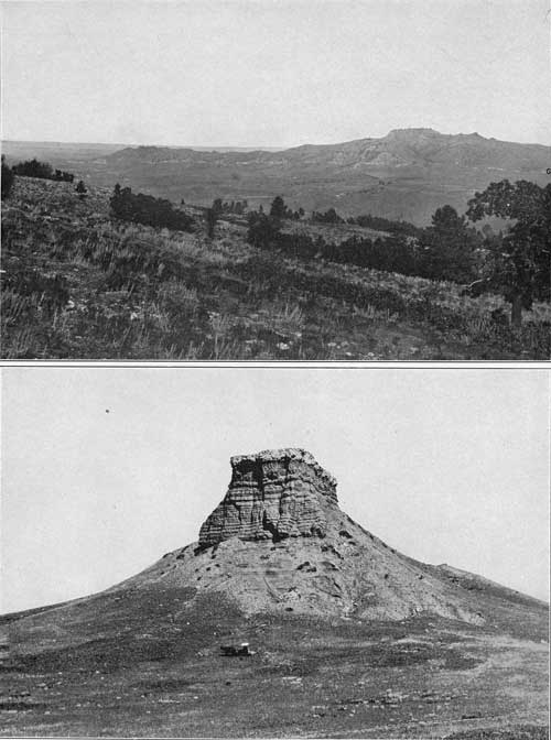
The Black Hills uplift is an irregular dome-shaped anticline, embracing an oval area 125 miles long and 60 miles wide, with its longer dimension lying nearly northwest and southeast. It is situated in a wide region of nearly horizontal beds and has brought above the general level of the plains an area of pre-Cambrian crystalline rocks about which there is upturned a nearly complete sequence of sedimentary formations ranging in age from middle Cambrian to later Cretaceous, all dipping away from the central nucleus. There are also extensive overlaps of the Tertiary deposits which underlie part of the adjoining plains area. The region affords most excellent opportunities for the study of stratigraphic relations and variations. Many of the rocks are hard, and the streams flowing out of the central mountain area have cut canyons and gorges, in the walls of which the formations are extensively exhibited. The structure along the sides of the uplift is that of a monocline dipping toward the plains. The oldest sedimentary rocks constitute the escarpment facing the crystalline-rock area, and each stratum passes beneath a younger one in regular succession outward toward the margin of the uplift. Plate XV gives cross sections showing the general relations of the formations in the northern Black Hills region. The sedimentary rocks consist of a series of thick sheets of sandstones, limestones, and shales, all essentially conformable in attitude, except the overlapping areas of the Tertiary deposits, which extend across the edges of the older formations. The stratigraphy presents many features of similarity to the succession of rocks in the Rocky Mountains of Colorado and of Wyoming, but it posesses numerous distinctive local features. The following table gives the principal stratigraphic components with their characteristics, range in thickness, and age:
Generalized section of the northern Black Hills region.
| Age. | Formation. | Principal character. | Thickness. |
| Feet. | |||
| Laramie (?) formation | Massive sandstone and shale, with lignite | 2,500+ | |
| Cretaceous | Fox Hills sandstone | Sandstone and shale | 250+ |
| Pierre shale | Dark-gray shale | 1,200—1,400 | |
| Niobrara formation | Impure chalk and calcareous shale | 120—225 | |
| Benton group: | |||
| Carlile shale | Gray shale with thin sandstones and concretions | 600—800 | |
| Greenhorn limestone | Impure slabby limestone | 50—80 | |
| Graneros shale | Dark shale with local sandstone in lower part | 900—1,150 | |
| Dakota sandstone | Gray to buff sandstone, mostly massive | 10—160 | |
| Fuson formation | Shale, mostly massive, white to purple, with sandstone layers | 10—100 | |
| Lakota sandstone | Buff sandstone, mostly hard, coarse, cross-grained | 25—300 | |
| Cretaceous (?) | Morrison formation | Massive shale, gray, greenish, maroon; thin limestones | 40—220 |
| Jurassic (?) | Unkpapa sandstone | Massive fine-grained sandstone, white, buff, purple | 5—150 |
| Jurassic | Sundance formation | Gray shales, buff soft sandstone, reddish sandy shale | 200—350 |
| Triassic (?) | Spearfish formation | Red sandy shale with gypsum beds | 450—695 |
| Carboniferous: | |||
| Permian | Minnekahta limestone | Thin-bedded gray limestone | 25—45 |
| Opeche formation | Red slabby sandstone and sandy shale | 60—100 | |
| Pennsylvanian- Mississippian (?) | Minnelusa sandstone | Sandstone, mainly white, buff, or red, also limestone | 350—600 |
| Mississippian | Pahasapa limestone | Massive gray limestone | 100—700 |
| Englewood limestone | Pink to buff slabby limestone | 25—65 | |
| Ordovician | Whitewood limestone | Massive buff limestone | 0—100 |
| Cambrian (Acadian) | Deadwood formation | Brown sandstone, partly conglomeratic, mostly massive; greenish gray sandy shales, slabby dolomitic limestone, and limestone conglomerate. | 200—500 |
STRATIGRAPHY.
CAMBRIAN SYSTEM.
DEADWOOD FORMATION.
General relations.—In the northern Black Hills region the Deadwood formation is between 400 and 500 feet thick, or many times greater than its thickness in the central and southern portions. It lies unconformably upon the upturned surface of the Algonkian schists and granites, on what was once a relatively smooth plain with local shallow channels. Probably at one time it covered the greater part if not all of the central area of the uplift, but now it appears in a narrow outcrop zone along the outer margin of the crystalline rocks. It is also brought to the surface by the Bear Lodge, Nigger Hill, Black Buttes, Crow Peak, Citadel Rock, and other minor uplifts.
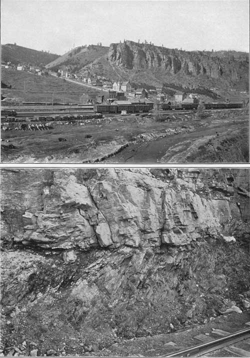
The occurrence of the formation in these detached areas indicates that it extends widely under the region adjoining the Black Hills uplift, and no doubt it underlies the great basin to the west, for it appears again in the Bighorn uplift with increased thickness. The materials of the formation are predominantly sandy and the color is mostly dark reddish-brown or dirty buff. The basal member ordinarily is a hard, massive reddish-brown sandstone, locally quartzitic. The medial beds are greenish sandy shales with flaggy dolomitic limestones and limestone conglomerates; and near the top there is always a prominent member of brown or buff sandstone. In the Deadwood region there is included at the top of the formation a thin series of greenish shales, and these also appear prominently in Sheep Mountain, on the east slope of the Bear Lodge Mountains. The basal sandstone is usually more or less conglomeratic and at many points it gives place in whole or in part to coarse conglomerates with pebbles several inches in diameter. These coarse materials are evidently of local origin and consist largely of quartz from veins in the underlying Algonkian schists. A view of the basal contact is given in Plate V, B; and a characteristic outcrop of the upper sandstone in the northern portion of Deadwood is shown in Plate V, A.
|
| PLATE V.—A (top), MASSIVE SANDSTONE OF DEADWOOD FORMATION IN NORTHERN PART OF DEADWOOD, S. DAK. B (bottom), CONTACT OF DEADWOOD FORMATION AND ALGONKIAN SCHISTS AT DEADWOOD, S. DAK. |
Thickness.—In the vicinity of Whitewood Creek the Deadwood formation varies in thickness from 380 to 400 feet, but it thickens to 450 feet in Spearfish Canyon and to a maximum of 500 feet on Bear Butte Creek. South of the latter stream it thins rapidly to about 200 feet on Elk Creek and remains at about this figure to Rapid Creek and beyond. Marked thinning to the west is shown on the headwaters of Squaw Creek, where the formation is from 200 to 300 feet thick. In the Nigger Hill uplift the thickness is 300 feet. On Bear Lodge Mountain 300 feet of beds appear in Rudy Canyon, interrupted to some extent by igneous intrusions. On Sheep Mountain, northeast of Sundance, a thickness of 300 feet is exposed without revealing the basal beds.
Conglomerate.—In the north-central Black Hills area the basal conglomerate has an average thickness of 5 to 6 feet but in places attains a thickness of 25 feet. It is most conspicuous in a belt which extends from the region east of Perry northwestward nearly to Garden. At many places it is absent and the base of the formation usually is a massive quartzite. At Deadwood the conglomerate is only a few inches in thickness, and contains distinctive middle Cambrian fossils. The rock is usually siliceous and hard, being made up of rounded pebbles of white quartz or angular fragments of schist in a brown sandy matrix. The pebbles vary in size from coarse grit to large bowlders, but most of them are small.
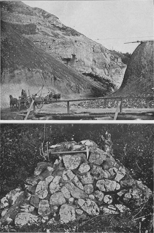
In the vicinity of Lead the basal beds show considerable variation in thickness and character. At the north end of the Homestake cut the conglomerate is lacking, and sandy shales with some breccia lie directly upon the schists, but in other places in the region the conglomerate fills channels 2 to 30 feet deep. It grades up into cross-bedded sandstones, in part quartzitic, carrying scattered conglomerate lenses. The basal conglomerate outcrops in Cole Creek southeast of Carbonate but is not conspicuous on the east side of the Ragged Top Plateau between Squaw Creek and Bald Mountains. On the spur west of West Strawberry Creek, southeast of Kirk, the basal contact of the Deadwood formation is well exposed. The conglomerate here is 20 feet thick and consists of rounded and subangular quartz pebbles with some slate pebbles in a sandy matrix. Toward the top the pebbles become small and angular and the rock merges into massive sandstone covered by porphyry. On the next spur to the southeast the conglomerate is only 4 feet thick. It also appears on the hills northeast and northwest of Lead and on the hill southwest of the Homestake cut. The zone in which it occurs is not more than 2 miles wide and trends in general north-northwest and south-southeast. On either side the conglomerate thins to only a few inches. The finest exposure of the contact at the base of the formation is in the cliff along the railroad on the east side of the gulch in the lower part of Deadwood, as shown in Plate V, B. Here the basal conglomerate is only 3 inches thick and consists of partly rounded quartz pebbles and schist fragments in a matrix of green chloritic matter. Above are thick beds of brown ferruginous sandstone. In the hills west of Garden also the conglomerate is thin. In the Terry districts the mines show 20 to 30 feet of basal quartzite. In the vicinity of Englewood the basal member is a hard quartzite forming a tabular bench 12 feet high. In the region from Whitewood Creek to Spring Creek the conglomerate is usually about 3 feet thick. In the region about Bear Butte Creek and south to Elk Creek the conglomerate averages 15 feet thick and the overlying beds gradually diminish in thickness. In the hills 2 miles west of Elk Creek post-office the conglomerate is very coarse and lies in irregular hollows. The bowlders, many of which are 3 feet in diameter, are in a red or brown sandy matrix. They vary from round to angular and greatly preponderate over the matrix. A typical exposure in this area is shown in Plate VI, B. The basal conglomerate along the creek 2 miles north of Brownsville is 3 to 10 feet thick and consists chiefly of small quartz pebbles. On Spearfish Creek there are quartzites and brown sandstones at the bottom of the formation.
|
| PLATE VI.—A (top), WHITEWOOD LIMESTONE BELOW DEADWOOD S. DAK. S, Overlying shale. E, Englewood limestone. P, Pahasapa limestone. B (bottom), BASAL DEADWOOD FORMATION ON ELK CREEK. Bowlders of quartzite and schist in yellow sandy matrix. |
The basal conglomerate is extensively exposed along Victoria Creek about 2 miles above the point where it enters the Rapid Creek canyon. Here the conglomerate is 10 feet thick and is made up largely of bowlders 6 inches in diameter, the larger subangular to well-rounded bowlders consisting of local materials derived from the underlying crystalline rocks. It is immediately overlain by 10 feet of flaggy sandstone or quartzite.
In Cement Ridge, along the southwest side of the Nigger Hill uplift, the conglomerate is a conspicuous feature, for it is thick and hard. The pebbles are mostly one-half to 1 inch in diameter and consist largely of quartz. Near the basal contact pebbles and bowlders of Algonkian schists and dark-colored igneous rocks are also included.
Local features.—Some representative sections of the Deadwood formation in the north-central portion of the Black Hills are as follows:
Section of Deadwood formation at Deadwood, S. Dak.
| Whitewood limestone. | Feet. |
| Olive-green shale, soft and flaky | 21 |
| White quartzite, with annelid trails and borings | 14 |
| Red sandstone, more massive in upper portions, with interbedded green shales and dolomite breccias, much glauconite, and fucoid markings | 100 |
| Gray flaggy dolomite limestones, at many places with pseudo-conglomerate structure, in lenses interbedded with green paper shales | 220 |
| Calcareous red sandstone and soft brown shales | 17 |
| Sandstones, brown or whitish, quartzitic above, cross-bedded in places; 3 inches of quartz-pebble conglomerate at base | 32 |
| Algonkian schists, unconformable contact. | 404 |
Section of upper and middle Deadwood formation 2 miles southwest of
Englewood, S. Dak.
[By T. A. Jaggar, jr.]
| Ft. | In. | |
| Talus, below cliff of Englewood limestone | 40 | |
| Green paper shales | 10 | |
| Talus | 80 | |
| Massive pink fucoidal limestone | 3 | 4 |
| Paper shales and calcareous flags | 1 | |
| Ocher-yellow calcareous sandstone | 2 | 2 |
| Green paper shales | 6 | |
| Arenaceous limestone with green-shale surface, showing mud cracks with red filling | 1 | |
| Massive hard arenaceous limestone | 6-1/2 | |
| Light-green paper shales and thin limestone flags, with irregular fucoidal surfaces and mud cracks | 1 | 5 |
| Massive calcareous quartzite coated with calcite on joint surfaces; red on fresh surface, showing much calcite | 2 | |
| Glauconitic sandstone, laminated on cross-bedding planes, with fucoids, in part deep green and full of glauconite; in other places dark red or limonitic yellow. Some of the higher beds show annelid borings | 16 | 6 |
| Very coarse, loose, and friable sandstone, with limonitic cement and some glauconite | 3 | |
| Ripple-marked glauconitic and ferruginous sandstone; massive as a whole, but separated into ripple-marked slabs, which are coated with hematite. Evidences of disturbance, such as cross-bedding and ripple marking, increase in the upper members of this section as a whole | 1 | 8 |
| Dark-green arenaceous shale, full of glauconite | 3 | |
| Ferruginous sandstone in two massive beds, separated by a thin band of shale | 33 | |
| Bright-red sandstone; calcite in veins and druses; limonite in irregular spots, as well as throughout the mass of the rock; a little glauconite. Rock is massive, showing some bedding lines and slightly wavy upper surface | 3 | |
| Glauconite shale. Bedding irregular and variable; cross-bedding common in places. This shale thins out and is replaced by overlying sandstone | 10 | |
| Massive glauconite sandstone. Variation in thickness is due to ridges resembling wave marks of 2 to 3 feet wave length and 2 to 3 inches height. Cross-bedded | 9-14 | |
| Glauconitic shale | 7 | |
| Massive glauconitic sandstone | 11 | |
| Arenaceous glauconitic shale | 5-1/2 | |
| Massive ferruginous sandstone, with limonite, quartz, and red matrix; very little glauconite. Coarse cross-bedding, dipping southwest | 1 | 9 |
| Highly glauconitic massive sandstone | 10 | |
| Massive ferruginous sandstone with a 12-inch quartzite bed below, showing quartz grains in a hematitic matrix and some glauconite. The quartzite is massive; the upper members weather in 2-inch laminæ | 3 | |
| Glauconitic sandstone in irregular laminæ, capped by red ferruginous sandstone, showing no glauconite but much iron | 4 | 2 |
| Gray arenaceous shales and irregularly bedded, glauconitic, shaly sandstones | 1 | 8 |
| Sandstone with very abundant glauconite; in two massive bands, with tendency to part on the bedding | 1 | 2 |
| Massive ferruginous sandstone, showing less glauconite than in bed below | 1 | 11 |
| Massive glauconite sandstone, showing cross-bedding in places, where the cross-bedding laminæ dip to the south | 1 | 1 |
| Fucoidal pink and green, loose, soft, shaly, glauconite sandstone. In a distance of 6 feet this bed thins out completely and merges into the massive sandstone above | 8 | |
| Glauconitic sandstone with pink and gray seams. Weathers in massive brown blocks, 4 to 10 inches in thickness | 3 | |
| Pink and green, fucoidal loose, soft, shaly, glauconitic, massive sandstone, breaking up into many lentils on weathered surface | 3 | 2 |
| Massive glauconitic sandstone, showing many small wormy fucoid marks in cross-section. Upper surface coated with green shale which shows concave impressions of coarse ropy fucoids one-half to three-fourths inch in diameter, mixed with irregular lumpy masses | 5 | |
| Thinly laminated green shale containing one pinkish sandy layer | 1 | |
| Massive glauconitic sandstone; joint surface covered with globular and botryoidal coating of white calcite. Cross-section of lower part of this bed shows pink fucoidal markings. Thins toward the south, and shows curved upper surface 4 feet long | 3 | 5 |
| Shaly glauconitic sandstone with abundant gray clay, lentiform fracture; fresh surface greenish gray speckled with glauconite | 1 | 7 |
| Alternate massive bands of glauconite sandstone and gray shale, The massive bands average 3 inches in thickness. Seen on a fresh cut these beds appear as a single massive band | 6 | 8 |
| Fine-grained calcareous glauconitic sandstone irregularly banded pink and greenish gray. The pink layers represent the fine-grained material of the ropy fucoid stems | 4 | |
| Evenly laminated alternate layers of glauconitic sandstone, thin gray paper shales, and pinkish sandy limestone flags varying in thickness from one-half to 3 inches. The surfaces of these flagstones are covered with small ropy fucoids | 1 | 3 |
| Massive ferruginous glauconitic sandstone in two beds with small veinlets of calcite | 2 | |
| Thinly laminated, very argillaceous glauconite shale, green-gray in color, with small wormy fucoids | 5 | |
| Glauconitic sandstone with limonite in streaks in cross section shaped like blades of grass. Surface of a slab shows fucoids in depressions, and ridges like the mud trails of a gasteropod | 8-1/2 | |
| Glauconitic shale with clay seams and grasslike fucoids in cross section | 10 | |
| Coarse limonitic glauconite sandstone, massive, with some brecciation like the usual limestone breccias | 1 | 2 |
| Speckled gray-green glauconitic sandstone | 1 | 3-1/2 |
| Hard glauconitic sandstone, with predominant quartz sand. All of this series of sandstones weather reddish brown; the shales to gray-green tints | 4 | |
| Irregular lentils of shaly glauconitic sandstone with much gray clay. Fresh surface greenish gray speckled with glauconite | 7 | |
| Very calcareous glauconitic sandstone with more calcite than quartz visible under the hand lens. Yellow clay on interlaminar seams. Surface gray and red speckled. with some appearance of fucoids, Evenly laminated in one-half to 1 inch layers | 3-1/2 | |
| Massive limonitic glauconite sandstone; highly calcareous; surface stained with iron streaks. Fucoid impressions not pronounced | 1 | |
| Similar to next below, but more massive, with hematitic bands and fucoid curves shown in cross section | 2 | |
| Loose shaly glauconitic sandstone; gray, speckled with dark green. Breaks into irregular lentiform pieces with one 2-inch massive band. Much gray clay | 6 | |
| Talus | 6 | |
| Impure glauconitic sandstone, calcareous and argillaceous. Fucoidal surfaces. A massive bed with a minute clay-seamed lenticular structure | 10 | |
| Talus | 1 | |
| Coarse glauconitic sandstone, showing under the lens abundant transparent rounded quartz grains, with interstitial smaller grains of limonite and glauconite. Parallel to the stratification there are bands of more abundant glauconite and some crystalline calcite. The whole bed is massive with some interlaminar slickensides | 1 | 3 |
| Similar to the bed below, with greenish-white clay on fracture surfaces. Small fucoids and some appearance of flat "pebbles," or breccia fragments, indicating proximity to horizon of limestone breccias. Laminae one-half to 1 inch thick | 7 | |
| Massive speckled glauconitic sandstone; purplish on weathered surface, with pinkish spots; variegated color on fresh surface. Whole series here is more or less fucoidal | 6 | |
Section of upper half of Deadwood formation on Bear Butte Creek east
of Galena, S. Dak.
[By T. A. Jaggar, jr.]
| Englewood limestone | Ft. | in. |
| Yellow and gray limonitic calcareous sandstone | 2 | |
| Massive brownish sandstone, with traces of Scolithus borings | 10 | |
| Hard white Scolithus quartzite, with well-marked gasteropod borings; thins toward the west | 1 | |
| Brown sandstone | 4 | |
| Hard white quartzite, Scolithus borings in upper surface, thins toward the west | 4-1/4 | |
| Pink and orange-colored quartzite | 2 | |
| Shale | 1/2 | |
| Pink quartzite varying to white, without borings | 1 | |
| Pink sandstone | 4 | |
| White quartzite | 1 | |
| Pink and yellow fine-grained sandstone. All these beds show a tendency to converge westward | 9 | |
| White quartzite | 1/2 | |
| Pink sandstone | 2 | |
| White quartzite | 2-1/2 | |
| White quartzite, weathering reddish on its upper surface | 1 | 2 |
| Yellow quartzite, weathering pink | 1 | 4 |
| Pink, yellow, and white sandstone, becoming more calcareous downward | 6 | |
| Gray calcareous shales, becoming thinner bedded and more shaly downward, with fine gray slaty shales at the base; Scolithus borings occur throughout this series | 6 | |
| Persistent white sandstone beds, showing ripple marks in cross section; veneered on its upper surface with gray shale carrying fucoids | 6 | |
| Brown shales with light-green surfaces and interbedded gray shales, showing ropy fucoids | 2 | |
| Cliff of massive brown sandstone, with glauconite beds on the south side of the creek | 25 | |
| Brown ferruginous sandstone, very glauconitic and massive above; laminated below and contains less glauconite | 8 | 11 |
| Massive dark-brown sandstone, forming a single bed, with siliceous infiltrations | 4 | 3 |
| Glauconitic sandstone, with a more thinly laminated middle band | 3 | 10 |
| Pale rose-colored massive sandstone | 8 | |
| Massive brown sandstone | 1 | 1 |
| Pale rose-colored, thinly laminated shaly sandstone, with gray fucoids Seems to thin toward the west; shows increasing shaly laminations in that direction | 11 | |
| Brown sandstone | 1 | 1 |
| Brown sandstone filled with yellowish fucoids | 1 | 9 |
| Strongly glauconitic hard sandstone | 8 | |
| Yellow and green shales, with fucoids and glauconite | 4 | |
| Soft rotten glauconitic shale | 1 | |
| Hard glauconitic quartzite | 9-1/2 | |
| Soft shales | 6 | |
| Speckled brown and green sandstone, with glauconite | 1 | |
| Thinly laminated glauconitic shale, with fucoid markings of yellow limonite, The whole series of rocks here is calcareous | 10 | |
| Massive red-brown sandstone, very ferruginous, with some glauconite | 5 | |
| Ocher-colored fucoid shale, with black blotches and thin films of green shale | 8 | |
| Glauconite shales, thin bedded, showing coarse ripple-marked surfaces covered with limonitic ocher-colored fucoids | 4 | 7 |
| Bright-green massive glauconitic sandstone | 10 | |
| Ocher shales | 5 | |
| Hard glauconitic sandstone, apparently thinning westward, with small yellow fucoid markings | 4-1/2 | |
| Glauconitic fucoid shale, thinly laminated | 3 | 10 |
| Yellow and green shale with large grains of glauconite | 3 | |
| Thin-bedded glauconite shales | 60 | |
| Light-gray quartzite, with ocher-colored cement and fucoids and entirely without glauconite. Absence of glauconite very conspicuous in contrast with adjacent beds | 8 | |
| Red ferruginous shaly limestone, carrying crystalline calcite, hematite, yellow fucoid traces, and near the base thin green lenses, slightly glauconitic, covered with fucoids | 2 | 10 |
| Similar to above, but more massive | 3 | |
| Thinly laminated light-brown dolomitic shale, with some glauconite; weathers red on edges | 3 | |
| About 40 feet below this the gray shaly dolomitic limestones outcrop in thin continuous laminated flagstones. The surfaces show fucoids, mud cracks, and glauconite and there are interlaminated limestone breccias or "intraformational conglomerates." | ||
In the region between Little Elk and Rapid creeks the formation is from 200 to 250 feet thick, and the general character is uniform throughout. It comprises 20 to 50 feet of red sandstone near the top, about 40 feet of massive brown sandstone at the bottom, and an intervening member of sandy shales and limestone breccia. The basal sandstone varies in character, in places consisting mainly of moderately fine-grained rock, in part quartzitic, but locally it includes much conglomerate, which may attain a thickness of 15 to 20 feet. It consists of angular, subangular, and well-rounded bowlders, many of which are 6 inches or even a foot in diameter. The middle member ranges in thickness from 100 to 150 feet, the amount diminishing gradually toward the south. It is composed mostly of calcareous and sandy shales containing much glauconite. The shales when fresh are usually green, but on weathering they present a dull-red tint, the change being largely due to the oxidation of the iron and glauconite. Included among the shales are bodies of highly characteristic flat-pebble limestone conglomerate, such as occurs in the middle Cambrian in many portions of the Northwest. It consists mostly of flat pebbles of limestone, apparently in limestone layers considerably contorted and broken and evidently not far from the original place of deposition. This conglomerate is generally in beds a few inches in thickness, but layers 6 to 10 feet thick occur at some localities. At the top of the formation are 15 to 20 feet or more of green papery shale of unknown age. The two following sections are representative:
Section of Deadwood formation near mouth of Little Elk Creek canyon, South Dakota.
| Feet. | |
| Massive sandstone or quartzite (reddish), overlain by thin green shale | 50 |
| Flaggy sandstone, glauconitic | 30 |
| Thin-bedded glauconitic sandstone | 40 |
| Shales of red, green, and yellow color, glauconitic, with layers of limestone breccia | 80 |
| Massive sandstone or quartzite, thinly bedded at bottom and top, lying on granite | 40 |
240 |
Section of Deadwood formation on Rapid Creek 7 miles west of Rapid, S. Dak.
| Feet. | |
| Massive sandstone, reddish gray, overlain by thin green shale | 12 |
| Massive sandstone, red | 30 |
| Shaly sandstone, reddish | 50 |
| Glauconitic shales, with layers of limestone breccia | 70 |
| Shaly sandstone, green and yellow, glauconitic | 15 |
| Coarse sandstone with occasional pebbles | 8 |
| Conglomerate with small pebbles | 3 |
| Coarse sandstone with occasional small and large pebbles | 6 |
| Conglomerate of large bowlders, lying on granite | 6 |
200 |
In most portions of the Bear Lodge Mountains the Deadwood formation is represented by a thick mass of gray to pinkish quartzite, or conglomerate, into which the igneous rocks have been intruded; here and there several such masses are separated by layers of igneous rock. In some of these places the quartzite appears to be at the top of the formation, and at one locality some of the top green shale outcrops. In Rudy Canyon, on the west side of the uplift, nearly 300 feet of Deadwood beds appear, owing to the fact that the igneous rock takes a lower plane of intrusion for some distance. The top member, under the Whitewood limestone, consists of 30 feet or more of green shale, as in other regions. Next there are 10 to 40 feet of purplish to gray quartzite, 40 feet of thin-bedded buff to purplish-gray sandstones and limestones with breccia and a small amount of flat-pebble limestone conglomerate, 200 feet of thin-bedded sandstone and sandy shale of buff and greenish-buff color with some reddish layers, and a 10- to 30-foot bed of quartzite lying on igneous rocks. About 200 feet farther east a thin mass of the quartzite is included in the porphyry.
The Deadwood formation appears prominently on the south slope of Sheep Mountain, having been brought up above the Minnekahta limestone by a local but profound fault. About 300 feet of beds are exposed, consisting of brown sandstones at the base, overlain by alternations of thin-bedded sandstones and shale of dirty-buff to greenish-buff color, a prominent ledge of brown, "worm-eaten" sandstone, and, at the top, 30 feet or more of grayish-green shale, as in the Deadwood region.
The outcrop in the Black Buttes is near the north end of the igneous area, where the porphyry has been intruded at a lower horizon for a short distance, uplifting upper Deadwood beds. These consist of 40 to 50 feet of sandstones and sandy shales, overlain by the regular succession of Ordovician and Carboniferous limestones.
The Deadwood formation appears in a nearly circular outcrop around the slopes of the Nigger Hill uplift. The principal plane of laccolithic intrusion is at or near the base of the formation, except for a short distance north of the Needles and at the east end of Cement Ridge, where the igneous rocks rise to a somewhat higher horizon. The formation is about 300 feet thick and consists of coarse sandstone, locally conglomeratic, at the base, sandstones and shales above, and local areas of limestone and limestone breccia near the top, the latter capped by or giving place to a thin layer of sandstones that lies a few feet below the Whitewood limestone. The sandstones consist of quartz sand varying from brownish to pale reddish in color, and are usually only moderately thick bedded. Nearly everywhere the basal member is conglomerate, the pebbles of which, in some places, are one-half inch in diameter. Shales occur at intervals in the formation. They are generally dark colored, greenish or dark gray, with a purplish cast, and are fine grained and compact. Some beds of shale on Little Spearfish Creek are bright red. The mineral glauconite, in its characteristic small bottle-green grains, occurs extensively in the sandstones and on the pebbles of the limestone conglomerates. This characteristic conglomerate outcrops in the valley of Little Spearfish Creek, and also near the saddle southwest of the Needles. It consists of flat pebbles or twisted and broken thin layers of gray to pinkish limestones in a limestone matrix.
In portions of the area the formation is split by the igneous intrusions, but in the central and western portions of Cement Ridge all the beds appear in regular order. Much of this ridge is due to the basal conglomerates, which are known as "cement" by the miners. This rock consists mainly of quartz pebbles, but at some points near the basal contacts includes also pebbles and bowlders of dark-colored igneous rocks of Algonkian age. Most of the overlying beds are sandy shales and slabby brown sandstones; and masses of these rocks, as well as of conglomerate, are included between some of the igneous bodies in the northwestern part of the uplift. The formation is extensively exposed in the slopes adjoining Beaver Creek north of Bear Gulch, and in the slopes south and southwest of Lytle Hill.
Fossils.—Fossils in the Deadwood formation occur most abundantly near the base and in the dolomitic limestone flags. The upper members of the formation are comparatively barren, carrying only casts of annelid borings (Scolithus) and in one place an undetermined cystid.
C. D. Walcott has determined the following species from the basal sandstones: Dicellomus pectenoides (Whitfield), D. politus (Hall), Hiolithes primordialis (Hall), Obolus (Lingulella) cuneolus (Whitfield), O. (Lingulepis) acumnetus (Conrad), O. (Lingulella) similis (Walcott), Dicellomus nana (M. and W.). These were collected near Deadwood, along Whitewood Creek, near the Homestake workings at Lead, near Galena, and near Bear Gulch, in the western part of the Spearfish quadrangle. At Deadwood, where the basal conglomerate is only a few inches thick, it contains Dicellomus pectenoides, Lingulepis, and fragments of trilobites. In the flaggy limestones and fissile green shales of the middle beds of the formation trilobites are the most abundant fossils. They occur also in the breccias and conglomerates of this series. The following forms have been determined by Walcott: Asaphiscus, Ptchoparia oweni (Hall), Olenoides Acrotreta, Obolus (Lingulella).
The fossils of the Deadwood formation represent an Acadian (middle Cambrian) fauna and some species are characteristic of the upper part of the Acadian. Walcott is of the opinion that no upper Cambrian fauna occurs in the Black Hills, so that the stratigraphic break between the Deadwood formation and Whitewood limestone represents later Cambrian and the earliest part of Ordovician time.
ORDOVICIAN SYSTEM.
WHITEWOOD LIMESTONE.
Character and outcrop.—The Whitewood limestone is a conspicuous member in the northern Black Hills, particularly at Deadwood, where it has a thickness of 80 feet and outcrops extensively in a number of canyons. The typical exposurea is in Whitewood Canyon below Deadwood. The limestone thins toward the south and finally disappears at some undetermined point west of Piedmont on the east side of the uplift and northwest of Rochford on the west side. On Bear Butte and Elk creeks its thickness is about 50 feet. The outcrop zone closely follows that of the Deadwood formation, except that the limestone has been removed by erosion in the ridges north and west of Galena, north of Terry Peak, and south of Deadwood. It appears in the uplifts of Crow Peak, Citadel Rock, Whitewood Peak, Deadman Mountain, Nigger Hill, Black Buttes, and Bear Lodge Mountain.
aJaggar, T. A., jr., Laccoliths of the Black Hills: Twenty-first Ann. Rept. U. S. Geol. Survey, pt. 3, 1901, p. 176. Irving, J. D., Emmons,S. F., and Jaggar, T. A., jr., Economic resources of the northern Black Hills: Prof. Paper U. S. Geol. Survey No. 26, 1904, p. 21.
The rock is a massive limestone of buff color with brownish spots or mottlings. In the region about Deadwood it is overlain by several feet of greenish shale in which no fossils were found. Owing to the hardness and massive character of the rock it usually gives rise to a prominent bench near the base of the Pahasapa limestone cliffs, where it surmounts slopes of the Deadwood formation. This feature is conspicuous for many miles along portions of Spearfish Canyon and in the region northeast and southeast of Deadwood. The following section is exposed in Whitewood Gulch below Deadwood, at the locality shown in Plate VI, A.
Section of Whitewood limestone in Whitewood Gulch below Deadwood, S. Dak.
| Feet. | |
| Yellow sandy limestone with reddish spots and large fossils and trails | 40 |
| Reddish-yellow limestone weathering to small rectangular joint blocks | 16 |
| White siliceous limestone (lies on green shales at top of Deadwood formation) | 24 |
80 |
In Spearfish Canyon at the mouth of Iron Creek the Whitewood consists of yellow limestone 70 feet thick. On Little Spearfish Creek near its mouth the formation is 95 feet thick and consists of light-colored limestone with egg-shaped chert nodules and pitted and mottled-buff limestone, lying on green sandy fucoidal beds and forming a distinct bench. It thins toward the south and is commonly masked by talus on East Spearfish Creek and in upper Spearfish Canyon. It appears in Spearfish Canyon at several points north of Annie Creek, and outcrops near Crown Hill and Carbonate. The thickness here is 80 feet and the limestone lies on 12 feet of the upper green shales of the Deadwood. On Bear Butte Creek, where the formation is 50 feet thick, it is the usual massive spotted sandy limestone. Near Elk Creek post-office the limestone is more than 100 feet thick and lies on olive papery shales. On Meadow Creek, southeast of Elk Creek post-office, the formation has 10 feet of hard yellow limestone at the top.
In the Nigger Hill uplift the formation is hidden at many points by talus from overlying beds and in places it is cut out by igneous intrusion. One conspicuous exposure is on the east side of Sand Creek, 2 miles north of Welcome. The limestone outcrops continuously around the southern half of the Bear Lodge uplift, but to the north is cut out by the igneous rocks. It appears prominently in mottled gray and pinkish ledges in Rudy Canyon, 3-1/2 miles northwest of Sundance, but it is displaced by igneous rocks a short distance west of Warren Peak. The limestone caps the south end of Sheep Mountain, on the east side of the Bear Lodge uplift. Here it is a dark mottled pink limestone 60 feet thick, rising in cliffs 30 feet high above the slopes of green shales at the top of the Deadwood formation.
Fossils.—The Whitewood limestone contains numerous large invertebrate fossils which occur mostly in the massive spotted limestone. The most conspicuous forms are large coiled gasteropods (Maclurina), masses of branching sponge (Receptaculites), and long Endoceras mostly 2 to 4 inches in diameter. The principal localities where these fossils have been collected are on Whitewood Creek, below Deadwood, on West Branch of Meadow Creek, and in Spearfish Canyon.
Walcott has identified the following species: Receptaculites oweni, Maclurina manitobensis, Endoceras annulatum, Halysites gracilis, Dalmanella testudinaria, Buthotrephis like B. succulen (Hall), Hormotoma ? major. Scolithus borings and other annelid trails occur in the sandy basal beds. They are similar to the annelid markings of the higher beds of the Deadwood formation.
The fauna is older Ordovician, representing approximately the upper portion of the Trenton or the same as the Bighorn limestone of the Bighorn Mountains.
CARBONIFEROUS SYSTEM.
In the Black Hills region the Carboniferous rocks comprise several formations which apparently represent continuous deposition from early in the period.
ENGLEWOOD LIMESTONE.
Character.—The Englewood formation consists of a series of thin-bedded pale pinkish-buff limestones which appear to extend continuously around the Black Hills, immediately underlying the Pahasapa limestone. In the northern portion of the area it lies on the Whitewood limestone and in the southern portion it overlaps the Deadwood formation, but it presents no other evidence of unconformity except a very abrupt change in the character of the materials. The average thickness is 25 to 50 feet. Outcrops appear at intervals in many canyons and slopes, although in numerous places the formation is masked by talus from the cliffs above. It merges rapidly into the overlying limestone, in some localities with a few feet of impure buff limestone intervening. The formation is not distinctly recognizable in the Bear Lodge uplift, but possibly it is represented there by sandy beds at the base of the Pahasapa limestone.
The name of the formation is derived from Englewood station,a south of which there are extensive exposures. On Bear Butte Creek and in the vicinity the formation consists of pink or purplish thin-bedded limestone with red iron-stained fossils, and has a total thickness of 50 feet. In Spearfish Canyon, where the thickness is 40 feet, the rocks are dove-colored slabby limestones with purplish concretions, merging upward into purplish-gray shales.
aJaggar, T.A., jr., loc. cit.
Section of Englewood formation in Whitewood Gulch below Deadwood, S. Dak.
| Feet. | |
| Purple shaly limestone, stained bright yellow, merging up into gray massive limestone streaked with dark-red hematite; many calcite druses | 50 |
| Gray slaty shale | 7 |
| Yellow shale (lies on Whitewood limestone) | 8 |
65 |
Fossils.—Many fossils were collected by Jaggar from the Englewood limestone in a quarry one-fourth mile south of the east end of Galena. The rock splits into very smooth slabs and the fossils are mostly incased in a mold of red hematite. Other localities for fossils are in the gulch west of Pillar Peak and in upper Spearfish Canyon near the mouth of Raspberry Creek. George H. Girty has indentified the following species: Leptaena rhomboidalis, Composita cf. humilis, Chonetes cf. logani, Spirifer peculiaris, Syringothyris carteri, Spirifer cf. grimesi, S. centronatus, S. mysticensis, S. striatiformis, Schuchertella crenistria, Fenestella (two species), Productus, Camarotoechia metallica?, Pugnax sp. nov., Platyceras, Zaphrentis, Lingula, a fish tooth, and crinoid stems.
This fauna represents an early stage of the Mississippian or lower Carboniferous series and may be correlated with the Chouteau limestone of Missouri.
PAHASAPA LIMESTONE.
Character.— The Pahasapa limestone, formerly known as the "Gray limestone," is a prominent feature in the northern Black Hills region. It constitutes the wide area of elevated plateau of the central divide for many miles, and the greater part of the high limestone front ridge on the east side of the uplift. It is conspicuous in the long line of cliffs at the margin of these limestone plateaus, forming an infacing escarpment encircling the central granite and schist area. Its high cliffs extend many miles along the canyon of Spearfish Creek and constitute the walls of numerous other deep canyons, including those of Castle, Elk, Little Elk, Rapid, Boxelder, Bear Butte, and Little Spearfish creeks. Its outcrop nearly encircles the Nigger Hill and Bear Lodge uplifts and it is brought to the surface in the uplifts of Black Buttes, Inyankara Mountain, Bear Butte, Crow Peak, and Bald Mountain. The name, suggested by Jaggar, is the Indian appellation for the Black Hills.
The formation consists of a thick body of massive gray limestone, usually outcropping m precipitous cliffs with many picturesque irregularities of form (see Pl. VII, B), or in wide, flat plateaus. Caverns are of common occurrence, some of them being of large size. The principal one in the northern Black Hills is Crystal Cave, on Elk Creek, southwest of Tilford, where there are several miles of galleries covered in places with dog-tooth spar.
The limestone is in general fine grained and massively bedded, and consists of nearly pure carbonate of lime, mostly white to pale cream in color but weathering to a light dove tint. It presents but few variations in character in its different portions. It appears to merge into the underlying Englewood limestone but the transition takes place in a few inches. Its upper limits are in places not clearly marked and there is some uncertainty as to whether there should be included in the formation certain local deposits of light-colored limestone from 50 to 60 feet thick, which are separated from the main mass of the formation by 40 feet of sandy beds.
Thickness.—The thickness presents much variation from a maximum of about 700 feet in Spearfish Canyon to a minimum of 100 feet on the flanks of Polo Mountain, as reported by Jaggar. According to the same observer, the thickness increases again toward the south, reaching 300 feet in Whitewood Canyon, 500 feet in Bear Butte Canyon, and 600 feet or more on Bear Butte Creek and Elk Creek. West of Tilford and Piedmont the thickness is 350 feet, and on Rapid Creek 300 feet. In the Nigger Hill and Black Buttes uplift the thickness appears to be between 500 and 600 feet, and in the Bear Lodge Mountains it is 550 feet or possibly somewhat less.
Local features.—Local variations in the rock are mainly in color, which is in some places brown, yellow, or pinkish. Chert occurs locally in some of the beds in masses of various size. One of these on McKinley Creek south of Ragged Top is 5 feet thick. It is usually black and in egg-shaped masses or in lenses along seams parallel to the bedding. Incipient spheroidal structure is faintly perceptible in the weathered rock. While most of the rock is massive, in places there are slabby portions and here and there partings of limy shales.
Section of part of Pahasapa limestone on north
side of Elk Creek southeast of Runkel, S. Dak.
[By T. A. Jaggar, jr.]
| Feet. | |
| Gray massive limestone | 100 |
| Gray limestone compact, crystalline, massive, containing many corals and spirifers. weathers pink or rusty; some calcite druses | 41 |
| Talus | 28 |
| Fine-grained hard limestones, black, gray, brown, white and pink, with interbedded brown or pink soft limestone | 4 |
| Massive buff limestones, containing chert and some calcite druses; rare corals | 117 |
| Cherty limestones, buff and gray; some shales and marls; individual beds thickening southward. Fossils toward base | 144 |
| Gray massive limestone | 25 |
459 |
Fossils.—Fossils are found in many places in the Pahasapa limestone consisting mostly of brachiopods and corals. G. H. Girty has identified the following: Leptaena rhomboidalis, Spirifer centronatus, S. forbesii, S. keokuk, Spirifer cf. striatus var. madisonensis, Spiriferina solidirostris, Composita humilis, Chonetes loganensis, Syringopora cf. surcularia, Syringothyris carteri, Schuchertella inaequalis, S. inflata, Straparollus obtusus, Productus semireticulatus, P. punctatus (or blairii), Productus sp. (probably related to P. vittatus), Productella alifera, Camarotoechia cf. metallica, Zaphrentis, Bellerophon, Euomphalus, and Pentremites.
The corals (chiefly Syringopora) are found almost exclusively near the base of the Pahasapa limestone, the more varied fauna with Spirifer, etc., occurs in the higher strata. A very individualized type of Syringopora ? sp. occurs on Elk Creek near Runkle, and also on West Fork of Meadow Creek.
The Pahasapa limestone has several species in common with the Englewood limestone, namely, Leptaena rhomboidalis, Spirifer centronatus, Composita cf. humilis. The fauna as a whole is that of the Madison limestone of the Rocky Mountain region, which is of Mississippian age and is equivalent in general to the Chouteau, Burlington, and Keokuk of the Mississippi Valley.
|
| PLATE VII.—A (top), MINNELUSA SANDSTONE ON BEAR BUTTE CREEK. Four miles west-southwest of Sturgis, S. Dak. B (bottom), TYPICAL CLIFF OF PAHASAPA LIMESTONE. Mouth of Hellgate Gulch, Spearfish Canyon, 6 miles west of Englewood, S. Dak. |
MINNELUSA SANDSTONE.
Character.—The Minnelusa formation, which consists largely of sandstone, is a prominent feature in most portions of the Black Hills uplift, especially in the slopes adjoining Cold Spring and Sand creeks, where its area is very wide. It constitutes much of the outer slopes of the limestone front ridges of the main Black Hills, and is brought to the surface by the Bear Lodge, Black Buttes, Inyankara, Bear Butte, Green Mountain, and Strawberry Mountain uplifts. The thickness varies from 300 to 600 feet. The sandstone is white, buff, or reddish in color; it is mostly fine grained and massively bedded, and in its unweathered condition contains a considerable proportion of carbonate of lime. Local beds of limestone, mostly thin, are included in the middle of the formation, and there are also in places sandy shales of red or gray color. Some layers are cherty. Although part of the formation was deposited at the same time as the measures which contain extensive beds of coal in the Mississippi Valley, it is barren of coal in the Black Hills, except in the occurrence of a few very thin beds of impure coal in gray shale. In most places there is a thin but persistent red shale member at the base.
The Minnelusa formation does not give rise to marked topographic features except that its sandstones cause steep walls in some of the canyons. Much of its outcrop area consists of elevated slopes surmounted by low hills and ridges due to the harder layers and characterized by sandy soil. Its inner boundary is not usually marked by an escarpment such as that at the inner margin of the Pahasapa limestone; and in the many canyons cut through the Minnelusa, the Pahasapa limestone is seen passing beneath it without any noticeable topographic feature to mark the contact.
Thickness.—The thickness of the formation varies considerably, but in general it appears to diminish northwest of the main Black Hills uplift. In the region north and east of Deadwood the thickness is 600 feet. South of Spring Creek it gradually decreases and on Bear Butte and Elk Creeks it varies from 425 to 500 feet. It is 450 feet on Boxelder Creek but diminishes to 400 feet on Rapid Creek. The formation also thins west of Deadwood to 425 feet in Spearfish Canyon. It is 489 feet thick on Sand Creek and 350 feet on Bear Lodge and Inyankara mountains. In the valley of Stockade Beaver Creek east of Boyd it is about 500 feet thick.
Local features.—Ordinarily the formation comprises three members of which the upper is the most conspicuous. This member consists of white to coffee-colored sugary sandstones in massive beds, in many places cross-bedded and usually of a considerable degree of hardness. (See Pl. VII, A.) A similar but thinner sandstone generally occurs at the base of the formation. Between the two there is a variable series of sandstones and limestones having a thickness of about 250 feet. Portions of this middle series are usually red and brecciated. On the north spur of the mountain east of Bear Den Gulch there is at the top of the formation a breccia of banded purplish limestones in large fragments in a matrix of similar limestone. Below this are 10 feet of salmon-colored sandstones with flint concretions, lying on a sugary sandstone, in part concretionary. In the slope east of Spiegels Gap on the northwest side of Whitewood Creek, northwest of Crook Mountain, the formation has the following components:
Section of Minnelusa formation northwest of Crook
Mountain, South Dakota.
[By T. A. Jaggar, jr.]
| Feet. | |
| Brown and lead-colored sandstones | 220 |
| Conglomerate with quartz fragments and massive white sandstones, becoming hard quartzite near top, but in part calcareous | 14 |
| Dull-purple limestone with hackly surface | 5 |
| Fine gray flinty limestone | 6 |
| White calcareous sandstone | 6 |
| Gray limestone | 1 |
| Massive loose pale-yellow sandstone with yellow spots | 3 |
| Light-brown slabby sandstone | 12 |
| Light-purplish limestone with calcite | 1 |
| Coarse pink sandstone | 3 |
| Yellow quartzite | 1 |
| Light yellow and pink sandstone | 6 |
| Thin-bedded salmon-colored sandstone | 2 |
| White limestone | 3 |
| Cross-bedded soft sandstone, striped pink and cream | 2 |
| Porous hackly limestone, containing a 2-toot siliceous bed | 95 |
| Cream-colored sandstone | 50 |
430 |
In the vicinity of Whitewood and Spring creeks, where the formation has a thickness of 600 feet, it consists of white and coffee-colored granular sandstone above, alternations of sandstone and limestone with some shales in the middle, and a white sandstone at the base. On Bear Butte and Elk Creek, where the thickness varies from 425 to 500 feet, a similar succession is presented. The following section on Bear Butte Creek west of Sturgis was measured by Jaggar:
Section of Minnelusa formation on Bear Butte Creek west of Sturgis S. Dak.
| Feet. | |
| Local cherty bed | 5-6 |
| White sugary sandstone with quartz layers and veinlets becoming more yellowish and then coffee colored; calcareous and cross-bedded in the lower portion | 188 |
| Purplish limestone; shaly, soft, and massive beds | 16-20 |
| Purplish-gray limestone, more massive | 11 |
| Purplish calcareous sandstone | 23 |
| Fine-grained white sandstone | 4 |
| Alternating beds of colored sandstones, yellow, salmon, purple, red, locally cross-bedded and ripple marked; partly calcareous and shaly | 45 |
| Gray, light-purple, and drab limestone, very fine grained; calcite druses | 5 |
| Fine yellow-gray sandstone | 8 |
| Massive purplish sandstone; calcareous | 3 |
| Pink, brown, and gray limestone beds, more gritty above and below | 22 |
| Fine salmon-colored sandstone; cross-bedded and calcareous | 4 |
| Pink, purple, yellow, and brown limestone bands, in places spotted; shaly, hackly and rectangular jointed | 31 |
| Massive salmon-colored calcareous sandstone | 10 |
| Purple and brown limestone | 1-1/2 |
| Friable white sandstone, purple spots at base | 12 |
| White sandstone, weathering red on surface | 15+ |
| Pahasapa limestone. | 425 |
On Spearfish Creek, where the formation is 425 feet thick, its lower half consists of alternating beds of limestone and sandstone and its upper member of a thick mass of coarse white to gray sandstone.
In the valley of Stockade Beaver Creek the formation comprises 300 feet of buff and gray sandstone at the base, overlain by 30 to 40 feet of red sandstone, 50 feet of hard white sandstone, 80 feet of red brecciated sandstone, and, at the top, hard white sandstone which is thin in that locality but gradually thickens toward the north. This top sandstone is more than 100 feet thick on the slopes north of the Nigger Hill uplift, where it is a conspicuous feature and caps the walls of many deep canyons. Ordinarily it is coarse grained and cross-bedded. In Cold Spring Canyon west of Welcome the formation consists of three members—white sandstone 125 feet thick, lying on about 50 feet of soft sandstone, red at the top, which is underlain in turn by a basal member of thinner-bedded buff sandstone with a few limy layers. In the extensive exposures in Sand Creek canyon the following features are presented in a section measured by W. S. Tangier Smith:
Section of Minnelusa formation near lower end of Sand Creek canyon, Wyoming.
| Opeche red sandstone. | Feet. |
| Buff sandstone; abundant cherty concretions; medium-thick beds | 10 |
| White to buff massive coarse-grained sandstone in vertical walls | 130 |
| Yellowish to reddish limestone; moderately thin bedded | 9 |
| White to reddish coarse-grained massive sandstone | 80 |
| Gray to purplish and reddish impure limestone; moderately massive | 12 |
| White to red coarse-grained cross-bedded sandstone | 8 |
| Gray limestone, fine gained; moderately thin bedded | 25 |
| White to buff coarse-gained cross-bedded massive sandstone | 20 |
| Grayish fine-grained hard sandstone; thin bedded | 10 |
| White massive sandstone | 22 |
| Gray fine-grained impure limestone; irregularly bedded | 3 |
| White massive sandstone | 20 |
| Pale-gray fine-grained limestone; thick to thin-bedded | 20 |
| Massive white sandstone | 5 |
| Pale-gray, very fine-grained limestone; heavily bedded | 75 |
| Light-colored sandstone, stained more or less grayish, about Pahasapa limestone. | 40 |
489 |
The thick bed of limestone in the lower part of the section and the underlying sandstone may belong in the Pahasapa.
On the west side of Inyankara Mountain the formation appears to have a thickness of only 350 feet, consisting mainly of gray and buff sandstone. On the slopes of the Bear Lodge Mountains the formation is from 300 to 350 feet thick and the upper white sandstone is the most conspicuous feature.
In the region from Elk Creek to Rapid Creek the Minnelusa rocks are predominantly sandy and mostly of reddish color. These features are particularly marked near the top, where there is a massive soft red to brownish sandstone averaging 100 feet in thickness. In many places this sandstone is brick-red, especially on weathered surfaces, and locally it is considerably broken and crumbled, forming an irregular coarse breccia. It also carries much calcite in veins and geodes. The middle and lower members are more thinly bedded and consist of alternations of limestone, sandstone, and sandy shale, the beds varying in thickness from 1 to 20 feet and presenting much local variation in character and succession. A typical section of the formation, measured by Mr. O'Harra, is as follows:
Section of Minnelusa formation on Rapid Creek 5 miles west of Rapid, S. Dak.
| Feet. | |
| Crinkled and brecciated sandstone, red | 110 |
| Soft yellowish-gray cross-bedded sandstone | 20 |
| Flaggy cross-bedded gray sandstone | 12 |
| Massive gray sandstone | 4 |
| Rough calcareous sandstone | 10 |
| Concealed | 8 |
| Pink arenaceous limestone | 2 |
| Sandstone and arenaceous gray limestone | 8 |
| Concealed | 20 |
| Arenaceous limestone | 3 |
| Thin sandstone and concealed | 14 |
| Massive arenaceous fossiliferous limestone | 2 |
| Thin-bedded red sandstone | 6 |
| Massive sandstone | 2 |
| Massive fossiliferous limestone | 3 |
| Thin-bedded soft sandstone | 10 |
| Massive gray sandstone | 6 |
| Thin-bedded soft sandstone | 10 |
| Arenaceous limestone with many poor fossils | 6 |
| Thin-bedded sandstone | 8 |
| Shaly soft yellow sandstone | 3 |
| Massive gray sandstone | 8 |
| Thin-bedded soft yellow sandstone | 20 |
| Yellowish-gray sandstone, mostly massive | 20 |
| Pink arenaceous limestone | 4 |
| Massive gray sandstone | 5 |
| Thin sandstone | 3 |
| Massive gray limestone | 3 |
| Thin limestone and calcareous shales, pink | 3 |
| Massive sandstone | 5 |
| Pink fossiliferous limestone | 2 |
| Impure limestone, sandstone, and shales | 50 |
| Red shale | 10 |
| Pahasapa limestone. | 400 |
In Stage Barn Canyon, 2 miles south of Piedmont, the upper massive sandstone is 125 feet thick, including a middle member 60 feet thick of massive reddish-yellow sandstone, a top bed 40 feet thick of distorted and somewhat brecciated sandstone containing chert and calcite, and a basal member 25 feet thick of red sandstone, somewhat brecciated and impure, with clay and calcite toward the base. This is underlain by flaggy sandstones red to gray in color and in part calcareous. The formation is exposed on the eastern and northeastern slopes of Bear Butte, where it is upturned at a steep angle.
Age.—No fossils were obtained in the Minnelusa formation in this area, but from molluscan remains found in its upper beds in the southern Black Hills it is believed to be in greater part of Pennsylvanian age, the lower beds probably representing the Mississippian.
OPECHE FORMATION.
The thin series of red shales and sandstones constituting the Opeche formation lies next above the Minnelusa sandstone. It is exposed mainly in slopes beneath an escarpment of the overlying Minnekahta limestone and in saddles between ridges of Minnekahta and Minnelusa formations. Its thickness is 100 feet in the vicinity of Rapid Creek, but the amount gradually diminishes toward the north and northwest to about 60 feet in the Bear Lodge uplift. On Spearfish Creek it is 75 feet, on Elk Creek 90 feet, on Whitewood Creek 85 feet, and in Higgins Gulch 85 feet. It outcrops in a narrow zone along the outer slopes of the limestone front ridge, and is brought to the surface in the Bear Lodge, Green Mountain, Inyankara, Elkhorn, Bear Butte, and other minor uplifts. Outlying areas extend around the syncline of Boulder Park and the various outliers of Minnekahta limestone south of Crow Peak, northeast of Spearfish Peak, and east of Whitewood Peak. The material is soft red sandstone, mainly in beds from 1 to 4 inches thick, red sandy shales, and at the top of the formation, for the first few feet below the Minnekahta limestone, shales which invariably have a deep-purple color. Ordinarily the formation is somewhat more massively bedded in its lower portion. Owing to the softness of the rocks, extensive outcrops are rare, and usually the surface is covered by thin soil more or less completely sodded.
The age of the Opeche formation has not been definitely determined, as it has yielded no fossils. From the facts that the overlying Minnekahta limestone contains Permian fossils and that red deposits are intercalated in the upper part of the Permian of Kansas and of eastern Nebraska, it is provisionally assigned to that series.
MINNEKAHTA LIMESTONE.
Character.—The Minnekahta limestone, formerly known as the "Purple limestone," is a prominent feature throughout the Black Hills uplift. It is thin, averaging less than 40 feet in thickness, but owing to its hardness and flexibility it usually gives rise to prominent ridges, with escarpments presenting nearly the entire thickness of the formation (Pl. VIII, A). Ordinarily its slopes rise gradually from the Red Valley and form the outer margin of the limestone front ridge. The slopes are mostly rocky and bear scattered bushes and a few cedars or pines. In the many canyons by which the formation is crossed, the limestone usually causes a narrow constriction, or gate, a feature particularly well shown in the regions west and northwest of Rapid, south of Whitewood, and at intervals east and west of Spearfish. (See Pl. III, B.) Besides the long continuous exposure skirting the main Black Hills uplift, the limestone forms the margin of the Bear Lodge uplift, except at a few localities where it is covered by Tertiary formations. Small exposures appear in the Bear Butte and Inyankara uplifts and in Lime Buttes south of Sundance Mountain. Green Mountain presents an irregular circular ring of the formation rising in the middle of the Red Valley east of Sundance. (See Pl. XVIII.) Its outcrop also encircles the Elkhorn Peak uplift and the syncline of Boulder Park.
The limestone is of light-gray color, but in general it has a light pinkish or purplish tinge, from which the name "Purple limestone" was derived. In the cliffs it appears to consist of massively bedded rock, but on close examination it is seen that the layers are thin and clearly defined by slight differences of color. On weathering it breaks into slabs usually 2 to 3 inches thick. In the region west and northwest of Rapid there are near the middle of the formation usually 2 or 3 feet of softer limestone, the presence of which is at many places brought out clearly by weathering. In this locality its relations to the Opeche formation are particularly well exposed. The purplish flaggy limestone grades downward into pinkish or purplish sandy shale which weathers with nodular surfaces, and this passes rapidly into the deep-red sandy shale of the typical Opeche beds, which also weather in part with nodular surfaces. In Bear Butte the formation presents its usual characteristics and varies in thickness from 25 to 45 feet, the smaller amount being due to faulting and crushing. The thickness is 40 feet on Elk and Bear Butte creeks, 30 feet on Whitewood, Spring, and Spearfish creeks, and 45 feet in the Rapid region. Sink holes occur here and there; one of the most notable is shown in Plate VIII, B.
|
| PLATE VIII.—A (top), TYPICAL GORGE IN MINNEKAHTA LIMESTONE, INVADING VALLEY OF SPEARFISH RED SHALE. West of Hermosa, S. Dak. B (bottom), SINK HOLE IN MINNEKAHTA LIMESTONE, SOUTHEAST OF BOYD, WYO. |
Composition.—The composition of the Minnekahta limestone varies somewhat, mainly in the admixture of carbonate of magnesia, which is usually present in considerable proportion, and in clay, which is a small but constant ingredient. An analysis of a typical sample of the limestone, made by George Steiger, of the United States Geological Survey, is as follows:
Analysis of Minnekahta limestone.
| Lime | 31.51 |
| Magnesia | 19.85 |
| Alumina, iron, etc | .36 |
| Water | 1.25 |
| Carbonic acid | 44.66 |
| Sulphuric acid | .07 |
| Silica | 1.12 |
| Manganese, soda, and potash | .00 |
98.82 |
Ordinarily the limestone has a bituminous odor when struck or broken.
Structure.—The Minnekahta limestone exhibits more local variation in the amount and direction of its dips than any other formation in this region. This is due to the fact that it is a relatively hard bed of homogeneous rock lying between masses of soft beds, so that it has frequently been bent, the plasticity of the inclosing beds favoring local flexure and warping. The thin bedding planes are traversed by small faults and minute crumplings, but, considering the large amount of deformation to which the limestone has been subjected, few of the flexures are broken.
Fossils and age.—Fossils are very rarely observed in the Minnekahta limestone, but a few have been obtained at various localities in the Black Hills, which indicate probable Permian age, in the sense in which that term is used in the Mississippi Valley. In specimens collected by O'Harra 5 miles northwest of Tilford, one-half mile south of the sawmill, there is a small Bakewellia similar to one occurring in the Permian in northeastern Kansas. Another species appears to be an Edmondia, and a third may be a Nuculana, according to determinations by Schuchert. These fossils occur in concretionary masses a few feet above the bottom of the formation. The most abundant remains are pelecypods of one species, the shape of which suggests the genus Pteria (Avicula); doubtless it belongs to the Pteriacea. The hinge characters and muscular impressions are not shown, except that a linear posterior tooth is probably present. It can not be referred to Bakewellia with certainty, and probably is not of that genus. Schuchert is disposed to regard the fossils as Permian, and Girty shares in this view, but holds it lightly. Jaggar reports fossils on the Iron Creek road near Spearfish, and on Bear Butte Creek, which Schuchert has determined as Bakewellia n. sp. Yoldia ? cf. subscitula, and Edmondia ? sp.
TRIASSIC (?) SYSTEM.
SPEARFISH FORMATION.
Character and outcrop.—The Spearfish formation, known also as the "Red Beds," consists of red sandy shales with intercalated beds of gypsum. Its thickness varies from 450 to nearly 700 feet. The outcrop zone is marked by the Red Valley, which extends continuously around The Black Hills uplift. It also encircles the Bear Lodge uplift and is exposed in the deep valley of the Belle Fourche from the vicinity of the Devils Tower for some distance northeastward. Small exposures occur in the Bear Butte uplift. The outcrop varies greatly in width and attains a maximum of about 6 miles in the Sundance region. In Centennial Prairie the width is 2 miles, and from Whitewood to the area south of Rapid it varies from 1 to 2 miles in greater part. In the Red Valley the formation appears in many bare slopes and buttes of bright-red color with the snow-white gypsum in striking contrast. The sedimentary material is almost entirely sandy red shale, generally thin bedded and without any special stratigraphic features except the gypsum, which occurs in beds at various horizons. In places the shale develops into massive sandstone, parts of which have slabby bedding. The material of this rock is largely fine sand intermixed with a varying proportion of clay. Small flakes of mica are usually present.
Gypsum.—The gypsum beds vary in thickness from 30 feet to less than an inch, and they are usually present along the entire course of the outcrop zone. Most of the gypsum is pure white, but some of it is gray to dirty blue. It is nearly all massive in structure.
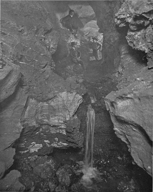
In the Sundance region a bed of gypsum, 20 to 30 feet thick in most places, lies about 120 feet above the base of the formation. In the Oil Creek region a bed of gypsum, which attains a thickness of 25 feet over an area of considerable extent, lies at the top of the formation; one of its most interesting exposures is at Red Butte, which it caps. (See Pl. IX, B.) In the vicinity of this butte a thin layer of gypsum at the base of the formation lies on the Minnekahta limestone. In the region northwest of Inyankara Mountain appears an upper bed of gypsum which extends to the vicinity of Sundance, where it is 8 feet below the top and 4 feet in thickness. The gypsum gives rise both to ridges, on many of the smaller divides, and to sinks, or caves (see Pl. X), where there is underground seepage on the slopes. One of the most remarkable sinks is on the east side of the main road 3 miles east of the center of Green Mountain. It is 30 feet in diameter and 25 feet or more deep, with a rim of red shale. Numerous small sinks were observed southwest of Black Buttes. A circle of gypsum ridges surrounds Green Mountain and the limestone dome south of Sundance Mountain and extends partly around Inyankara and Strawberry mountains. Gypsum Buttes, south of Sundance, are due to a small dome in Spearfish beds, and exhibit a rim of gypsum ridges with revetments. This is a miniature reproduction of the dome in Lime Buttes just to the north, and of Green Mountain, but is not uplifted sufficiently for erosion to have exposed the underlying limestone. The upper gypsum reaches a thickness of 18 to 20 feet in the ridge east of Spearfish, 6 to 8 feet near Whitewood, and about 10 feet near Sturgis. The lower bed is thin in the region between Spearfish and Rapid.
|
| PLATE IX.—A (top), LOOKOUT PEAK, NEAR SPEARFISH, S. DAK., FROM THE SOUTH. Slope of Minnekahta limestone in foreground; Spearfish to left; peak capped by Lakota sandstone. G, Gypsum ledges. B (bottom), RED BUTTE, SOUTHWEST OF BOYD, WYO. Spearfish red shale, capped by 30-foot bed of gypsum. |
|
| PLATE X.—INTERIOR OF CAVE IN GYPSUM, NEAR SUNDANCE, WYO. |
Thickness.—The thickness of the Spearfish formation is difficult to ascertain, owing to the lack of continuous exposures in the Red Valley. In the deep well at Fort Meade the amount appears to be 695 feet, but in the outcrops in the Red Valley farther south, notably in the vicinity of Piedmont, the amount measures considerably less than this. In the deep boring at Aladdin the "Red Beds" were entered about 400 feet below the surface and were penetrated for about 750 feet without reaching the base. Probably this boring passed entirely through the Spearfish formation and the Minnekahta limestone into the Opeche formation; but even if this is the case, it appears to indicate that the thickness of the Spearfish formation is at least 650 feet. In Redwater Valley near the mouth of Crow Creek the thickness is approximately 680 feet. In the region about Sundance and extending southward to Inyankara the amount is about 600 feet. In the Cambria well, a short distance south of the region to which this report relates, a precise measurement of 492 feet was made. In a section measured by G. B. Richardson, 1-1/2 miles west of Whitewood, with uniform dips of 28°, the thickness was 450 feet.
Local features.—In the Devils Tower region the most extensive exposures of the Spearfish formation are near the mouth of Barlow Canyon, midway between Hulett and the Devils Tower, where 200 feet of beds are above the river level. In this region some of the fresh surfaces show an indistinct nodular structure at many horizons, due to an incipient tendency to concretionary development. Several thin beds of gypsum occur near the top of the formation, but their thickness does not in general exceed 2 feet, and they are interbedded with soft shales. A typical section in this area, measured by O'Harra, is as follows:
Section of Spearfish formation on Belle Fourche River at base of Devils Tower, Wyoming.
| Feet. | |
| Red shales, mostly concealed | 25 |
| Gypsum in 1 and 2 foot bands with thin red shales between | 8 |
| Red clay shales, nodular and sandy in upper part | 10 |
| Massive and nearly uniform bed of red sandy shale | 30 |
| Very soft, and thin, clay shales, red | 12 |
| Soft clay shales with some arenaceous layers, red | 10 |
| Massive arenaceous bed, red | 4 |
| Very soft thin red clay shales, slightly green at top | 1/2 |
| Sandy bed with little clay, red | 1/2 |
| Very soft red clay shales, slightly nodular | 5 |
| Massive arenaceous bed, red | 2-1/2 |
| Arenaceous clay shales, inclined to nodular, red | 3 |
| Very soft, very thin, red clay shales | 6 |
| Thin arenaceous red shales | 1/2 |
| Very soft, very thin, red clay shales | 5 |
| Rather hard arenaceous red clay shales, slightly green near the top | 4 |
| Massive arenaceous bed, red | 6 |
| Arenaceous red clay shales, nodular | 5 |
| Gypsum; thin seam, one-eighth inch thick | |
| Soft, thin, red clay shales | 1 |
| Arenaceous red shales | 1/2 |
| Arenaceous clay shales, red and nodular | 2 |
| Massive arenaceous clay shales, red | 5 |
| Thin clay shales, red | 6 |
151-1/2 |
The exposures of the upper members of the formation on the north side of Redwater Valley near the mouth of Crow Creek exhibit the following beds:
Section of upper part of Spearfish formation in Redwater Valley, South Dakota.
| Feet. | |
| Greenish-gray sandy shale | 14 |
| Red sandy shale | 14 |
| Massive white sandstone, merging into gypsum | 3 |
| Green sandy shale, mottled red | 2 |
| Red sandy shale | 20 |
| Gypsum | 2 |
| Red sandy shale and soft red sandstone | 225 |
Below this are 395 feet of red sandy shale and soft sandstone, containing a 5-foot bed of gypsum 120 feet above the base of the formation. In places the gypsum is in two or three beds separated by thin bodies of red shale. East and northeast of Spearfish the upper gypsum beds increase in thickness, and one bed is 18 to 20 feet thick in the slopes near Lookout Peak. (See Pl. IX, A.) A section of these upper beds just east of Spearfish is as follows:
Section of upper beds of Spearfish formation east of Spearfish, S. Dak.
| Feet. | |
| Pink and green shales, with some gypsum | 12 |
| Light-red sandy shales | 2 |
| Massive gypsum | 2 |
| Light-red and green sandy shales | 4 |
| Gypsum | 2/3 |
| Light-red sandy shales | 3 |
| Gypsum | 1/3 |
| Light-red sandy shales | 4 |
| Massive gypsum | 12 |
| Deep-red shales down to alluvial flat | 100 |
In the lower beds in this section there are several thin beds of gypsum, one of which reaches a thickness of 2 feet on the northeast side of Lookout Peak.
The three following partial sections of the Spearfish formation are by Richardson:a
Section of upper beds of Spearfish formation on east side of Lookout Peak, South Dakota.
| Sundance formation. | Feet. |
| Massive white gypsum | 2 |
| Clayey sandstone | 12 |
| Massive white gypsum | 20 |
| Red sandy shale, with a few green streaks | 50 |
| Gypsum on red and green clay | 1/4 |
| Chocolate-brown sandy shale; a few gypsum veins | 20 |
| Red sandy shale under 1 inch of green clay | 2 |
| Gypsum | 1/6 |
| Red sandy shale, more massive below | 8-1/4 |
| Chocolate-brown sandy shale with streaks of green | 1 |
| Thin-bedded red sandy shale with specks of green | 10 |
| Chocolate-brown sandy shale with many gypsum veins. |
aRichardson, G. B. Upper Red Beds of the Black Hills: Jour. Geology, vol. 11, 1903, pp. 373-375.
Section of Spearfish formation 2 miles northwest of Beulah, Wyo.
| Feet. | |
| Sundance sandstone and conglomerate | 3 |
| Chocolate-brown sandy shale | 20 |
| Gray-drab clayey sandstone | 3 |
| Dark brick-red sandy shale | 5 |
| Red sandy shales, with beds of green clay 1 to 6 inches thick | 171 |
| Mottled gypsum (red-clay admixture) | 10 |
| Red sandy shale. | |
| Concealed | |
| Red sandy shale | |
| Massive white gypsum | 4 |
| Red sandy shale | 10 |
| White gypsum | 2 |
| Red sandy shale with veins of gypsum | 15 |
| Bedded gypsum. | |
| Minnekahta limestone. |
Section of lower Spearfish beds 1 mile northwest of Sundance, Wyo.
| Feet. | |
| Impure gypsum | 8 |
| Red sandy shale with network of gypsum veins | 20 |
| Massive white gypsum | 2 |
| Red sandy shale | 5 |
| White gypsum with gypsum veins | 1 |
| Chocolate-brown sandy shale | 3 |
| White gypsum | 1 |
| Red sandy shale with small specks of green clay | 5 |
| Concealed to Minnekahta limestone. |
Composition.—The composition of the sediments of the Spearfish formation has been investigated by Richardson, with the following results:a
Analysis of Spearfish red sandy shale.
[Analyst: George Steiger, U. S. Geological Survey.]
| SiO2 | 58.32 |
| TiO2 | .48 |
| Al2O3 | 8.59 |
| Fe2O3 | 2.04 |
| FeO | .18 |
| MnO | .07 |
| CaO | 8.45 |
| BaO | None. |
| MgO | 3.65 |
| K2O | 2.71 |
| Na2O | .72 |
| Water, 100°— | .52 |
| Water, 100°+ | 1.40 |
| P2O5 | .05 |
| SO3 | .43 |
| CO2 | 12.08 |
| Cl | Strong trace. |
99.69 |
aRichardson, G. B. op. cit., p. 380.
The elements are so distributed that an exact determination of the relative abundance of the minerals in the rocks analyzed is impossible. Estimates based on the analyses and the appearance under the microscope give the following approximate mineral composition of average red shale:
Mineral composition of Spearfish red shale.
| Quartz | 41 |
| Muscovite | 20 |
| Kaolin | 10 |
| Calcite | 9 |
| Magnesite | 8 |
| Feldspars | 5 |
| Hematite | 3 |
| Gypsum | 2 |
| Magnetite, ilmenite, chlorite | 2 |
100 |
Microscopic characters.b—Under the microscope the red shale is seen to be composed of minute white particles with irregular outlines coated by and frequently including an amorphous brown-red pigment. Quartz is the chief constituent, besides which the white minerals are muscovite, calcite, magnesite, kaolin, gypsum, and feldspar. Some magnetite and ilmenite and occasional fragments of chlorite are also present.
bRichardson, G. B., op. cit., pp. 377-380.
No systematic arrangement of the minerals occurs, the texture being characteristically sedimentary. The individuals are all minute; few are over 0.1 mm, in cross section, and the average is about 0.04 mm.
The quartz grains vary in size from 0.03 to 0.06 mm. in cross section. The particles are angular to subangular, seldom well rounded. Some of the contours are so irregular, though smooth, as to suggest corrosion. Many of the quartz grains are perfectly clear and transparent, while others contain inclusions. Slender prisms of rutile are included in a few of the quartz grains, while others contain fluid inclusions. These do not contain red pigment and probably are original minerals derived from the disintegration of the parent rocks. Other quartz grains contain numerous inclusions of the red pigment, and doubtless this quartz is secondary, being formed in the presence of iron oxide.
Muscovite is present in small clear rods, averaging 0.1 mm, long by 0.006 mm. wide. Sericite occurs sparingly in irregular patches, averaging 0.006 or 0.007 mm. in cross section and consisting of minute fibrous plates.
Carbonates occur scattered throughout the slides in rhombs that average about 0.03 mm. in cross section and in small irregular particles.
The presence of kaolin is suggested under the microscope by dull white flakes of irregular outline and of low refraction and birefringence. Bits of red pigment are frequently included, and the presence of kaolin is probable from chemical tests. The color was discharged from a piece of red clay by digestion in hydrochloric acid. The resulting gray powder was examined under the microscope, and white flakes of low double refraction were isolated, excluding quartz as far as possible. These flakes reacted for aluminum and water before the blowpipe.
Feldspars are very sparingly present. Some clouded fragments seem to be decomposed orthoclase. A few irregular areas of microperthite of fibrous appearance are also present, and very rarely bits of decomposed plagioclase occur.
Gypsum and dolomite, or magnesite, were not determined under the microscope, but their presence is shown by chemical analysis.
Amorphous red pigment is prominent in the slides. It irregularly coats and spots the minerals, and is included in some. The inclusions seem to be restricted to quartz and kaolin. This pigment constitutes the chief interstitial substance. It does not occur in continuous veinlike impregnations, nor does it form bands or local accumulations.
Analysis shows that the red pigment is iron oxide and that probably it is completely anhydrous. Sample No. 54, in which the complete analysis shows 2.84 per cent of combined water, was treated with hot hydrochloric acid until all of the iron was dissolved. The residue was found to contain 1.90 per cent of combined water, leaving 0.94 per cent available for the hydrous minerals which hydrochloric acid would attack. Gypsum, and possibly an iron hydrate, are the only ones that the acid would decompose. Calculating the amount of gypsum from the amount of SO3, it is found that 4.8 per cent of the rock is gypsum. This requires 1 per cent of water, which practically is the amount available. No water, therefore, is left for combination with the iron. It is true this calculation is but an approximation, but it appears evident that the red pigment is either anhydrous or nearly so.
Age.—The Spearfish deposits are distinctly separated from the Permian Minnekahta limestone below by an abrupt change of material. No fossils have been discovered in the formation and its precise age is unknown. From the fact that it lies between the Permian below and the marine Jurassic above it has been regarded as Triassic in age, but it may prove to be Permian, at least in part. It is separated from the Sundance formation by a planation unconformity representing all of early Jurassic and doubtless much of Triassic time.
JURASSIC SYSTEM.
SUNDANCE FORMATION.
Outcrop and character.—The Sundance formation, consisting of sandstones and shales, outcrops continuously around the Black Hills uplift, usually constituting a portion of the slope between the Red Valley below and the hogback ridge above. It also constitutes the surface over a wide area in the Belle Fourche Valley northwest of the Bear Lodge uplift, and a small area of the formation appears in the Bear Butte uplift. The most extensive exposures are in the portion of the Black Hills uplift which extends into Wyoming, especially in the region about Sundance and in the numerous high ridges in the Belle Fourche Valley in the vicinity of the Devils Tower and northward. There are also wide areas in the district drained by Redwater Creek. From Whitewood southward the formation extends along the inner or western slope of the hogback ridge where, owing to the steeper dips, the outcrop zone is narrow, and the rocks are in many places covered by talus from the cliffs above.
The formation consists mainly of shales, partly sandy, and sandstones, and has an average thickness of less than 300 feet. Several members remain persistent throughout, although there is considerable variation in the different sections. At the base are dark-gray or greenish-gray shales, usually 50 feet or more thick, overlain by a fine-grained sandstone of moderate hardness from 30 to 40 feet thick. This sandstone is a very characteristic, conspicuous, and persistent member of the formation, and in the regions of moderate dip it gives rise to tabular surfaces of considerable area, with marginal cliffs 25 to 40 feet high. It is of buff or slightly reddish tint and varies from massive to slabby in bedding. Some of the layers are strongly ripple marked, a characteristic feature of this horizon throughout the Black Hills. Its upper part merges into sandy shales of buff to gray color and these into soft impure sandstones or sandy shales, generally of pronounced reddish tint and from 50 to 150 feet thick. They resemble the Spearfish red shales, but the tint usually is much paler. Next follows a member consisting of dark-gray and greenish-gray shales 150 to 250 feet thick, containing a few thin beds of highly fossiliferous limestones. Thin beds of sandstone also occur in these shales. Near their top the shales become very sandy, are not fossiliferous, and grade into buff sandstone at the base of, or representing the Unkpapa sandstone. At the base of the Sundance formation there is usually exhibited a clearly defined erosional unconformity, in places showing slight channeling and thin deposits of sandstone and conglomerate.
Thickness.—The thickness of the Sundance formation is about 350 feet in the Belle Fourche Valley west of the Bear Lodge Mountains, 225 to 250 feet in the Redwater Valley, 325 feet in the region west and south of Sundance, 200 to 225 feet in the vicinity of Sturgis, 300 feet near Rapid, and somewhat less than 250 feet a few miles southwest of Rapid.
Local features.—At some localities the lower shales are underlain by a local thin bed of sandstone. In the vicinity of Sundance and farther south the basal shales are from 20 to 50 feet thick, the amount increasing gradually toward the south. Four miles south of Sundance the basal shale is 30 feet thick and lies on a 3-foot bed of red sandstone at the top of the Spearfish formation. In the small outlier northeast of Sundance the basal bed is 8 feet of light-colored soft sandy shales and sandstone, and it is overlain by 30 feet of green shale, capped by the usual buff, massive sandstone. This sandstone in the Sundance region is of buff color, fine grained, in part massively bedded, and 30 to 40 feet thick. It is a prominent feature, usually outcropping as a distinct bench with precipitous ledges in the general shaly slope. In many places it gives rise to terraces and low buttes. The upper part of this sandstone member merges into sandy shales of buff to gray color, and these into soft impure sandstones of a distinctly reddish tint, having a thickness of 40 to 60 feet. Above are dark-gray and greenish-gray shales about 150 feet thick, containing thin layers of fossiliferous limestone.
In the region south and southwest of Aladdin the basal gray shales are uniformly about 40 feet thick, are moderately hard, and in some places carry thin layers of sandstone. At a few localities they are underlain by a thin bed of sandstone, locally conglomeratic, lying on the Spearfish red beds. The sandstone member above the shales is in greater part massively bedded and from 30 to 40 feet thick. It has the usual buff or slightly reddish tinge, and some of the beds are slabby and strongly ripple marked. The overlying sandy shales are mostly red, and have a thickness of 50 to 150 feet, the latter amount in the region about Table Mountain. They thin rapidly toward the west, and near Alva are only a few feet thick. The upper shale series, which is 150 feet thick about Table Mountain, increases in thickness toward the west, and includes a number of thin beds of sandstone and a few thin beds of highly fossiliferous limestone. Near Alva one thin bed of sandstone in the upper shale series is 2 to 3 feet thick, but it thins out and is not noticeable in other portions of the region. Near their top the shales become more sandy, cease to be fossiliferous, and grade into a thin bed of bright-buff sandstone, which immediately underlies the Morrison shale and probably represents the Unkpapa sandstone.
Northwest of Beulah the lower shale is of green-drab color and 60 feet thick; 12 feet from the bottom it contains a 1-inch bed rich in fossils. At the base are 3 feet of white sandstone with smooth rounded quartzite pebbles from the size of a pea down, lying on the undulating eroded surface of the top of the Spearfish red beds. In the slopes of Lookout Peak east of Spearfish the basal green shales are 60 feet thick, and the massive sandstone member next above is 20 feet thick, with a few soft layers and shale partings and ripple-marked surfaces. Next above are 15 feet of green shales and thin sandstones, followed by 20 feet of buff sandstones, mostly thin bedded. These grade upward into 85 feet of soft sandstone and shales, mostly of red color. At the top are 125 feet or more of green shales, with a 2 to 3 foot bed of very fossiliferous limestone near the top.
In the Belle Fourche Valley, in the Devils Tower region, the basal shales are usually from 75 to 90 feet thick, the massive buff sandstone member from 40 to 60 feet, and the upper shales from 150 to 200 feet. The upper shales contain thin limestone layers, and are usually red in their lower portion. The limestones are nowhere more than a few feet thick, but are very fossiliferous. The shales appear to grade upward into a sandstone supposed to represent the Unkpapa. The lower sandstone is a prominent feature along the sides of the Belle Fourche Valley, where it gives rise to numerous cliffs and mesas, many of which are of considerable extent. (See Pl. XVI, A.) The color varies, fresh surfaces being generally light pink or gray and exposed surfaces showing some shades of red, yellow or buff. There is a degree of regularity in the areal distribution of colors. In the region southeast of the Devils Tower, along the upper portions of Whitetail, Blacktail, and Lytle creeks and their tributaries, the red is pronounced. In the vicinity of the Devils Tower the red color softens to a reddish-yellow or buff; north, northeast, and northwest of Hulett the reddish tinge is almost wholly lacking; west and south of the tower, and especially along Miller Creek, light yellow prevails.
The basal shales of the formation are in part sandy, and at many places include layers of sandstone which, with one exception, are soft, flaggy, and inconspicuous. The exception is in the vicinity of the Devils Tower, where midway in the shales there is a massive, sparingly fossiliferous quartzitic sandstone 4 to 8 feet thick. The best exposure of this quartzitic sandstone is along the roadside immediately north and northwest of the tower. The shale constituting the middle and upper parts of the formation is mainly of dark greenish-gray color and is more than 200 feet thick. In portions of the area the lower beds of this shale member for a thickness of 20 or 30 feet or more are pink, as in the eastern part of Bush Canyon, or red, as in the vicinity of Miller Creek. These red beds resemble the red shales of the Spearfish formation, but their position above the prominent massive sandstone member indicates their relation.
Several beds of massive, slabby, and shaly limestones occur in the upper shale member, varying considerably in character in different localities. North of the lower part of Miller Creek some of the limestones contain numerous clay-lime concretions or nodules. Nearly all contain considerable sand, and on well-weathered outcrops, where percolating water has had opportunity to dissolve out the lime, the sandy residue masks in considerable degree the original nature of the rock. The limestones are more resistant than the inclosing shale, so that they outcrop prominently on many of the slopes, but the exposures are almost nowhere sufficiently clear to admit of accurate measurement and it is not always practicable to determine the nature of the rock from the weathered material. The thickness ranges from a few inches to 10 feet, but is mostly from 4 to 6 feet, and the beds are from 5 to 40 feet or more apart. Most of them are highly fossiliferous, especially those nearest the top of the formation. Slabs filled with fossils and weathered individual fossils, particularly belemnites, which are in places very abundant, are conspicuous features on the surface. Here and there the belemnites occur in profusion among the other fossils in the limestones, but their chief occurrence seems to be in thin, hard, sandy beds and in lime nodular layers.
The following detailed sections by C. C. O'Harra show the thickness and character of the Sundance beds in the Devils Tower region:
Section of Sundance formation 2 miles north-northwest of Hulett Wyo.
| Feet. | |
| Massive yellow sandstone, very soft (Unkpapa?) | 30 |
| Shale, partly concealed | 25 |
| Highly fossiliferous limestone | 6 |
| Shale and talus | 10 |
| Fossiliferous limestone containing belemnites, etc.; chiefly concealed | 10 |
| Highly fossiliferous limestone, many oysters, few belemnites, some limestone pebbles 2 or 3 inches in diameter | 8 |
| Chiefly concealed; many fragments of limestone conglomerate | 8 |
| Highly fossiliferous limestone with a few lime-clay pebbles | 6 |
| Yellowish-gray shale; not well exposed but evidently containing several bands of belemnites | 12 |
| Greenish-yellow shale with lime-clay nodules | 5 |
| Highly fossiliferous, blue, slabby limestone | 2 |
| Chiefly concealed; apparently nearly all shale but with some thin highly fossiliferous limestones. Belemnites in great abundance; one fragment of ammonite | 50 |
| Massive reddish-yellow sandstone | 40 |
| Greenish-gray sandy shale, grayish-white in lower part | 80 |
| Flaggy grayish-white sandstone | 2 |
| Gray sandy shales lying on red beds | 3 |
297 |
Section on north side of Bush Canyon 3 miles north of Hulett, Wyo.
| Feet. | |
| Massive yellow sandstone, very soft (Unkpapa?) | 30 |
| Drab shale | 8 |
| Fossiliferous sandy limestone, slabby to nodular | 1 |
| Gray shale | 5 |
| Fossiliferous sandy limestone, slabby | 1 |
| Shale; mostly concealed | 20 |
| Massive gray sandy limestone, fossiliferous in upper part | 4 |
| Shale; mostly concealed | 18 |
| Fossiliferous sandy limestone | 4 |
| Shale; mostly concealed, containing at least three limestone beds, each limestone being sandy in lower part. The limestones divide the shale into three nearly equal portions | 92 |
| Fossiliferous sandy limestone | 4 |
| Purple and green shale, about | 40 |
| Massive yellow sandstone | 40 |
| Greenish-gray shale with thin sandstones, lying on red beds | 80 |
347 |
Section of Sundance formation north of Lytle Creek 4 miles east-southeast of Devils Tower, Wyoming.
| Feet. | |
| Massive yellow sandstone, very soft (Unkpapa?), about | 10 |
| Shale; partly concealed | 24 |
| Fossiliferous sandy limestone | 3 |
| Shale; mostly covered by talus | 5 |
| Flaggy nonfossiliferous limestone | 4 |
| Shale; partly concealed | 30 |
| Massive gray sandstone | 5 |
| Shale; partly concealed | 25 |
| Massive brownish sandstone | 6 |
| Shale; partly concealed | 35 |
| Gray flaggy limestone | 3 |
| Reddish shale; largely concealed | 60 |
| Massive reddish-yellow sandstone, thin bedded at top | 62 |
| Thin sandstones and shales | 6 |
| Gray shales; largely concealed | 14 |
| Heavy gray sandstone | 8 |
| Gray and drab shale | 14 |
| Massive sandstone | 2 |
| Gray sandy shales and thin sandstones | 25 |
| Massive sandstone | 4 |
| Thin sandstones and shales | 16 |
| Greenish-purple shale lying on red beds | 5 |
366 |
Section of lower part of Sundance formation on east bank of Belle Fourche River at Hulett, Wyo.
| Feet. | |
| Yellow, massive, highly ripple-marked sandstone, slight reddish tinge | 45 |
| Soft yellow sandstone | 10 |
| Very soft greenish shale with a few thin sandstones | 24 |
| Massive but soft yellow sandstones | 8 |
| Flaggy yellowish-gray sandstone with some fossils | 3 |
| Greenish clay shale | 12 |
| Buff sandy shale; a few fossils | 1 |
| Fissile gray shale | 3 |
| Gray sandstone with chalcedonic pebbles in upper part | 1 |
| Thin-bedded purplish-white soft shale | 1/2 |
| Gray sandstone | 1/2 |
| Fine white shale much resembling fire clay, lying on red beds | 4 |
112 |
Section of upper beds of Sundance formation on Cabin Cree southwest of Devils Tower, Wyoming.
| Feet. | |
| Massive yellow sandstone, very soft (Unkpapa?) | 12 |
| Thin gray and purple shale with a few lime-clay nodules | 20 |
| Flaggy yellowish sandstone | 2 |
| Yellowish-gray sandy shale with scattered lime-clay nodules and many small irregular fragments of chalcedonic material | 18 |
| Slabby sandstone | 4 |
| Purple and gray sandy shale with some lime-clay concretions | 16 |
| Massive, highly fossiliferous sandy limestone | 4 |
| Concealed. | 76 |
There are extensive exposures of the Sundance formation in slopes along the north side of the Redwater Valley southwest of Belle Fourche. The formation consists mainly of shale, partly sandy, and sandstones, and varies in thickness from 250 feet on the west to about 225 feet on the east. The several members are persistent throughout, although considerable local variation is presented. The basal dark-gray or greenish-gray shales are 50 feet or more thick. They are overlain by fine-grained, moderately hard sandstone from 30 to 40 feet thick, of buff or slightly reddish tint. This rock varies from massive to slabby in bedding, and some of the layers are strongly ripple marked. Its upper part merges into sandy shales of buff to gray color, and these into soft impure sandstones or sandy shales mostly of a pronounced reddish tint, which are from 25 to 50 feet thick. Next follows the usual upper member of dark-gray and greenish-gray shales, about 100 feet thick, containing local thin beds or lenses of highly fossiliferous limestone. Thin beds of sandstone also occur in these shales, and they usually grade upward into a few feet of buff sandstones at the top of the formation.
The reddish member in the middle of the formation is a pronounced feature throughout, especially in the slopes east of Spearfish, though along the Redwater Valley it is somewhat less noticeable. The following section near the mouth of Crow Creek illustrates the principal features:
Section of Sundance formation in Redwater Valley opposite mouth of Crow Creek, South Dakota.
| Feet. | |
| Greenish and yellowish shales; a few sandstone layers at top and near middle, and several very fossiliferous layers near top | 40 |
| Dark-gray to black shales with occasional harder layers containing belemnites and few layers of lime nodules | 60 |
| Greenish and yellow shales with thin sandstones, some belemnites | 10 |
| Soft sandstone | 1/2 |
| Green shale | 2 |
| Soft sandstone | 14 |
| Massive, very soft gray sandstone | 2 |
| Light-red, somewhat sandy shale | 16 |
| Massive soft pinkish-gray sandstone | 4 |
| Soft pinkish to buff sandstones | 14 |
| Soft grayish-buff massive sandstone | 18 |
| Greenish shales and thin sandstones | 4 |
| Massive grayish-buff sandstone | 3 |
| Flaggy, ripple-marked grayish-buff sandstone | 4 |
| Thin grayish-buff sandstone, with thin partings of greenish shale; all soft | 12 |
| Massive grayish-buff sandstone and greenish-gray shale, with thin sandstones containing a thin fossiliferous bed | 16 |
| Gray slabby sandstone lying on Spearfish red beds | 2 |
221-1/2 |
Along the east side of the Black Hills the Sundance formation presents the usual succession of beds with various local modifications. In places the lower shales contain flaggy sandstone and are separated from the Spearfish red beds by sandstone. Some portions of the lower beds contain considerable red material. The massive buff sandstone appears in all sections. The overlying reddish member is conspicuous throughout. The upper shales are extensively exposed on Rapid Creek, where they show a distinct green tint. They contain beds of limestone from 6 inches to 5 feet thick, mostly filled with fossils. A sandy bed with belemnites appears to be continuous at a horizon about 60 feet above the top of the red member. West of Sturgis and east of Elkhorn Peak a bed of quartzite is included, which is 7 feet thick near the former place.
The following sections were measured by C. C. O'Harra:
Section of Sundance formation 3 miles south or Rapid, S. Dak.
| Feet. | |
| Mostly concealed; contains a few geodes with quartz crystals | 80 |
| Gray and drab shale | 60 |
| Soft yellow sandstone | 10 |
| Soft gray shale | 25 |
| Red sandy shale | 85 |
| Gray shale, capped by ripple-marked yellowish-gray sandstone, all more or less fossiliferous | 50 |
310 |
Section of Sundance formation 6 miles southwest of Rapid Creek, South Dakota.
| Feet. | |
| Flaggy sandstone | 12 |
| Heavy sandstone | 4 |
| Limestone with fossils | 1/2 |
| Flaggy sandstone | 5 |
| Limestone with fossils | 2 |
| Heavy sandstone | 8 |
| Fossiliferous limestone | 2 |
| Light-colored shale | 3 |
| Sandy limestone, fossiliferous | 1/2 |
| Shale and concealed; apparently some fossils | 16 |
| Light-colored shale | 10 |
| Flaggy sandstone | 4 |
| Concealed; apparently some fossils | 20 |
| Mostly concealed; apparently contains belemnites | 50 |
| Yellow massive sandstone | 6 |
| Concealed | 4 |
| Heavy sandstone | 8 |
| Concealed | 30 |
| Flaggy sandstone | 10 |
| Redshale | 30 |
| Flaggy sandstone | 10 |
235 |
Fossils.—Fossils are abundant in all the exposures. One of the most conspicuous and abundant is Belemnites densus, a cigar-shaped form of heavy, hard carbonate of lime, smooth on the outside, but having a radiate structure within. These occur mostly in sandy layers in the upper shale series and weather out on the surface in such numbers as to be a notable feature in most of the outcrops. In the upper shales there also occur the following species:
|
Ostrea strigilecula. Avicula mucronata. Camptonectes bellistriatus. Astarte fragilis. Trapezium bellefourchensis. Trapezium subaequalis. Pleuromya newtoni. Tancredia inornata. |
Tancredia corbuliformis. Tancredia bulbosa. Tancredia postica. Dosinia jurassica. Saxicava jurassica. Ammonites cordiformis. Lingula brevistriatus. |
In the northwestern portion of the area a few layers of fossiliferous limestone and sandstone occur in the lower shales. The forms reported are as follows:
|
Ostrea strigilecula. Camptonectes bellistriatus. Pseudomonotis curta. |
Psammobia prematura. Belemnites densus. |
All these species are of later Jurassic age.
The Sundance formation is believed to be equivalent to the Ellis formation of Montana and the Yellowstone Park region.
UNKPAPA SANDSTONE.
The Unkpapa sandstone is much less extensively developed in the northern Black Hills than in the southern part of the uplift. It is, however, a distinct feature along the middle inner slopes of the hogback ridge northward beyond Whitewood, and is apparently traceable farther to the northwest and west as a thin bed of yellowish sandstone which is a constant feature in the portion of the uplift extending into Wyoming. In the southeastern portion of the area the sandstone is a massive fine-grained rock of remarkably uniform texture, varying in color from white to purple and buff, and always clearly separable from the Sundance below and the Morrison above. It outcrops continuously along the western slope of the hogback ridge, but is in places covered by talus from the ledges and cliffs of Lakota sandstone above. It rarely forms abrupt cliffs, but appears in slopes and gently rounded faces. Its thickness near Sturgis is from 60 to 70 feet; near Tilford and Piedmont 40 feet; and south of Rapid 30 to 50 feet; but in the slopes a mile north of Rapid it thickens locally to 150 feet. A small amount of the formation is exposed in the anticline 3 miles southeast of Piedmont Butte. A mile north of Rapid, where the formation is 150 feet thick, it is one body of soft white massive sandstone, which has been quarried to a small extent. The bedding of the sandstone is usually regular, but in some places considerable cross-bedding appears and much of the rock is stained irregularly with brown streaks of oxide of iron.
North of Sturgis the Unkpapa sandstone is easily traceable to the vicinity of Whitewood, appearing here and there as a soft, white, fine-grained rock, but, owing to its softness and the large amount of talus on the slopes, its thickness and relations could not be ascertained satisfactorily. In Lookout Peak it is either very thin or perhaps lacking. In the Belle Fourche region, north of the Devils Tower, as well as in most other portions of the uplift in Wyoming, the Sundance shales are capped by a sandstone of yellowish color, from 10 to 30 feet thick, which probably represents the Unkpapa sandstone. At one point between the Devils Tower and Missouri Buttes it attains a thickness of 40 feet, but in the Aladdin and Sundance regions and farther south it is considerably thinner than this.
The age of the sandstone is not known, but from its close association with the Sundance formation it is believed to belong in the Jurassic system. It may be the product of latest Jurassic time.
CRETACEOUS SYSTEM.
MORRISON FORMATION.
Character.—The Morrison formation consists mostly of massive shale of fresh-water origin, and it extends continuously throughout the northern Black Hills region. Its average thickness is about 200 feet, and its outcrop generally constitutes the upper portion of the slopes rising to cliffs or ridges capped by the Lakota and overlying sandstones. It has been called the "Beulah shale," but the name Morrison, from a town near Denver, Colo., has priority.
The prevailing color of the shale on weathered slopes is greenish gray or yellowish gray; but pink, maroon, and purple tints are not uncommon, and in a few places, particularly north of Hulett, the lower beds are red. Some exposures show decidedly darker shades, and in many places some of the upper beds are black and somewhat carbonaceous. Thin layers of lime-clay nodules are common, and at many outcrops develop into thin beds of limestone of various kinds. Sandstones are present locally, but are not usually conspicuous. The formation presents many local variations in character, but nearly everywhere the massive texture of the shale and its chalky appearance serve to distinguish it from the Sundance formation.
Thickness.—The Morrison formation is usually between 150 and 200 feet thick. Near Rapid it measures 165 feet. North of Piedmont it reaches a thickness of 220 feet locally, but appears to decrease to 70 feet in the slopes 2 miles south of Fort Meade. Four miles north of Tilford a thickness of 110 feet was measured; 1 mile south of Piedmont, 130 feet; 1 mile north of Rapid, 170 feet; 1 mile south of Rapid, 90 feet; 3 miles south of Rapid, 165 feet; in the region about Sundance and to the south, 150 feet; at Aladdin, 60 feet; east of Aladdin, 80 feet or more; in Redwater Valley southwest of Belle Fourche, 50 feet; near Lookout Peak, 100 feet; about Table Mountain and north of Eothen, 150 feet or more; in the slopes about Alva, approximately 100 feet; in Barlow Canyon, 85 feet; 3 miles north of Hulett, 150 feet; and on Miller Creek, 7 miles southeast of the Devils Tower, 160 feet. The thinnest section observed was 40 feet in Barlow Canyon, due north of the Devils Tower.
Local features.—In Owl Creek Canyon southwest of Boyd the formation contains much white sandstone. In the vicinity of Mona a bed of sandstone extends for some distance. In Barlow Canyon an 8-foot bed of sandstone occurs 30 feet above the bottom of the formation. About 3-1/2 miles north-northeast of Hulett, between Bush Canyon and Burnt Hollow, a 1-foot bed of sandstone was observed 70 feet below the top, followed 20 feet lower by a 2-foot bed. The total thickness at this place is about 150 feet. Near the head of Bush Canyon a 2-foot bed of sandstone occurs 20 feet above the bottom of the formation, and for several feet above this there are a few chalcedonic nodules and chalcedonized fragments of saurian limb bones and vertebrae. The following sections by C. C. O'Harra illustrate some characteristic features of the formation in the Devils Tower and Rapid regions.
Section of Morrison formation on north side of Moores Canyon 2-1/2 miles northwest of Hulett, Wyo.
| Feet. | |
| Grayish-purple shale | 20 |
| Dark-purple shale | 36 |
| Yellowish, slightly sandy shale | 4 |
| Nodular layer | 1 |
| Dark-greenish-gray shale | 10 |
| Nodular layer | 1 |
| Purple shale | 6 |
| Dark-gray shale with lime-clay nodules | 2 |
| Drab shale | 8 |
| Very soft sandy shale | 8 |
96 |
Section of Morrison formation 2-1/2 miles west of Belle Fourche River.
| Feet. | |
| Purple, gray, and yellowish shale with one or two thin sandstones | 60 |
| Flaggy to massive white sandstones | 4 |
| Purple and green shale with a few limestone nodules | 60 |
124 |
Section of Morrison formation on ridge south of Lytle Creek 8 miles southeast of Devils Tower, Wyoming.
| Feet. | |
| Argillaceous limestone | 2 |
| Concealed | 3 |
| Argillaceous limestone | 1 |
| Grayish soft shale | 12 |
| Argillaceous limestone | 1 |
| Yellowish-gray shale | 6 |
| Argillaceous limestone | 1 |
| Greenish shale | 40 |
| Argillaceous limestone | 1/2 |
| Greenish shale | 30 |
96-1/2 |
This section is believed to present nearly the full thickness at this place, although the upper and lower contacts are not clearly shown.
Section of Morrison formation on prominent Lakota-capped hill 4 miles east-southeast of Devils Tower, north of Lytle Creek, Wyoming.
| Feet. | |
| Impure fire clay, containing rough nodular layer | 2 |
| Fine green shale | 12 |
| Sandy fire clay | 1 |
| Fine green shale, locally with purple tinge | 70 |
| Lime-clay shale | 6 |
| Fine green and drab shale | 12 |
| Green shale with some lime-clay nodules | 16 |
| Limestone, slightly argillaceous | 6 |
125 |
Section of Morrison formation near head of Burnt Hollow 4 miles northwest of Hulett, Wyo.
| Feet. | |
| Very black shale, resembles a coal outcrop on weathered surface; may possibly represent the horizon of the Aladdin coal | 10 |
| Gray shale | 32 |
| Sandstone | 1 |
| Shale with poorly preserved plant impressions | 3 |
| Interbedded shales and thin sandstones | 18 |
64 |
Section of Morrison formation a short distance east of the foregoing section
| Feet. | |
| Very black shale, as in above section | 10 |
| Brownish-gray and purple shale | 14 |
| Sandstone | 2 |
| Brownish-red shale | 8 |
| Black shale | 40 |
| Light-gray shale | 36 |
110 |
Section of Morrison formation on north side of Sourdough Creek, 6 miles north of Hulett, Wyo.
| Feet. | |
| Shale, yellow at top, red at bottom | 18 |
| Black shale | 14 |
| Black shale with 4-inch sandstone near top, slight purple or pink tinge throughout and rather conspicuous near the middle | 17 |
| Black shale | 26 |
| Slightly sandy green soft shale; some lime nodules near base | 10 |
| White sandstone | 2 |
| Green shale | 5 |
| White sandstone, carbonaceous streaks | 2 |
| Gray and reddish shales | 40 |
134 |
Section of Morrison formation on north side of Deer Creek, 10 miles northeast of Hulett, Wyo.
| Feet. | |
| Dark-purple shale, weathers to light purple | 9 |
| Massive sandstone | 1 |
| Purple shale | 10 |
| Concealed | 8 |
| Purplish-gray shale | 12 |
| Dark-purplish shale | 20 |
| Very dark shale | 14 |
| Gray shale | 17 |
| Concealed; contains some sand | 24 |
| Green and purple shale | 6 |
| Sandy shale | 4 |
| White sandstone, weathering to a dirty velvety brown | 1 |
| Grayish-white shale | 5 |
| Green shale | 2 |
| Fissile purple shale | 6 |
| Grayish-green shale with some lime nodules | 16 |
155 |
Section of Morrison formation 3 miles south of Rapid Gap, S. Dak.
| Feet. | |
| Concealed to base of Lakota sandstone | 20 |
| Mostly green shale; partly concealed | 40 |
| Dark-green shale, weathering into small fragments | 6 |
| Massive gray sandstone | 5 |
| Green and purple massive shale, with some sand iron stains | 12 |
| Soft thin sandstones | 2 |
| Green sandy shale | 2 |
| Soft sandstone, green and gray | 12 |
| Green shale with some sand | 12 |
| Purple shale | 4 |
| Calcareous nodular layer Massive shale, green and purple | 2 |
| Purple shale, with calcareous nodular layer | 4 |
| Calcareous nodular layer | 1 |
| Massive shale, green and purple | 3 |
| Massive but soft sandstone, light red and brown at bottom, but mostly white; slightly brecciated near the top and contains some calcite | 20 |
| Massive red shale with some sand | 12 |
| Massive shale with calcareous nodules, purple and yellowish | 5 |
| Soft bright-red argillaceous shale | 3 |
165 |
About 1-1/2 miles south of Piedmont the lowest 30 feet of the beds are decidedly red and somewhat resemble the red member of the Sundance formation. North of Tilford there is considerable chert in the formation near its top, and a bed of pinkish limestone a foot thick occurs near its middle. At Rapid a bed of fire clay several feet thick at the bottom of the formation has been utilized to some extent in the manufacture of fire brick. A mile and a half north of Rapid, where the formation appears to be only 97 feet thick, it consists mostly of dark-greenish shale in its upper portion and of sandstones and sandy shales in its lower third. The sandstone is moderately massive in greater part and lies on a thick mass of Unkpapa white sandstone. A short distance farther south the lower sandstones are about 30 feet thick, and there is a middle member of thin-bedded sandstones and sandy shales and some breccia at the base. Three miles north of Piedmont, as well as in the vicinity of Tilford, a band of impure fire clay occurs near the middle of the formation; the impurities are largely calcite and silica, the latter appearing both as crystals and chalcedony. Six miles south of Rapid the top of the formation is a 10-foot bed of fire clay which merges downward into 50 feet or more of greenish shale.
Fossils and age.—Numerous bones of large dinosaurs have been obtained from the Morrison formation on the banks of Elk Creek, on the north side of Piedmont Butte, and similar remains occur at several other localities in the Black Hills and elsewhere. Many bones were observed by O'Harra 2 miles east-northeast of Eothen. These remains have usually been regarded as late Jurassic in age, but some eminent authorities now believe that they are earlier Cretaceous. The stratigraphic relations at various localities in some measure sustain this latter view. In the upper part of the Morrison formation, 3 miles north of Piedmont, small fossils about the size of a pin's head are found in great numbers; they are generally not conspicuous, but careful search will almost always reveal them on the weathered slopes, and here and there they extend up into the lowest strata of the Lakota. These small fossils have been examined by T. W. Stanton, who reports that they are small ostracod crustaceans belonging to the family Cypridae, and are somewhat similar to specimens collected in Morrison beds at Canon City, Colo.
LAKOTA SANDSTONE.
Distribution.—The coarse, hard Lakota sandstone constitutes the crest and inner face of the hogback ridge forming the outer encircling rim of the Black Hills. Its cliffs surmount rounded slopes of Sundance and Morrison shales, and in many portions of the region are of considerable extent and prominence. From Rapid northward for some distance, where the dips are moderately steep, the outcrop is narrow and the sandstone is in the crest of the ridge. In the northwestern portion of the uplift, where the dips are low, the sandstone outcrop widens into sloping plateaus of considerable extent, capped to a greater or less extent by the Dakota sandstone. These two sandstones constitute the northern portion of the high range known as the Bear Lodge Mountains and extend for many miles in a prominent escarpment along the northwest side of the Belle Fourche Valley.
Thickness.—The thickness of the formation is not uniform, but in general to the south and southeast it averages from 150 to 200 feet, while to the north and northwest it is considerably thinner, notably in the northern portion of the Belle Fourche Valley, where, in Burnt Hollow and on Deer and Sourdough creeks, it measures only 25 to 30 feet. On Cabin Creek, near Carlisle, it is only 30 feet thick, increasing to 60 feet farther up the creek. Midway between the Devils Tower and the Missouri Buttes and about the head of Lake Creek, south of the Missouri Buttes, the thickness is 40 feet. About 3-1/2 miles northwest of Hulett it is 50 feet. On Left Creek, 3 miles south-southwest of the Missouri Buttes, and in Barlow Canyon, northeast of these buttes, the formation is 50 feet thick. As it approaches Aladdin the thickness gradually increases to a maximum of about 183 feet half a mile west of the mines. It diminishes toward the east and is from 125 to 150 feet in the region south of Belle Fourche. From Whitewood southward the thickness varies from 70 to 200 feet. Near Piedmont it is 160 feet and on Boxelder and Rapid creeks it is 200 feet. In the Sundance region the thickness ranges from 150 to 300 feet. South of Inyankara the amount diminishes gradually to a minimum of less than 100 feet on Owl Creek, in T. 46 N.
Character.—The formation consists mainly of gray sandstones, mostly hard, massive, coarse grained, and cross-bedded. The basal beds are conglomeratic at most places, and where this is the case they are sharply separated from the underlying Morrison shale. Locally they are finer grained and less distinct from the Morrison. At a few localities, as in the region north of Mona, the sandstone is soft and disintegrates readily. Usually the formation is distinctly separated from the overlying Fuson clays, but in the region north and west of the Devils Tower and at some localities about Aladdin, it is difficult to draw the line between them. Small bodies of clay or shale are included in the formation and thin streaks of conglomerate also occur locally at various horizons, as well as at the base. At many localities there are slabby beds, some of them with ripple-marked surfaces.
Coal measures.—At or near the bottom of the formation occur local accumulations of coal in lens-shaped deposits or possibly channels of considerable area. This coal has been mined in the vicinity of Aladdin, Sundance, and Skull Creek, and by mines of moderate size at Cambria, a short distance south of the region to which this report relates. The deposits vary in thickness, reaching a maximum of 9 feet of thin coal beds in carbonaceous shale in the ridge west of Inyankara Mountain. At the Holwell mines, on Skull Creek, the coal attains a thickness of 8-1/2 feet and has been worked to some extent for local use. West of Sundance beds 4 feet thick are worked to supply the surrounding neighborhood.
At Aladdin, where the coal is mined to some extent for shipment, there are two workable beds. The principal bed, which is 2-1/2 to 3-1/2 feet thick, lies at the bottom of the formation. Another thinner bed lies about 10 feet higher, and the two are separated by sandy clays and shales. Above the coals there are about 60 feet of sandy shale, overlain by a massive coarse grained cross-bedded sandstone constituting the main mass of the formation and giving rise to prominent cliffs. The underlying coal and shale series is extremely variable in thickness and occurrence. Owing to the slipping of the overlying sandstone and to talus derived from it the coal horizon is rarely exposed, so that it is difficult to ascertain its relations except where excavations have been made. In some localities to the west and north it is known to be thin or absent.
Local features.—Jenneya reports the following beds at Aladdin:
Section of Lakota sandstone at Aladdin, Wyo.
| Feet. | |
| Fuson formation | 73 |
| Massive yellow sandstone, cross-bedded; cliff | 45 |
| Conglomerate of small pebbles of flint and quartz | 3 |
| Breccia of angular fragments of sandstone and shale in white clay | 3-10 |
| Yellow sandstone | 10 |
| Massive gray sandstone; thin layers form cliff | 40 |
| Drab clay shale; plant remains | 2-5 |
| Soft sandy shale, with carbonized plants | 2 |
| Coal | 1 |
| Soft yellow sandstone | 4 |
| Drab-clay shales | 12 |
| Coal | 3 |
| Drab massive shale (Morrison) | 15 |
aNineteenth Ann. Rept. U. S. Geol. Survey, pt. 2, 1899, p. 582.
The total thickness of the Lakota in this section is about 135 feet. Half a mile farther west the thickness appears to be 183 feet, including 75 feet of beds penetrated by a shaft. The following section is given by Jenney; some of the upper beds may belong in the Fuson formation:
Section of Lakota sandstone in western part of Aladdin, Wyo.
| Talus on lower Fuson beds. | Feet. |
| Yellow sandstone with iron concretions | 12 |
| Sandstone, in part shaly | 26 |
| Breccia of shale in white clay | 3 |
| Soft yellow sandstone | 6 |
| Massive yellow sandstone, forming cliff (typical Lakota) | 30 |
| Shale, in part sandy | 3 |
| Conglomerate (pebbles 1 to 2 inches), hard sandstone, and siliceous limestone; a few quartz pebbles | 8 |
| Soft sandstones and sandy shales | 20 |
| Shaft: | |
| Shales, clays, and soft sandstones | 55 |
| Coal | 5 |
| Clay and shales | 13 |
| Coal | 2 |
183 | |
The sandstones overlying the 3-foot breccia bed unite east and west of the section and form a cliff for some distance in either direction.
A section of the Lakota sandstone on the south side of the first ridge south of Aladdin, beginning at a slope of Fuson beds above and extending to light-colored Morrison clays below, is reported by Jenney as follows:
Section of Lakota sandstone south of Aladdin, Wyo.
| Feet. | |
| Massive yellow sandstone, cross-bedded | 35 |
| Yellow sandstone weathering in thin layers; cliffs | 35 |
| Clay shales and sandy shales | 4 |
| Soft yellow sandstone | 2 |
| Drab-clay shales with plant remains | 8 |
| Coal | 2 |
| Gray clay | 1 |
| Soft ocher-colored sandstone, thick bedded | 18 |
| Soft yellow sandstone | 8 |
| Gray sandy shales | 4 |
| Soft yellow sandstone | 3 |
| Gray clay shales | 4 |
| Coal, impure and shaly | 2 |
| Yellow sandy shales | 6 |
| Drab clay | 3 |
| Coal | 1 |
| Gray clay | 2 |
| Gray clay shale | 7 |
| Carbonaceous shale with thin layers of coal | 1 |
| Gray sandy shales | 15 |
| Carbonaceous shales with fossil plants | 3 |
| Soft yellow sandstone, iron stained | 1 |
| Morrison light clays. | 165 |
Some excellent sections of the Lakota are exposed in coal prospects north of Forks, mainly in a tunnel run into, the hillside about 60 feet, and in two shafts each 190 feet deep. These are 1-1/2 miles and 2 miles north of Forks, respectively. Data for the following combined section are reported by Jenney:
Section of Lakota sandstone north of Forks, Wyo.
| Tunnel: | Feet. |
| Coarse gray sandstone | 5 |
| Massive yellow sandstone, cross-bedded | 30 |
| Massive, soft, yellow sandstone, thin bedded; underlain by two thin beds of coal 9 inches and 1 foot thick at the tunnel | 40 |
| Shafts: | |
| Drab clay shales | 20 |
| Shaly coal | 1 |
| Sandstone | 1 |
| Alternating beds of shales and sandstone | 12 |
| Coal | 1/2 |
| Black shale | 2 |
| Sandstone | 3 |
| Coal and shale | 1 |
| Clay | 3 |
| Sandstone | 2 |
| Black clay shale, changing to gray shale at base | 12 |
| Sandstone | 2 |
| Shale with plants | 2-1/2 |
| Sandstone | 6 |
| Morrison clay. | 143 |
In the Devils Tower region, as in other portions of the Black Hills uplift, the Lakota formation shows considerable resemblance to the Dakota. It is, however, not so continuously massive and, although hard in some localities, it is generally softer than the Dakota and a less marked feature in the topography. On Cabin Creek, 4 miles west of the Belle Fourche, the Lakota sandstone consists of an upper member of reddish flaggy sandstone 20 feet thick, and a lower member of nearly white massive sandstone 40 feet thick. Near Miller Creek, 4 miles east of the Belle Fourche, it consists entirely of white massive sandstone 60 feet thick.
Section of Lakota sandstone in Burnt Hollow, north of Hulett, Wyo.
| Feet. | |
| Massive gray cross-bedded sandstone | 2 |
| Shaly sandstone | 7 |
| Massive cross-bedded sandstone, much iron stained | 10 |
| Flaggy sandstone with iron concretions | 4 |
| Massive cross-bedded yellowish-gray sandstone, with few iron concretions | 8 |
| Shaly sandstone, with considerable iron | 3 |
| Massive gray sandstone | 3 |
| Shaly sandstone; considerable iron near bottom | 4 |
| Flaggy sandstone | 2 |
| Gray sandy shale | 3 |
| Massive sandstone | 1 |
47 |
Section of Lakota sandstone on north side of Sourdough Creek, northwest of Hulett, Wyo.
| Feet. | |
| Massive yellowish-gray sandstone | 10 |
| Soft shaly purplish-gray sandstone | 1 |
| Flaggy purplish sandstone; several bands of iron oxide | 14 |
| Massive sandstone | 1 |
| Shaly sandstone | 1 |
| Massive soft sandstone | 3 |
30 |
In the portion of the hogback ridge extending from Hay Creek to Whitewood Creek the Lakota sandstone varies from massive to flaggy and from gray to buff; much of it is coarse grained, hard, and to some extent cross-bedded. There are in many places three members—an upper massive gray to buff coarse sandstone with fragments of petrified wood; a middle gray sandstone, mostly soft and flaggy, in part quartzitic, and containing much petrified wood; and a lower massive gray to buff sandstone closely resembling the upper member, but without the petrified wood. The middle member generally contains some clay as pebbles or irregular masses tn its upper part. Generally either the upper or the lower member is well exposed, and in places both are prominent. In the ridge north of Falsebottom Creek, where the thickness is 90 feet, the formation consists of 20 feet of flaggy buff sandstone at the top, 25 feet of soft dark sandstone in the middle, and 45 feet of massive gray to buff sandstone merging downward into a fine grained conglomerate at the base. Near the mouth of Polo Creek similar features are presented, but the thickness is somewhat less. In the ridge north of Redwater River, opposite the mouth of Lake Creek, the total thickness is about 60 feet; and this amount is the average thickness for some distance eastward. In the uplift southeast of St. Onge the following section was measured:
Section of Lakota sandstone 6 miles southeast of St. Onge, S. Dak.
| Feet. | |
| Massive buff sandstone | 25 |
| Soft flaggy sandstone, in part quartzitic; streaks of conglomerate with moderately large quartz pebbles, and with pebbles and masses near top; petrified wood | 30 |
| Soft flaggy sandstone, irregularly bedded | 15 |
70 |
Other sections are as follows:
Section of Lakota sandstone on Spring Creek, 4 miles northwest of Sturgis S. Dak.
| Feet. | |
| Buff sandstone, partly cross-bedded; ripple marks | 94 |
| Sandstone, purple | 5 |
| Sandstone, rusty | 2 |
| Sandstone, gray, slabby, ripple-marked | 1-1/2 |
| Sandstone, massive, buff, pitted; shaly partings | 30 |
| Talus | 35 |
| White shale | 1 |
| Lilac hackly shale | 6 |
| Sandstone, brick colored | 10 |
| Sandstone, massive, cross-bedded, buff to variegated; ripple marks | 15 |
| Sandstone, buff | 25 |
| Sandstone, white | 6 |
| Sandstone, dark buff | 5 |
| >Morrison green shales. | 235-1/2 |
Section of Lakota sandstone on south side of Piedmont Butte, South Dakota.
| Feet. | |
| Concealed, but containing petrified wood scattered on surface | 40 |
| Massive sandstone | 10 |
| Soft white sandstone | 24 |
| Massive sandstone and conglomerate; well-rounded pebbles less than one-half inch in diameter | 10 |
| Concealed | 8 |
| Sandstone with 2-foot bed of conglomerate of small rounded pebbles with a few scattered bowlders, 2 inches or more in diameter | 8 |
| Red, irregularly bedded, locally brecciated sandstone; calcite in crystals and botryoidal laminated, or pisolitic form | 60 |
160 |
Section of Lakota sandstone on Boxelder Creek, South Dakota.
| Feet. | |
| Weathered sandstone; largely concealed | 25 |
| Ragged, uneven sandstone, with angular blocks and streaks of clay and with numerous pieces of petrified wood in place, but not in original position of growth | 25 |
| Heavily bedded sandstones 1 to 4 feet thick; intervening soft shales 1 to 6 inches thick | 60 |
| Thin-bedded sandstones; mostly concealed | 50 |
| Heavy sandstone in 1 to 4 foot beds | 40 |
200 |
On the north side of Elk Creek several slabs of sandstone were found in the lower part of the Lakota formation carrying impressions of hopper cubes, which apparently are casts of halite crystals.
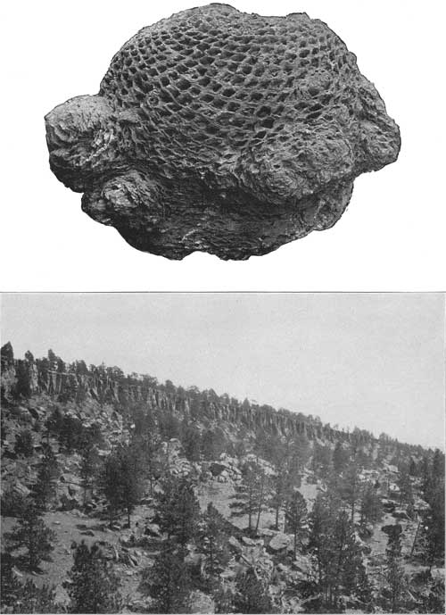
|
| PLATE XI.—A (top), CYCAD TRUNK FROM THE LAKOTA SANDSTONE. B (bottom), TYPICAL CLIFFS OF DAKOTA SANDSTONE. |
Fossils and age.—In the upper portion of the Lakota sandstone a large amount of petrified wood occurs. This lies on many of the slopes of the hogback ridge, but it is rarely exhibited in place. At one exposure on Boxelder Creek, near the cycad locality southeast of Piedmont, the wood is exposed in the upper sandstone member. Two miles southeast of Piedmont Butte one tree trunk is exposed, having a length of 25 feet. In the wood-bearing stratum a few scattered bowlders occur, up to 3 inches or more in diameter, consisting of quartz, quartzite, and other rocks similar to those of the Algonkian in the central portion of the Black Hills uplift. A large amount of petrified wood occurs in Barlow Canyon due north of Missouri Buttes, and smaller amounts were observed 2-1/2 miles northwest of Hulett and 4 miles east of Devils Tower. Numerous cycads have been obtained from the upper portion of the Lakota sandstone at several localities in the vicinity of Blackhawk. These plants had an oval trunk extending a short distance out of the ground, with leaves on long stems growing out of its surface. The fossil cycad ordinarily consists of the petrified trunk, which shows the deep scars of the former sockets of the leaf stems. (See Pl. XI, A.) The principal locality from which cycads have been collected is nearly due north of Blackhawk, at a point half a mile south of Clemmons Spring. Some specimens are reported northeast of Harding Gulch, near the north end of the Bear Lodge Mountains. These cycads are believed to be of earlier Cretaceous age. Fossil leaves of various kinds found in the Lakota formation in various portions of the Black Hills are also of that age. The principal collections of leaves have been made by. W. P. Jenney north of Hay Creek. They are described by Ward and Fontaine.a
aNineteenth Ann. Rept. U. S. Geol. Survey, pt. 2, 1899, pp. 521-946.
Three miles north of Piedmont, in almost the lowest stratum of the formation, were found numerous isopods, probably of the family Ægidae, similar to forms still living. They were determined by Stanton, who states that they occur as early as the Purbeck, or latest Jurassic. These are the first isopods found fossil in America. A short distance below the stratum containing them, which was 25 feet above the top of the Morrison formation at this locality, occurs an undetermined form of Estheria, scales of a gar (Lepidostus), and a crocodile tooth, all fresh water forms. Numerous remains of a small ostracod crustacean, similar to those in the underlying Morrison beds, were found in the basal beds of the Lakota sandstone, 3 miles north of Piedmont.
FUSON FORMATION.
Character and outcrop.—The series of shales and thin-bedded sandstones lying between the massive Lakota and Dakota sandstones has been designated the Fuson formation. Much of the material is massive sandy shale, in part of purplish color, with thin sandstone layers. The formation is extensively concealed by talus or wash from the overlying beds, but usually its position is indicated by a well-defined slope between the sandstone cliffs. On the east side of the Black Hills uplift the formation generally lies on the lower, outer slopes of the hogback ridge.
Thickness.—The formation is 100 feet thick on Rapid Creek; but it thins slightly toward the north and is only 65 feet thick near Sturgis. In the vicinity of Whitewood the thickness is about 70 feet. South and southwest of Belle Fourche it ranges from 70 to 80 feet. At Aladdin it is from 73 to 102 feet, west of Farrall it is 80 feet, 2 miles east of Eothen it is 60 feet, and near Alva and north of Forks it is 122 feet. In the Belle Fourche Valley in the vicinity of the Devils Tower, it measures from 50 to 100 feet. In the Sundance region and farther south the thickness is much less, being mostly from 10 to 15 feet, but attaining 40 feet in a few places.
Local features.—On the west side of Oil Creek, where the formation is 20 feet thick, it consists of dark-gray shale and sandy shale overlain by 6 feet of thin-bedded buff sandstone. In the slopes northwest of the Bear Lodge uplift the sandstones of the formation are of more than usual prominence, and constitute at least two-thirds of its thickness—50 to 100 feet. Two miles south of Aladdin the formation includes an 8-foot and a 3-foot bed of sandstone. Near Eothen the sandstones constitute nearly half of the formation. Here the upper beds usually show a rapid transition from purple and red clay to yellow, gray, and carbonaceous shales with thin ironstone and sandstone layers. In the region about Mona and north of Hulett a large amount of sandstone occurs in the formation, both near the bottom and locally toward the top. The following sections measured by O'Harra illustrate the stratigraphic features of the formation in a number of representative exposures near Belle Fourche River in, the Devils Tower region:
Section of Fuson formation north of Cabin Creek, 2-1/4 miles west of Belle Fourche River, Wyoming.
| Feet. | |
| Massive black shale overlain by Dakota sandstone | 10 |
| Sandy shale and concealed | 10 |
| Flaggy to massive sandstone | 4 |
| Shales, thin sandstones, and concealed | 30 |
| Massive sandstones | 2 |
| Sandy shale and concealed | 10 |
| Shaly sandstone | 6 |
| Black carbonaceous shale | 6 |
| Yellowish-gray sandy shale | 8 |
| Massive purple shale | 5 |
| Yellowish sandy shale | 4 |
95 |
Section of Fuson formation north of Cabin Creek, 4 miles west of Belle Fourche River, Wyoming.
| Feet. | |
| Yellowish-gray sandy shale, darker near the top | 36 |
| Massive yellowish sandstone | 3 |
| Yellowish sandy shale | 6 |
| Massive yellowish sandstone | 5 |
| Yellowish-gray shale, darker near the top | 50 |
100 |
Section of Fuson formation 2-1/2 miles northwest of Hulett, Wyo.
| Feet. | |
| Shale and concealed | 12 |
| Sandstone | 4 |
| Shale | 6 |
| Sandstone | 2 |
| Shale and concealed | 85 |
109 |
Section of Fuson formation on north side of Burnt Hollow, Wyoming, near its head.
| Feet. | |
| Sandy shale, very dark near the top, gray below | 16 |
| Flaggy sandstone with some iron concretions | 4 |
| Dark-gray shale | 12 |
| Massive sandstone | 2 |
| Gray sandy shale | 22 |
56 |
Section on Sourdough Creek north-northwest of Hulett, Wyo.
| Feet. | |
| Flaggy sandstones and sandy shales | 32 |
| Grayish-black shale | 10 |
| Flaggy sandstone | 4 |
| Purple sandy shale | 5 |
51 |
Near the headwaters of Pine Creek, northwest of Aladdin, Wyo., the formation comprises the following beds, as reported by Jenney:
Section on north side of Pine Creek, Wyoming, near its forks.
| Dakota: | |
| Massive gray sandstone, weathering in large blocks, red to black on surface. | |
| Fuson: | Feet. |
| Light-gray sandy shale; base not exposed | 5 |
| Unexposed slope (probably shale) | 30 |
| Yellow sandstone, weathering brown | 4 |
| Gray clay shale; base covered | 4 |
| Unexposed slope | 28 |
| Yellow sandstone, thin bedded | 8 |
| Gray sandy shale | 2 |
| Clay shale with imperfectly preserved plants | 2 |
| Unexposed slope | 6 |
| Yellow sandstone, thin bedded | 3 |
| Gray sandy shale; well-preserved plants; low bluff | 14 |
| Unexposed slope to Pine Creek | 5 |
111 | |
The basal gray sandy shale yielded a large collection of fossil plants in the vicinity of this section. On the south side of the creek, half a mile to the southwest some of these beds are again exposed together with lower ones.
Oak Creek, near its junction with Alum Creek, cuts through the Dakota sandstone and reveals the greater part of the Fuson formation. The following beds are reported by Jenney:
Section in Oak Creek canyon, near Alum Creek, north of Aladdin, Wyo.
| Top of plateau. | |
| Dakota: | Feet. |
| Red sandstone, much denuded | 2 |
| Carbonaceous shale with thin coal | 1 |
| Red sandstone | 10 |
| Fuson: | |
| Shales and sandstones partly exposed on slope | 60 |
| Carbonaceous black shale, coaly | 1 |
| Drab sandy shale with finely preserved plant remains | 4 |
| Yellow sandstone | 3 |
| Drab clay and sandy shales | 2 |
| Gray sandstone | 7 |
| Gray sandy shale | 5 |
| Black carbonaceous shale, base of cliff, creek bottom | 4 |
99 |
The following section at the Robbins ranch, on Oak Creek a mile above the locality of the preceding section, illustrates some of the stratigraphic variations in the formation:
Section at Robbins ranch on Oak Creek northeast of Aladdin, Wyo.
| Dakota sandstone | Feet. |
| Unexposed slope with outcrops of sandstone | 60 |
| Soft massive sandstone, weathering thin bedded | 15 |
| Black carbonaceous shale and clay | 3 |
| Light-purplish sandstone | 10 |
| Gray massive shale | 2 |
| Reddish-purple sandstone and sandy shales, iron concretions | 4 |
| Soft yellow sandstone | 6 |
| Massive shale and sandy shale; well-preserved plants | 2 |
| Gray shale | 3 |
| Carbonaceous black shale | 3 |
| Drab clay | 3 |
| Sandstone | 5 |
| Talus to Oak Creek | 20 |
In this section the formation appears to have a thickness of about 110 feet, but the top and bottom are not clear. The prolific plant horizon mentioned in the section lies 102 feet below the supposed base of the Dakota sandstone. In Robbins prospect tunnel, a mile to the southeast, where 122 feet of the formation are exposed to or very nearly to the top of the Lakota sandstone, this plant horizon is 117 feet below the Dakota ledges.
On South Branch of Hay Creek the formation is mostly obscured by talus so that complete exposures are rare. At Aladdin the following beds are reported by Jenney:
Section of Fuson end adjoining formations at Aladdin, Wyo
| Feet. | |
| Dakota sandstone | 30+ |
| Talus | 15 |
| Yellow-brown sandstone | 5 |
| Talus | 12 |
| Yellow-brown sandstone | 6 |
| Purple clay, partly exposed | 20 |
| Yellow sandstone, thin bedded | 15 |
| Massive Lakota sandstone | 45 |
The thickness here is only 73 feet. Half a mile farther west the formation appears to be 102 feet thick, comprising the usual succession of shales and clays with beds of soft brown sandstone 6 to 15 feet thick, but its limits are somewhat indefinite. On the south side of the ridge, a mile farther south, it is 70 feet thick.
The following is a section near St. Onge:
Section of Fuson formation 4 miles southeast of St. Onge, S. Dak
| Feet. | |
| Yellowish sandy shale | 18 |
| Dark shale, weathering to light purple | 20 |
| Shale, dark gray to black; iron stained; weathers dark purple | 10 |
| Sandy fire clay; conchoidal fracture; sandy and carbonaceous near bottom | 12 |
| Concealed | 10 |
70 |
Near the road 4 miles south of Belle Fourche the formation consists largely of dark shale that weathers to yellow in the upper part and to drab and purple tints lower down.
In the region between Rapid and Whitewood the formation consists mainly of clay. It outcrops along the eastern slope of the hogback ridge, but owing to the softness of the material large outcrops are rare. The clay gives rise to many small areas of miniature badlands. There are fair exposures on Rapid Creek and in the gulches south of that stream. The principal materials are shale, fire clay, and thin sandstones of various colors. The upper beds are in many places black and the middle and lower ones white, yellow, red, and purple. North of Tilford the upper half of the formation is a soft shale, purple, buff, and red below, underlain by black shale. Southeast of Piedmont the upper beds are dark-gray and black shales with a few layers of soft sandstone. South of Rapid the upper shale is dark, the middle beds white, and the lower beds yellow and red fire clay and shale. The fire clay has been mined to some extent 7 miles south of Rapid. At these mines the formation consists of 10 feet of thin-bedded shaly sandstone grading upward into the Dakota; 3 feet of dark-blue shale; 1-1/2 feet of dark bluish-gray shaly sandstone; 10 feet of brown and gray shale with several iron-bearing layers from 1 to 3 inches in thickness; 1-1/2 feet of hard sandstone; and 45 feet of gray fire clay weathering in badlands slopes. At the base of the exposure are 6 feet of massive sandstone, probably at the top of the Lakota formation.
A section northwest of Whitewood, measured by O'Harra, is as follows:
Section of Fuson formation northwest of Whitewood, S. Dak.
| Feet. | |
| Yellowish sandy shale | 18 |
| Dark-gray clay, weathering light purple | 20 |
| Dark-gray to black iron-stained clay, weathering dark purple | 10 |
| Sandy fire clay, with carbonaceous fragments | 12 |
| Concealed | 10 |
70 |
Fossils and age.—The Fuson formation constitutes part of "bed No. 2 of the Dakota group," as described by Jenneya in the Hay Creek coal field. It here includes a plant-bearing horizon which apparently is continuous over a wide area in the region lying between Pine and Hay creeks and to the south. From it Jenney obtained a large number of finely preserved plant remains, which have been described by Ward and Fontaine.a According to Ward the age of these plants is Lower Cretaceous.
aNineteenth Ann, Rept. U. S. Geol. Survey, pt. 2, 1899, pp. 521-946.
DAKOTA SANDSTONE.
Character.—The formation here described as the Dakota sandstone is the uppermost member of the series formerly designated "Dakota sandstone" in the Black Hills and other regions. It is more than 100 feet thick at most localities, and usually constitutes only a small part of the hogback ridge, but it is conspicuous because it rises steeply out of the adjoining valley or level plain excavated in the overlying Graneros shale.
The rocks are mainly brown sandstones, usually more iron stained than those of the Lakota, hard and massive in structure below and thinner bedded above. The sandstone is thin and inconspicuous in the hogback ridge about Rapid and for some distance northward, as well as in the region south and southwest of Sundance; but in the northern portion of the uplift it caps many high ridges and constitutes the surface of elevated plateaus of considerable extent.
Throughout its course the lower, massive member usually appears in cliffs of reddish color, many of them with a characteristic rude columnar structure. (See Pl. XI, B.) The Dakota sandstone contains considerable iron, to which is due the red color of the rocks when weathered. There is also a considerable amount of iron in small concretions of ironstone or sand cemented by oxide of iron. The sandstones are light gray on fresh fracture, but all prominent cliffs show a light brown or yellowish brown on exposed surfaces.
Here and there deposits of shale are included, especially in the lower portions and where the formation expands in thickness. This shale varies from nearly pure clay to mixtures of sand and clay and ranges in color from gray to black. In the high vertical walls of Government Canyon the shales and thin-bedded sandstones are of sufficient importance to mask in considerable measure the general massive nature of the formation. In a few places carbonized fragments of plants occur in the shales, notably in Government Canyon, where the carbonaceous material makes up a very considerable portion of one or two of the beds.
Thickness.—The thickness of the Dakota in the Bear Lodge Mountains and farther west varies from 70 to 160 feet and is not usually less than 100 feet. In the region west and south of Sundance the Dakota presents its usual characteristics, but diminishes in thickness to less than 100 feet, and west of Mason and Skull creeks it is only 40 to 60 feet thick. South and southeast of Aladdin its thickness averages 60 feet. In the Devils Tower region it varies from 70 feet near the head of Burnt Hollow to 160 feet on Barlow Canyon. In the vicinity of Rapid it is from 25 to 40 feet; 2 miles south of Rapid it is apparently not more than 26 feet. Southeast of Piedmont it is 20 feet, midway between Tilford and Fort Meade 10 feet, and north of Sturgis 35 feet. In the Sturgis-Whitewood region it varies from 35 to 50 feet, and is 40 feet or even less on Spring Creek. Southeast of St. Onge it is from 40 to 50 feet, and south and southwest of Belle Fourche from 60 to 80 feet.
Local sections.—The principal features of the formation at several localities in the Devils Tower region are shown by the following sections, measured by O'Harra:
Section of Dakota sandstone in Barlow Canyon, southwest of Hulett, Wyo.
| Feet. | |
| Thin sandstone to top of hill | 30 |
| Flaggy to massive sandstone | 10 |
| Shaly sandstone | 28 |
| Massive sandstone | 4 |
| Shaly sandstone | 8 |
| Massive sandstone | 6 |
| Concealed slope | 10 |
| Massive sandstone | 6 |
| Shaly sandstone and concealed | 22 |
| Massive, highly cross-bedded grayish-brown sandstone | 36 |
160 |
The above section is on the north side of Barlow Canyon, just across from the foot of the steep road leading up to Missouri Buttes.
Section on the north side of Barlow Canyon, 1 mile east of preceding section.
| Feet. | |
| Concealed; slope | 20 |
| Massive sandstone, slightly flaggy at bottom | 65 |
| Shale and concealed | 40 |
| Massive sandstone, with iron oxide near bottom | 8 |
| Concealed; slope | 5 |
| Massive sandstone | 8 |
146 |
Section of Dakota sandstone on the north side of Burnt Hollow, Wyoming, near its head.
| Feet. | |
| Soft flaggy sandstone | 20 |
| Massive yellowish-gray sandstone | 5 |
| Shaly sandstone | 5 |
| Massive sandstone | 1 |
| Shaly sandstone | 4 |
| Massive sandstone | 3 |
| Flaggy and shaly sandstone | 5 |
| Limonitic sandstone | 1/2 |
| Sandy shale | 2 |
| Massive gray sandstone, iron oxide at bottom | 4 |
| Shaly sandstone; iron-oxide bands | 4 |
| Thin gray shale | 1 |
| Massive sandstone | 3 |
| Flaggy sandstone | 1 |
| Gray shale | 3 |
| Black shale | 2 |
| Massive sandstone | 1 |
| Sandy shale | 1/2 |
| Massive yellowish-gray sandstone | 5 |
70 |
The following section is in Government Canyon, 3 miles above its mouth, or 16 miles north of Hulett:
Section of Dakota sandstone near mouth of Government Canyon, Wyoming.
| Feet. | |
| Flaggy sandstone | 16 |
| Massive sandstone | 6 |
| Dark sandy shale | 15 |
| Sandstone with iron concretions | 1 |
| Highly carbonaceous black shale | 10 |
| Massive sandstone | 14 |
| Flaggy to massive sandstone | 8 |
| Grayish shaly sandstone with iron concretions | 4 |
| Flaggy to massive sandstone with iron concretions near the bottom | 10 |
| Dark-gray carbonaceous shale | 5 |
| Shaly sandstone | 6 |
| Flaggy to massive sandstone | 4 |
| Sandstone with iron concretions | 1 |
| Shaly to flaggy sandstone | 5 |
| Massive sandstone | 4 |
| Shaly sandstone with iron concretions | 12 |
| Flaggy sandstone | 7 |
| Yellow sandy shale with iron concretions | 8 |
| Shaly carbonaceous sandstone | 4 |
140 |
Near the Robbins ranch, on Oak Creek, northeast of Aladdin, where the Dakota sandstone is 78 feet thick, it comprises 25 feet of sandstones and sandy gray shales at the top, underlain by 3 feet of black shales with poorly preserved plant remains, 10 feet of thin-bedded sandstone, and, at the base, 40 feet of massive sandstone of yellow to gray color, weathering reddish and brown. Below is a 60-foot slope, probably all Fuson, with only a few sandstone layers outcropping, and then a succession of Fuson sandstones and shales.
In the vicinity of Aladdin the Dakota beds capping the cliff present about 70 feet of beds, mostly soft gray and yellowish sandstone, thin bedded for the lower 15 feet.
The following is a section near Spearfish Creek:
Section of Dakota sandstone 2 miles west of the mouth of Spearfish Creek, South Dakota.
| Feet. | |
| Shaly and slabby sandstone | 20 |
| Massive cross-bedded quartzitic sandstone, in part pinkish on fresh fracture | 16 |
| Massive to flaggy gray sandstone | 4 |
| Flaggy to shaly sandstone of pinkish tint | 8 |
| Shaly sandstone, much stained with yellow and red | 4 |
| Soft shaly sandstone, brown stains | 8 |
| Sandstone, mostly thin bedded; a few ironstone layers and nodules | 20 |
80 |
East of this section the sandstone is less hard and portions of the hogback slope consist of sandy surfaces. North of Hay Creek the formation usually presents three members, consisting of harder sandstones at the top and bottom separated by softer sandstones. The thickness in that area is 80 feet.
In the region about Rapid and northward nearly to Belle Fourche the Dakota sandstone is thinner and much less prominent than in most other portions of the Black Hills. Its thickness rarely exceeds 30 feet, and, although the rock is hard, it is too thin to give rise to prominent topographic features. Its outcrop extends along the foot of the east slope of the hogback range, rising at many places to the summit of a small ridge or line of knolls. In general, the formation consists of massive sandstone, but here and there this rock gives place in whole or in part to soft slabby sandstone and sandy shale; this feature is illustrated in a gulch 2 miles south of Rapid, on one side of which the massive sandstone is exposed in a perpendicular cliff, while on the other side a hundred yards distant the formation is so soft that it shows but little of the usual character. In the narrow gap 1-1/2 miles north of Rapid, the upper portion of the formation is rather flaggy, but near the middle there is a 5-foot bed of conglomerate consisting of rounded pebbles varying in size from one-half inch downward. The total thickness here is 40 feet.
Fossil leaves occur in the Dakota sandstone in various portions of the Black Hills. They are mostly dicotyledons and are of Upper Cretaceous age.
GRANEROS SHALE.
Character and outcrop.—The formation here designated the Graneros shale is the lowest member of the Benton group and is believed to be the equivalent of the Graneros shale of southeastern Colorado, for it lies between the Dakota sandstone and the characteristic Greenhorn limestone. It extends entirely around the Black Hills uplift in a course usually marked by lowlands and valleys. The material is nearly all black shale, averaging 1,000 feet in thickness. In portions of the Little Missouri Valley and near Rapid and Belle Fourche it includes a massive sandstone member which attains a thickness of 50 feet a short distance north of the Missouri Buttes. A constant and conspicuous member composed of hard shale lies from 150 to 350 feet above the base of the formation, or immediately above the sandstone. It also occurs in the region adjoining the Bighorn Mountains, where it has been termed the Mowry shale member. Its thickness varies from 115 to 250 feet, and though much of the rock is hard shale it includes some fine-grained, thin-bedded, dark-colored sandstone.
The Mowry member contains large numbers of fish scales, which are found in all portions of it. In places they are closely packed together, but in some beds they are somewhat widely scattered. Generally they are sprinkled singly over the shale surfaces in the proportion of one to four scales in 6 square inches. Most of the scales range from one-half to thee-fourths of an inch in diameter. In the hand specimen of fresh rock the Mowry shale differs but little in general appearance from the lower shale of the Graneros except in fissility, the lower shale being thin and papery while the shale of the Mowry member is in thicker laminæ or thin slabs and is much harder. Owing to the fact that the Mowry beds are so much harder than the adjoining shales, they give rise to hills and ridges of moderate prominence. The shale affords a fairly firm hold for tree roots, and the Mowry hills are generally well covered with pines and scrub oaks. The shale is dark gray or decidedly black when fresh, but, unlike the other shales of the Graneros, weathers through drab to a distinct light silvery gray, and this light color, together with the wooded hills and ridges, causes the Mowry outcrop to be very conspicuous. The contact of Mowry beds with the underlying sandstone is generally distinct, but the upper contact is one of transition. There are extensive developments of the Mowry beds in Piney Ridge north of Jerome and Upton and in the ridges about St. Onge Peak southwest of Belle Fourche. In the Piney Ridge region the thickness of the Graneros shale is about 1,000 feet and its upper portion contains a thin bed of bentonite, a light-colored, massive, soft rock or hard clay from 3 to 5 feet thick, which is conspicuous in the slopes and knobs just north of the railroad east of Iron Creek. It has been mined to some extent at this place and, owing to the low dip of the beds, is spread out so widely that it is readily accessible. It has great capacity for absorbing water and in some portions of the outcrops where the drainage is imperfect the bentonite is softened into "soap holes," or deep miry spots in which cattle are occasionally lost. The bentonite deposit is traceable northward to the Belle Fourche and it occurs in the valley of Little Missouri River and at intervals along the east side of the uplift. Oval and biscuit-shaped concretions, mostly from 1 to 2 feet in diameter, occur in some of the Graneros beds, especially the lower ones. In the region near Jerome and for some distance farther north, about 1-1/2 to 2 miles south of the railroad, the top shale of the formation contains hard calcareous concretions which give rise to knobs and low ridges. This feature is also presented in the Little Missouri and Belle Fourche regions.
Local features.—In the region adjoining Little Missouri River the four members of the Graneros are distinctly represented, especially in their topography, for the massive sandstone and overlying Mowry beds constitute ridges of moderate prominence. The lower shale is fissile and of dark-gray to intensely black color. Thin beds of sandstone and sandy shale are included near the bottom and here and there are iron-carbonate concretions, some of which are inclosed in a shell of cone-in-cone structure 2 to 6 inches thick. Owing to the extremely soft nature of the lower shale many portions of its area are cut into miniature badlands. West of the Devils Tower its thickness is 120 feet and toward the north it gradually increases, reaching about 200 feet near the Montana state line. In this district the massive sandstone member is most extensively developed in the ridges lying north of the Missouri Buttes. It extends along the east side of the Little Missouri Valley as far as Mud Creek, where it crosses the river under the alluvium. Thence northward it outcrops at intervals a short distance west of the river. Extensive outlying areas cap the irregular ridges adjoining and at the heads of T. L., Elkhorn, and Hulett creeks, and smaller outliers occur west and northwest of Little Missouri Buttes and cap Strawberry Hill on the ridge next to the north. The rock is a massive sandstone of medium to coarse grain and in a few places it grades into a conglomerate. The conglomeratic character is conspicuous in the two areas west and northwest of the Missouri Buttes. The rock in the outcrops nearest the buttes consists largely of pebbles about the size of a pea, but in the larger area 2 or 3 miles away many of the pebbles are 1 inch in diameter and there are a few 2 to 4 inches in diameter. The thickness of the sandstone varies from 8 feet, the approximately general amount south of Poison Creek, to 50 feet in the area south and west of Elkhorn Creek. In the center of T. 57 N., R. 65 W., it is from 25 to 40 feet. East of Hulett Creek the sandstone is much the same in general appearance as the Dakota and appears in many prominent cliffs. To the north and south the sandstone is much less distinct topographically, and there are extensive areas in which it is not clearly exposed.
In the Little Missouri Valley the Mowry member outcrops in a zone about half a mile wide immediately, west of the sandstone above described; in the vicinity of North Fork of Little Missouri River, where the dip is low, the outcrop is much wider. From Mud Creek to the mouth of the North Fork the Mowry ridge is on the west side of the Little Missouri and only moderately prominent. There are several outliers on the high ridges between the Little Missouri and Belle Fourche valleys; three of them cap portions of the high divide between Poison Creek and the head of Elkhorn Creek northwest of the Missouri Buttes. A fourth isolated area is of small size and lies alongside the granite outcrop west of the main peak of the Missouri Buttes. Here the beds are steeply upturned.
The thickness of the Mowry member is nearly constant in the Little Missouri region, where several measurements give 115 to 125 feet. The material is a compact shale of dark color, containing large numbers of detached fish scales. One exceptional local feature is in the prominent exposure near the west end of the area between Poison Creek and the head of Hulett Creek, where the Mowry is tinged with red oxide of iron and from a distance presents a most unusual bright-reddish tint, unlike the common light-gray coloring. Without close examination this outcrop might be mistaken for the massive sandstone of the Graneros.
Owing to low dips the soft shale constituting the upper member of the Graneros outcrops in a wide area across the northern portion of the Black Hills uplift. West of Devils Tower and for some distance to the south, however, where the dip is steeper, the outcrop zone narrows to less than half a mile. These upper shales are dark gray to black in color and contain lime-clay and sandy concretions, some of which are fossiliferous. Many of them are septarian. The concretions near the bottom usually contain much iron, and disintegrate readily into dark-brown or black chips which lie thickly strewn over the weathered surfaces in many places. Perhaps the most distinctive concretionary layer of the formation is one near the top. The concretions of this layer are somewhat sandy and many of them contain fossils.
Midway between Mud and Driscoll creeks, west of Little Missouri River, the upper shale of the Graneros is approximately 850 feet thick. Farther north the thickness appears to be greater but the data are less definite. In the section given below the measurements were obtained by estimate for that part of the formation exposed along the prominent ridge west of the alluvial flat along North Fork of Little Missouri, culminating in Blackbank Hill. The general lithologic features are correct, but the thickness measurements may be somewhat in error on account of irregularity of dip. As the section does not include the portion concealed by the alluvium nor the portion exposed east of the alluvium area, it would seem that if the measurements are approximately correct, the full thickness in this locality might reach considerably more than 1,000 feet. The section was made by C. C. O'Harra, who obtained also most of the other data in this region.
Partial section of upper shale of the Graneros southeast of Blackbank Hill, north of Little Missouri River, Wyoming.
| Feet. | |
| Black shale with lime-clay concretions about every 8 or 10 feet | 75 |
| Highly fossiliferous lime-clay concretions and black shales, alternating in beds from 4 to 8 feet thick | 60 |
| Black shale | 60 |
| Thin sandstone lenses | 1 |
| Black shale, with some bands of sandy septarian concretions | 200± |
| Black shale | 100± |
| Large septarian concretions, sandy and fossiliferous | 12 |
| Black shale | 40 |
| Concretions | 12 |
| Black shale with a few bands of sandy septarian concretions | 300± |
860 |
From the big bend in Belle Fourche River to a point 5 miles east of Snoma, the stream flows in a wide valley of Graneros shale, exhibiting features similar to those above described. The lower shale member increases somewhat in thickness and the upper shales diminish. The Mowry shale is at least 200 feet thick and at its base is a nearly continuous layer of soft, buff, massive, coarse-grained sandstone from 6 to 8 feet thick. The greatest thickness which this sandstone was observed to have in the Belle Fourche region was 8 feet near St. Onge Peak. In the upper portion of the upper shale series about 20 feet below the top there occur scattered, biscuit-shaped concretions which are conspicuous in most outcrops. They are mainly 1 to 6 feet in diameter and are iron-stained and weathered to a grayish-yellow color. The Mowry shale outcrops in a large area along the Belle Fourche Valley, appearing at many places in the river banks and crossing the stream a short distance below Belle Fourche. A low anticline brings to the surface an area of considerable size north of Kilpatrick Creek, and the member appears in considerable prominence south of Snoma, along the anticline which extends north from Whitewood. In the vicinity of Belle Fourche the Graneros shale has been penetrated by numerous artesian wells and its thickness found to average 1,100 feet. The Mowry member lies about 250 feet above the base of the formation and is nearly 250 feet thick. This member appears in considerable prominence in St. Onge Peak and surrounding ridges.
In the Belle Fourche region the lower shale of the Graneros formation is as usual mostly of dark color, especially near its base. It contains a few thin beds of sandstone and some lens-shaped concretions. A short distance above the Mowry member there is usually a thin bed of bentonite. This bed is 3 feet thick in the slopes north of Belle Fourche River west of Belle Fourche, where it lies 8 feet above the Mowry beds. The thick mass of shale overlying the Mowry member measures from 500 to 600 feet, as nearly as can be ascertained. In the middle occurs an extensive bed of thin flaggy sandy limestone averaging about 1 foot in thickness, containing shells and fish remains. This bed is sufficiently hard to be a ridge maker, and it constitutes the crest of the distinct ridge extending northwestward from Belle Fourche on the northeast side of Middle Creek. Another ridge due to this bed occurs 1-1/2 miles southeast of Susie Peak, and it appears also at Haystack Buttes, and in adjoining ridges southeast of Snoma. Above and below this limestone layer, particularly above, there are numerous ferruginous lime concretions, which on weathering give a decided yellowish-brown color to the inclosing shales.
To the south, along the east side of the uplift, the Mowry member rises considerably in the formation, owing to gradual increase in thickness of the underlying shales. In the vicinity of Rapid, where the entire thickness of the formation is about 850 feet, the top of the Mowry member appears to be within about 100 feet of the top of the formation. In the lower portion of the formation at this locality there is a bed of hard sandstone 20 feet thick, which gives rise to a small but sharp ridge extending a short distance north of Rapid Creek. Here it lies 330 feet above the base of the formation. It appears at intervals toward the north, but is much less prominent, and north of Tilford is only from 2 to 5 feet thick.
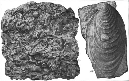
|
| PLATE XII.—CHARACTERISTIC FOSSILS OF NIOBRARA FORMATION AND GREENHORN LIMESTONE, IMPORTANT GUIDES IN WELL BORING. A (left), Ostrea congesta; B (right), Inoceramus labiatus. |
GREENHORN LIMESTONE.
The Graneros shale is overlain by a thin body of limestone that is believed to represent the Greenhorn limestone of southeastern Colorado. It outcrops in a low but distinct ridge which extends continuously around the Black Hills uplift, rising out of the shale lowlands a short distance from the foot of the hogback range. The thickness is usually about 60 feet. The formation is characterized by large numbers of impressions of Inoceramus labiatus, a fossil of uncommon occurrence in the adjoining formations. (See Pl. XII.) The rock contains a considerable amount of clay and fine sand. In its unweathered condition it is of gray color and only moderately hard, but it appears to gain hardness on weathering and in the outcrops breaks into hard, thin, pale-buff slabs covered with impressions of the distinctive fossil. The limestone layers usually are separated by beds of dark shale from one-half inch to 3 inches thick. The formation is usually distinctly separated from the dark shales of the Graneros formation, but its upper portion appears to grade into the Carlile shale through 6 or 8 feet of passage beds. The northern extremity of its outcrop extends into Montana, and there and for some distance southward the rock is much less calcareous than usual and contains fewer remains of the characteristic fossil. Some of the most conspicuous exposures are in a low cliff at the crest of the ridge north of the town of Belle Fourche, notably in Susie Peak, a prominent butte capped by the formation.
The Greenhorn limestone has been penetrated by some of the artesian wells, where ordinarily it is reported as "rock," so that evidently it is sufficiently hard underground to be noticeable as a definite stratum in the inclosing softer shales. There are conspicuous exposures from Bear Butte Creek southward, in the westward-facing escarpment of a ridge of moderate prominence. In Rapid Creek valley there is an excellent exposure on the irrigating ditch at a point 4 miles southeast of Rapid, and there is another one just below the schoolhouse at Grashull, near Elk Creek. At these places the fresh material is of dark-gray color and there is an alternation of shale and limestone beds. The thickness is 65 feet. In the slopes west of the Little Missouri Valley the formation varies in thickness from 60 to 80 feet and consists of lime-clay concretions and black shale. The concretions are from a few inches to several feet in diameter, the usual size being 1 to 4 feet. They have a bluish-gray color and are spherical or ellipsoidal in shape. The following section was measured by O'Harra:
Section of Greenhorn limestone near Blackbank Hill, Crook County, Wyo.
| Feet. | |
| Large septarian lime concretions, 1 to 6 feet in diameter, with Inoceramus | 15 |
| Black shale | 8 |
| Shale, with smaller lime concretions | 2 |
| Blackshale | 30 |
| Shale, with lime concretions | 1 |
| Black shale | 12 |
| Shale, with large lime concretions, at supposed base of formation | 10 |
78 |
CARLILE SHALE.
The outcrop of Carlile shale encircles the Black Hills uplift in the plains from 2 to 10 miles from the base of the hogback ridge. The thickness averages about 600 feet; but it is probably somewhat greater than this near Jerome, and it increases locally to 800 feet in wells north and northeast of Belle Fourche. The Carlile merges into the adjoining formations through a few feet of beds of passage.
The shale is mostly dark gray to black and fissile. Some thin beds of sandstone are included in all portions of the region, and in the vicinity of Belle Fourche there is an almost continuous bed of sandstone from 1 to 6 feet thick, about 100 feet above the base. Numerous biscuit-shaped concretions occur, especially in the middle of the formation; in the Little Missouri Valley these are a prominent feature. In this valley the formation is made up of three fairly distinct divisions. The upper division is about 300 feet thick and is nearly all shale; a few concretions are present, occurring at indefinite horizons. The middle division is 125 feet thick and consists of shale carrying many concretions which give rise to low ridges. The lower division is 200 feet thick and is made up of shale with only a few concretions.
A section measured by O'Harra 8 miles northwest of Missouri Buttes is as follows:
Section of Carlile shale Near Mud Creek, Wyoming.
| Feet. | |
| Fissile light-gray shale | 70 |
| Yellow and dark-gray shale | 80 |
| Light-gray septarian lime concretions, 4 to 8 feet in diameter, in dark shale; much carbonate of lime in veins | 6 |
| Yellowish-gray shale; a few concretions 1 foot in diameter near the bottom | 12 |
| Fissile black shale with a few septarian concretions 1 foot in diameter | 25 |
| Large septarian concretions in black shale; a few fossils in the concretions | 12 |
| Fissile black shale with a few small concretions | 90 |
| Grayish-black shale, with iron-stained lime concretions abundant and very fossiliferous in lower part (Inoceramus, Prionocyclus, and a few baculites); this series forms a slight ridge | 125 |
| Grayish-black shale, with local sandy lime concretions | 200 |
620 |
About 5 miles due north of Belle Fourche the sandstone which occurs so persistently about 100 feet above the base of the formation grades locally into a conglomerate 4 inches thick containing sharks' teeth and pebbles up to 1 inch in diameter.
Fossils occur at various horizons in the formation, mostly in the concretions; they consist mainly of Inocerami of large size, Prionocyclus wyomingensis, and Prionotropis woolgari, the last two being especially characteristic of the upper portion of the formation.
NIOBRARA FORMATION.
The light-yellow outcrops of the Niobrara formation are conspicuous at various localities in a narrow zone encircling the Black Hills uplift. The formation consists largely of carbonate of lime mixed with a varying amount of clay and interbedded to some extent with shale. Owing to scarcity of complete outcrops and general low dips, the precise thickness is difficult to ascertain. In general it is not far from 200 feet, except in the region east and south of Sturgis, where it appears to be somewhat greater, and in the Little Missouri Valley, where it is not more than 120 feet. Owing to the softness of the materials, the outcrops occur usually in low ground, where the rocks are more or less extensively covered by wash and alluvial deposits.
The color of the fresh material is light gray to pale buff, but on weathering this changes to a rich creamy yellow which is highly characteristic. The formation includes many thin masses made up of irregular aggregates of Ostrea congesta (Pl. XII), which are distinctive of the formation, and this species also occurs scattered through the shales. The limits of the formation, especially the upper one, are indefinite; owing to the presence of beds of passage. Two sections measured by O'Harra are as follows:
Section of Niobrara formation midway between Mud end Driscoll creeks, Wyoming.
| Feet. | |
| Creamy-yellow shale | 12 |
| Grayish-yellow and dark-gray shale | 14 |
| Very deep creamy-yellow soft shale, with a few thin layers of Ostrea congesta | 94 |
120 |
Section of Niobrara formation nearly due west of Hulett Wyo.
| Feet. | |
| Grayish-yellow soft shale | 20 |
| Very deep creamy-yellow soft shale, with some thin masses of Ostrea congesta one-half to 1 inch thick | 50 |
| Yellowish-gray soft shale with few fossils | 14 |
84 |
Some prominent exposures appear east of Rapid near Boxelder Creek, on the north slope of the divide between Elk and Alkali creeks, in the banks of Belle Fourche River 8 miles northwest of Vale, and at Miller Butte. In a portion of the region northeast and east of Moorcroft the formation contains so much gray shale that it is traceable with difficulty. Scattered bone fragments occur and several small amonites were obtained from large limestone concretions near the top of the formation several miles east of Twin Buttes, west of Vale.
PIERRE SHALE.
A large portion of the plains area adjoining the Black Hills is occupied by Pierre shale, especially to the east, where this formation extends down the valley of Cheyenne River to its mouth. The shale is dark colored but weathers light brown and is relatively uniform in composition throughout. It gives rise to a wide succession of low, rounded hills sparsely covered with grass and not very useful for agriculture. (See Pl. III, A.)
So far as can be ascertained the formation varies in thickness from 1,200 to 1,500 feet, but it is only rarely that it can be measured. Ordinarily it dips so gently that it is not possible to determine the rate of dip accurately. In the steeply dipping strata in the upper portion of the Little Missouri Valley, the formation appears to have a thickness of about 1,500 feet; and in the region northeast of Belle Fourche it is about 1,400 feet, In most regions it includes, at a horizon about 1,000 feet above its base, scattered lenses of limestone filled with shells of Lucina occidentalis. These lenses vary in size from 2 or 3 cubic feet to masses 20 feet in diameter and 6 or 8 feet thick, usually of irregular shape. Owing to their hardness, they give rise, when uncovered by erosion, to low conical buttes resembling in form squat tepees, and accordingly they have been designated "tepee buttes." They are conspicuous features in the valleys of Willow and Horse creeks and along the Belle Fourche Valley southeast of Bear Butte. A characteristic tepee butte is shown in Plate XIII, A. The occurrence of this horizon in the Pierre shale has been an important aid in determining the structure of some portions of the plains where the surface consists of wide areas of shale.
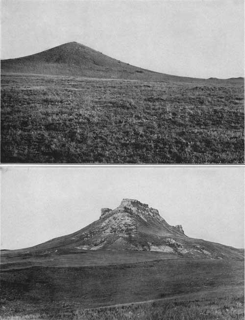
|
| PLATE XIII.—A (top), TYPICAL TEPEE BUTTE, DUE TO LIMESTONE CONCRETION IN PIERRE SHALE. B (bottom), CASTLE ROCK, FROM THE SOUTHEAST. Tertiary sandstone capping Cretaceous shale. |
Numerous concretions occur at various horizons in the formation. These usually contain large numbers of distinctive fossils, of which the more abundant are the following: Baculites compressus, Inoceramus sagensis, Nautilus dekayi, Placenticeras placenta, Heteroceras nebrascensis, and here and there Lucina occidentalis. The most fossiliferous horizon is in the upper part of the formation. The concretions are generally of small size and of a siliceous nature, and break into small pyramidal fragments which are more or less thickly scattered over all the Pierre surfaces. Some of the concretions are inclosed in a shell of cone-in-cone.
At a point 4 miles south of Antelope Butte, 1 mile southwest of the Road ranch, on Hilderbrand Creek, a soft, large, weathered sandstone dike traverses the Pierre shale for about 100 yards. It is 6 inches wide and follows a general direction of S. 10° W. It is approximately vertical.
FOX HILLS SANDSTONE AND LARAMIE (?) FORMATION.
The Fox Hills sandstone and overlying sandstones and shales occupy a wide area lying west and north of the northern Black Hills. They approach nearest to the foot of the hogback range southwest of the Devils Tower, but their margin usually lies much farther away, the distance being 25 miles in the region north of Belle Fourche.
The rocks consist largely of sandstone, but the upper formation includes bodies of shales, mostly carbonaceous, and beds of lignite. The upper beds of Pierre shale give place rapidly to buff and gray sandstones that are continuous with at least a portion of the Fox Hills beds of Fox Ridge, the type locality. The distinctive Fox Hills fossils occur in some places, notably in the outlying area on the divide at the head of Bad River and west of Newcastle, both localities being outside of the area treated in this report. In the small outlying area of Castle Rock and in the line of buttes extending to Antelope Butte no fossils were found. The extensive area on which Moorcroft is situated has not been examined in detail but it comprises a considerable thickness of Fox Hills and overlying beds.
The outliers on Antelope, Two Top, and Wolf buttes consist of soft slabby sandstone at the bottom, merging upward into massive soft pinkish to yellow sandstone. Fragments of conglomerate appear at many points on the extensive talus slopes but nowhere was this material observed in place. It is believed to have been a local upper member. Some of the blocks are 10 by 12 by 6 feet. The pebbles commonly are the size of wheat grains, but some of them are one-half inch or more in diameter. The thickest deposits of the sandstone are on the ridge of which Two Top Peak is one of the summits, where 140 feet of beds remain. In Castle Rock several hundred feet of sandstones overlie the Pierre shale and doubtless include a representative of the Fox Hills sandstone. (See Pl. XIII, B.) Next above these beds there is a thick mass of lead-colored sandy clays, with brown sandstone layers, of unknown age.
In the region west and southwest of the Devils Tower the sandstone is massive but it is extremely soft and in few places well exposed. It grades into the Pierre shale through a few feet of sandy shale. Some hard layers are present, but they do not seem to have any wide distribution. On the north side of Good Lad Creek, northwest of Yeast's ranch, a partly concretionary sandstone appears in one or two places about 80 feet above the Pierre. This and the beds intervening down to the Pierre were carefully searched for fossils, but none were found. Three miles southwest of Yeast's ranch a 1-foot bed of sandy limestone was observed near the bottom of the formation. This likewise contained no fossils. One sandstone of more than usual hardness and persistence caps a number of the higher hills between Prairie and Good Lad creeks. In places it reaches a thickness of 30 feet and is highly cross-bedded, and in one locality on the meridian of 105°, 2-1/2 miles south of Prairie Creek, it contains bones of turtles and some other vertebrates, fossil wood, and here and there an Inoceramus. Thin beds of hard rock are included at intervals below this fossiliferous stratum for a hundred feet or more. Concretions are present in these beds and in at least two places they have the distinctive form of "log concretions." These were best observed on a little knoll south of the Little Missouri, 200 yards west of the north-south wagon road 2 miles west of Yeast's ranch. The log concretions are near the bottom of the formation, in a soft sandstone which differs but little from the concretionary material, except that the latter is harder. Some of the concretions are spherical, as usual, but most of them are elongated and a number present excellent cylindrical forms. They are gray and some are slightly iron stained, but in general not more so than ordinary weathered sandstone of the region. The matrix sandstone is brownish yellow. It is extremely soft, and the wind has carved it in an interesting manner. About 5 miles north-northwest of this locality there is another but less important exposure of log concretions, about 350 feet above the bottom of the formation. The concretions in general vary much in shape. Some are 1 or 2 inches in diameter and 1 to 5 feet in length; others are 4 to 5 feet in diameter and 15 to 20 feet in length. The spherical forms reach as much as 5 feet in diameter. Some are sharply conical and others roughly nodular, as if several had been joined together. As a rule they weather free from the matrix, but some of them merge into hard, slabby sandstone. The age and relations of the lignite-bearing formation overlying the Fox Hills sandstone in the region north and west of the Black Hills have not yet been satisfactorily determined. If the formation is found to be in conformable succession with the Fox Hills it is Laramie. Leonard,a however, has traced the lignite-bearing Fort Union formation from North Dakota southwest to the northwestern margin of South Dakota, and it may extend still farther south.
aLeonard, A. G., The North Dakota—Montana lignite area: Bull. U.S. Geol. Survey No. 285, 1906, pp. 316-330.
|
| PLATE XIV.—A (top), WEST SLOPE OF BLACK HILLS UPLIFT ON STOCKADE BEAVER CREEK. B (bottom), CHADRON CONGLOMERATE, SOUTH OF RAPID, S. DAK. Constitutes high plain crossing hogback range. Looking northwest. |
TERTIARY SYSTEM.
A few outliers of Tertiary deposits remain high on the slopes of the northern Black Hills and an outlying mass caps Castle Rock. These are remnants of more extensive deposits which probably at one time covered a wide area of the northern Black Hills region.
Lead and Garden.—One of the most notable outliers was discovered several years ago, in excavations on the hill south of Lead, where, in a light-colored sandy clay, numerous skulls of Oreodon culbertsoni were obtained. This species is characteristic of the White River formation, of Oligocene age, which constitutes the Big Badlands 40 miles east of the Black Hills. Jaggar reports that from a tunnel on the divide south of Lead was thrown out a large quantity of whitish clay, which was found to contain vertebrate remains identified by F. A. Lucas as a jawbone of a small Mesohippus and the skull and jaw of Ischyromys typus, which are also characteristic White River species. This area of White River formation is at an altitude of 5,100 feet and another outlier in the western part of Lead is slightly higher. North of Garden there are similar deposits having an area of several hundred acres and extending from altitudes of 4,975 to 5,300 feet. One small area lies on the slope just east of Garden. These deposits are more than 2,500 feet higher than the Big Badlands.
Beulah to Nigger Hill.—On the slopes of the Nigger Hill uplift just north of Lytle Hill, 15 miles northwest of Lead, there are small areas of supposed Tertiary deposits. They consist of gravels and bowlders and occupy a distinct terrace on Minnelusa sandstone at an altitude of 5,100 to 5,200 feet. Sands, gravels, fuller's earth, and conglomerate cap a number of high ridges and isolated knobs south and southeast of Beulah at altitudes up to 4,100 feet.
Bear Lodge Mountains.—In the Bear Lodge Mountains extensive deposits of supposed Tertiary age cap ridges from 5,100 to 5,900 feet high, which have a gradual upward slope from north to south to a shore line extending around the north end of the high igneous area culminating in Warren Peak. The deposits are more than 100 feet thick and consist of gravels, conglomerates, fine loam, sandy clays, and impure fuller's earth. The surface of the formation constitutes a plateau deeply dissected by the headwaters of Redwater, Lytle, Blacktail, Beaver, and Lame Jones creeks. The conglomerate contains numerous pebbles and bowlders from the adjacent formations, including many of the igneous rocks from Bear Lodge Mountains. No fossils were found in any of these deposits, so that they can not be definitely correlated with other formations elsewhere. The predominating material is fine-grained loam of buff color, with a few hardened or nodular layers; in some places the loam merges into an impure fuller's earth similar to that which is characteristic of the Chadron formation (Titanotherium beds) of the Big Badlands and elsewhere. The masses of igneous rocks included are mostly angular and from 1 to 6 inches in length. Numerous beds of bowlders occur at the base and at intervals higher up, and there is generally a capping by bowlders and sand constituting the top of the terrace. Whether the cap is a part of the underlying beds or a separate deposit was not ascertained, though there is no evidence of unconformity between them.
In some localities, especially southwest of Beulah and in places in the Bear Lodge Mountains, the top beds are conglomerates, of which the bowlders and pebbles represent the rocks of the slopes adjoining on the south; the matrix is mostly lime and sand. In the extensive exposures west of Sheep Mountain the upper beds are a breccia of angular igneous rocks in a lime matrix. A similar breccia is also exposed at the top of the terrace at the head of Blacktail and Lytle creeks. One of the most extensive exposures of the Tertiary is on the west edge of this terrace, a short distance west of the main road, where there is a steep bare slope of it more than 100 feet high. Other extensive exposures occur along the east side of the terrace on Bear Lodge Mountain a short distance west of Sheep Mountain. On the west side of these mountains fuller's earth and overlying bowlder deposits apparently 100 feet thick occur at the head of East Fork of Hewston Creek, at an altitude of 5,800 feet, and another deposit extends along the ridge followed by the road east of Miller Creek, sloping upward from an altitude of 5,300 feet to 5,800 feet.
Missouri Buttes region.—In the region northwest of Devils Tower there are several small outlying areas of supposed Tertiary deposits. The largest is on the high flat east of Poison Creek, where the deposit consists of a thin sheet of poorly exposed white clay and nodular argillaceous limestone. The greatest thickness—8 feet—is near the south end of the area. The deposit lies unconformably on the massive sandstone of the Graneros formation in the central and southern parts of the area and on the Mowry shale in the northern part. Another smaller area lies just northwest of the Missouri Buttes. Its southern edge begins within 150 yards of the base of the northwestern butte and, curving southward, extends to a point within 250 yards of the lake. From this edge the area extends westward and northwestward one-half mile or more. Exposures are not good on the side next the buttes, but along the western edge 20 to 30 feet of beds are clearly shown in several places. The material is the usual fine, massive, creamy-white calcareous clay, with thin bands or bunches of argillaceous limestone. There is indication that a considerable area in addition to that mapped lies beneath the heavy grass-covered porphyry talus northwest and north of the northwestern butte. The thickness can not be determined with accuracy, for, though the formation appears to have a dip of 5° or more, this could not be proved. There is a vertical distance of about 160 feet between the lowest exposure on the west side of the area and the highest exposure near the buttes. The Tertiary lies on the sandstone of the Graneros at the west, but toward the south end it rests on Mowry shale, while nearer the lake it appears to extend onto the lower shale of the Graneros formation.
One-half mile west of the Missouri Buttes area there is another very small area. Between the two occur scattered fragments of Tertiary limestone, remnants of a connection between the deposits which existed at no distant time.
Castle Rock.—Castle Rock is capped by 110 feet of Tertiary deposits lying on dark-gray clays. At the base are 30 feet of mostly fine white sandy massive clay, merging downward into 5 feet of grayish-green sandy clay. The upper 75 feet is of sandstone, mostly soft but partly quartzitic, as a rule massive, but in places thin bedded and with a few pebbly layers. In some respects it resembles portions of the White River formation of the Big Badlands, but the entire deposit or at least its upper member may be an outlier of the Arikaree. No bones were found to throw light on this question.
Rapid.—Conglomerate with Titanotherium remains occurs south of Rapid and is shown in Plate XIV, B. This deposit constitutes a high plain which extends across the top of the hogback range and Red Valley to the slope of the limestone ridges. The materials are sands, gravels, fuller's earth, and local bodies of conglomerate.
Mason Creek.—Seven miles west-southwest of Inyankara Mountain an outlying mass of Graneros shale on the summit of the hogback range is capped by a deposit of supposed Tertiary age. It is about 50 feet thick and consists of soft buff sand with some darker clayey sand.
QUATERNARY SYSTEM.
EARLIER TERRACE DEPOSITS.
General character and relations.—Remnants of old terrace deposits occur at various levels above the present stream bottoms in many portions of the northern Black Hills. They mark the courses of old streams which have since cut to lower levels. Undoubtedly they were more extensive originally, but with the degradation of the country a large amount of the material has been removed or widely scattered, especially in areas where it was thin. The deposits usually consist of sand, loams, gravels, and bowlders containing materials of relatively local origin. They range from bodies 10 to 15 feet thick down to a thin sprinkling of gravel. They are similar to the alluvium, but generally contain a larger amount of coarse material.
Region north of Aladdin.—One of the most notable remnants of these earlier terraces constitutes Stoneville Flats, where it marks the former course of the upper Belle Fourche drainage into Little Missouri River. This terrace merges into the valley of the Little Missouri, but the Belle Fourche has cut down to a level about 100 feet lower than its original bed. The extension of this terrace level southward up the Belle Fourche Valley is defined for some distance by gravel-capped benches that stand from 50 to 60 feet above the present stream.
There are also higher terrace levels along the Belle Fourche Valley and on the divide to the east of Stoneville Flats, indicating a still earlier stage of the valley development. Small remnants of earlier terrace deposits occur on both sides of the Little Missouri Valley, but they are mostly thin and discontinuous. On a portion of the divide between the Belle Fourche and Crow Creek valleys are remnants of higher terrace gravels, which extend far to the north. Similar deposits occur in the basin of Graneros shale that extends southward from the mouth of Deep Creek to and across the divide to Hay Creek, east of Aladdin.
There are numerous small gravel remnants on both sides of the Redwater Valley, which in the upper portion of Government Valley widen into an area of considerable extent. On the divide between the headwaters of Lame Jones and Blacktail creeks a number of high-level gravel deposits lie at an unusually high altitude.
Sundance region.—Extensive areas of earlier terrace deposits occur in the Red Valley between Inyankara post-office and the canyon of Stockade Beaver Creek. Other areas occur on the south side of Inyankara Creek, on terraces west of Sundance, on the divides between Sundance Creek and Rocky Ford Creek, on the ridge north of Rocky Ford Creek, on the divide between Skull Creek and Turner Creek, and along an old stream channel extending southward through the depression in the divide between Beaver and Mason creeks in R. 63 W. Most of these deposits lie on well-marked terraces elevated considerably above the present stream bottoms; they consist largely of sand, pebbles, and bowlders of various kinds The largest deposit occupies a broad terrace level south of Boyd post-office, where it lies mainly on a thin mass of Spearfish red shales; other deposits cap several ridges north and northwest of Boyd. The materials here are sands and loams containing many pebbles and bowlders from the Minnekahta, Minnelusa, and Pahasapa formations and carrying, just south of Boyd, many lens-shaped siliceous concretions mostly from 8 inches to 2 feet in diameter. About Inyankara post-office there are terraces thinly capped by sands containing pebbles from various local sources. In the Sundance region and toward the northeast thin sheets of sands and gravels cap extensive terraces. West of Inyankara, on both sides of Inyankara Creek, there are well-marked terraces with gravel, sand, and loam covering, evidently deposited by a predecessor of the present creek. In the gap in the ridge in the west-central portion of T. 50 N., R. 63 W., occurs a deposit of gravel and sand which was laid down by a stream which flowed southward, for there are numerous remnants of terraces extending in that direction and sloping down part way to the level of Inyankara Creek. On the next divide to the south, where the road crosses the ridge, there is an extensive flat covered with gravels and sand, possibly representing the ancient course of a creek flowing northward into Inyankara Creek. Gravel deposits begin on the ridge west of Skull Creek in the southern part of T. 48 N. and extend at intervals to the southern margin of the area treated in this report, probably representing a predecessor of the present Skull Creek.
The gravel deposit overlying the supposed Tertiary outlier west of North Fork of Mason Creek, in T. 49 N., may possibly belong to the Quaternary and be related to the early system of the drainage above described, but apparently it belongs to a still earlier one. It contains fragments of Minnekahta limestone and Belemnites densus. A small cap of bowlders of early Quaternary age lies on the Sundance formation in the small butte 4 miles northeast of Sundance.
Belle Fourche—Whitewood region.—The most extensive deposits in the Belle Fourche—Whitewood region are on the ridge east and southeast of Belle Fourche and along the sides of the Spearfish Valley. There is a wide area of high terrace heavily capped by gravel south of Whitewood Creek east of the hogback range, and smaller areas occur on the north side of Belle Fourche River north of Snoma. Most of these terraces do not reach an altitude of more than 300 feet above the present streams and many of them slope downward to the margins of the alluvial flats. Some, however, are considerably higher, notably that capping the high ridge north of Hay Creek, the remnants on the high ridge east of St. Onge, including Baldy and St. Onge peaks, and small remnants on Haystack, Twin, and Miller buttes. Small remains of this deposit at high levels also occur along the flanks of the limestone ridge northwest of Spearfish and east of that place along the south side of Centennial Valley. A conspicuous line of high terrace deposits occurs along the north side of Indian Creek valley, mostly in R. 4 E. As a rule the deposits vary in thickness from 12 to 15 feet.
Sturgis to Rapid.—On the east side of the Black Hills there are numerous deposits of high-level gravels. Some of the most remarkable of these are east of Deadwood, notably in Boulder Park halfway between Deadwood and Sturgis. At this place there is a thick deposit of gravel, sand, and bowlders, which may be in whole or in part, however, of Tertiary age. Between all of the streams flowing eastward there are ridges capped by gravels, especially from Whitewood Creek southward. These terraces are usually about 300 feet above the streams, presenting steep slopes to the north and gentler slopes to the south and east. They extend to the base of the hogback ridge and some of them still farther west. In the Rapid Creek valley west of Rapid extensive deposits of gravels lie on two sets of terraces, the higher one being about 500 feet above the stream and capping the divide separating the Rapid Creek valley from the one adjoining. It is probable that a portion of these deposits are of Tertiary age, especially on the higher terraces.
Central area.—In the crystalline-rock area of the central portion of the Black Hills, small deposits of gravels cap a few of the minor divides. One of the most extensive of these extends northward from Dumont.
ALLUVIUM.
Alluvial deposits extend along most of the valleys in the northern Black Hills region, except in some of the steeper canyons and in the many smaller draws in the highlands where erosion predominates over deposition. The Belle Fourche is bordered by alluvial bottom lands of considerable width, especially in the eastern part of its course. Owing to the numerous meanders of the streams, the bottom lands are cut into small areas, for at the end of nearly every large bend the water is cutting into banks of underlying formations which border the valley.
Wide areas of alluvium occur in the Little Missouri Valley, especially in the Shale district which it traverses. There are large alluvial areas along its north fork. The various streams in the Pierre shale and underlying soft formations on the east side of the uplift all have wide valleys floored with alluvium. There are numerous wide valleys with alluvial floors in the Red Valley, especially on the north and west sides of the uplift. The most extensive ones are along Sundance Creek, for 8 or 10 miles below Sundance, along the main Redwater and Spearfish creeks, and along Indian Creek below the mouth of Hilderbrand Creek, the last area extending across the divide to the south and down Owl Creek valley in the center of T. 9 N., R. 4 E.
The alluvium consists mainly of local materials and ranges from a thin soil to deposits 20 to 30 feet thick in some of the deeper valleys. It merges into local talus on the slopes adjoining the valleys, except where there are cliffs or cut banks. Along Redwater and Spearfish creeks there is considerable reddish material derived from the Spearfish red shale. Along much of Owl and Indian creeks the alluvium is slightly yellowish to gray owing to the presence of carbonate of lime derived from the chalky shales of the Niobrara. The alluvium along Whitewood Creek, which originally was mostly gray loam, is capped by extensive deposits of grayish tailings brought down from the mines and mills of Lead and vicinity in the Black Hills. In places there are deposits of gravel and sand in the alluvium, especially along Belle Fourche River near Snoma, where on the north side of the river a deposit is being extensively utilized in making concrete for the reclamation dam on Owl Creek.
Lake Creek, a tributary of the Redwater, is now depositing calcareous tufa; and accumulations of this material several feet in thickness may be observed in various places, particularly along the road side a short distance south of the mouth of the creek. The tufa shows the usual porous structure, with numerous casts of weeds and grass. The creek is fed near Cox Lake by springs that probably dissolve lime from the Minnekahta limestone, which lies at no great depth.
STRUCTURE.
GENERAL STRUCTURE OF THE BLACK HILLS UPLIFT.
The Black Hills uplift, if not eroded, would present an irregular dome rising on the north end of an anticlinal axis extending northward from the Laramie or Front Range of the Rocky Mountains. (See Pl. XIX.) It is elongated to the south and northwest, has steep slopes on the sides, is nearly flat on top, and is subordinately fluted. The greatest vertical displacement of the strata, as indicated by the height at which the granite and schist floor is now found, amounts to about 9,000 feet. The minor anticlines branching from the dome are mainly along the east side of the uplift. The most notable are the one extending northward from Crow Peak, another just west of Hot Springs, and a third extending from Runkel northward by Whitewood to the valley of Indian Creek north of Belle Fourche. Another flexure of considerable prominence occurs 3 miles east of Hot Springs and a smaller one ends near Belle Fourche. These subordinate flexures are all characterized by steeper dips to the west and gentler dips to the east. They branch from the general dome and run out with declining pitch under the plains. In the northern Black Hills there are numerous local domes and flexures due mainly to laccolithic igneous intrusions, but in the southern hills no features of this character are indicated.
Faults are rarely to be observed; and, except for some short breaks due to igneous intrusion, few have been found which amount to more than a few feet in vertical displacement.
STRUCTURE OF THE NORTHERN BLACK HILLS.
The principal structural features of the northern Black Hills are illustrated by the six structure sections (Pl. XV), in which the vertical scale is about twice the horizontal; their positions are indicated on the map (Pl. IV). The structure of the rocks underground is inferred from the position of the strata observed at the surface and from determinations of their thickness made where they are uplifted or are penetrated by deep borings.
DEVILS TOWER REGION.
In the region lying west of the northern portion of the Bear Lodge Mountains the rocks dip west and northwest, mostly at very low angles. (See sections 1 and 2, Pl. XV.) There are several local irregularities in the monoclinal structure, consisting mainly of variations of strike and pitch and a few low subordinate flexures. The rate of dip in the vicinity of Belle Fourche Valley generally varies between 50 and 100 feet to the mile, but to the west and northwest the amount is much greater. Near Devils Tower and for 10 or 12 miles in every direction the strike is north and south, but farther north it is northeast and southwest. Near Belle Fourche Valley this change in strike is gradual, but in Little Missouri Valley the change takes place abruptly near the mouth of Prairie Creek. The low dips which prevail in the region east of Little Missouri River rapidly give place to steep dips west of that stream in a narrow zone extending southward from the mouth of Prairie Creek. To the north, however, in the region adjacent to North Fork of Little Missouri River and Thompson Creek, all the dips are low; at North Fork the Niobrara dips to the west at an angle of 15°, but where it enters the zone of steep dips a mile farther south it dips 60°. Midway between Driscoll and Mud creeks it dips 40°, while the Greenhorn beds dip 30°. In the center of T. 54 N., R. 67 W., west of Missouri Buttes, the dip increases to 80° W., but 2 miles farther south it decreases to 22°. On the divide south of the head of Little Missouri River it increases to 45° but farther south it decreases again to 10°. It is 20° at Cabin Creek. In R. 68 W. the strata dip to the west at very low angles, and midway between Good Lad Creek and Prairie Creek they are horizontal. From Good Lad Creek to Cabin Creek the dips in the Fox Hills and overlying beds vary from 2° to 6°. In the region north of Prairie Creek and surrounding Blackbank Hill the dips are less than 5°. Due north of the gap between the two northernmost of the Missouri Buttes, near the head of the steep gulch leading northward to Barlow Canyon, a small anticline trends north and south, with dips of 5° to 7° on either side. A small but sharp anticline a mile southwest of Missouri Buttes trends northeast and southwest, with dips of 35° on the northwest side and 25° on the southeast. On Poison Creek a small but rather steep-sided dome, and still farther north along Hulett Creek an elongated but lower dome, bring up the Dakota sandstone. Broad, low domes extend from Elkhorn Creek to the region beyond Tie Creek, and one in the area surrounding Government Canyon extends southwestward beyond Broncho John Creek. Another dome includes the vicinity of Strawberry Hill near the head of Sourdough Creek. These domes are mostly indicated by the Dakota sandstone. With the exception of the Poison Creek and Hulett Creek domes, where the westerly dip reaches 15° or more, the dip is generally not more than 5° or 6°.
In the vicinity of the Belle Fourche Valley in the Devils Tower region the dips are mostly very low. North of the tower the valley crosses the slope of a low dome which causes the Spearfish red beds to rise to a moderate height in the slopes. This dome rises to the southeast, where with gradual increase in dip it finally merges into the Bear Lodge uplift. This steeper dip is a marked feature on the upper part of Lytle Creek, where the Spearfish red beds and adjoining formations rise at a high angle in the vicinity of the igneous intrusions. There is no evidence of uplift connected with the igneous masses of Devils Tower and Little Missouri Buttes and only a slight local doming in the immediate vicinity of the intrusion in Barlow Canyon.
An anticline extends southward from Cabin Creek and is crossed by Belle Fourche River 2 miles below the mouth of Wind Creek; some of its relations are shown in section 3, Plate XV. It gives rise to a high ridge of Dakota to Lakota sandstones and at the river causes a canyon in which Morrison and Sundance beds are exposed. The latter are also bared by small streams cutting into the axis of the anticline a short distance south of Cabin Creek. In general the dips are steeper on the west side of the anticline, where they range from 12° to 35°; on the east side they are from 5° to 20°. North of Cabin Creek this anticline is soon lost in the Graneros shale area, but south of the Belle Fourche it is traceable into the northern part of Weston County in the Graneros shale and its Mowry member.
SUNDANCE REGION AND SOUTHWARD.
The central-western portion of the Black Hills uplift presents a general westward-dipping monocline bearing a few minor crenulations and several irregular domes due to laccolithic intrusion. On the high limestone plateau in the northwestern part of Pennington County and the southwestern part of Lawrence County the strata are nearly horizontal and there is a wide area of low dips in the Minnelusa outcrop south of the Nigger Hill uplift. In the vicinity of the Pennington-Weston county line the beds pitch steeply downward to the west, but they flatten again along Stockade Beaver Creek (Pl. XIV, A). West of this canyon low westerly dips prevail, giving a wide expanse of Minnekahta limestone in the Canyon Springs Prairie district. In this area there are various undulations of the strata, the most notable of which are a low anticline which extends southward through Mount Pisgah and a strong general pitch of the beds to the south in the ridges in the southeastern part of T. 47 N., R. 62 W. A low local anticline extending east and west crosses the Oil Creek valley near the southern margin of the area treated in this report. Gentle southwesterly dips prevail in Black Canyon, on Skull Creek, and from Inyankara Creek, far to the southwest, to Buffalo Creek and beyond.
In the region east of Cold Springs Creek the Minnelusa sandstone presents a broad monocline or very flat anticline traversed by a number of gentle undulations and rising steeply at the north into the great dome of the Nigger Hill uplift. Bald Mountain is a local interruption in the structure due to a steep-sided dome of Pahasapa limestone. West and north of the Nigger Hill uplift there is a general dip to the west and north, which is very gentle and regular far out into the Red Valley, except where it is interrupted by the local uplift of the Black Buttes.
North of Green Mountain lies a broad, shallow syncline occupied by Spearfish red beds, which rise steeply on the flanks of the Bear Lodge uplift to the west. The Green Mountain dome is a local feature, soon lost to the south, but repeated again on a smaller scale in Lime Buttes and Gypsum Buttes, east of which there is a broad, shallow syncline. In Black Flat the dips are very gentle to the west. South and west of Sundance the dips are low for some miles. A low anticline passes near the west line of R. 63 W., crosses Inyankara Creek 4 or 5 miles northwest of Inyankara Mountain, and merges into a general monocline of southwesterly dips in the vicinity of the Crook-Weston county line. West and southwest of this anticline gentle westerly dips extend far to the southwest, to and into Weston County.
ALADDIN REGION.
In the central-northern portion of the Black Hills uplift east of the Bear Lodge Mountains the rocks dip gently to the northeast. The relations are shown in the central portions of sections 1 to 3, Plate XV. In this monoclinal structure there are local irregularities, consisting mainly in variations of strike and pitch and in the presence of several low diagonal undulations of the strata. The general rate of slope is about 150 feet to the mile, but the amount varies considerably. Adjoining the igneous uplift in the Bear Lodge Mountains it is much greater, and in the region between Belle Fourche River and Owl Creek and about the northern extension of the Bear Lodge Mountains it is much less. In the vicinity of the state line east of Aladdin is the northern prolongation of the prominent anticline which appears so prominently in Crow Peak. Just west of Aladdin is a faint northern prolongation of the Nigger Hill uplift which crosses the Red Valley west of Beulah. These two anticlines are separated by a shallow syncline in which Spearfish red beds, the formations in the hogback ridge, and finally the Graneros shale are deflected far to the south. The Crow Peak anticline extends northward to Belle Fourche River and ends near the mouth of Kilpatrick Creek. It is especially prominent on Hay Creek near Forks, and for 5 or 6 miles to the north, extending the Dakota sandstone ridge northwestward to Alum Creek. The dips are gentle on its east side but steeper on its west side, where the strata descend into a syncline holding a wide basin of the lower shale of the Graneros formation, extending southward to Middle Fork of Hay Creek. South of Hay Creek this basin contains a broad area of the Lakota sandstone, extending southward to the northern margin of the Dry Creek valley. About Aladdin the dips are to the north-northeast and moderately steep. North and west of Eothen the dips diminish greatly and the Dakota and underlying formations are spread out in a broad area in which the strata dip very gently to the northeast. It is on this monocline that Bear Lodge Mountain extends far to the north, its height and prominence being due to its capping of Dakota sandstone. To the west, where the land is greatly lowered along the valley of Belle Fourche River, the Sundance formation extends over a wide area, dipping gently northward. In the wide area of plains underlain by shales in the northeast corner of Crook County the strata dip gently to the northeast, but this monoclinal structure is interrupted by a shallow syncline in the valley of Kilpatrick Creek, and by two low anticlines in the ridges between this valley and that of Crow Creek. The dips in this syncline and in the anticlines are so low that the strata appear to be horizontal, but the presence of the flexures is clearly indicated by the distribution of the formations, especially of the Mowry member of the Graneros. There is no relation between the drainage and the structure, except that in the shale area the streams mostly flow southeastward along the strike of the softer beds.
BELLE FOURCHE REGION.
On the northeastern slopes of the Black Hills uplift the rocks dip to the northeast at low angles. The few local irregularities in this monoclinal structure consist mainly of variations of strike and pitch and the presence of several low diagonal undulations of the strata. The rate of slope averages 150 feet to the mile, but in many places varies from 100 to 200 feet, and in the outcrop area of Minnekahta limestone there are zones of steeper dip. The monocline is crenulated by three distinct anticlines. One of these gives rise to the prominent ridge of Minnekahta limestone extending northward from the Crow Peak intrusive mass. This flexure may possibly be due to the northern extension underground of the laccolith which appears in Crow Peak. It is peculiar in having steep dips on the sides and a relatively flat top, except that in its southwestern portion a still higher dome rises on its side in which the Minnelusa sandstone is exposed to some extent. The summit of this subordinate anticline is also flat, as shown by the smooth summit of the Minnekahta limestone which forms its crest.
Another anticline extends along the front of the hogback ridge east of Spearfish Creek and is exhibited mostly in the Spearfish and Sundance formations. It extends northward a short distance beyond Belle Fourche, where it soon dies out in the Carlile and Niobrara formations. In the syncline on the west side of this anticline the lower shale of the Graneros extends far up the slope of the hogback ridge 4 miles south-southwest of Belle Fourche. In this syncline, also, the Sundance formation is spread out widely in the area lying southeast of the mouth of Spearfish Creek.
The third anticline extends northward from the Deadman Mountain igneous area and with north-northwest trend passes a short distance east of St. Onge and Susie peaks. It pitches down and is lost in the wide area of Pierre shale in the valley of Indian Creek. It causes the prominent deflection of the outcrop of Greenhorn limestone about Susie Peak and the wide area of lower shale of the Graneros between St. Onge and Baldy peaks. Southeast of St. Onge its presence is marked by the Dakota and Fuson formations. Farther south it causes the prominent northerly deflection of the Red Valley in the vicinity of Whitewood. In this vicinity the dips are steep on its western side. In the syncline on the west side of this anticline there is a long southward projection of the upper shale of the Graneros and the Mowry member, the outcrop of the latter terminating in St. Onge Peak. In the region of Pierre shale in Indian Creek valley and farther north the strata are inclined at very low angles, and north of Willow Creek they appear to be nearly horizontal. No faults have been discovered except a few very small slips along joint planes, which doubtless are not deep seated. The steepest dips observed are some at an angle of 15° in the Dakota and underlying sandstones on False Bottom Creek south of Belle Fourche. The strata are also steeply inclined in places along the west slope of the anticline near the public road 4 to 5 miles south of Belle Fourche—40° in some places and at one or two points 60° to 70°.
CENTRAL NORTHERN AREA.
The region extending from Spearfish southward through Deadwood and eastward to Sturgis and Tilford comprises much of the high portion of the northwestern slope of the Black Hills uplift. It presents a general monoclinal structure, dipping gently to the north and northeast. In the southern part of this area a wide zone of low dips is traversed by various undulations, the principal one of which is a low dome that reaches its culmination in the vicinity of Terry Peak. In the broad limestone plateau to the west of this dome the strata are almost level. Along a zone extending from the vicinity of Sturgis to a point beyond Crow Peak the strata dip at angles of 2° to 15° to the north and northeast. In the vicinity of Whitewood this monocline is traversed by an anticline and then by a syncline, both of which pitch downward to the north. The monoclinal structure is also diversified by many local dome-shaped uplifts due to the intrusion of laccoliths. The most notable of these are a wide high dome east of Galena and the small but steep circular uplifts of Crook Mountain, and of Elkhorn, Crow, and Citadel peaks. While no igneous rock is exposed in Crook Mountain and Elkhorn Peak, it is believed that their dome-shaped structure is due to laccoliths at no great distance beneath the surface. Doubtless the strata which cover some of the other igneous masses in the central area were also uplifted in domes and have since been removed by erosion. Faults are rare, but there are two short, prominent dislocations which cross Whitewood Creek between Whitewood Peak and Deadwood, and there is another one on the west side of Deadman Mountain. Further details as to the structure of this region will be given in the detailed decriptions of the various igneous intrusions.
STURGIS-RAPID REGION.
The east side of the Black Hills uplift from Sturgis to the vicinity of Rapid is a monocline with the strata dipping to the east at low angles. From Whitewood Creek to Boxelder Creek the general strike is north-northwest; in the vicinity of Rapid it is nearly due north and south. The monocline bears upon its surface a few small crenulations consisting of a small anticline in the Red Valley south of Blackhawk and a local anticline and syncline in the hogback ridge near Elk Creek. The rate of dip in the monocline varies considerably, and it diminishes to a very small amount in the Pierre shale area. The dips along the limestone range are from 8° to 10° in greater part; but for a short distance west of Piedmont the Minnelusa sandstone dips at an angle of 45°, and in Little Elk Creek canyon the Deadwood formation dips 57° at the point where it passes beneath the Pahasapa limestone. A short distance east of this point, however, the beds are nearly level for some distance. Along the hogback ridge the dips are moderately steep—12° to 15°—near Sturgis, but they diminish to the south and in the shale area on the east. On the east slope of Piedmont Butte the Dakota sandstone dips at an angle of 4°, on Elk Creek 8°, and on Rapid Creek 22°. On the west side of the anticline southeast of Piedmont a dip 60° is exhibited locally. The Greenhorn limestone dips eastward at an angle of 10° east of Rapid, but the amount is considerably less than this in the regions to the north and south. Along the outcrop zone of the Carlile and Niobrara formations dips of 2° to 3° are common, but locally the amount increases to 5° or 6°. In the area of Pierre shale it is difficult to discern the dip at most localities, but from scattered observations and the disposition of the tepee buttes there is apparently a general dip of about 2°. No faulting was observed except that in places the Minnekahta limestone shows slight thrust faults of a few feet throw, some of which may be superficial.
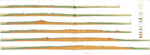
|
| PLATE XV.—SECTIONS ACROSS THE NORTHERN BLACK HILLS REGION. (click on image for a PDF version) |
STRUCTURE AND RELATIONS OF THE IGNEOUS MASSES.
LACCOLITHS.
Among the most striking features of the geology of the northern Black Hills are the large masses of igneous rock intruded among the strata. Most of these masses are in the form of laccoliths and are attended by characteristic dome structure. They occur entirely in a zone about 20 miles wide, extending east and west across the region. The Missouri Buttes are at the western extremity of this zone and Bear Butte is at its eastern extremity. In the central portion of the area the plane of intrusion is mostly in the lower portion of the Deadwood formation, while in Missouri and Bear buttes it rises to the Benton. The laccoliths in the Deadwood-Lead region have been minutely investigated by T. A. Jaggar, jr.,a and by J. D. Irving,b and to the reports of these observers the reader is referred for details, as only a brief summary is given in the following pages. Some of the broader structural relations of these igneous masses are shown in sections 2, 3, 4, and 5, Plate XV. Petrographic descriptions of the igneous rooks are given by J. D. Irving,b W. S. Tangier Smith,c and Alfred Johannsen.d
aLaccoliths of the Black Hills: Twenty-first Ann. Rept. U. S. Geol. Survey, pt. 3, 1901, pp. 163-303.bContribution to the geology of the northern Black Hills: Ann. New York Acad. Sci., vol. 12, 1899, pp. 187-340.cSundance (No. 127) and Aladdin (No. 128) folios, Geologic Atlas U. S., U. S. Geol. Survey, 1905.dDevils Tower folio (No. 150), Geologic Atlas U. S., U. S. Geol. Survey, 1907.
NIGGER HILL LACCOLITH.
The Nigger Hill uplift, which is almost a perfect dome in shape, is due not only to a large laccolith but also to uplift of the floor of pre-Cambrian rocks, as shown in section 4, Plate XV, and in figure 2. The strata have been eroded from the top, and in part of the central area the porphyry has been removed, revealing pre-Cambrian schist and pegmatite and an intruded mass of nepheline syenite and pseudoleucite porphyry in Mineral Hill. Owing to the somewhat irregular intrusion of the igneous rock there is great irregularity in the structure of the lower strata and in places long masses of Deadwood sandstone are completely unclosed in the igneous rock. The principal plane of intrusion has been low in the Deadwood formation, but at the east end of Cement Ridge the porphyry rises to the Minnelusa sandstone for some miles. Elsewhere there is a complete ring of Pahasapa limestone around the uplift, with radial dips in all directions, steep on the flanks of the igneous rock but of less amount elsewhere. The principal features are shown in figure 2.

|
| FIG. 2.—Sections across the Nigger Hill uplift. The upper section is northwest and southeast, passing a short distance south of Welcome. The lower section is at right angles to the first and passes a mile east of Welcome. d, Deadwood formation; pa, Pahasapa and associated limestones; ml, Minnelusa sandstone; ph, phonolite; pp, pseduoleucite porphyry; s, nepheline syenite. |
The dips on the north side of the laccolith are 10°, on its west side 40° in places, and on its southwest side from 14° to 25°. Their diminution to low angles farther away is shown by the long extension of the Pahasapa down the various marginal canyons, especially to the west. The limestone is nearly flat north of the Needles, where the igneous rock cuts across its lower beds.
BEAR LODGE MOUNTAIN.
The Bear Lodge laccolith is a dome-shaped mass somewhat elongated from northwest to southeast. The central portion is a thick mass of porphyry rising to an altitude of 7,160 feet in the summits known as Warren Peaks. Upturned strata encircling the laccolith and extending part way up its flanks dip away regularly on the sides, but the dips are steepest on the west side. The general structure is shown in figure 3.
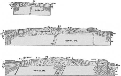
|
| FIG. 3.—East-west sections across the Bear Lodge laccolith. pg, Pegmatite; d, Deadwood formation; pa, Pahasapa and Whitewood limestones; ml; Minnelusa sandstone; mk-o, Opeche and Minnekahta; sp, Spearfish red beds; l, Sundance to Lakota formations. |
The principal plane of intrusion is low in the Deadwood formation, but the igneous rock has cut across the strata at many places, and some of the beds have been torn from their normal position. The most notable example of the latter feature is on the eastern bank of the headwaters of Blacktail Creek, where a small mass of Sundance and underlying beds is several hundred feet out of place. Bodies of Deadwood sandstone and of pre-Cambrian pegmatite are included in the central igneous mass, and there have been branch intrusions into higher strata. At its south end, just north of the town of Sundance, there is a small adjoining dome, exhibited mainly in the Minnekahta limestone, out of the sides of which igneous rock has broken along two lines of intrusion. A small branching dome of Minnekahta limestone, which rises locally east of the main Bear Lodge uplift at the forks of Rocky Ford Creek, in R. 62 W., may possibly be due to a low branch laccolith. At Sheep Mountain the beds uplifted by the Bear Lodge intrusion are steeply upturned and profoundly faulted, apparently by a separate intrusion or branch which has lifted a small block nearly 1,500 feet so that the Deadwood formation abuts against the Minnekahta limestone. The fault passes along the western, southern, and eastern bases of the mountain, and to the north gives place within a short distance to a steep-sided flexure. The igneous mass which probably underlies the uplifted block is not bared, but there is a small sheet and dike in the Deadwood formation near the base of the mountain on its south side. Immediately west of the fault on the west side of Sheep Mountain there is a shallow syncline containing a small mass of Minnekahta limestone.
In the valley of Lytle Creek on the northwest slope of the Bear Lodge uplift several detached igneous masses cut formations from Pahasapa to Sundance. They comprise two different rocks, phonolite. and syenite porphyry, but doubtless are branches of the main Bear Lodge intrusion. Some of the relations are shown in the upper section in figure 3.
On one of the spurs of the ridge of Lakota sandstone, in the northwest corner of T. 52 N., R. 54 W., the Morrison shales are traversed by three narrow perpendicular dikes of lamprophyre. They run N. 80° W. but are exposed for only a few yards. The widest dike is 5 feet wide and about 4 rods distant from the other two. The thinner dikes are each about 1 foot wide and separated by a foot of shale. The latter is not visibly altered and shows but slight disturbance.
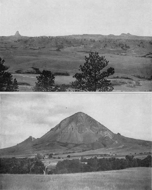
|
| PLATE XVI.—A (top), DEVILS TOWER AND MISSOURI BUTTES, FROM THE NORTHEAST. Slopes of Sundance formation. Plateau of Lakota sandstone to right, in distance. B (bottom), BEAR BUTTE, FROM THE NORTH. Ridge of Pahasapa limestone to left. Slope of Sundance and Spearfish formations to right. |
DEVILS TOWER.
The mass of igneous rock known as the Devils Tower is one of the most conspicuous and notable features in the Black Hills province. It is a steep-sided shaft rising 600 feet above a rounded ridge of sedimentary rocks, about 600 feet high, on the west bank of the Belle Fourche. A characteristic view is given in the frontispiece (Pl. I). Its nearly flat top is elliptical in outline, with a north-south diameter of more than 100 feet and an east-west diameter of about 60 feet. Its sides are strongly fluted by the great columns of the igneous rock, and are nearly perpendicular except near the top, where there is some rounding, and near the bottom, where there is considerable outward flare. The base merges into a talus of huge masses of broken columns lying on a platform of the lower buff sandstone of the Sundance formation. Lower down are slopes of Spearfish red beds which present high cliffs to the east, on the bank of the Belle Fourche, as shown in Plate I. All the strata lie nearly horizontal, with a slight downward deflection toward the center of the igneous mass. In the narrow ridges northwest of the tower the strata are somewhat tilted, but apparently this is due to undermining by erosion in the adjacent gulches.
The great columns of which the tower consists are mostly pentagonal in shape, but some are four or six sided. The average diameter is 6 feet, and in general the columns taper slightly toward the top. In places several columns unite in their upper portions to form a large fluted column. The columns are not perpendicular, but slope inward toward the top, the angle being 4° to 5° on the west side and 10° to 12° on the east side. They are not much jointed but are marked horizontally by faint ridges or swellings, which give the rock some appearance of bedding, especially toward the top of the tower. Near the top the rock is much cross jointed and irregularly fissured, and is more or less decomposed, crumbling into rounded fragments. The color at the top is brownish, mottled with dirty yellowish green, due to lichens. In the lower quarter or third of the tower the columns bend outward and merge rapidly into massive rock, which, toward the base, shows but little trace of columnar structure. This massive rock circles the tower as a bench extending out for 30 to 40 feet. It is strongly jointed in part into irregular prismatic forms and in part into rough, coarse layers. On the southwest face the long columns curve outward over the massive basal portion and lie nearly horizontal. The rugged pile of talus extends high up the lower slopes of the massive bench at the base of the tower and also far down the adjoining slopes of the sedimentary rocks. In places it rises as a low ridge not far from the base of the tower, the fragments falling from the higher cliffs having bounded some distance away. At one point on the platform a short distance south of the tower a low hill of porphyry shows a surface of 30 or 40 feet of massive rock, which may possibly be in place, and a low cliff of massive porphyry a few rods southeast of the base of the tower strongly suggests igneous rock in place.
At the edge of the main talus slope on the west-southwest side of the tower is a small elliptical grassy hill encircled by talus. It is about 150 yards long, trends west-southwest, and consists of agglomerate which does not appear elsewhere in the vicinity, although it may underlie some of the talus. The matrix appears to be a decomposed porphyry and the rocks included comprise irregular fragments of granite, limestone, sandstone, quartzite, purplish rhyolite, slate or schist, black shale, flint, and coarse pegmatite. The most conspicuous ingredient is granite in rounded and angular masses, varying in size from small grains to bowlders 1 and 2 feet in diameter. The rounded masses have a somewhat faceted character. A bowlder of fossiliferous Carboniferous limestone a foot in diameter was noted, incased in a 1/2-inch shell which could be easily stripped, and which appeared to be due to calcination. Some of the sandstone grains have a crust about them, suggesting fusion. The shales in the agglomerate are carbonaceous and present two varieties, one breaking into small blocks of dark-gray color and the other into soft, coaly flakes. Shales of this character occur at intervals in the formations from Minnelusa to later Cretaceous. The agglomerate closely resembles that of the Little Missouri Buttes, except in containing a somewhat greater variety of rocks.
There is no conclusive evidence as to the location of the vent of the Devils Tower rock. The vertical columns have been supposed to indicate that the tower is not the stock of a flow or intrusion at higher levels, but recent observations by Johnson in the Mount Taylor region of New Mexico and by C. A. Fisher in central Montana show that vertical columns may exist in stocks. Doubtless the mass was much larger originally, for evidently much of the laccolith has been eroded, but the original form and extent can only be conjectured. It is believed that the vent is under the tower or the talus, as shown in figure 4, for the agglomerate is of local origin and no dikes appear in the surrounding area. It has been suggested that the tower is a remnant of the southeast end of a laccolith extending from the Missouri Buttes, but this idea involves an improbable amount of erosion and numerous other difficulties.
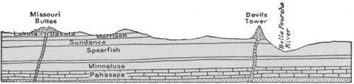
|
| FIG. 4.—Section from Missouri Buttes eastward to Belle Fourche River through Devils Tower. |
MISSOURI BUTTES.
The Missouri Buttes rise prominently above the plateau of Dakota sandstone on the divide between the Belle Fourche and Little Missouri valleys, 3 miles northwest of the Devils Tower. Four principal buttes rise from 500 to 800 feet above the adjacent plateau, which is somewhat higher than the top of the Devils Tower. The buttes are on the four corners of a rudely rectangular ridge about a mile in diameter, the east side of which is cut away by a deep draw at the head of the east prong of Lake Creek. The highest butte is on the northwest corner and rises to an altitude of 5,372 feet; the next in height, on the northeast corner, has an altitude of 5,218 feet; and the other two are about 200 feet lower. The butte on the northeast corner is separated from the peak on the west by a deep saddle, but the depressions between the others are less deep. The buttes and the adjoining ridge consist of igneous rock, but possibly the rock is not continuous in the saddle on the north side. All the adjoining slopes consist of talus, which is narrow to the south, west, and east, but extends down the gentle slopes for more than half a mile to the north and northwest. In the depression between the two western buttes there is a low ridge of igneous rock which may possibly be a dike, but its relations are not exposed. All of the rock is phonolite. The columnar structure, which is so strongly exhibited in the Devils Tower, is much less developed in Missouri Buttes, but columns appear on some of the exposures, standing at various steep angles, while on the northeastern butte they lie nearly horizontal, with their pentagonal ends projecting from the face of the cliff.
These buttes are the remains of a laccolith, or series of laccoliths, of irregular oval form, apparently derived from a vent or vents lying beneath the present igneous masses. The igneous rock appears to lie on a platform of nearly level Dakota sandstone, but on its west side the lower shale of the Graneros and an outlier of Tertiary are overlapped by the talus and possibly by the igneous rock. At a few points the beds have dips of 10° or more, but it is not apparent that these steeper dips are due to the igneous rock.
On the east and southeast sides of the buttes are several exposures of agglomerate, similar to that of the Devils Tower. Apparently the deposit extends under the buttes, but the relations are not exposed. The rock carries much coarse material, consisting largely of fragments of pink granite and sandstones of various kinds in a vesicular or highly porous matrix, the porosity being due to the leaching out of secondary minerals. Half a mile west of the buttes a granitic rock, whose structural relations are not exposed, appears on the slopes of the lower shale of the Graneros north of a small lake, and extends northward about 50 yards to a point at which it disappears beneath a small area of Mowry shale and a wide area of Tertiary deposits. Its greatest width is 20 yards. One massive pile of the rock is 12 feet long, 10 feet wide, and 8 feet high. It is separated from the igneous rocks of the buttes by slopes of the lower shale of the Graneros formation. Probably this granite is a remnant of agglomerate from which the finer materials have all been removed by erosion, but there is a possibility that it may be a separate intrusion.
BARLOW CANYON.
In the bottom of Barlow Canyon, 2 miles northeast of Missouri Buttes, igneous rock appears in a small cliff north of the road for a distance of about 250 yards. It is intruded immediately below the massive sandstone in the lower portion of the Sundance formation, and this bed is domed over the laccolith with dips of 7° to 10° on the west side and 5° on the east side. The base is not exposed. The sedimentary rocks show no marked evidence of alteration and the disturbance is confined to the immediate vicinity of the laccolith.
BEAR BUTTE.
Bear Butte is a large mass of porphyry rising steeply out of the plains 6 miles northeast of Sturgis. It is a very prominent landmark, especially from the east, for it is entirely isolated and rises to an altitude of 4,422 feet, or nearly 1,400 feet above the adjoining plains. The intrusion has taken place along the general line of strike of the Benton and Niobrara beds, but has brought to the surface upturned strata as low as the middle beds of the Pahasapa limestone, while just west of the butte in the center of a dome-shaped uplift the Spearfish red beds are exposed. The distribution of the formations as ascertained by O'Harra is shown in Plate XVII, together with a cross section showing the structural relations along an east-west line through the center of the butte. The appearance of this butte from the north is shown in Plate XVI, B, which also shows the knob due to upturned strata at its east end. These strata comprise a regular succession from Pahasapa to Sundance, terminated by a fault as shown on the map and sections. The dips in this block at the east end of the mountain vary from 50° to 90° and there are steep dips also on the north side. The relations along the south side of the intrusion are completely masked by a heavy talus. At the west end there is a regular succession of strata from the Minnelusa up, penetrated by two small branch sheets of the intrusive rock. In the dome-shaped uplift on the west; which may be due to a laccolithic intrusion underground, the dips are mostly low—30° to 40° on the northeast side, 12° to 20° on the north, 12° to 15° on the south, and 8° to 12° on the west. The circular outcrops in this dome are beautifully exposed in part of their course, but to the west and north the higher beds are mostly hidden by alluvium and terrace deposits.
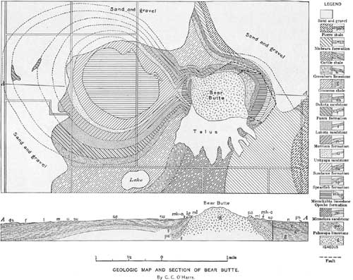
|
| PLATE XVII.—GEOLOGIC MAP AND SECTION OF BEAR BUTTE. (click on image for a PDF version) |
LEAD-DEADWOOD REGION.
The rugged mountain region extending from Bear Butte to Spearfish Creek exhibits a low wide dome rising on the north end of the main Black Hills uplift. This dome is widely truncated so that an extensive area of the pre-Cambrian crystalline schist is revealed. At intervals in this district there remain laccoliths of various sizes, intrusive sheets, and numerous dikes and stocks. The structure, which is very complex in places, has been worked out by Jaggar and is described in his report on the Black Hills.a Some of the largest laccolithic masses remaining are those about Dome and Sheep mountains; others, such as Deer Mountain, Ragged Top, and Spearfish peaks, are isolated masses on the western margin of the district. Terry Peak, the highest mountain in the region, is made up of a thick laccolithic remnant, lying on Deadwood strata penetrated by numerous dikes and sheets, and Bald Mountain is of similar character. The principal plane of intrusion in the district has been in the Deadwood formation, but locally the igneous rocks cut higher strata.
aJaggar, T. A., jr., Laccoliths of the Black Hills: Twenty-first Ann. Rept. U. S. Geol. Survey, pt. 3, 1901, pp. 163-303.
VANOCKER LACCOLITH.
The extensive laccolithic intrusion in the limestone front range east of Bear Butte Creek has been described by Jaggar as the Vanocker laccolith. It is of irregular form and consists of several masses of igneous rock. The principal plane of intrusion varies from a horizon low in the Deadwood formation on the west to one at the top of the Pahasapa at the eastern termination 2 miles west of Tilford. Along the margin of the laccolith the strata usually dip outward at low angles, but in places, as on the west side of Kirk Hill, the dips are steep. An igneous mass exposed on the north side of Deadman Mountain appears to be connected underground with the main laccolith, but on the surface it is separated by a syncline in the limestones on Deadman Gulch west of Deadman Mountain. This outlying igneous mass is in the axis of a prominent anticline which extends far to the north along the east side of Boulder Park and passes east of Whitewood and near Snoma.
CROW PEAK.
Crow Peak is a very prominent outcrop of igneous rock rising on the slopes of the limestone front ridge 6 miles west of Spearfish. Its structure has been described in detail by Jaggar. It is due to a laccolithic intrusion, apparently at the base of the Deadwood formation, that has uplifted the overlying strata to the Minnekahta limestone. The area of marked disturbance is about 3 miles in diameter, but the exposure of igneous rock is less than 1 mile long and three-fourths of a mile wide. The igneous rock cuts across the Deadwood formation irregularly and sends off some local dikes and sheets into it. The dips are mostly steep, ranging from vertical in places near the igneous contact to 10° to 30° in the Minnelusa sandstone. In most places the change from the steeper to the gentler dips is abrupt, and evidently the original crest of the dome was high. Some faulting is apparent and there has been considerable compression, stretching, and flow in the steeper portions of the sides of the dome. The section in figure 5 shows the principal features.
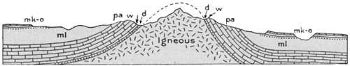
|
| FIG 5. —Section across Crow Peak laccolith. d, Deadwood formation; w, Whitewood limestone; pa, Pahasapa and associated limestones; me, Minnelusa sandstone; mk-o, Opeche and Minnekahta formations. |
CITADEL ROCK.
The Citadel Rock laccolith lies 3 miles south-southeast of Crow Peak and is a much less prominent topographic feature. The igneous rock has been exposed by the erosion of a branch of Higgins Gulch and crops in an irregular amphitheater surrounded by a rim of sedimentary rocks. The plane of intrusion is low in the Deadwood formation and the uplift involves the overlying formations up to the Minnelusa. The dips are moderate and indicate a dome of much less height than that of Crow Peak. The section by Jaggar, shown in figure 6, indicates the structure. Citadel Rock is the peak shown rising in the center and the sedimentary rocks constitute the encircling horseshoe rim, part of which rises 200 feet higher.
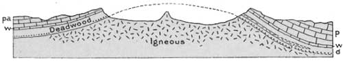
|
| FIG. 6.—East-west section across Citadel Rock laccolith. d, Deadwood formation; w, Whitewood limestone; pa, Pahasapa and Englewood limestones. |
BLACK BUTTES.
In the Black Buttes (see fig. 7) the structure is somewhat irregular, there being two domes considerably broken by cross intrusion. The Pahasapa limestone and a small area of the Deadwood formation show on the surface on the west and the east sides of the northern dome. The southern dome is almost completely inclosed by the Minnekahta limestone.
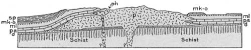
|
| FIG 7.—East-west section through laccolith of Black Buttes. ph, Porphyry; p, phonolite; d, Deadwood formation; pa, Pahasapa and associated limestones; m, sandstone; mk-o, Minnekahta limestone; sp, Spearfish red beds. |
INYANKARA MOUNTAIN.
Inyankara Mountain is a prominent peak of porphyry rising about 1,200 feet above the adjoining Red Valley, 13 miles south of Sundance. The intrusion has caused an irregular dome-shaped uplift which to the north presents a regular succession of tilted strata from Pahasapa to Sundance. Figure 8 shows the principal relations. The uplift is considerably broken and faulted on its south side, where the igneous rock ascends to higher horizons. At one point in the southwest corner of the ridge the intrusion and faulting has brought a mass of the Pahasapa limestone up to the level of the Cretaceous strata.
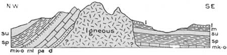
|
| FIG. 8.—Northwest-southeast section through Inyankara Mountain. d, Deadwood formation (?); pa, Pahasapa limestone; me, Minnelusa sandstone; mk-o, Minnekahta limestone on Opeche formation; sp, Spearfish red beds; su, Sundance formation; m, Morrison formation; l, Lakota sandstone. |
SUNDANCE MOUNTAIN AND VICINITY.
Sundance Mountain consists of a conical mass of porphyry about 600 feet high lying on a platform of nearly horizontal Sundance beds. The strata show no evidence of disturbance, and the igneous mass is evidently a remnant of the lower part of a laccolith spread out horizontally in Sundance shale, the upturned overlying beds and the edges of the igneous lens having been removed by erosion. A similar laccolithic remnant on a floor of the Spearfish formation forms the sharp knob 2 miles southeast of Sheep Mountain, 6 miles north-northeast of Sundance.
CUSTER PEAK.
Custer Peak, the southernmost of the known Tertiary igneous intrusives of the Black Hills, consists of a large mass of igneous rock lying on a platform of the Deadwood formation. A short distance north and south are outliers of the Pahasapa limestone. The igneous mass is evidently the remains of an old laccolith from which the overlying dome has been entirely removed by erosion. The plane of intrusion appears to have been a slightly irregular one, crossing the Deadwood strata for short distances.
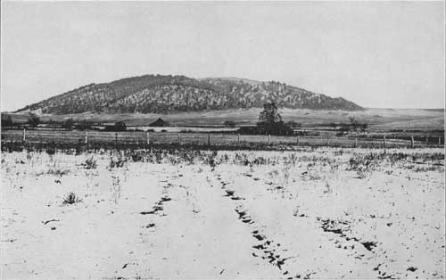
|
| PLATE XVIII.—GREEN MOUNTAIN, FROM THE NORTH. A dome of Minnelusa and associated formations; probably due to buried laccolith. |
COVERED LACCOLITHS.
In the northern Black Hills region several prominent domes in the sedimentary rocks probably indicate the presence of laccoliths underground. No igneous rocks appear, but as the dome structure is precisely similar to that in uplifts in which erosion has exposed the igneous core, it is difficult to ascribe them to any other cause. One of the most marked examples is the well-known Green Mountain, or "Little Sundance Hill," shown in Plate XVIII. This dome rises out of the middle of the Red Valley a short distance east of Sundance and is beautifully symmetrical, with dips of 8° to 10° on its flanks. The greater portion of its slope consists of Minnekahta limestone, but in the center the upper sandstone of the Minnelusa is exposed. A smaller outer encircling ridge due to the lower gypsum bed in the Spearfish formation is a notable feature. A similar but smaller dome known as Lime Buttes rising out of the Red Valley 6 miles southwest of Green Mountain presents only the Minnekahta limestone; another, Gypsum Buttes, 2 miles farther south, consists entirely of gypsum.
Elkhorn Peak, 3 miles northwest of Whitewood, is a very prominent dome rising out of the northern portion of the Red Valley. Its lower slopes present revetments of Minnekahta limestone, and the entire central portion and summit consist of Minnelusa sandstone. The dome is nearly symmetrical, but the dips are slightly steeper on the southeast side. Crook Mountain, 5 miles south of Whitewood, is a dome on the slope of the limestone front range. It consists almost entirely of the Minnelusa sandstone dipping at angles from 15° to 20°. The Minnekahta limestone circles around on the west, north, and east and also occurs in a small syncline on the south. Whitewood Creek and its branches have cut into the underlying Pahasapa limestone on the west and north. Strawberry Mountain is a dome of moderate prominence rising out of the Red Valley 6 miles southeast of Inyankara Mountain. Its lower slopes consist of Minnekahta limestone, dipping at angles of 5° to 7°. The greater part of the interior area is Minnelusa sandstone, but on the south side the Minnekahta extends to the crest of the dome. The uplift is elliptical in outline, with the longer axis trending northeast and southwest. Figure 9 shows the relations along that line.
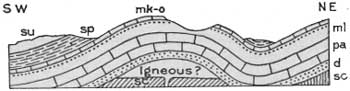
|
| FIG. 9.—Northeast-southwest section across Strawberry Mountain, south of Inyankara Wyo. sc, Schists; d, Deadwood formation; pa, Pahasapa and associated limestones; ml, Minnelusa sandstone; mk-o, Minnekahta limestone on Opeche; sp, Spearfish red shale; su, Sundance formation. |
Bald Mountain is a rugged limestone hill about a mile in diameter, rising on the Minnelusa sandstone slopes 8 miles east of Black Buttes. It exhibits only the Pahasapa limestone, which is brought up by a round, steep-sided dome with dips of 12° to 20° on its sides. It is possible that some other domes which occur in portions of the region may be due to laccoliths, but they are of less pronounced character than those above described.
GEOLOGIC HISTORY.
GENERAL SEDIMENTARY RECORD.
The rocks appearing at the surface within the limits of the Black Hills uplift are mainly of sedimentary origin—that is, they were deposited by water. They consist of sandstone, shale, limestone, sand, loam, and gravels, all presenting more or less variety in composition and appearance. The principal materials of which they are composed were originally gravel, sand, or mud derived from the waste of older rocks, or chemical precipitates from salty waters. There are also igneous rocks which have been intruded in a molten condition. In the center of the uplift is revealed the floor of schists and granites upon which the sedimentary rocks lie.
These rocks afford a record of physical geography from middle Cambrian time to the present. The composition, appearance, and relations of the strata indicate in some measure the conditions under which they were deposited. Sandstone ripple marked by waters and cross-bedded by currents, and shales cracked by drying on mud flats, show deposition in shallow water; pure limestones suggest clear, open seas and scarcity of land-derived sediment. The fossils which the strata contain may belong to species known to inhabit waters that are fresh, brackish, or salt, warm or cold, muddy or clear. The character of the adjacent land may be shown by the character of the sediments derived from its waste. The quartz sand and pebbles of coarse sandstones and conglomerates, such as are found in the Lakota formation, had their original source in crystalline rocks, but have been repeatedly redistributed by streams and concentrated by wave action on beaches. Red shales and sandstones such as make up the "Red Beds" result as a rule directly from the revival of erosion on a land surface long exposed to rock decay and oxidation and hence covered by deep residual soil. Limestones, on the other hand, if deposited near the shore, indicate that the land was low and that its streams were too sluggish to carry off coarse sediments, the sea receiving only fine sediment and substances in solution. The older formations exposed by the Black Hills uplift were laid down from seas which covered a large portion of the west-central United States, for many of the rocks are continuous over a vast area. The land surfaces were probably large islands of an archipelago, which was in a general way coextensive with the present Rocky Mountain province, but the peripheral shores are not even approximately determined for any one epoch, and the relations of land and sea varied greatly from time to time. The strata brought to view by the Black Hills uplift record many local variations in the ancient geography and topography of the continent.
CAMBRIAN SUBMERGENCE.
One of the notable events of early North American geologic history was the wide expansion of an interior sea over the west-central region. The submergence reached the Rocky Mountain province in Cambrian time, and for awhile the central portion of the Black Hills remained as one of the islands rising above the waters. From the ancient crystalline rocks streams and waves gathered and concentrated sands and pebbles, which were deposited as a widespread sheet of sandstone and conglomerate on sea beaches, partly in shallow waters offshore and partly in estuaries, where they remain as sediments containing much local material, abutting against the irregular surface of the crystalline rocks which formed the shore. Subsequently, the altitude being reduced by erosion and the area possibly lessened by submergence, the islands yielded the finer-grained muds now represented by the shales that occur in the upper portion of the Cambrian in some areas. In many regions the land surface of crystalline rocks was buried beneath the sediments.
ORDOVICIAN-DEVONIAN CONDITIONS.
Of the interval from the close of the Cambrian period to the beginning of Carboniferous time the Black Hills area presents a scanty geologic record, the Ordovician, Silurian, and Devonian being absent in the south and only a portion of the Ordovician being present in the north. This meagerness of sedimentary deposits is probably to be explained by the existence of an extensive but very shallow sea, or land so low as to leave no noticeable evidence of erosion. Whether the region remained land or sea or alternated from one to the other condition, it shows no evidence of having undergone any considerable uplift or depression until early in Carboniferous time, when there was a decided subsidence that established relatively deep-water and marine conditions, not only over the Black Hills area, but generally throughout the Rocky Mountain province.
CARBONIFEROUS SEA.
Under the marine conditions of early Carboniferous time were laid down calcareous sediments that are now represented by several hundred feet of nearly pure limestone, the greater part of which is known as the Pahasapa limestone. As no coarse deposits of this age occur here it is probable that no crystalline rocks were then exposed above water in this region, although elsewhere the limestone or some stratigraphic equivalent was deposited immediately upon them. In the latter part of the Carboniferous period the conditions were so changed that fine sand was brought into the region in large amount and deposited in thick but regular beds, apparently with much calcareous precipitate and more or less ferruginous material. The presence of iron is indicated by the color of many beds of the Minnelusa formation. The Minnelusa deposition is believed to have been followed by an uplift, which appears to have resulted in ponding saline water in lakes, in which accumulated the bright-red sands and sandy muds of the Opeche formation. The Minnekahta limestone, which is the next in sequence, was deposited from sea water, and its fossils show with a fair degree of certainty that it is representative of the latest Carboniferous (Permian) time. It was laid down in thin layers to a thickness now represented by only 40 feet of the limestone. The very great uniformity of this formation over the entire Black Hills area is an impressive feature, probably indicative of widespread submergence.
RED GYPSIFEROUS SEDIMENTS.
At the close of the epoch represented by the Minnekahta limestone there was a resumption of red-bed deposition, and the great mass of red sandy clay constituting the Spearfish formation was accumulated. This material was probably laid down in vast salt lakes that resulted from extensive uplift and aridity. The mud accumulated in thin layers to a thickness of nearly 700 feet, as is now attested by the formation, which is so uniformly of a deep-red tint that this is undoubtedly the original color. This color is present not only throughout the extent of the formation over a vast area, but also through its entire thickness, as shown by deep borings, and therefore is not due to later or surface oxidation. At various times the accumulation of the clay was interrupted by the chemical precipitation of comparatively pure gypsum in beds ranging in thickness from a few inches to 30 feet and free from mechanical sediment. It is believed that these beds are the products of evaporation during an epoch of little or no rainfall, and consequently of temporarily suspended erosion; otherwise it is difficult to understand their nearly general purity. It has been supposed that the Spearfish red beds are Triassic, but there is no direct evidence that they are of this age, and they may be Permian. Their deposition appears to have been followed by extensive uplift without local structural deformation, but with some planation and occasional channeling, which represents a portion of Triassic-Jurassic time of unknown duration. This was succeeded by the deposition of later Jurassic sediments.
JURASSIC SEA.
In the Black Hills region the Jurassic was a period of varying conditions, shallow and deep marine waters alternating. The materials deposited in these waters are nearly all fine grained and indicate the absence of strong currents. In the southeastern Black Hills region some of the earliest deposits are thin masses of coarse sandstone, indicating shore conditions, but most of them consist of shale, lying directly on the Spearfish red beds. Upon this shale is ripple-marked sandstone, evidently laid down in shallow water and probably the product of a time when sedimentation was in excess of submergence, if not during an arrest of submergence. The red color of the upper part of the medial sandy series in some portions of the Black Hills appears to show a transient return to arid conditions similar to those under which the Spearfish formation was laid down. An extensive marine fauna and the limestone layers in the upper shale of the Sundance formation indicate that deeper water followed. After this stage widespread uplift gave rise to fresh-water bodies. The first product was the thick body of fine sand of the Unkpapa sandstone, now a prominent feature along the eastern side of the Black Hills, but thinner or absent elsewhere.
CRETACEOUS SEAS.
During the Cretaceous period deposits of various kinds, but generally uniform over wide areas, gathered in a great series, beginning with such as are characteristic of shallow seas and estuaries along a coastal plain, passing into sediments from deep marine waters and changing toward the end to fresh-water sands and clays, with marsh vegetation. The earliest of these deposits, beginning possibly in late Jurassic time, constitute the Morrison formation, a widespread mantle of sandy shales. The absence of this shale in the southeastern part of the uplift is due either to the presence of a local land area of Unkpapa sand or to slightly greater local uplift causing increased erosion at the beginning of the next uplift. The extent of this degradation is not known, and although it has given rise to a general erosional unconformity at the base of the Lakota sandstone, the next succeeding deposit, it is believed to have been of very short duration. The Lakota materials consist mainly of coarse sands spread by strong currents in beds 30 to 40 feet thick, but include several thin partings of clay and local accumulations of vegetal material.
Next, a thin calcareous series, represented by the Minnewaste limestone, was deposited, but apparently this was laid down only in a local basin in the southern portion of the Black Hills. Over it was spread a thin but widely extended sheet of clay of the Fuson formation. After the deposition of this clay there was a return to shallow waters and strong currents, as in Lakota time, and the coarse sands of the Dakota formation were accumulated. At the beginning of the Benton epoch there was everywhere in the region an abrupt change of sediment from sand to clay.
During the great later Cretaceous submergence marine conditions prevailed throughout the Benton, Niobrara, and Pierre epochs, and several thousand feet of clay were deposited. In Benton time there were occasional deposits of sand—one of them in the latter part of the epoch that was thin but widespread, and one, earlier, that was local and produced the lenses of sandstone which now underlie the Mowry shale at various localities. Another marked episode was that which resulted in the general deposition of the thin Greenhorn limestone somewhat above the middle of the Benton sediments. The clay of Benton time was followed by about 200 feet of impure chalk, which now constitutes the Niobrara formation, and this in turn by more than 1,200 feet of Pierre shale, deposited under very uniform conditions. The retreat of the Cretaceous sea corresponds with the Fox Hills epoch, during which sands were spread in an extensive sheet over the clay beds, and resulted in the development of extensive bodies of brackish or fresh water, which received the sands, clays, and marsh deposits of the next formation. Whether these two last-named groups of sediments were deposited over any of the area now occupied by the Black Hills is not definitely known, but it is possible that they were, as they are upturned around two sides of the uplift.
EARLY TERTIARY MOUNTAIN GROWTH.
The Black Hills dome developed early in Tertiary time—or possibly in latest Cretaceous time—to a moderate height, and the larger topographic outlines of the region were established before the Oligocene epoch, the dome being truncated and its larger old valleys excavated in part to their present depths (Pl. XIX). This is shown by the occurrence in them of White River (Oligocene) deposits, even in some of their deeper portions. Where the great mass of eroded material was carried is not known, for in the lower lands to the east and southeast there are no early Eocene deposits nearer than those of the Gulf coast and Mississippi embayment. The deposits to the southwest, including those of the Denver Basin, were doubtless derived from the Rocky Mountains.
The igneous intrusions probably occurred during early Tertiary time and in connection with the general uplift. In portions of the area the igneous rocks cut or uplifted Upper Cretaceous formations as young as the Benton, but the fine-grained deposits of the Niobrara and Pierre in the vicinity indicate that there was no interruption in the sedimentation until, at the earliest, the later part of Cretaceous time. As fragments of the igneous rocks occur in the early Oligocene deposits, it is evident that they were intruded prior to the Oligocene.
OLIGOCENE FRESH-WATER DEPOSITS.
Oligocene deposits were laid down by streams and in local lakes or bayous and finally covered the country to a level now far up the flanks of the Black Hills. Erosion has removed them from most of the higher regions where they formerly existed, especially along the west side of the hills, but in the vicinity of Lead small outliers remain at an altitude of over 5,200 feet, and on the north end of the Bear Lodge Mountains they are a thousand feet higher. In many places on the slopes of the uplift there is clear evidence of superimposition of drainage, due to a former capping of Oligocene formations.
MIDDLE TERTIARY MOUNTAIN GROWTH.
After the Oligocene the Black Hills dome was raised several hundred feet and was more extensively eroded. No representatives of the succeeding Arikaree and Ogalalla formations have been discovered in the immediate vicinity of the Black Hills, but they are extensively developed in Pine Ridge to the south and remain on the high buttes to the north, in the northwest corner of South Dakota. There were probably uplifts during this period, and materials were contributed by the higher slopes of the Black Hills, but whether they were ever deposited in the immediate vicinity of the hills has not been ascertained.
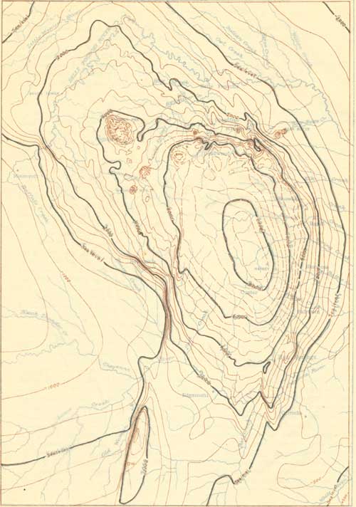 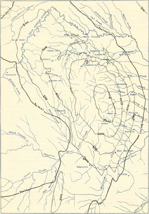
|
| PLATE XIX.—MAP SHOWING CONFIGURATION OF BLACK HILLS UPLIFT AT SURFACE OF MINNEKAHTA LIMESTONE. (click on images for a PDF version) |
QUATERNARY CONDITIONS.
During the early part of the Quaternary period there was a marked increase in erosion, probably due to increase in rainfall, which enabled the larger streams to deepen their valleys. In a later stage the rainfall seems to have decreased, and the streams laid down the gravels, sands, and loams which now constitute the high terrace deposits. Then followed another erosion epoch, apparently associated with tilting to the northeast on the east side of the Black Hills uplift. With this tilting began an extensive rearrangement of the existing drainage conditions that has caused many streams which originally flowed southeastward in Oligocene valleys to be diverted slightly toward the north. Such streams flow for some distance in the old valleys and then turn abruptly northward into more recent canyons, leaving numerous elevated saddles to mark abandoned portions of the old courses. Examples of this stream robbing occur at many localities. One of the most notable is that of Belle Fourche River, which originally flowed through Stoneville Flats to join the Little Missouri near the Wyoming-Montana state line. These flats form a wide, smooth-bottomed valley which to the north merges into that of the Little Missouri. (See fig. 10.) At the great bend in the Belle Fourche at the south end of these flats the stream now occupies a new canyon cut about 100 feet below the floor of the old valley. This robbery was made by a relatively small branch of Cheyenne River, which had moderately steep declivity and was in greater part cutting along the strike of soft shales, so that it had greatly the advantage of the original headwater branch of the Little Missouri and finally tapped it. The water now flows to Missouri River in central South Dakota by a course 300 miles shorter than its former roundabout one down the Little Missouri far to the north and then back to the southeast through central South Dakota.
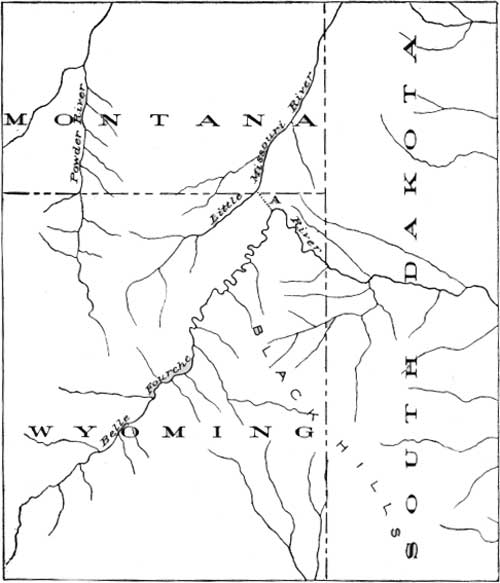
|
| FIG. 10.—Map showing relations of upper Belle Fourche and Little Missouri rivers. A, Old course of Belie Fourche River. |
The development of the present course of Whitewood Creek has been investigated by G. R. Mansfielda (see fig. 11), who has noted that early in Pleistocene time Whitewood Creek turned eastward a short distance below Deadwood and flowed along the Boulder Creek valley through the north end of Boulder Park, and across the hogback ridge into the wide gap now occupied by Spring Creek (1, fig. 11) In Boulder Park it was joined by a predecessor of Bear Butte Creek, a stream which has since been diverted into the present Bear Butte Canyon east of the park. In the next stage Whitewood Creek was tapped by the small creek on the east side of Crook Mountain and for a short period it flowed northward to join its present valley near the old settlement of Crook (2, fig. 11). Later its headwaters were captured by a portion of the present stream about 2 miles below Deadwood and carried northward across the limestone ridge through the pass a mile northwest of Whitewood Peak into the present False Bottom Creek (3, fig. 11). A third stage of capture was effected by the westward cutting of the gorge to a point (4, fig. 11) north of Whitewood Peak, which brought the creek into approximately its present course.
aBull. Mus. Comp. Zool., Harvard Coll., vol. 49, pp. 59-76.
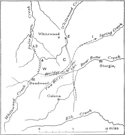
|
| FIG. 11.— Diagram of a portion of northern Black Hills, showing present and earlier Pleistocene drainage. C, Crook Mountain; w, Whitewood Peak. Broken lines indicate earlier courses of Whitewood Creek. |
Apparently still further uplift occurred in late Quaternary time, for the present valleys, below the level of the earlier Quaternary high-level deposits, seem to be cut more deeply than they would be in simply grading their profiles to the level of Missouri and Cheyenne rivers. Wide, shallow valleys have developed in the soft deposits, and canyons of moderate extent and depth in the harder rocks. Later, erosion progressed with but little local deposition, but in some place, with the shifting of channels, there have been alluvial accumulations, which now remain as small terraces at various levels. (See Pl. XX, B.)
| <<< Previous | <<< Contents >>> | Next >>> |
pp/65/sec2.htm
Last Updated: 24-Aug-2009