|
CHIRICAHUA
Historic Structure Report Historical and Archeological Data Sections A History of the Building and Structures of Faraway Ranch |

|
| III. ARCHEOLOGICAL DATA SECTION |
FIGURES
|
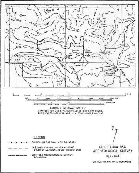
| Figure 1. Map of Study Area. (click on image for a PDF version) |
Figure 2. West Half of Survey Area: Prehistoric Loci.
(omitted from the online edition)
Figure 3. East Half of Survey Area: Prehistoric Loci.
(omitted from the online edition)
Figure 4. West Half of Survey Area: Historic and 20th Century Loci.
(omitted from the online edition)
Figure 5. East Half of Survey Area: Historic and 20th Century Loci.
(omitted from the online edition)
|
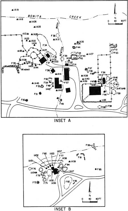
| Figure 6. Insert A: Faraway Ranch Area; Insert B: Stafford Cabin Area. (click on image for a PDF version) |
| <<< Previous | <<< Contents>>> | Next >>> |
chir/hsr/part3-2.htm
Last Updated: 27-May-2008