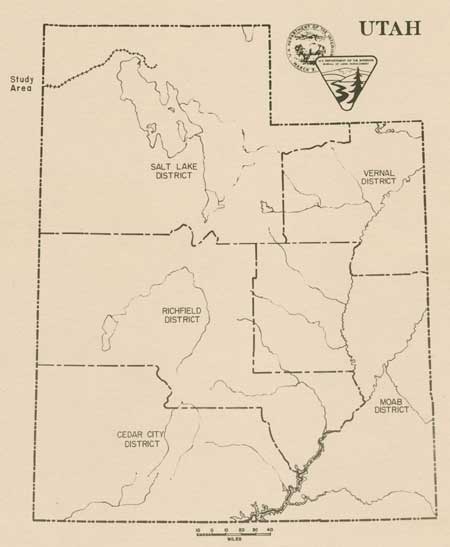
|
Rails East to Promontory The Utah Stations |

|
TABLE OF CONTENTS
Preface to Special Edition Reprint
The Promontory Branch Stations
Umbria and Historic Lucin
Medea
Bovine
Walden
Watercress
Terrace
Old Terrace
Red Dome
Matlin
Romola
Gravel Pit and Ombey
Peplin
Zias
Kelton
Elinor
Seco
Nella
Ten-Mile
Monument
Kosmo
Lake
Metataurus
Centre
Rozel
Promontory
Visual Features and Facilities Today
LIST OF FIGURES
Fig. 2: The Emigrant Wagons Meeting the Train at Monument Point
Fig. 3: The Gunnison/Beckwith Proposed Railroad Route Through Utah in 1854
Fig. 4: A Work Train in Nevada
Fig. 5: A Water Train During Construction
Fig. 6: Telegraph Installation Alongside Railroad Construction
Fig. 7: Railroad Construction Camp
Fig. 8: Chinese Work Crews
Fig. 9: Harper's Magazine Lithograph of Chinese Workers in 1869
Fig. 10: Track Laying in the Utah Desert
Fig. 11: Track Laying in the Desert
Fig. 12: Parallel Railroad Grades Near Metataurus, Utah
Fig. 13: Ten Miles of Track Laid in One Day - April 28, 1869
Fig. 14: The Rails Joined at Promontory Summit - May 10, 1869
Fig. 15: A Central Pacific Railroad Building Inventory - 1869
Fig. 16: The Promontory Branch Stations 1869 - 1904
Fig. 17: Illustration of a Wye Siding
Fig. 18: 1872 Cadastral Plat - Nevada/Utah Border to Kelton
Fig. 19: 1871 Cadastral Plat - Kelton to Lake
Fig. 20: Umbria Junction Today
Fig. 21: Southern Pacific Railroad Plat Map - Umbria to Lucin
Fig. 22: Historic Lucin Today
Fig. 23: Bovine Station Today
Fig. 24: Southern Pacific Railroad Station Plan Map - Bovine
Fig. 25: An Outhouse Foundation
Fig. 26: Walden Siding Today
Fig. 27: Remains of a Root Cellar at Watercress
Fig. 28: Stock Pond at Watercress
Fig. 29: Cadastral Plat Showing Terrace in 1873
Fig. 30: Southern Pacific Railroad Station Plan - Terrace
Fig. 31: Terrace Main Street in 1875
Fig. 32: Terrace Depot and Main Street ca. 1880
Fig. 33: Terrace Railroad Yards
Fig. 34: View of the Terrace Switchyard Today
Fig. 35: Reservoir at Rosebud Ranch Today
Fig. 36: Water Supply Line to Terrace Today
Fig. 37: Locomotive "God Run" outside Terrace Roundhouse
Fig. 38: Remnants of the Terrace Roundhouse Today
Fig. 39: Remnants of the Terrace Turntable
Fig. 40: Remnant Detail of the Turntable Foundation at Terrace
Fig. 41: Remains of Central Pacific Shop and Office Building
Fig. 42: Foundation of a Terrace Hotel
Fig. 43: Red Dome Siding Today
Fig. 44: Matlin Siding with Wye Today
Fig. 45: Cadastral Plat Showing Matlin in 1873
Fig. 46: Southern Pacific Railroad Station Plan - Matlin
Fig. 47: Romola Siding Today
Fig. 48: Foundation of a Section House at Gravel Pit
Fig. 49: Southern Pacific Railroad Station Plan - Ombey
Fig. 50: Ombey Siding Today
Fig. 51: Townsite of Ombey
Fig. 52: Ombey Surface Artifacts
Fig. 53: Peplin Siding Today
Fig. 54: Zias Siding Today
Fig. 55: Kelton Cemetery
Fig. 56: Cadastral Plat Showing Kelton in 1875
Fig. 57: Kelton Cemetery
Fig. 58: Kelton Cemetery
Fig. 59: Southern Pacific Railroad Station Plan - Kelton
Fig. 60: Kelton Depot ca. 1905
Fig. 61: Kelton Depot Site Today
Fig. 62: Section House From Kelton
Fig. 63: Site of the Kelton Section House Today
Fig. 64: Kelton Hotel ca. 1905
Fig. 65: Kelton Hotel Site Today
Fig. 66: Elinor Siding Today
Fig. 67: Seco Siding Today
Fig. 68: Seco Townsite Today
Fig. 69: Surface Artifacts at Seco
Fig. 70: Nella Siding Today
Fig. 71: Site of the Section House at "Ten Mile"
Fig. 72: Cadastral Plat Showing Monument in 1872
Fig. 73: The Locomotive "Jupiter" at Monument Point in May 1869
Fig. 74: Remnants of the Desert Salt Works Plant Near Monument
Fig. 75: Remnants of the Desert Salt Works
Fig. 76: Remnants of the Salt Lake Potash Company Facilities at West Kosmo
Fig. 77: East Kosmo Siding Today
Fig. 78: Cadastral Plat Showing Lake in 1887
Fig. 79: Southern Pacific Railroad Station Plan - Lake
Fig. 80: Lake Siding Today
Fig. 81: East Lake Townsite Today
Fig. 82: A Walkway at West Lake
Fig. 83: Metataurus Siding Today
Fig. 84: Centre Siding Today
Fig. 85: Southern Pacific Railroad Station Plan - Rozel
Fig. 86: Rozel in 1869
Fig. 87: Promontory in 1869
Fig. 88: Engineering Design for Special Roadbed in Arid Regions
Fig. 89: The Railroad Grade in Utah Today
Fig. 90: A Rock Cut in the Peplin Mountains
Fig. 91: An Earthen Fill Above Dove Creek Sink
Fig. 92: Erosional Control
Fig. 93: Trestle Over Rosebud Creek
Fig. 94: Single Stringer Trestle
Fig. 95: Engineering Design for Three Stringer Trestles
Fig. 96: Engineering Design of a Winged Bulkhead for a Stringer Trestle
Fig. 97: Wooden Box Culvert
Fig. 98: Wooden Box Culvert
Fig. 99: Engineering Designs for a Box Culvert
Fig. 100: Dual Wood Box Culvert
Fig. 101: Barrel Stave Culvert
Fig. 102: Stone Box Culvert
Fig. 103: Open-Deck Stone Culvert
Fig. 104: Rail Rests Near Ombey
Fig. 105: Remnants of Early Telegraph Poles
Fig. 106: Later Telegraph Cross Arm
Fig. 107: Goodyear Patent Insulator
Fig. 108: Brooks Patent Insulator
Fig. 109: E.C. & M. Co. Insulator
Fig. 110: Brookfield Insulator
Fig. 111: Remains of an Early Telegraph Pole
Fig. 112: An Early Telegraph Cross Arm
| <<< Previous | <<< Contents>>> | Next >>> |
ut/8/contents.htm
Last Updated: 18-Jan-2008