National Park Service LogoU.S. Department of the InteriorNational Park ServiceNational Park Service
National Park Service:  U.S. Department of the InteriorNational Park Service Arrowhead
Oregon National Historic TrailShortcuts like the Lander Road in western Wyoming sometimes saved hundreds of miles on the emigrant trail to Oregon.
view map
text size:largestlargernormal
printer friendly
Oregon National Historic Trail
Auto Tour Route - Missouri

Below are driving directions to begin the Oregon National Historic Trail. A general map showing the route is below the directions.


From Independence, MO to the Kansas border:

1. Take U.S. Route 24 west to Interstate 435.
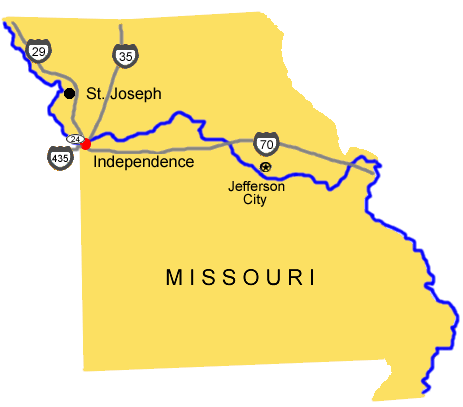
2. Turn south onto Interstate 435.
3. Take Interstate 435 south into Kansas.

Total original route miles in Missouri: 16


Back to the auto route map page.

 
Map image of the auto tour route driving directions from Missouri.
NPS Image
Map image of the auto tour route driving directions from Missouri.
Marshall's Ferry on the Big Blue River at Marysville, KS.  

Did You Know?
Francis Marshall established the first ferry on the Big Blue River near Marysville, Kansas in 1852, charging fees to ferry emigrant wagons and livestock across the river.
more...

Last Updated: November 01, 2006 at 15:51 EST