|
For current information about the Paradise Fire, active during summer 2015, please visit InciWeb. 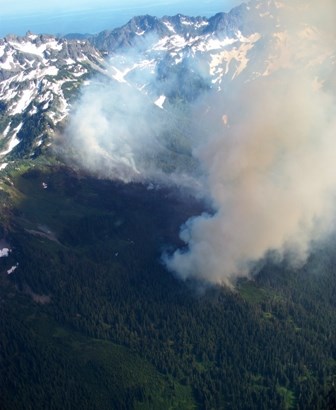
NPS photo The Hopper Fire The Hopper Fire was first reported on August 6th 2010. It was ignited by lightning on the upper 1/3 of a remote ridge on the south side of Mt. Hopper 10 miles up the North Fork of the Skokomish River from the Staircase Ranger Station, and it was managed for resource objectives. The new start was established in an old fire scar from a previous blaze (also called the Hopper Fire). The lightning storm that ignited the fire also produced a fair amount of precipitation and the fire remained small (less than 1/10 acre) for many days after it began. On August 9th, local resources reported very little sign of fire activity and foggy, wet weather. On August 11th the Olympic National Park fuels specialist Todd Rankin was advised by an IMET (incident meteorologist) at the Northwest Coordination Center that a thermal trough would be setting up over the fire area resulting in a critical fire weather pattern that could increase fire activity. On August 13th, a ranger reported a visible and growing smoke column from Lena Lake, 5 miles due east from the fire location. Later that day an aerial recon reported the fire had grown to 120 acres. It was burning actively, making short runs in sub-alpine fir and doing some short range spotting. NPS fire personnel hiked in to the site to monitor fire behavior. On August 14th resources on the ground reported minimal fire behavior and cool, mild weather in the morning and then fire behavior increasing significantly after 1330 with limited crown runs and moderate rates of spread. The fire continued to burn quite actively through August 15th and had grown to over 300 acres. When the thermal trough broke down after August 16th and more seasonable weather returned, fire behavior slowed significantly. The Hopper Fire continued to burn much less actively, smoldering and creeping for weeks until significant precipitation late in the season put it out. 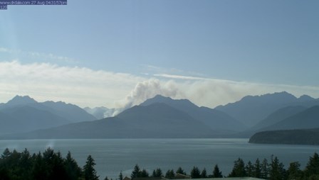
NPS Photo The Heatwave Complex The Heatwave Complex of 2009 consisted of four significant fires (10 Mile, Constance, Knife and Buckinghorse) ignited by several different lightning storms over the course of a month. All four fires were managed for resource objectives. An additional fire the Sol Duc fire was ignited up near the seven lakes basin and was grouped in with the complex, but this fire, unlike the others was on the west side of the rain shadow and only grew to 5 acres. The 10 Mile Fire The 10 Mile fire was discovered on June 23rd, 2009. It was determined to have been started by a lightning strike near the edge of the Duckabush river at the bottom of a 1000 ft slope on a south facing aspect. This fire was pinned in by a hiking trail that effectively acted as a containment line, and it smoldered on the moist flat valley floor for nearly a month before it crossed the trail and began to grow. The fire remained at less than .5 acres until July 29th when it grew to 2 acres. Beginning on this day and lasting for nearly a week, temperatures increased dramatically and relative humidities fell sharply across western Washington in what the National Weather Service referred to as the 2009 Heatwave. The fire grew exponentially during this period: On the 30th it grew to 4 acres, on the 1st it grew to 250 acres, and by the 4th it was at 450 acres. On August 1st, the fire had established itself at the base of the south aspect of the drainage and was making large runs upslope with spotting occurring ½ mile out. The fire's pace moderated after the week long heatwave. It continued to grow steadily reaching 650 acres by August 26th and topping out at 817 acres by the time 17 inches of rain snuffed it out in a season ending event in mid-October. 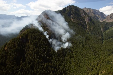
NPS photo The Constance Fire The Constance fire was discovered on July 11th, 2009 just below the top of a south facing ridge near Mt Constance. This area is up the Dosewallips River drainage which is the next river drainage to the north from the Duckabush River drainage where the 10 Mile Fire was burning. The fire elevation was around 2500 ft and the slope 75-100%. This fire, also started by lightning grew slowly at first. It was 2 acres at the time of discovery and had only grown to 5 acres in nearly two weeks. During this time the fire grew primarily from burning debris rolling out over steep terrain and igniting fire below. Beginning on July 21st and continuing until August 4th, the fire grew rapidly, and during the week long heatwave episode July 26th-August 2nd, firefighters observed ¼-1/2 mile spotting, significant runs, and some sustained crown fires. Strong downdrafts produced by nearby thunderstorms caused increased fire activity and spread rates on July 29th and created considerable smoke issues for the community of Brinnon about 9 miles down-drainage from the fire. The fire grew to nearly 400 acres during this time and then continued to grow at a moderated pace with little growth from August 7th through October 12th. The fire did make one small, late season up-slope run at night in early October that was called into Park Dispatch from an airline pilot. At 443 acres, like the 10 mile fire, it was put out by heavy rain in October. 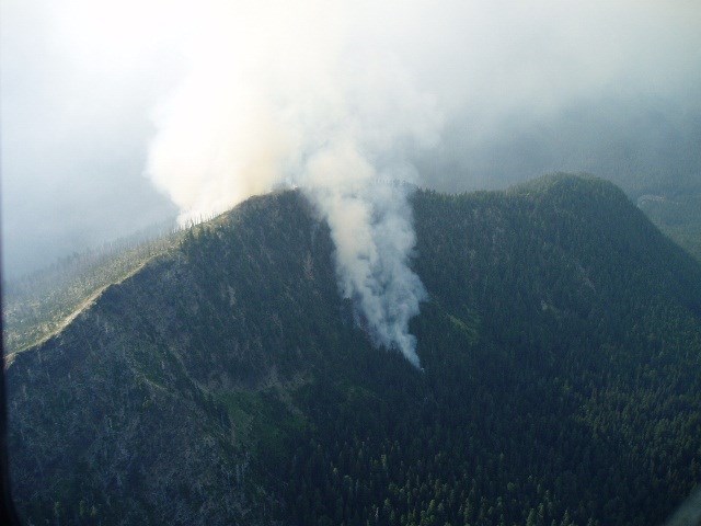
NPS photo The Knife and Buckinghorse Fires The Knife and Buckinghorse fires were both discovered on July 24th 2009. Both fires were started by the same lightning storm that caused the increased fire activity and smoke problems in Brinnon that were seen on the Constance Fire. They occurred near the ridgetops across a river drainage from eachother some 10 miles NW from the 10 mile fire but still on the East (rain-shadow) side of the park. Both of these were high elevation fires (4500-5500ft) and occurred on very steep 75-100% slopes. Unlike the 10 Mile and Constance fires which smoldered for some time before becoming active, the Knife and Buckinghorse fires quickly put up significant smoke columns shortly after ignition. In the middle of the Olympic Heatwave and pushed by winds from nearby thunder cells, the Buckinghorse fire exhibited running crown fire behavior and grew to over 100 acres in a short time. The Knife fire grew less quickly that the Buckinghorse because it started in a burn scar from the 1981 Chimney Peak fire and lacked the heavy fuel loading seen at the Buckinghorse site. Both of these fires spread from the ridgetops downslope, where rolling debris ignited fuels below and generated enough heat to make some upslope runs. These fires grew most quickly within the first ten days of ignition and then continued to grow more slowly until heavy rain in October and snow in November put them out. The Knife fire had grown to 127 acres and the Buckinghorse to 299. 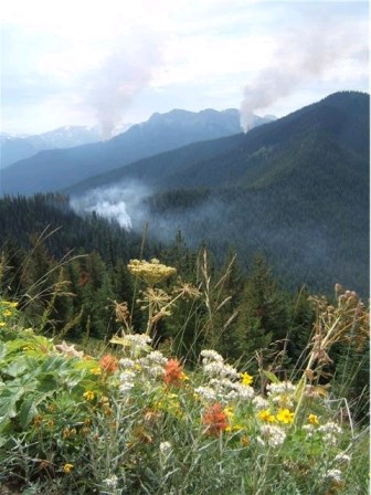
NPS photo The Olympic Complex The Olympic Complex of 2008 serves as an example of what happens when multiple ignitions occur but lack the fuel and weather conditions to encourage large fire growth. On August 17th 2008, a significant lightning storm produced 35 fires. Not all of the 35 fires were staffed and monitored, but of those that were, resources on scene reported seeing steady upslope growth with isolated torching. These fires continued to torch trees and make small upslope runs for the remainder of the afternoon of 8/17 until a thunderstorm moved across the area and moderated fire activity. The fires continued to creep and smolder for the next few days until 8/23 when activity picked up again. On 8/25 rain activity returned and dampened fire activity and on 8/28 heavy rains arrived and put a halt to fire growth. Park Fire Managers had decided to manage these naturally caused wildfires for resource benefit, but none of the fires grew to over 5 acres before going out naturally. 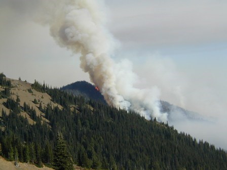
NPS photo The Griff Fire The Griff Fire of 2003 was discovered on September 6th, near what many consider to be the end of fire season in the Olympics. It was ignited by a late season lightning storm near the top of Griff Peak. This fire was on a NE aspect only three air-miles from town of Port Angeles. It was in the NE portion (still well over on the dry/ rainshadow side) of the park and was highly visible from town. Full suppression strategies were considered due to the fire's proximity to this community, however, due to the incredibly steep terrain (75-100% slopes) concern about firefighter safety, and the fact that it was already late in the season with cool, moist conditions, Park Fire Managers opted for a confine/contain strategy that would keep the fire away from residences and herd it back toward the park's interior. The fire grew only minimally for the first 14 days after ignition due to cool, moist weather. However, dry conditions returned to the area towards the end of September which triggered an increase in fire activity and spread. An offshore flow had produced very low relative humidities and poor nighttime humidity recovery. Fire activity at this time was increasing by early morning and the fire was growing 100-150 acres a day. Confinement efforts were effective and the fire grew to 820 acres but never threatened life or property. Precipitation that started on October 6th and continued through much of October hampered fire spread and ultimately extinguished the fire. |
Last updated: June 30, 2015
