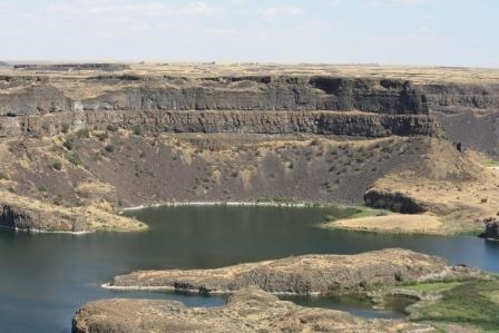
NPS/Handke The United State Congress created Ice Age Floods National Geologic Trail not because people hiked, walked, drove or paddled it, altough millions of people have done this, Congress created Ice Age Floods National Geologic Trail to follow the path of the flood waters. Today you can follow this same path as an automobile route that travels about 3,380 miles (5,439 km) through Montana, Idaho, Washington, and Oregon. Follow your own path of discovery and explore the fascinating landscape of some of the largest known floods in the geologic record. The National Park Service manages the trail in collaboration with other federal agencies, state parks, private land owners, and the Ice Age Floods Institute. |
Last updated: May 11, 2021
