|
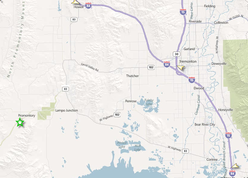
Golden Spike National Historical Park is 32 miles west of Brigham City, Utah, via Utah Hwy. 83 The following directions correspond to the map link below. Northbound on I-15: exit #365, turn right (west) on Hwy. 13 to Hwy. 83. Follow signs to Golden Spike. (32 miles) Southbound on I-15: exit I-84 west to exit #40 (Hwy. 102). Turn left and follow signs to Hwy. 83. Turn right on 83 and follow signs to Golden Spike. (Approximately 29 miles) Eastbound on I-84: exit #26, south on Hwy. 83 past ATK Rocket display, turn right at sign to Golden Spike. (Approximately 27 miles) Westbound from Logan: Hwy. 30 west to I-15, then follow directions for Southbound on I-15. (Approximately 50 miles) GPS Coordinates Golden Spike National Historical Park is located at latitude - longitude coordinates (also known as lat-long or GPS coordinates) of N 41.62048 and W -112.54747. Visitors relying on GPS Units, in order to direct them to our site, need to be cautious once they turn off State Highway 83. Several different GPS systems have misdirected visitors headed to our site. Road signs are more reliable as you approach the site and have turned off of State Highway 83. |
Last updated: April 29, 2025