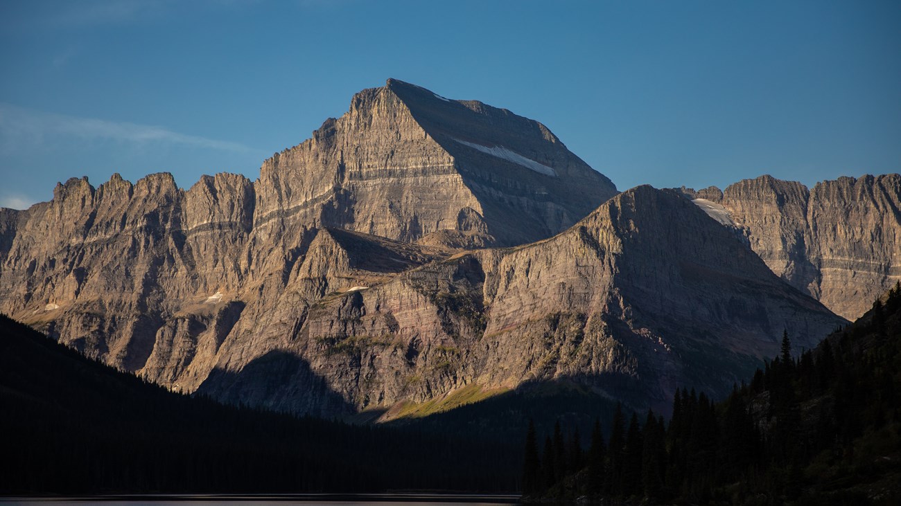
The SettingOver 1800 square miles (4660 sq. km) of the rugged Rocky Mountains are found within the boundaries of Waterton-Glacier International Peace Park. Two mountain ranges, the Livingston and the more easterly Lewis Range trend from northwest to southeast through Glacier. The Continental Divide follows the crest of the Lewis Range. Elevation varies from a low of 3150 feet (960 m) at the junction of the Middle and North Forks of the Flathead River (near the Lake McDonald valley to a high of 10,466 feet (3192 m) on Mt. Cleveland. There are 6 peaks over 10,000 feet (3050 m) and 32 peaks over 9100 feet (2770 m) found in Glacier National Park. The impressive mountains and valleys within the park are the result of approximately 1.6 billion years of earth history and a number of geologic processes, including, erosion, sediment deposition, uplift and thrust faulting and glaciation Waterton-Glacier is a geologic park. The geologic processes happened in three stages: 1. The sedimentation or deposition of the rock; Waterton-Glacier has some of the oldest and best preserved sedimentary rocks found anywhere in North America. Usually, over time and with heat and pressure, sedimentary rock becomes metamorphic rock. For example, limestone becomes marble. It is quite unusual that this old rock still retains its sedimentary characteristics. 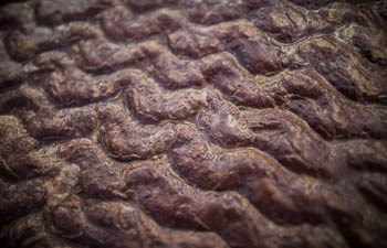
NPS Ancient Sediments – 1.6 billion to 800 million years agoThe majority of the rocks forming the mountains of the Peace Park are the result of the deposition of sediments into an ancient inland sea that existed over 1600 million years ago during the middle Proterozoic Era. The ancient Belt Sea covered parts of present-day eastern Washington, northern Idaho, western Montana, and nearby areas in Canada. During the period of active deposition over 18,000 feet (5500 m) of sediment eroded from nearby highlands and were carried into the sea. Accumulation of sediment subsequently resulted in downwarping of the sea floor. Also, over time and as environmental conditions varied, a variety of different materials were eroded and washed into the Belt Sea. With time the sediments of the Belt Sea accumulated into vast layers, which allowed years of mounting heat and pressure to create layers of quartzite, siltite, argillite, limestone, and dolomite. The sedimentary nature of the rocks in Waterton-Glacier and their history as part of a vast inland sea can be seen in preserved mudcracks, ripples, and layers.
Strictly speaking the crystal structure of each sedementary formation has been slightly metamorphosed, creating what can accurately be called metasedimentary rock. The combined rock formations that occur in Waterton-Glacier are part of the Precambrian Belt Supergroup, and can be seen above treeline in one-third of the park. From the pebbles in Lake McDonald to the faces of entire mountains, perhaps the most eye-catching feature of Glacier's geology is it's varying shades of red and green. Different layers of rock in Glacier can be dramatically different colors, and their color can tell us a great deal about their history. The process that created these striking colors centers around one element: Iron. The argillite in the park throughout its formation contained significant amounts of iron, which is a reactive metal. Much like metal on an old car, iron will oxidize (or rust) and turn reddish/orange when exposed to oxygen. The red colors in our rocks formed the same way! As the belt sea began to retreat, it exposed argillite and the iron within to oxygen, allowing for oxidation to occur.
Conversely, the green found in our rocks is a result of argillite forming without access to oxygen. Forming underwater in the belt sea, argillite starved of oxygen instead goes through a process known as reduction, with iron bonding to silica compounds. Under heat and pressure the iron-silicate minerals were converted to chlorite, a mineral which produced the green rocks found in the park today. 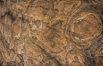
NPS Stromatolites – a fossil algae colony dating from the Belt SeaSome of the earliest forms of life on earth were oxygen producing bacteria known as cyanobacteria. Six species of cyanobacteria, often called blue-green algae, thrived in shallow parts of the Belt Sea and played a significant role in the formation of the carbonate rocks of the park. The remains of these cyanobacteria are called Stromatolites. Found mostly in the Altyn and Helena (Siyeh) Formations, Stromatolites have shapes and internal structures very similar to blue-green algae that live in present-day seas less than 100 feet (30 m) deep. The closest modern day examples can be found off the coast of southwest Australia. As some of the earliest forms of photosynthetic life, stromatolites began to change the world around them. Sunlight allows algae to consume carbon dioxide from seawater and release oxygen in the process. There are two important results from this process:
Thanks to the unique geology of Glacier, the fossils of large mammals or ancient dinosaurs found in other places throughout western North America have mostly eroded away or sit inaccessible under layers of much older rock.
The most prolific fossil in the park, Stromatolites hail from a time long before dinosaurs or mega-fauna, and can be found throughout the park. However, they are not the only fossils that have been found here. For more information on modern-day stromatolites and other fossils found in the park, check out our Fossils in Glacier Page. 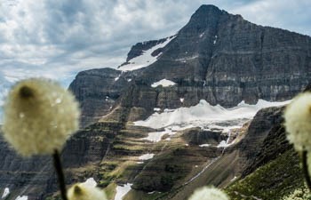
NPS / Glacier An Intrusion of Magma - 750 million years agoWhile most of the rock in the Peace Park is metasedimentary in nature, late in the Proterozoic some igneous rock flowed as lava onto the sea floor. Some of that igneous material forced itself between layers of limestone forming sills at an even later time. Today the igneous materials are evident as pillow lava formations (black basalt) in the Granite Park area, and as the Purcell Sill that runs through the Siyeh Limestone. A dark band of igneous rock (diorite) about 100 feet (30 m) thick, the heat of the intrusion recrystallized the surrounding limestone into white metaporphic marble.The Purcell Sill can be seen on Mt. Siyeh and Mt. Cleveland in Glacier, and Mt. Blakiston near Red Rock Canyon in Waterton. 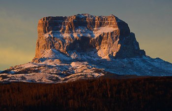
NPS Lewis Thrust Fault – 60-70 million years agoApproximately 150 million years ago, plates of crust collided on what was then the western edge of North America. That collision began a process of mountain building that would continue for nearly 90 million years. In the area that would become Waterton-Glacier International Peace Park, massive forces uplifted a slab of rock several miles thick. The bottommost layer of this slab is roughly 1.6 billion years old, and it was pushed east for 50 miles (80 km) over rock only 70 million years old. Geologists estimate that this movement occured at a rate of less than half an inch every year. When the slab finally came to a halt, the layer on top was over a billion years older than the rock beneath it. The Lewis Overthrust Fault is not only Glacier's most famous geological feature, it's also major evidence of the tectonic events that created the mountains here in the Crown of the Continent. As a result of the uplift, erosive forces accelerated and over several million years removed the upper layers of material, exposing the rock formations evident in the park today. However, numerous other events were occurring at the same time as the overthrust. Folding warped many of the formations into synclines and anticlines, bending the rock upward and downward like an S-Curve. Multiple smaller faults also curved, cracked, and broke different layers in various places throughout the park. Yes! While there are many places to see evidence of the thrust, the most famous and photographed view of it can be found at Marias Pass on US Highway 2. Marias Pass is just outside the southeast corner on the park, and can be found on the Park Map on our Map Page. The fault can be seen on Summit and Little Dog Mountains as a thin tan line of rock roughly halfway between the peak and the ground below.
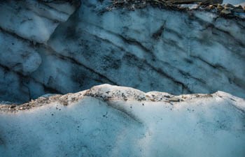
NPS Glaciation: The Ice Age – 2 million years agoThe defining geological event in shaping this landscape began with a global cooling trend approximately 2 million years ago. The Pleistocene Ice Age saw large ice sheets repeatedly advance and retreat throughout the temperate regions of North America until about 10,000 years ago. In the area that would become Waterton-Glacier International Peace Park, ice advanced and retreated until probably melting completely about 12,000 years ago. During the ice advances, the lower valleys were filled with glaciers and only the very tops of the higher peaks were visible. The "rivers of ice" sculpted the mountains and valleys into a variety of landforms associated with major alpine and valley glacial action. Even though the Ice Age glaciers are gone, the results of their passing are evident on the landscape. Massive u-shaped valleys, numerous cirque lakes or tarns, horns, cols, moraines, and aretes are but a few of the glacially carved landforms that contribute to the beauty of Waterton-Glacier International Peace Park. To learn more about how glaciers shaped the park and how to find evidence of that today, check out our Glacial Geology page 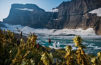
Recent Glaciation – dating from about 6,000 years agoToday, we are living in a relatively warm interglacial period. All remnants of the Pleistocene ice have disappeared. There are no active glaciers in Waterton Lakes National Park; however, the last survey in Glacier NP resulted in about two dozen named alpine glaciers. They are of relatively recent origin, having likely formed in the last 6,000 to 8,000 years. They probably grew rapidly during the Little Ice Age that started about 400-500 years ago and ended about 1850. However, they work in the same way as larger glaciers of the past. A glacier forms when more snow falls each winter than melts the next summer. With alternating freezing and thawing, the snow becomes granular ice. As these layers build up, the ice recrystallizes, becomes denser, and eventually forms a massive sheet. A glacier is a mass of ice so big that it flows under its own weight. A commonly used threshold for determining if a body of ice is big enough to flow under its own weight is an area of 0.1 km², which is about 25 acres. Below this size the ice is less likely to move and is not considered a glacier. This general definition works most of the time, but there are exceptions. Some glaciers may be smaller than 0.1 km² and yet remain active. Others may stop moving under their own weight and still remain larger than 0.1 km². Ice near the surface of the glacier is often hard and brittle. Due to the pressure of ice above, the ice near the bottom of the glacier becomes flexible. This flexible layer allows the ice to move. Depending on the amount of ice, the angle of the mountainside, and the pull of gravity, the ice may start to move downhill. Once the ice begins to move, it is called a glacier. As the ice moves, it plucks rock from the sides and bottom of the valleys. Rocks falling on the glacier from above mix with the glacial ice as well. Over long periods of time the sandpaper-like quality of the moving ice and rock scours and reshapes the land into broad U-shaped valleys, sharp peaks, and lake-filled basins. Tree-ring studies indicate that retreat of the recent glaciation began about 1850. When Glacier National Park was established in 1910, there were around 80 glaciers within the national park compared to about two dozen now. Retreat rates appear to have been slow until about 1910. There was a period of rapid retreat during the mid- to late 1920s. This corresponds to a period of warmer summer temperatures and decreased precipitation in this region. Several of the larger glaciers separated into two smaller glaciers at this time. The Jackson and Blackfoot Glaciers separated as did the Grinnell and Salamander Glaciers. Some of the first people to visit the park to document our Glaciers, like George Bird Grinnell, arrived in the late 1800's. Not long after the Little Ice Age ended, intrepid explorers and researchers began photographing alpine glaciers as they were at the time. Those photos allow for us to make some remarkable comparisons today. To see how these glaciers have melted and changed in the last 100 years, check out our Melting Glaciers Page, and the USGS Repeat Photography Project.

NPS / Jacob W. Frank What Sets Our Mountains Apart?
|
Last updated: June 6, 2023
