|
UNIT 64 Description: The northern end of the Kantishna Hills in the eastern half of this large unit is the most reasonable area for hiking. The ridgeline of the hills in this area is fairly wide and covered with alpine tundra vegetation in many areas. Chitsia Mountain is at the northern end of the ridge system. Beyond it to the north and west the land falls away first into birch hillsides and ridges and then into the huge expanse of lowland black spruce forest and muskeg that characterizes the northwestern part of the park and preserve. Lower Moose Creek makes the western boundary of the unit all the way to the Bear Paw River. 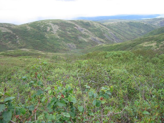
nps photo Tips/Special Features: There are views in all directions off the top of this ridge system, from the Alaska Range in the south to the seemingly endless horizon of the interior lowlands to the northwest. This is a very remote area that receives very little us yet there is reasonable access due to the road systems in the southern portion of the Kantishna Hills. It takes at least a three day walk to reach the main part of this unit so a commitment of time and a stay in other units is required. Access: The most realistic way to access this unit is from the south. Use the old mining roads and ridgelines of units 41 and 42 to reach upper Caribou Creek and then go north from there. Drainages of the Clearwater Fork in Unit 40 also lead up to the ridgeline in this unit, but two days of travel are required just to get to them. Another access route starts at the north end of the Kantishna Airstrip at the end of the Park Road. A winter trail continues north on the northeast side of Moose Creek. Lower Moose Creek and the Bear Paw River was how most miners accessed the Kantishna district in the early 1900s. This river is floatable by experienced rafters, but there is no road access to this river after you leave the Park Road. Moose Creek flows eventually into the Kantishna River which hits the Tanana River about 75 miles downriver of the George Parks Hwy. Travelling down Moose Creek on foot is not recommended. Additional Notes and/or Hazards: Mosquitoes are extremely dense in this park of the park in June and July. If you plan to hike in this unit, you should be aware that this area is outside of designated Wilderness. In 1980, Mount McKinley National Park was expanded and renamed Denali National Park and Preserve and this area was included as part of the new park’s additions. The Kantishna Hills and surrounding area is a historic mining district dating back to the early 1900s. There are patented and un-patented mining claims in the area, private properties and privately owned and operated lodges. People who have traditionally hunted, fished and trapped in the area continue to do so. The miners in this area established travel routes along ridges and in creek beds to access their claims. There are cabins, equipment, old roads and assorted refuse on public and private land in very remote areas. Hikers in the Kantishna Hills must respect private property and the cultural significance of the mining history. Do not disturb the historic relics and never enter a private residence without prior permission. It may be unsafe to drink the water from the following streams due to heavy metal contamination: Eldorado, Slate, Friday, Eureka, Caribou, Spruce, Glacier, Stampede and Moose Creek below Spruce Creek. Water filters, boiling and chemical treatments are ineffective for treating water with heavy metal contamination. 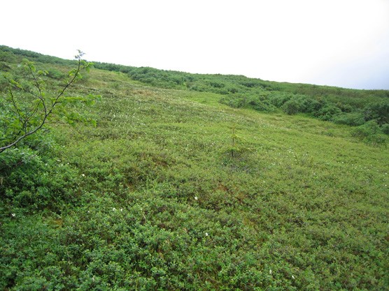
nps photo |
Last updated: April 14, 2015