Tips and Special Features
This unit is a good starting point for multi-day hikes into areas that are rarely visited, even though they are near the busy eastern end of the Park Road. You can access this area by using the free Savage River Shuttle that runs frequently in the summer months. This area of the park is known for its brilliant fall color displays and excellent moose and grizzly bear habitat.
Access
The best place to access the Savage River gravel bar is at the southern end of the Savage River Campground or the Savage River Bridge, depending on which portion of the unit you want to explore. It is a 30-minute bus ride to this area from the park entrance.
Common Routes and Hiking Corridors
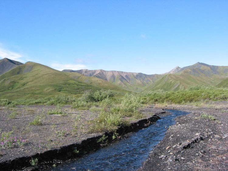
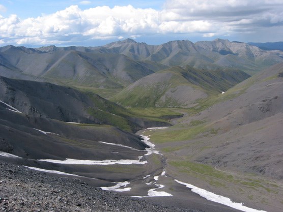
The primary hiking corridor is the Savage River itself. This river offers the first wide gravel bar hiking into the Alaska Range as you travel west along the road from the park entrance. The riverbed is relatively brushy for about five miles south from the Park Road, and then as it climbs farther into the Alaska Range, the brush thins and the walking is easier. Upper Savage River is braided and crossable in most places except during extremely heavy rain. Do not underestimate the size of the upper river valley as a destination. An out-and-back trip to the headwaters of the Savage River can be a tremendous experience, especially for a group new to cross-country hiking in Alaska.
If you do want to go farther, there are many options for getting into other drainages and units once you reach the Savage River headwaters. The passes east into Riley Creek (Unit 2) are very steep and may be covered with snow and ice late in the season. They are not recommended unless you are very comfortable with off-trail hiking on very steep slopes of scree and snow. A less difficult way out of the drainage and into Riley Creek is to travel east along the ridges that head toward Jenny Creek (Unit 3) and the park entrance area. Travel to the west (Unit 5) from the headwaters area is possible via low passes between the Savage and Sanctuary drainages. The eastern sides of these passes are covered with low vegetation. The descent into the Sanctuary is brushy, but the worst of it can be avoided by sticking to the ridges rather than the creek bottom. Hikes linking up with Caribou Creek in the western portion of the unit and looping back to the Park Road are also possible. Caribou Creek is much brushier than the main Savage River and travel along it will be slower.
Additional Notes and Hazards
A hike of about 3 miles is required to get out of sight of the Park Road south of the nearby campground.