|
UNIT 27 Description: This small unit encompasses both the western end of Primrose Ridge (See Unit 26) and all of Mt. Wright. Mt. Wright, like Primrose ridge, is a broad, flat-topped expanse of alpine tundra and is part of the Outer Range. In between these two areas is the steep, rocky canyon of the Sanctuary River. The lower elevation hillsides of this valley are spruce forest and brush. 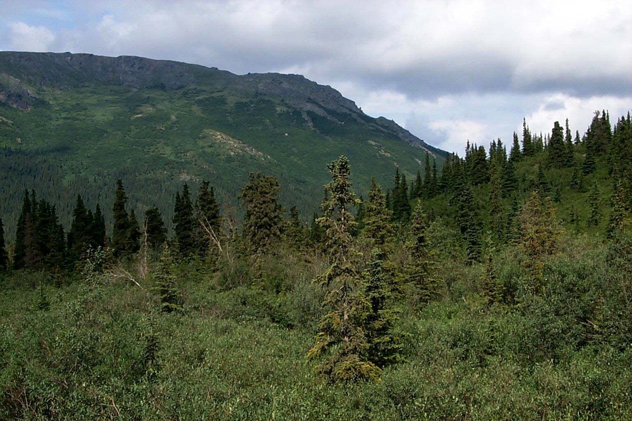
nps photo Tips/Special Features: Primrose Ridge (also known as Mt. Margaret) and Mt. Wright are both excellent day and overnight hikes. These mountains are part of the Outer Range which rise about 1,500 feet above the Park Road and consist mostly of dry tundra and rolling hills. This unit is a relatively short ride out the Park Road, yet within 1 to 1 ½ hours of walking it is still possible to be in some of the best alpine terrain in the park. The area provides easy walking and expansive views from the tops of Mt. Wright and Primrose Ridge. The fall colors are especially brilliant in this area of the park in mid to late August. Access: To access the Primrose Ridge portion of the unit, it is easiest to approach from Unit 26 and traverse west on top of the ridge. You also could climb the south facing ridges that ascend from the road in the area of Hogan Creek. The best place to start your climb of Mt. Wright is from the west side of the Sanctuary River Bridge near the Sanctuary Campground. It is about an hour bus ride to this area. Another access point is to get off the bus where the Park Road first stars paralleling the Teklanika River (around Mile 25). You can follow the east side of the river for a few miles downstream along the gravel bar. 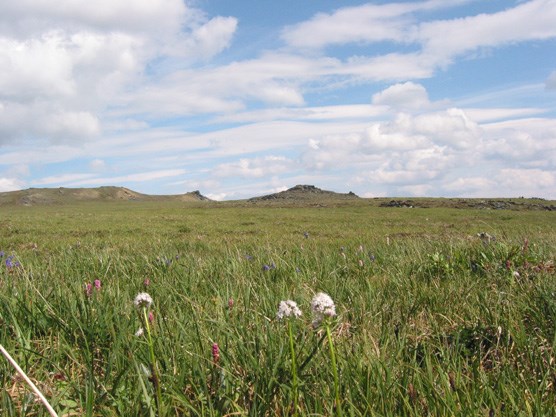
nps photo The climb to the top of Mt. Wright is similar in many respects. Starting from the west side of the Sanctuary River Bridge, the first 1000’ of elevation gain is through a spruce forest with an open willow understory. Remember to spread out while hiking to help prevent the development of social trails along your route. At about the 3500’ level the brush will become thicker for a few hundred feet, but then it begins to thin out fairly quickly as the tundra vegetation takes over. The angle of the hillside will also start to diminish as the broad, flat summit of Mount Wright appears. Once you are on top it is easy to explore in any direction. This route can also be used as a way to access the northern flank of this unit. It is possible to travel a few miles down the east side of the Teklanika River after you pass Mile 25 on the Park Road. There are few places for camping in this area and from this point it is difficult to climb Mt Wright or cross the Teklanika River into Unit 28. However, this could be an option for people who only want to travel a short distance to get out of sight of the Park Road and take a bus out farther into the park the next day. Additional Notes and/or Hazards: Traveling north down the Sanctuary or Teklanika Rivers from the Park Road should not be attempted because they flow into steep sided canyons that are not passable on foot. The rivers are swift and murky with large slippery rocks and boulders that can trap you or cause a fall. Water can be difficult to find on the open ridge tops after the snow patches have melted; you will need to be prepared to filter water from tundra pools or descend off the sides of the flat topped areas to find small seeps and springs. Watch out for lightning storms and high winds on the exposed ridges in the summer months. 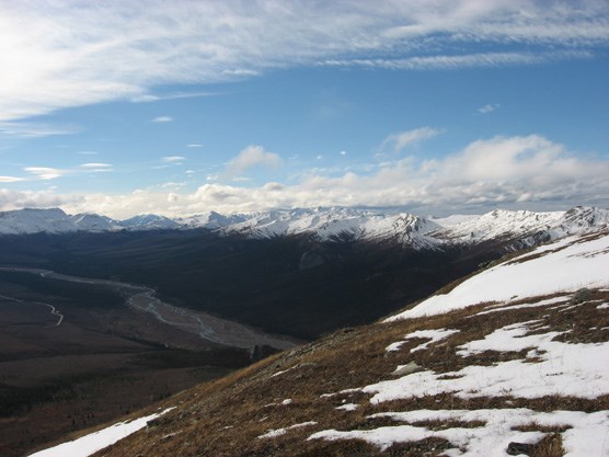
nps photo |
Last updated: April 14, 2015