Tips and Special Features
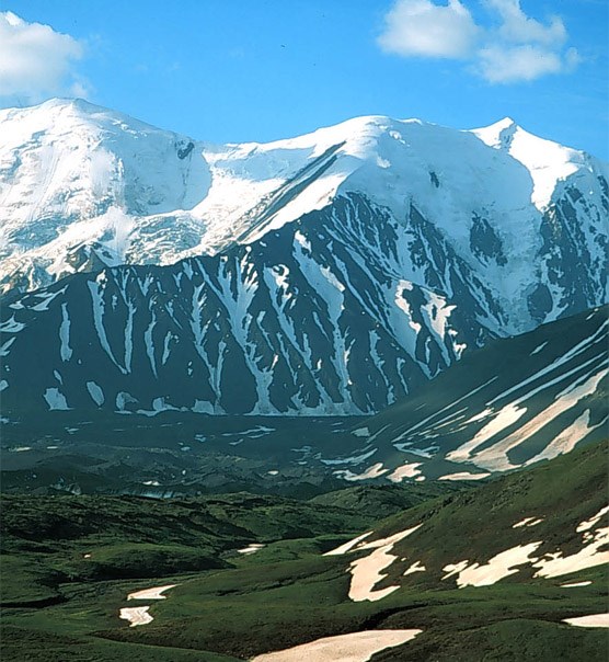
The proximity to the Muldrow Glacier and the ice falls and glaciers of the Alaska Range all provide spectacular scenery. Anderson Pass is one of the few passes over the Alaska Range you can reach without glacier travel equipment. The Muldrow Glacier is the largest north-flowing glacier in Alaska, pushing down into this region as a mixture of rock and ice. Travel into this unit is along a narrow and popular corridor in Unit 13, so expect to see people and some signs of human use as you travel in this area. This unit can be very difficult to get a permit for, so it is better to end your trip here if you have a longer itinerary.
Access
Access to this unit is generally by following Glacier Creek through Unit 13. It is about a 5-mile hike from the Park Road to reach the unit along this creek. It also can be accessed by a long traverse from the south side along the Denali Fault (Unit 23).
Common Routes and Hiking Corridors
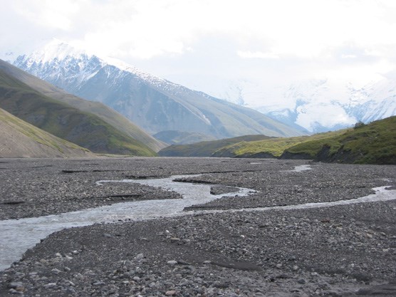
Access to Unit 18 is along the gravel stream bed of Glacier Creek. Expect to cross the fast-flowing creek several times. Water levels can rise quickly during rainstorms or hot weather. Anderson Pass is a common destination for many hikers in the area. The pass is usually reached during a strenuous day hike from a base camp on Glacier Creek. The hike up the pass is steep and contains sections of loose rock, scree and steep snow. From the pass, hikers have a grand view of the Muldrow Glacier and the Alaska Range. The large West Fork Glacier lies to the east of the pass.
There are no reasonable passes or connections out of the headwaters area other than over Anderson Pass to the south side of the Alaska Range (Unit 23). Steep, 1,000 ft walls and hanging glaciers can be found blocking other routes. Prior experience with glacial travel and long distance cross-country hiking is strongly recommended before attempting this trip over the Alaska Range. See the discussion of this route in the description for Units 23, 17 and 16. Contact the Backcountry Information Center for further information about a hike over the Alaska Range.
For another long trip, it is possible to traverse the Muldrow Glacier to Pirate Creek (Unit 19) beginning near the vicinity of Green Dome and Crystal Creek. The 2-mile-long hike across the glacier is long, rigorous and very dangerous. Prior glacier travel experience on moraines is necessary. Small streams, ice ponds and deep crevasses may be encountered and you should plan on travelling less than 1 mile an hour while on the glacier.
Additional Notes and Hazards
Due to this unit’s high elevation and proximity to the Alaska Range, be prepared for unpredictable weather patterns. This includes summer snow storms, cooler temperatures and high winds. Grizzly bears like to use the Glacier Creek drainage for travel, so be extra alert in this area.