
The Apaches called this place "The Land of Standing-Up Rocks," a fitting name for the canyons of extraordinary rock towers. Early pioneers in the late 1800s sensed the unique beauty and singularity of the rock formations in the area. The Ericksons and Riggs were instrumental in persuading Congress to protect this "Wonderland of Rocks," so much so that in 1924 the Chiricahua National Monument was created. 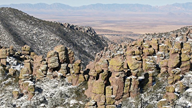
'Wonderland of Rocks' Geology
Rock pinnacles are the result of the erosion of compacted volcanic ash from the eruption of an ancient volcano just south of the park. 
Explore the Night Sky
Chiricahua protects dark night skies and is a great place to stargaze. 
What is a Sky Island?
Discover the unique aspects of sky island. 
Flora of Chiricahua
Chiricahua is at the crossroads of four biogeographical regions, boasting over 1000 plant species. 
Fire Regime
Fire has shaped the landscape of Chiricahua National Monument. 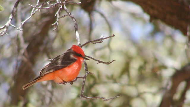
Birding at Chiricahua
Southeast Arizona, and Chiricahua in particular, is a premier birding area of the country. Download the bird checklist for your visit. 
Mammals of Chiricahua
What mammals could you see on your visit? 
Gould's Turkey
Gould's turkeys were successfully reintroduced into the Chiricahua Mountains. 
Thick-billed Parrot
Discover the story of thick-billed parrots in the Chiricahua Mountains. 
Rattlesnakes
Learn about rattlesnakes in southern Arizona. |
Last updated: February 11, 2026