NPS Photo/Cait Johnson An Ancient Landscape Ten thousand years ago, there was no beach at what is now Cape Krusenstern National Monument. Instead of the crashing waves of the Arctic Ocean, an endless sea of grass teaming with wildlife stretched as far as the eye could see. This was Beringia – the thousand mile wide land bridge that connected the old world to the new. During the Ice Age, the huge amounts of water locked up in the massive, continent-spanning glaciers caused the sea level to drop by 300 feet, exposing the floor of the shallow Bering and Chukchi Sea. The flat, grassy plain that was exposed by the retreating water was the Bering Land Bridge, an expansive corridor which linked Asia and North America for thousands of years. Herds of massive Ice Age animals like wooly mammoths, Arctic camels and muskox lumbered across the fertile plain in search of food. They were followed by tribes of nomadic hunters – the first Americans. 
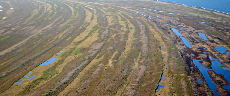
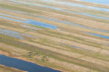
NPS Photo/Paul Stolen Old Beaches When the glaciers melted, the Bering Land Bridge disappeared beneath the waves. Many early North Americans settled along the shore of the Chukchi Sea where they hunted seals and whales and fished for salmon and sheefish. The beach ridges of Cape Krusenstern show that the ancestors of the Inupiaq people used the coastline for centuries. Beach ridges form when wind and ocean currents dump huge loads of sediments just offshore. Eventually, the sediment deposit grows high enough that the waves cannot wash over it, creating a new beach. Over time, beach after beach was formed, creating a series of ridges stretching out into the ocean. The people who came to Cape Krusenstern to hunt marine animals settled on the beach closest to the water, resulting in an archeological timeline of Cape Krusenstern’s history. Archeologist Louis Giddings, who excavated the three-mile wide complex of 114 beach ridges at Cape Krusenstern in the 1950s, uncovered old houses, caches, and living areas from generations who had hunted along the beaches of Cape Krusenstern for the last 5,000 years with an evolving culture and technology. 
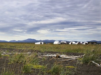
NPS Photo/Emily Mesner A Thriving Tradition Because of its central location, settlements at Cape Krusenstern National Monument have long served as an economic and cultural hub for the area. Every summer a large trade fair (Qatŋut in Iñupiaq) was held at Sisualik, a fish camp located on a fringe of land surrounded by salmon and beluga rich waters at the southern tip of the monument. For two weeks in late July, 2,000 people would converge on Sisualik from throughout the Arctic, even coming as from as far away as Siberia to trade food and goods, socialize, dance and compete in traditional games. Qatŋut is still held every two years in Kotzebue, just 14 miles across the Kotzebue Sound from Sisualik. The Iñupiat from Kotzebue and Noatak maintain subsistence camps along Cape Krusenstern National Monument’s shore. The rich bounty of the ocean, lagoon and tundra remains an important source of food in Northwest Alaska. As people set fishnets, collect berries and eggs and hunt for seal and beluga off the coast, they are carrying on a 200 generation long tradition of living off the land. |
Last updated: November 18, 2024
