
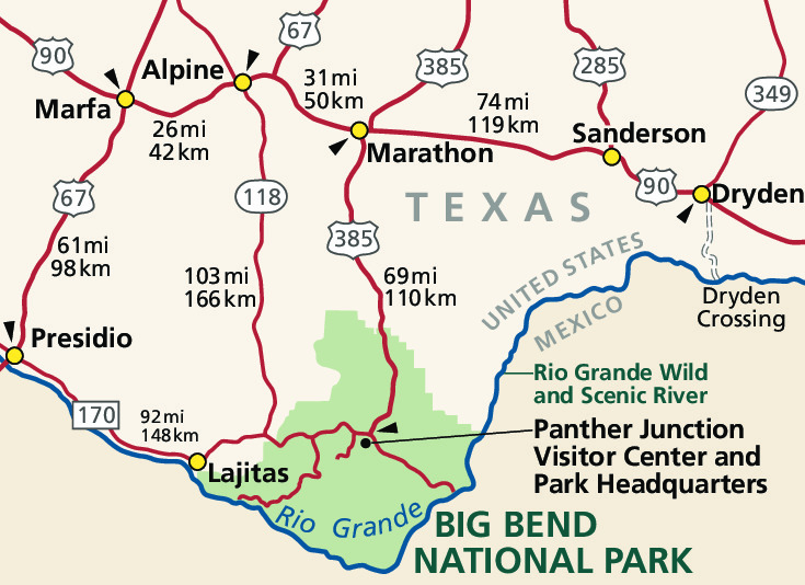
Several highways lead to Big Bend National Park: TX 118 from Alpine to Study Butte or FM 170 from Presidio to Study Butte (then 26 miles east to park headquarters), or US 90 or US 385 to Marathon (then 70 miles south to park headquarters). Distances between towns and services are considerable. Be sure you have plenty of gas, oil, food, and water for your trip. There are no electric vehicle charging stations in Big Bend National Park. The closest EV charging station is 130 miles away in Fort Stockton, TX. Visit our maps page for more help with directions in and around this remote area. Caution: GPS is Not Always Reliable Here.
Public Transportation There is no public transportation in the immediate vicinity of the park. A variety of transportation methods can get you to cities within a day's drive of the park.
Airports The nearest airports served by major airlines are located in Midland/Odessa, Texas (235 miles from park headquarters) and El Paso, Texas (330 miles from park headquarters). Rental cars are available at both airports.Rail Service The nearest Amtrak station is located in Alpine, Texas (100 miles from park headquarters). Call Amtrak at 1-800-USA-RAIL for schedule information.Bus Service Greyhound provides daily service to Alpine, Texas (100 miles from park headquarters). Call Greyhound at 1-800-231-2222 for schedule information. |
Last updated: September 12, 2022