
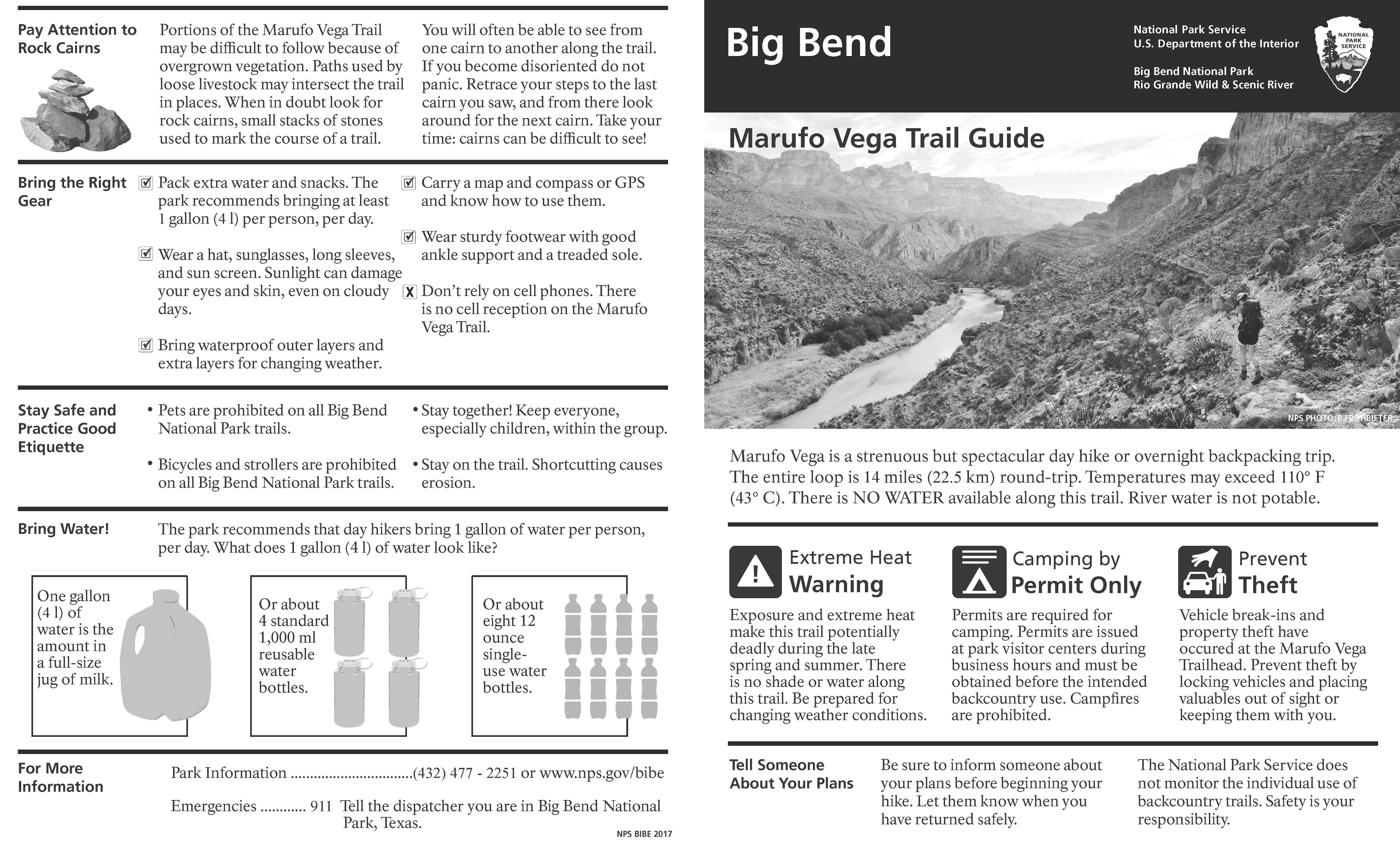
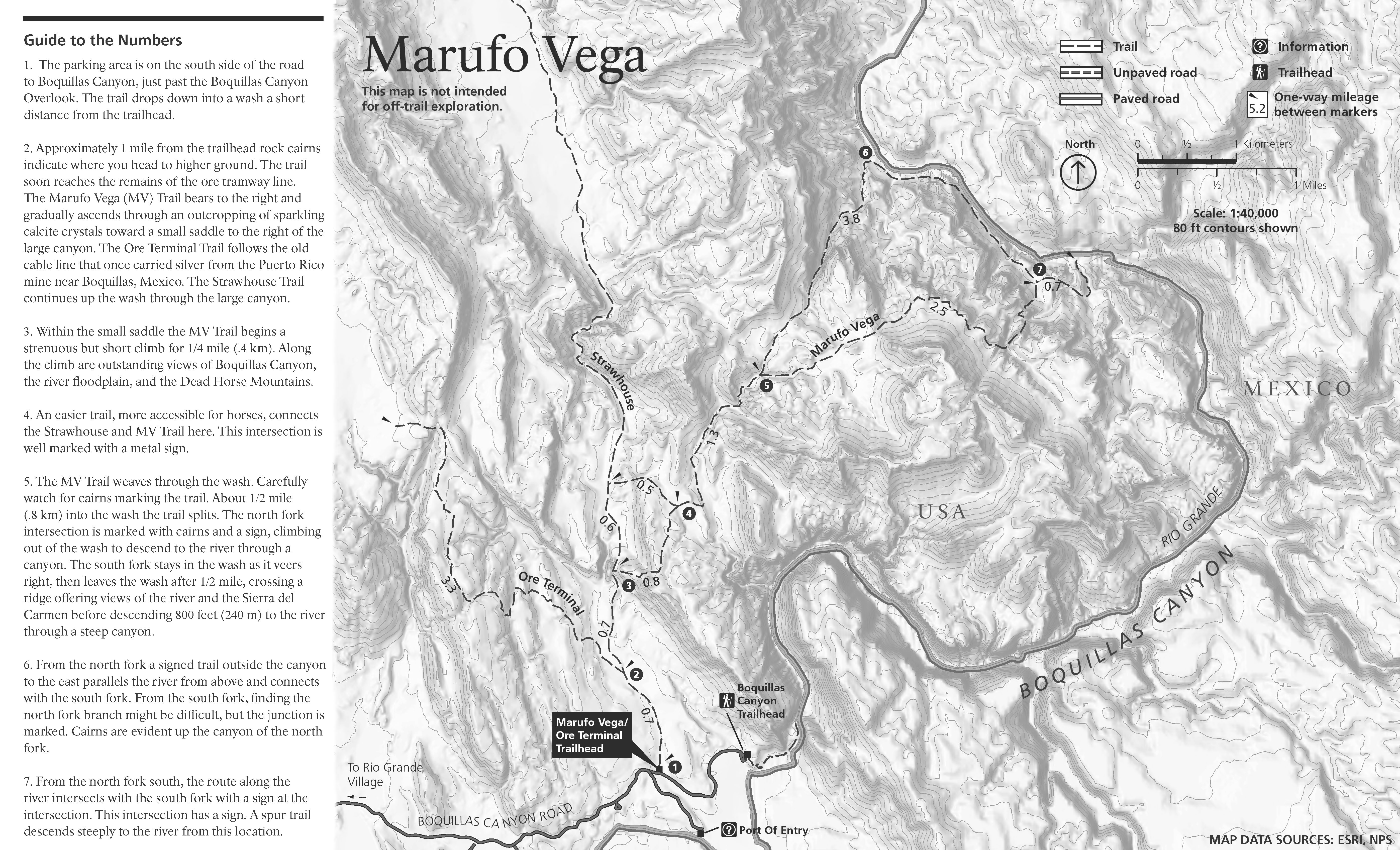
This is a strenuous, but spectacular day hike or overnight backpacking trip through stark but stunning terrain. The trail is named after Gregorio Marufo, who once grazed goats along the Rio Grande. Be PreparedHikers must be duly prepared for the challenges of this trail. This trail is not an appropriate hike for the unprepared or unfit.. Temperatures regularly well exceed 110°F during spring and summer. You will find NO shade and NO water along this trail—and river water is not potable. The trail ascends and then descends through the Deadhorse Mountains. Total elevation gain (climbing) is approximately 2000' each way. Marufo Vega is pleasant to hike during the winter months, but hikers have died in the intense heat of spring and summer. This combination of factors make this trail potentially deadly from April through September.

|

Last updated: January 7, 2021