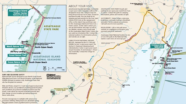
Find Your Way on Assateague with a Map!
Park maps, trail maps, campground maps and more. 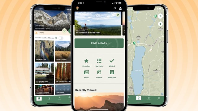
Download the NPS App!
One app, every park at your fingertips. DirectionsBy Vehicle By Plane Public Transportation Warning about GPS Systems! Vehicle Navigation Systems and GPS units may provide inaccurate information - sending drivers to wrong destinations. Physical AddressesBusiness Offices - Maryland District Ranger Station/Campground Office - Maryland District Assateague Island Visitor Center - Maryland District Toms Cove Visitor Center - Virginia District |
Last updated: August 8, 2024