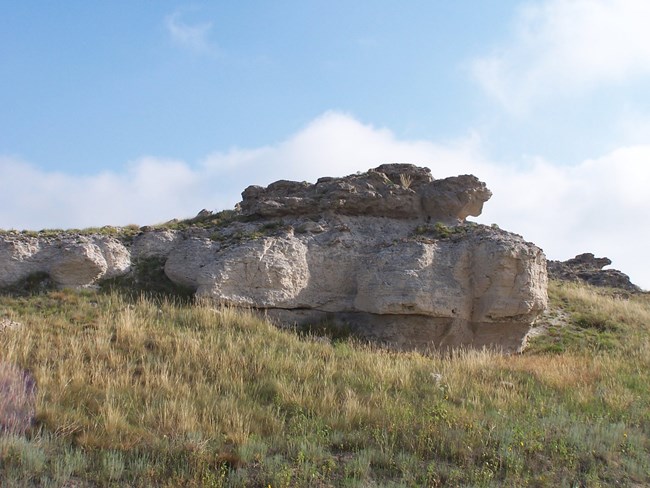
NPS photo Types of Rock Found at AgateThe kinds of rocks that you’ll find here at Agate Fossil Beds National Monument are sandstone and limestone with thin lenses of agate. There are two formations exposed at the monument. A rock formation is a group of rocks that share lithology (physical characteristics such as composition, grain size, fossil content, and color) and share a particular place in the stratigraphic column. The Environment in the MioceneThe sediments that are exposed in these formations are remarkably unaltered, which points to a dry/arid depositional paleoclimate. During the lifetimes of the early-Miocene mammal fossils that were uncovered here, the climate in this region became drier and a savannah of mixed trees, shrubs, and grass became a grassland. Streams of the Anderson Ranch Formation cut channels in the underlying Harrison Formation that became waterholes. These waterholes attracted animals, and many died during periods of drought. The rapid deposition of ash and sand provided a good environment for fossil preservation; the remains of animals were covered quickly protecting them from scavengers and decomposers, and the ash produced an alkaline chemical environment which stabilized the bones. 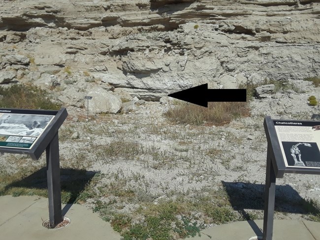
The Bonebed LocationThe level of the bonebed is near the base of the Fossil Hills. The top of the former waterhole is marked by white, limey mudstone and thinly laminated brownish sediments. Above these, evidence of paleosol (fossilized soil) is visible through silica-cemented root structures. Determining the Age of the MammalsThe volcanic ash present in the sandstones at Agate Fossil Beds provides a reliable way to date the rocks. Zircon crystal dating measures the ratio of uranium-238 to lead; uranium-238 decays to lead at a constant rate. Using this method, scientists have determined that the sandstone directly beneath the bonebed is 22.9 million years old. 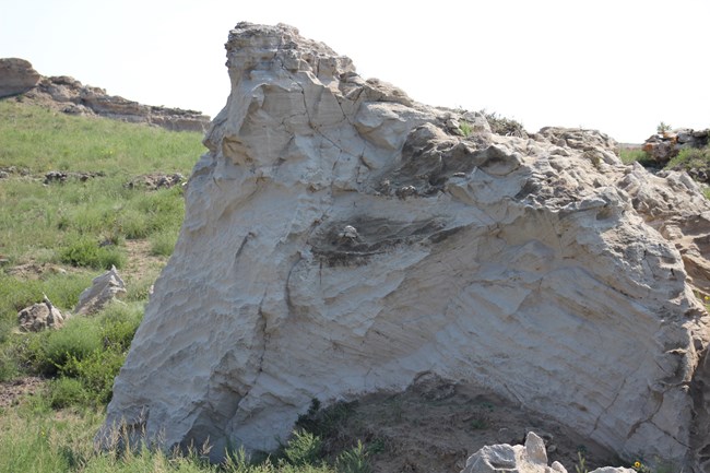
NPS photo The Harrison FormationGray “salt-and-pepper" colored ash-rich sandstone with fossilized features such as sand dunes and spiral-shaped burrows called Daemonelices or “devil’s corkscrews,” which are displayed on our Daemonelix Trail and in the Visitor Center. 
The sand dune deposits formed from wind-blown sediments. The sloping lines visible in the rock face pictured below are “slip-face” surfaces, formed when grains accumulate on the windward side of a dune until they reach the angle of repose and cascade down the downstream side of the dune. The angle of repose is the steepest angle relative to the horizontal plane on which a granular material can be piled without slumping. The direction of the slip-face surfaces tells us that the prevailing wind direction was from the northwest at the time the dunes were formed. 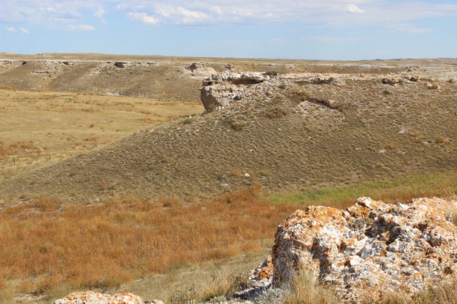
The Anderson Ranch FormationIt's also called the Upper Harrison Formation. Tan or light beige colored stream deposits and paleosol (fossilized ancient soil) layers, topped with a silcrete layer and limestone lake deposits. The silcrete layer underneath the limestone caprock is a paleosol surface hardened by dissolved silica that formed a mineral matrix binding the paleosol sediments together. Due to the impervious nature of silcrete and therefor lack of drainage, the lithification of this layer allowed for the development of a broad, shallow fresh-water lake that is evidenced by the limestone layer that caps many of the buttes in this region. 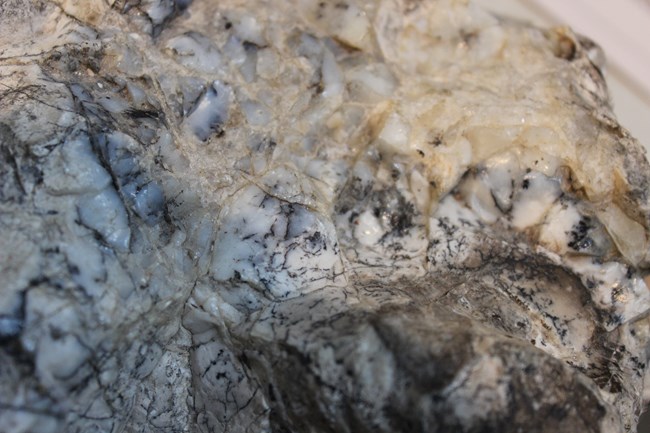
Where Did the Sediments Come From?Seasonal streams carried sand and silt from the uplifting Rocky Mountains to the west. Wind-blown ash was deposited at Agate, primarily from repeated eruptions of volcanoes in southern Utah and Nevada. Volcanic ash in the rocks is gradually broken down, and groundwater concentrates the silica into air pockets within the sedimentary rocks which are then filled with cryptocrystalline quartz, resulting in thin lenses of agate within these formations. The Type of Agate Found HereThe type of agate that was once found here is moss agate, a variety of chalcedony which lacks the characteristic banding of other agates, containing iron and manganese oxides which result in dark “dendritic” or fern-like inclusions in the transparent to milky mineral. We have some samples at the front desk in the Visitor Center, but you’re unlikely to find any along our trails these days, until erosion exposes more. If you are lucky enough to find some agate within the monument grounds, we ask that you leave it there so that other visitors may enjoy the natural beauty that Agate Fossil Beds offers. 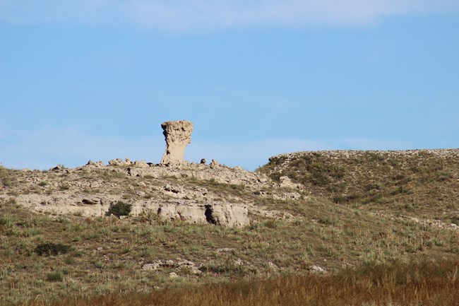
Erosional FeaturesBy the late 1800s, erosion by the Niobrara River and its tributaries had exposed Miocene aged mammal fossils from the bonebed within the Fossil Hills, which paved the way for the excavations that occurred here in the decades to follow. Fed by a wetter climate, the Niobrara was a much larger stream thousands of years ago when it began cutting through the Harrison Formation. As the valley eroded, the river carved buttes such as Carnegie and University Hills. In other places, only thin spires, or “hoodos,” remain. 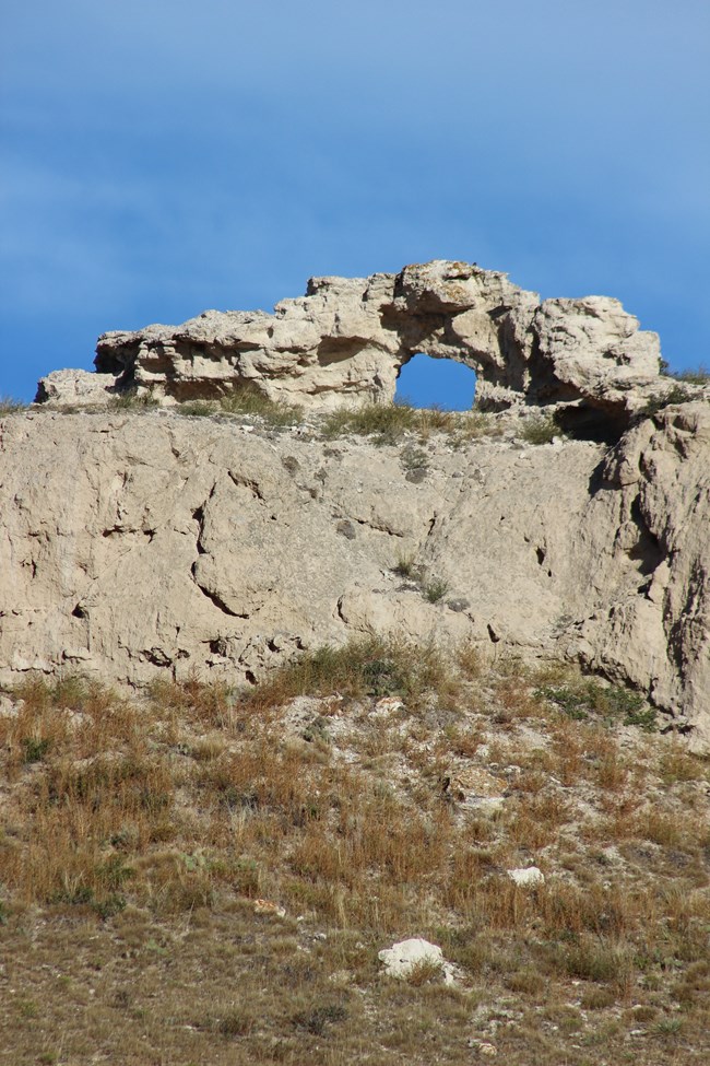
At the east end of the park, a circular window is visible in the north cliffs. Windows such as this form when groundwater weakens the cement matrix binding grains together within a thin “fin” of rock. Windblown sediments erode the face of the fin, eventually boring a hole through the rock. |
Last updated: March 18, 2024
