
NPS Glacier Bay National Park and Preserve Glacier Bay Park brochure map (3.3MB Jpg)

The Fairweather 
NOAA Chart of Glacier Bay 
Map of park areas subject to boating restrictions, speed limits, or other regulations designed to protect wildlife and provide for a range of visitor experiences. Intended for visitors boating, camping, or kayaking in Glacier Bay's waters and on its coastlines. 
Camper Drop-off Locations 
Close-up of the lodge, showing main lodge, room layout and connecting boardwalks. 
Bartlett Cove Trails 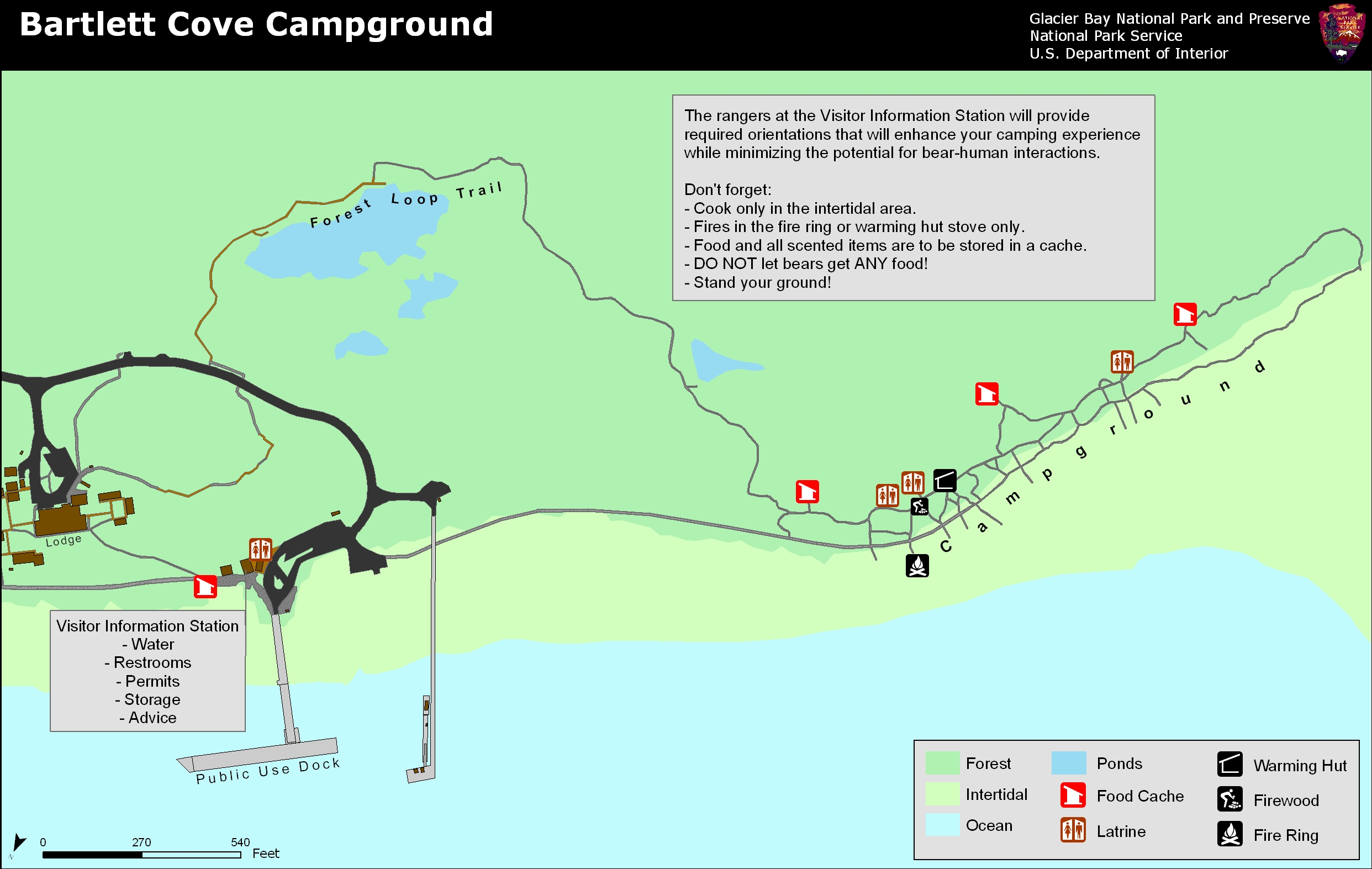
Diagram of Bartlett Cove campground showing individual and group campsites, fire ring, warming hut, food caches, etc. (1mb Jpeg file). 
Schematic diagram of the Bartlett Cove Dock showing no-anchor zones and slips available to the public. (1.7mb Jpeg file) 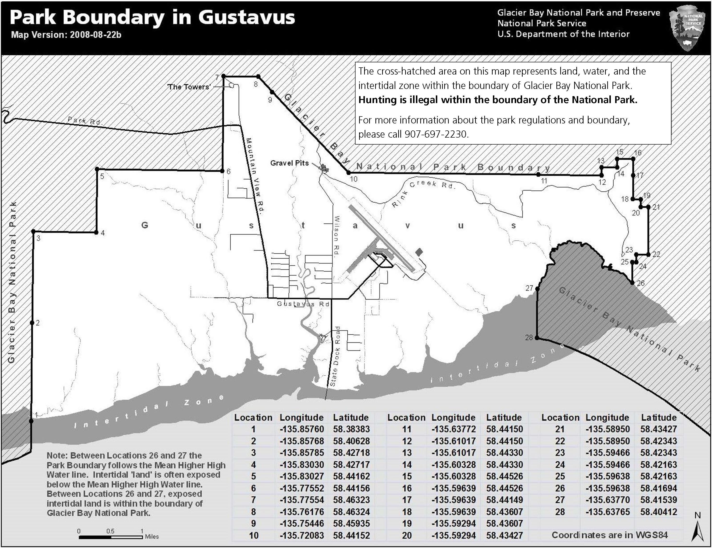
A detailed map showing the Gustavus boundary with the park. Includes GPS coordinates. 
Commercial Fishing 
Cruise Ship Routes 
Tour Boat Routes
|
Last updated: April 10, 2024