|
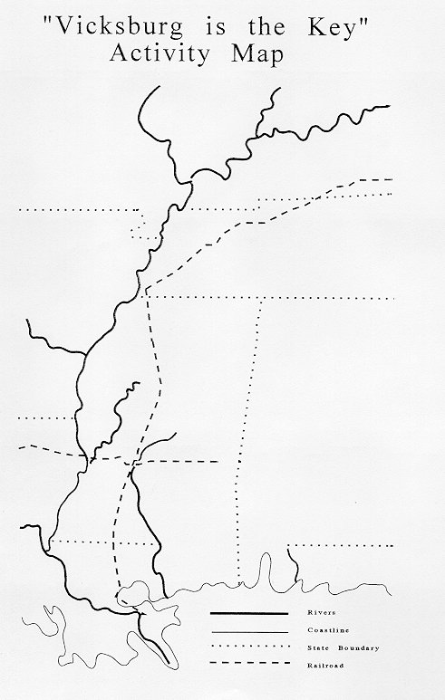
Background: Vicksburg, located on the east bank of the Mississippi River was a strategic point in the Civil War era. Vicksburg, linked by the river North and South and by the railroad east and west, was a major transportation center before the war. Goods and people from all over the world came to Vicksburg. Both President Lincoln and President Davis realized Vicksburg was the major point of control for these goods and the Mississippi River. Vicksburg's geology of high bluffs and deep ravines created a natural fort. President Davis called Vicksburg the "The Gibraltar of the West". Lincoln said of Vicksburg: "See what a lot of land these fellows hold, of which Vicksburg is the key...Let us get Vicksburg and all that country is ours. The war can never be brought to a close until that key is in our pocket." Methods: Students will study maps of the United States. Highlight the rivers that drain into the Mississippi River with one color. Students will make a list of the states affected by the Mississippi River belonging to two nations. Students will list the food producing states for both the North and South. Students will connect the Eastern and Western United States by railroad lines that existed during 1860. Students can do the activity sheet on cardinal directions. Questions to Ponder
Classroom Activities:
Grades:
Objectives: Students will understand the geographic importance of Vicksburg to the Civil War Materials: Map of the United States. Historical Atlas of the United States. Vicksburg is the Key activity sheet and map. |
Last updated: April 14, 2015