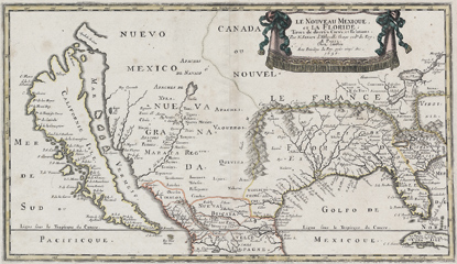
What: An exhibition of 45 magnificent and rare maps, books and illustrations of Pacific Coast exploration, dated 1544 through 1802.
Where: In the Maritime Museum, 900 Beach Street, at Polk Street, San Francisco.
When: July 1 to October 31, 2011 Extended!! Now open until 4:00 pm, Sunday, November 27, 2011.
Mapping The Pacific Coast, showcasing rare, historic maps, books and illustrations, invites visitors on a voyage beginning with the very first exploration of the West Coast by Europeans.
This world-class exhibition represents the accumulation of knowledge leading to Thomas Jefferson's commission of Lewis and Clark's Corps of Discovery. The exhibition traces many of the greatest adventures in history, including dangerous ocean voyages by Spanish, French, English and Russian explorers, the race to discover the northwest Passage, sightings of "sea monsters," and the very first contacts between Native Americans and Europeans. Many of the documents included in the exhibition tell dramatic stories in their own right, with references to explorers such as Juan Rodriguez Cabrillo, Sir Francis Drake, and Captain James Cook, all of whom left their mark on the Pacific Coast. These historic stories are told through original maps of the time and illustrations - the earliest being woodcuts and the majority being copperplate engravings, many in original hand color.
The exhibition is further enhanced by an audio tour of selected maps narrated by collector Henry Wendt, and is accompanied by a beautifully printed and illustrated catalog, documenting and further describing each map and document.
Mapping the Pacific Coast was originally shown at the Sonoma County museum in 2004, and has been on tour around the country ever since. Other venues have included the Mystic Seaport Museum, in Mystic, CT. and the Maritime Museum of San Diego. Following its exhibition in San Francisco, the exhibit will move to its permanent home in Oregon, at the Columbia River Maritime Museum. Go to http://www.mappingthepacificcoast.com for more information.
San Francisco Maritime National Historical Park is located at the west end of Fisherman's Wharf, in San Francisco. The park includes a magnificent fleet of historic ships, visitor center, Aquatic Park Historic District, and library. For more information about the park, or its public programs, please call 415-447-5000 or visit the park's website at https://www.nps.gov/safr.
### 05-21-11
Last updated: November 10, 2021
Park footer
Contact Info
Mailing Address:
2 Marina Boulevard,
Building E, 2nd Floor
San Francisco,
CA
94123
Phone:
415 561-7000
The public information office is open from 8 A.M. to 5 P.M. PST.