
NPS Photo / Jim Ecklund The Continental Divide runs the length of the park, north to south, and divides the park hydrologically. Waters on the park's west side form the headwaters of the Colorado River, while east side streams and rivers are part of the Mississippi drainage. Prevailing winds drop most of their moisture on the western slope. The eastern slope in comparison is relatively dry. The exceptions to this pattern are heavy spring snows and summer thunderstorms, both driven by upslope winds from the south and east. Real time river discharge and height data is available from two United States Geological Survey (USGS) streams gauges in the park.
Here's a sampling of water sources and resources we have in the park.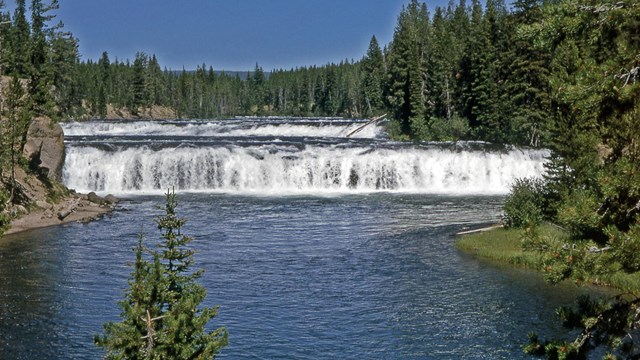
Rivers and Streams
They wind their way 450 miles through the park. NPS Photo 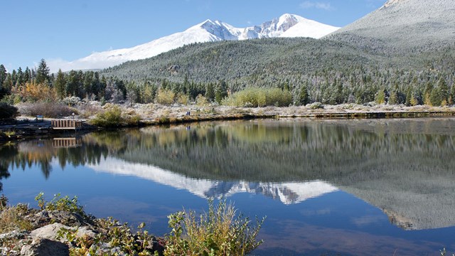
RMNP Lakes
Lakes dotting the landscape number around 147. NPS Photo 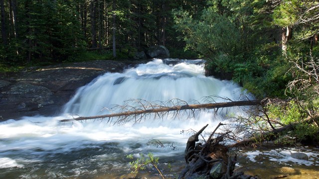
Waterfalls
Waterfalls and cascades can be found in the forests or running down rocky cliff faces. NPS Photo 
Ground Water
Ground water seeps through the ground creating habitat for all forms of life. NPS Photo 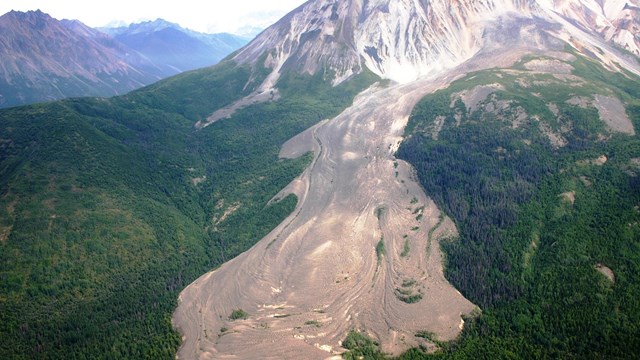
Glaciers
Glaciers are few in Rocky, but sculpted this landscape long ago. NPS Photo 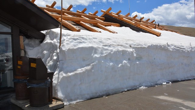
Precipitation
Precipitation falls in the form of snow in the winter and thunderstorms in the summer. NPS Photo 
NPS Water QualityAlthough water quality is high in Rocky compared to much of the country, threats do exist. Nitrogen deposition is a factor influencing soils and waters in the park. The impacts of nitrogen deposition in lakes and streams grow worse over time as the natural buffering capability of the soil and rock is used up. Eventually, chronic acidification can lead to the loss of many aquatic organisms and entire fish populations. As experience in the northeastern U.S., Canada, and Europe has shown, these changes can be almost impossible to reverse. On an international scale, recent research is demonstrating that volatile chemicals, such as pesticides, can be transported long distances to remote lakes. Because mountains are year-round cold environments, deposited compounds seldom move back into the atmosphere. Such lakes become "sinks" for pesticides, mercury, and various organic compounds. Over time concentrations can become deadly to lake and stream organisms. The Loch Vale WatershedThe Loch Vale Watershed includes Sky Pond, Lake of Glass, the Loch, Icy Brook, and adjoining mountainside streams. It is one of the most studied watersheds in the world. Scientists have been monitoring chemical inputs to the watershed from wind and precipitation for well over twenty years. They have also studied the "background" chemistry of the local rocks, soils, and vegetation. This work helps distinguish between human impacts and natural processes that occur in this type of alpine and sub-alpine environment. Much of what we know about air and water quality trends in the park comes from this long-term project. These scientists have given us the information necessary to make informed decisions. It is, however, up to society to act on this information. Each of us who enjoys the park has an obligation to take actions in our daily lives that will protect the blue skies and sparkling waters of Rocky Mountain National Park. Link to the USGS web page on research at Loch Vale. Thanks to Dr. Jill Baron, of the Natural Resource Ecology Laboratory at Colorado State University and USGS, and Dr. Donald Campbell, USGS, for contributing to this page. |
Last updated: May 7, 2018