Left image
Right image
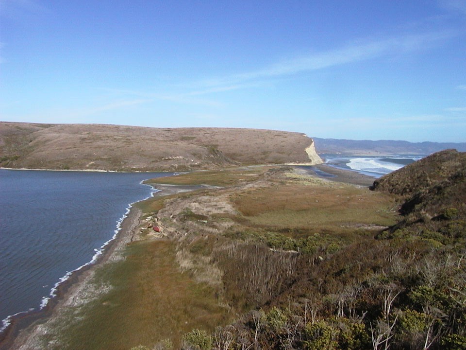
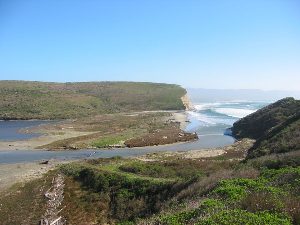
In 2004, Point Reyes National Seashore proposed the restoration of natural hydrologic and shoreline process to the Horseshoe Pond area of the historic D-Ranch. Horseshoe Pond is a former 35-acre coastal lagoon situated on the north side of Drakes Beach between the Ken Patrick Visitor’s Center and the mouth of Drakes Estero. For hundreds of years, the Horseshoe Pond area functioned as a lagoon, controlled by the sand-dominated outlet to the west side of the beach interface. Horseshoe Pond was constructed as a road access to the hunting blind at the mouth of Drakes Estero in the late 1940s by filling across the sandy beach lagoon interface with upland fill. The facility has undergone major maintenance and modification since construction, including realignment in the 1970s and the installation of a cement spillway in the late 1980s. The pond was part of the D-Ranch dairy operation acting as a water source and ultimate destination for much of the dairy waste. Constant maintenance of the dam facility was required as high seas constantly eroded and breached the dam facility. The pond breached in January 2002. The brackish waterbody was heavily influenced by tidal overwash into the pond area, as well as freshwater runoff. The configuration of the remaining dam structure prevented natural shoreline and hydrologic process from occurring at the site. The objectives of the Horseshoe Pond Restoration Project were:
This EA evaluates the potential environmental consequences of three alternative strategies for implementing the Horseshoe Pond Project. Environmental AssessmentEnvironmental Assessment - June 21, 2004 (1,059 KB PDF) Technical Background ReportsAppendix A: Map (2,199 KB PDF) Botanical Survey Report - May 17, 2002 (1,344 KB PDF) Red-legged Frog Surveys at Horseshoe Pond - May 15, 2002 (365 KB PDF) Wetland Delineation Report based on U.S. Fish and Wildlife Service’s Cowardin Wetland Classification System - February 2002 (1,960 KB PDF)
|
Last updated: February 5, 2024