|
abbotts lagoon coastal dune restoration project includes: Abbotts Lagoon Coastal Dune Restoration Project The project area supports a number of federally listed threatened and endangered wildlife and plant species, as well as plant species listed by the California Native Plant Society (CNPS). For this reason, construction and hand removal activities have been subject to limitations imposed by requirements of the Seashore's formal consultation and Biological Opinion with U.S. Fish and Wildlife Service (USFWS), as well as internal agency guidelines and standards. Because there are so many sensitive resources to protect-and restore-at the Dunes, the Seashore had several levels of project oversight, including a team of Construction Managers during Phase I (Winzler & Kelly, San Francisco, CA) and Seashore Environmental Monitors during Phases I, II, and III (Sarah Minnick and Will Johnson). These teams worked together with the construction contractor to ensure that all avoidance, minimization, and mitigation measures stipulated in all the project's permits and consultations were adhered to during the construction process. Sensitive Resource Areas (Wetlands, Rare Plant Areas, Native Dune Communities, Identified Wildlife Habitat) 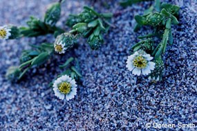
Sensitive Resource Areas include wetlands, rare plant areas, dune mat areas or native dune communities, identified wildlife habitat, and patches of western dog violet (Viola adunca), the larval plant of the Myrtle's silverspot butterfly (Speyeria zerene myrtleae, federally endangered). Rare plant areas, most of which occur in the native dune mat, support at least two federally endangered plant species—Tidestrom's lupine (Lupinus tidestromii) and beach layia (Layia carnosa)—along with a considerable number of species considered rare by the CNPS. Sensitive Resource Areas were off-limits to all mechanical equipment with the exception of one crossing area that allowed access to the northern portion of the backdune area. This secondary access route crossed a large Rare Plant area: the alignment was carefully chosen to represent the shortest route through the Sensitive Resource Area that would have the least impact on native dune resources, including rare and endangered plant species. 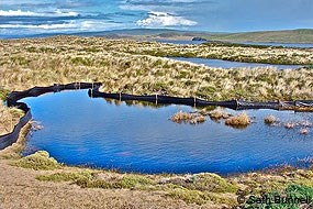
Other than these designated access routes, the only activity that was allowed in Sensitive Resource Areas is hand removal of European beachgrass and iceplant or supervised spot application of herbicides using a drift shield or protective barrier. During the period when mechanical work was performed adjacent to Sensitive Resource Areas, silt fencing was installed to ensure that soils do not accidentally move during construction into these areas. The silt fencing was placed such that the bottom of the fence is in contact with the ground, but it was not necessarily be buried. The silt fence was removed once work in the area was completed and moved to another area of construction. 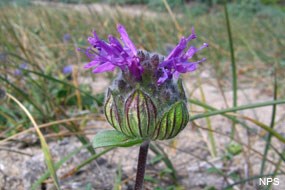
Rare plants, including federally endangered plant species and those with a higher priority listing by CNPS or the Seashore, require a 10-foot buffer in which no mechanical removal will be performed. Rare plant mapping has been conducted in this area historically, and mapping was updated in 2009 and 2010 to better locate Sensitive Resource Areas, buffers, and primary and secondary access routes. Grassland areas east of the treatment area were specifically surveyed in spring 2010, so that the primary access road and staging areas would avoid as much as possible wetlands, rare plants, and western dog violet to the greatest extent possible. Threatened and Endangered Wildlife Some of the threatened and endangered species that occur in or on the perimeter of the Project Area include the federally threatened western snowy plover (Charadrius alexandrinus var. nivosus), the federally threatened California red-legged frog (Rana aurora draytonii), and the federally endangered Myrtle's silverspot butterfly. 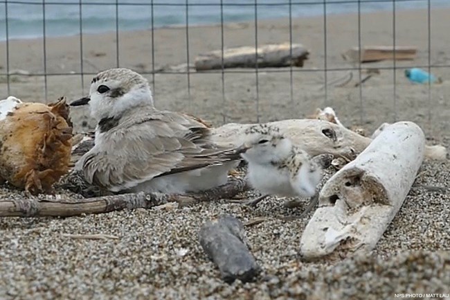
NPS / Matt Lau Snowy Plover Snowy plover nesting season officially extends from March 1 to September 15, but, at Point Reyes, historical records indicate that almost all nesting occurs after April 1 (NPS, unpub. data). Most of the nesting occurs above the high tide line on coastal beaches just oceanward of the foredunes, however, plovers and their chicks will enter the dunes to forage and seek cover from predators. Plovers also nest on the western edge of Abbott's Lagoon. During project implementation, the Seashore had a plover biologist monitoring nesting activities on the beach, as has been done for a number of years. In addition, during Phase I, additional surveys were conducted by a qualified avian biologist. These people were in close communication with project staff to ensure that, should plovers started nesting on the beach adjacent to the Project Area, the USFWS-stipulated 500-foot buffer would be established between active nests and construction activities. 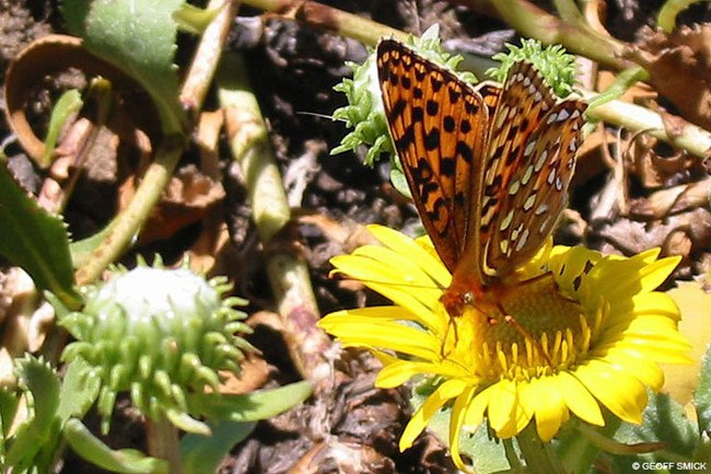
© Geoff Smick Myrtle's Silverspot Butterfly The Project Area is also home to the Myrtle's silverspot butterfly, which uses the common plant, western dog violet, as its only larval plant. Western dog violet does not occur in the dunes, but many of the plants that the adult butterfly uses as nectar sources occur in the native dune or dune mat communities, which is another reason why these areas are designated as Sensitive Resource Areas and are off-limits to mechanical removal of European beachgrass. Some of the other avoidance measures for this project included detailed mapping of western dog patches in the adjacent pasture where this species does occur, so that all access, staging, and stockpiling could be located in areas without this plant species and other rare plant species. One of the primary impacts to the butterfly in the Seashore is mortality associated with speeding cars. For this reason, speed within the Project Area and access routes was limited to 10 mph during the flight season, which stretches from June 15 to July 31. 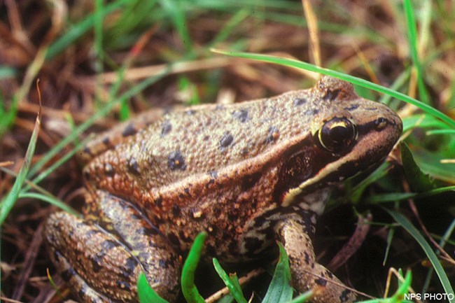
California Red-Legged Frog California red-legged frog does not breed in the Project Area, but it does breed on the perimeter of the Project Area in a drainage swale that flows through the pasture to Abbott's Lagoon. A number of avoidance and minimization measures were implemented to minimize indirect project impacts on this species. A trenched, buried silt fence was installed to preclude or at least minimize the potential for red-legged frogs to move from the drainage swale into the more inhospitable, sandy European beachgrass habitats. A qualified amphibian monitor was present during installation to ensure that there were no impacts to frogs. Pre-construction surveys were conducted by a qualified amphibian biologist several times after installation of the fence to evaluate whether red-legged frog were present in the construction work area. As frogs were detected, a full-time qualified construction monitor was present during construction within the 100-foot-buffer or construction work area closest to the drainage swale, which is approximately 6.06 acres in size. Nesting Birds Other non-listed species may nest or breed in the dunes, too. During Phase I, the main species observed included song sparrows, savannah sparrows, white crowned sparrows, horned larks, and killdeer. Some of these were found in more open dune areas (horned larks, killdeer), and others also occurred in the large monotypic expanses of European beachgrass (song sparrows, savannah sparrows). Weekly breeding bird surveys were conducted by qualified avian biologists in the construction work areas to determine presence of nesting birds. When breeding birds were found, a 100-foot buffer was established between the nest and any construction or hand removal activity. Archaeological and Historic Resources In addition to biologically significant resource areas, archaeologically significant resource areas also existed. Within these zones, contractors were required to take special care during excavation to ensure that no previously undiscovered buried archaeological or historic resources were damaged. The contractor was also required not to excavate below any dark, organic horizons encountered as these soil strata may contain archaeological or historic resources. The primary access routes, untrailering, staging, and stockpile areas were all chosen to have no impact on the historic RCA radio transmission facility, its surrounding landscape, and underground and aboveground lines and poles. Per the consultation with the State Historic Preservation Office (SHPO), a qualified cultural resources specialist was on-site during construction performed in culturally related Sensitive Resource Areas. This monitoring was performed by a representative of the Federated Indians of Graton Rancheria (FIGR). Should the contractor have encountered any archaeological or historic resources relating to middens, burial grounds, shipwrecks or the nearby radio facilities, all construction in this work area would have been required to stop, and the Seashore's Cultural Resources representative would have been contacted and allowed to investigate and give his approval before work in this area could have resumed. abbotts lagoon coastal dune restoration project includes: Abbotts Lagoon Coastal Dune Restoration Project |
Last updated: September 19, 2022
