|
WAR IN THE PACIFIC National Historical Park |
U.S. Department of the Interior National Park Service |

|
Asan Beach Guide
|
"Some of the most rugged country I have ever seen." Lt. General Alexander A. Vandegrift, Commandant |
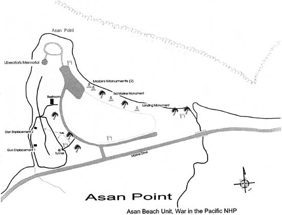
Begin your tour by turning right onto Marine Drive as you exit the Visitor Center parking lot. Drive .7 miles to the entrance to the Man Beach Unit, and turn right into the park at the National Park Service sign. An MK14 MOD5 torpedo is on display at the entrance to the park. This type of torpedo, launched by submarines, served as the primary anti-shipping weapon during World War II. Follow the road to the left, past the restrooms into the parking area. The map of the Asan Point area will help you locate features and sites.
This flat, grassy area has seen many uses, and its landscape and contours have been considerably altered. From 1892-1900 it was the site of a leper colony. It has been a prison twice: for exiled Filipino insurgents (1901-1903), and for the crew of the German cruiser Cormoran for three weeks during World War I (1917). It became a U.S. Marine Corps camp in 1922. Before World War II, the area was the site of Asan village, with coconut trees and rice paddies. The invasion destroyed the village, which was subsequently located across Marine Drive where you see it today. After the war (1945-47) the site was a camp for the Seabees (U.S. Navy Construction Battalion), and the area was filled with 2 feet of rubble to provide a foundation for the Naval Hospital Annex which occupied the site from the 1950s to 1972. Before the buildings were razed, they served as a refugee camp for Vietnamese in 1975. Today, this is a favorite spot for jogging, picnicking, kite flying, or just enjoying the beach.

Last Updated: 01-Apr-2004