|
Raising the Roof of the Rockies
A Geologic History of the Mountains and of the Ice Age in Rocky Mountain National Park |
PART II
The Ice Age Cometh
For the past 2 million years or so the earth's climate has alternated from cold periods to warm periods, each lasting many thousand years. What has caused these climatic changes? Many scientists believe that they have resulted from fluctuations in the amount of heat which the earth receives from the sun. The fluctuations are thought to be caused by variations in the amount of eccentricity, or off-centeredness, of the earth's orbit around the sun.
It is also known that the amount of heat received from the sun may be affected by changes in the earth's atmosphere. For example, a time of world-wide increase in the amount of carbon dioxide or volcanic dust in the atmosphere would prevent some of the sun's heat from reaching the earth's surface. The relative importance of these different possible causes is not understood. However, their total effect has been alternately to cool the oceans and cause large continental icecaps and mountain glaciers to form at some times, and to warm the oceans and cause the glaciers to waste away at other times. Alternation of cold- and warm-water shells at successive depths in ocean sediments, and alternating layers of glacial deposits and interglacial soils on the continents show that this has happened several times in the last 2 million years. This series of climatic changes is called the Ice Age or the Quaternary Era. Thought until recently to have included four or possibly five times of widespread glaciers, it is now believed by some to have consisted of more, the precise number being still undetermined. Each glaciation included several secondary advances and recessions of the ice.
|
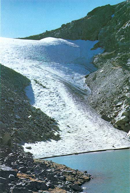
| Andrews Glacier, showing long ridge of accumulated neve formed by snow blowing over the crest. (Fig. 15) (Benjamin Slater) |
What Is a Glacier?
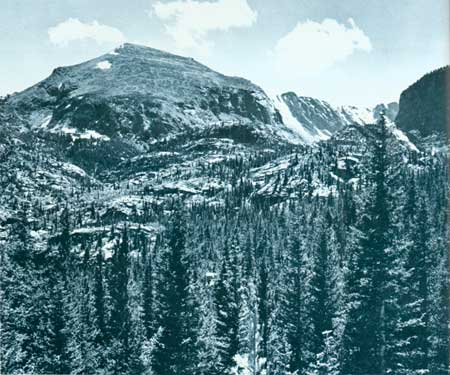
In early summer, snow still covers much of the high country in Rocky Mountain National Park. Gradually it disappears until, by late August, the small amount remaining is mostly on the upper parts of small glaciers nestled at the foot of high cliffs. Snow is the life blood of glaciers; they cannot develop or grow without it. Whether snow will remain throughout the summer depends on the amount of snow accumulated in winter and on summer temperatures.
In July though the temperature may be over 100° at the airport, a plane, as it climbs will be in colder and colder air until, at some altitude, it passes through air that is at freezing temperature (32°F.) into air that is below freezing temperature. Mountains that rise above the average altitude of summer freezing temperature have glaciers on their summit uplands if enough snow accumulates. The average altitude of freezing temperature in summer over Rocky Mountain National Park is about 14,800 feet. This is more than 500 feet above Longs Peak and some 2,000 feet above most other peaks. Therefore, under present conditions of snowfall, glaciers cannot form on the summit uplands in the Park. Were it not for the high cliffs along the Continental Divide there would be none at all. These cliffs, acting like snow fences, cause snow blowing off the uplands to fall in the basins beneath. This greatly increases the accumulation of snow in the basins during the winter. Andrews Glacier, today, well exemplifies this process. In summer, the cold shadows of the cliffs protect the snow sufficiently so that some lasts from year to year to nourish the existing small glacier.
|
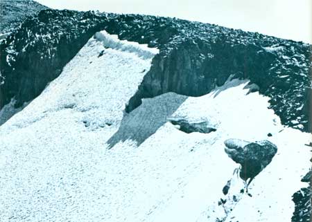
| Névé exposed above ice of Rowe Glacier (1923). (Fig. 16) (National Park Service) |
How does snow become glacial ice? As snow accumulates, the pressure of individual flakes against each other causes them to recrystalize into tiny crystal granules. During times of thaw, especially in summer, melt-water from the upper layers infiltrates and refreezes in the granules beneath, causing them to grow. As granules come in contact, adjustment in growth takes place, controlled by the pressure of granules against one another, until all granules are about equal in size. This process is completed in a single season, and the resulting mass of granular snow is known as névé (pronounced nevay). Old gray névé of past summers can often be seen protruding from beneath younger whiter snow at the head of a glacier.
As a layer of névé is buried by an increasing thickness of younger névé and surface snow, it compacts, forcing the air out from between the granules. These continue to grow until, when all are completely in contact and all of the air except for a few bubbles has been expelled, the mass is solid ice. This process may take only a few years or as long as 20 to 30 years, and is completed under a cover of snow and névé as much as 100 feet thick.
Ultimately the weight of the snow, névé, and ice exerts sufficient stress to cause the lower part of the ice to begin to flow downslope in the same way that a plastic flows. Flow is fastest in the central part of a glacier. It is slower in the lower part because of friction against the ground. The upper 200 feet or so of a glacier does not flow. It rides on the underlying flowing ice and breaks under stress to form crevasses; for example, where a glacier flows over a cliff in a valley floor. At the front it may shear upward and be thrust over itself by the pressure of the flowing ice behind it. At the head of a glacier, the ice tends to pull away from its rock headwall, opening a deep arcuate crevasse known as a bergschrund.
|
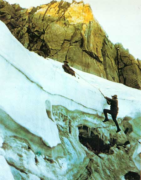
| Bergshrund at head of Tyndall Glacier (1947). (Fig. 17) (National Park Service) |
Glaciers, like snowbanks, melt and evaporate in summer. Water runs both down their surface and beneath them, and flows from their fronts. During the warm summers of the 1930's and 1940's, glaciers melted and evaporated so much that their fronts receded considerable distances and their surfaces were noticeably lowered. Throughout this time, however, the ice of each glacier continued to flow forward. Glacier fronts recede when melting and evaporation are greater than the forward flow of the ice. Glacier fronts advance when melting and evaporation are less than the forward flow. Which may happen is forecast by changes in the year-to-year position of the névé line, the lower limit of the névé on a glacier in late summer. When the névé line becomes lower in successive years, the glacier is building up its ability to grow; when the névé line recedes headward in successive years, the glacier is losing its ability to grow.
What a Glacier Does
Before the first glaciers formed, the few cliffs along the Continental Divide were mostly at the heads of sinuous V-shaped canyons cut by streams during the time of deep erosion, 2 to 5 million years ago. The first lasting snows accumulated in these valley heads. Snowbanks are by nature more or less elliptical in outline. Summer meltwater saturates the ground under them and the seepage from their lower margins causes the soil to flow or be washed from beneath them. In this way, soil was removed gradually from beneath the first snowbanks until they lay on rock in broad elliptical basins which, though shallow, were deep enough to permit formation of the first glaciers.
|
| Cirques at head of Glacier Basin. From left to right Taylor, Andrews, Chaos, and Tyndall (photo in February 1973). (Fig. 18) (I. J. Witkind.) |
Glaciers quarry the rock at their heads. Summer melt-water seeps into fractures in rock adjacent to the ice. The water expands when it freezes and breaks out fragments of the rock, which become incorporated in ice against the headwall and are carried down and away when the ice begins to flow. Gradually through successive periods of glaciation the great cliffed basins, called cirques, have been quarried into the flat-topped uplands. A glacier flowing down a valley also quarries rock at each other or against bedrock. Though abrasion produces many spectacular phenomena, it does not seem to account for deep glacial erosion. Quarrying and shearing are the major ways in which glaciers erode deeply into bedrock.
|
| Glacially scoured and polished rock knobs south of Bear Lake parking area. (Fig. 19) (Gerald M. Richmond.) |
Glaciers deposit the rock debris they carry, either at the edge of the ice or under it. The debris slides or is dropped from the edge of a glacier where it gradually builds up a ridge. Such a ridge at the side of a glacier is called a lateral moraine; if at the end, an end moraine. The pushing and shearing of the ice at the snout of a glacier helps to build up end moraines. Rock debris dropped or sheared from beneath a glacier is called ground moraine. At the edge of an advancing glacier the material of moraines is continuously being picked up and deposited again, but as the glacier recedes from the farthest position of any advance it leaves its lateral and end moraines behind.
Early Glacial And Interglacial Times
The most ancient glacial deposits in the Rocky Mountains, known only from a single locality in Yellowstone National Park, are about 1.6 million years old. Deposits of at least two younger early glaciations, both older than 600,000 years, have been recognized in several mountain areas. Such deposits are difficult to find and identify, for most have been stripped away by later glaciers. As yet, no record of any of the early glaciers has been found in Rocky Mountain National Park. However, from what is known about them in other mountains they probably extended down the canyons in the Park about as far as did the younger glaciers.
Each of the early glaciations was separated from its successor by an interglacial period during which no glaciers existed. In Glacier National Park and elsewhere in the Rocky Mountains, the deposits of early glaciations have been found one above the other in sequence. Each deposit is separated from its successor by an unusually thick soil, which required a long period of interglacial weathering in which to form. The last of the early glaciations ended about 600,000 years ago. Toward the end of the long interglacial period following it, streams deepened the canyons about 200 feet along the eastern margin of the Front Range before the advance of the oldest intermediate glaciers.
The Intermediate Glaciers
Glaciers intermediate between the early glaciers and the last great glaciers may have advanced down the canyons and then wasted away completely several times between about 500,000 years ago and about 87,000 years ago, but deposits of only the last two of these intermediate glaciers are known in the Park. The glacial times were separated by interglacial times about which little is known. They may have been colder, warmer, wetter, or drier than today.
The oldest of the intermediate glaciations known in the Park probably occurred about 160,000 years ago. Its deposits can be seen in roadcuts along Colorado Highway 7 in the southern part of Tahosa Valley, near the eastern boundary of the Park. They consist of reddish-yellow unsorted silty sand, small angular pieces of disintegrated gneiss, scattered dark and light round pebbles and cobbles, and a few boulders. Some of the dark, hard stones bear the scratches of the glacier which carried them from the area of Longs Peak. The boulders have crumbly surfaces and tend to be broken. The deposits are only 1 to 6 feet thick, and overlie yellowish, deeply disintegrated gneiss bedrock. Any end moraines which they may once have formed have been destroyed by the years. The reddish color and decayed character are due to weathering since the recession of the oldest known intermediate glaciers.
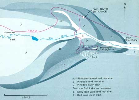
Similar old intermediate glacial deposits have been found east of the Fall River entrance to the Park, at the lower end of the straight, broadly U-shaped stretch of the valley of Fall River just above the canyon leading to Estes Park. These deposits mark the maximum extent of glaciation in the valley as shown by the fact that the canyon immediately downstream is a narrow, sinuous, V-shaped stream-cut gorge in deeply weathered rocks that show no evidence of ever having been glaciated.
The younger intermediate glaciation, called the Bull Lake Glaciation, consists of two advances separated by a major withdrawal of the ice. The early Bull Lake advance probably began after about 127,000 years ago and ended about 105,000 years ago. The late Bull Lake advance probably began after about 100,000 years ago. It may have ended about 87,000 years ago but was certainly completed before about 70,000 years ago. These two glacial advances were much alike. Their glaciers stemmed from the same cirques, extended down the same canyons, and joined with tributary glaciers to form large rivers of ice in the same major valleys. At both times, the glaciers were as much as 2,000 feet thick in the upper canyons, and their lower ends extended beyond the boundaries of the Park. Here they left behind end moraines and lateral moraines, the principal deposits of these two glacial advances remaining today.
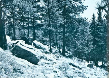
The end moraines of the early and late Bull Lake glaciers are similar in appearance. Both are broad, smooth ridges. Where they cross major valleys they have been widely breached by later stream erosion. The moraines are composed of pale-brown compact silty sand containing stones of many sizes, shapes, and rock types. A few of the hard stones still show glacial scratches. The weathered zone, or soil, at the surface of both moraines is brown to reddish brown, compact, silty, and 3 to 4 feet deep. This weathering is much less intensive and less deep than that of the oldest intermediate glacial deposits. Boulders are not abundant on the surface of the moraines, and tend to be broken or to have crumbly outer rinds.
The end moraines of the early Bull Lake advance usually lie only a short distance downstream from those of the late advance. In view of their similarities, it is logical to ask, "Why don't these two moraines simply represent two minor pulsations of a single glacial advance?" They don't because in several places in the Rocky Mountains deposits of the late Bull Lake advance overlie conspicuously weathered deposits of the early Bull Lake advance. The presence of the weathered zone, or soil, between the two glacial deposits denotes a considerable time of glacial recession and perhaps nearly complete disappearance of the ice. The two end moraines therefore, must represent two distinctly separate major glacial advances.
End moraines of the early and late Bull Lake glaciers can be seen in a number of places near the Park boundaries. In the valley of Fall River, just east of the Park entrance, the highway crosses two low, bouldery ridges. The outer is the end moraine of the early Bull Lake glacier and the inner is the end moraine of the late glacier. The outer moraine descends from above the highway into the valley at about the position of the Water Plant and swings back upstream along the ridge on the south side of the valley. The inner moraine descends into the valley just outside the Park boundary and swings back up the south side of the valley through Aspenglen Campground. It is easily seen in the lower part of the campground, where it overlies a bedrock ridge that projects in places from beneath it. The brownish, compact, silty deposit containing both stained and disintegrated stones contrasts markedly with the pale-gray, sand deposit, containing fresh gray stones, of the large end moraine of the last glaciation immediately upstream.
|
| Bull Lake end moraine along Glacier Creek in Tuxedo Park. Boulders are cracked or broken and preserve little of their original glacially abraded surface. (Fig. 20) (Wayne B Alcorn) |
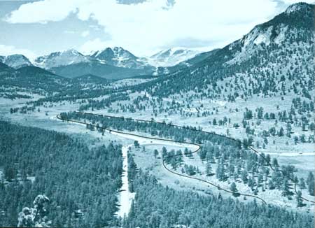
A moraine of the early Bull Lake advance is crossed by the highway just west of the Beaver Meadows entrance to the Park. It is a broad, low, smooth, pine-covered ridge, about 40 feet high, that is sparsely littered with large and small, more or less weathered and broken boulders. Beyond, to the west, the highway follows the south side of the moraine and then turns and crosses it again to ascend Deer Ridge. The brownish, compact soil on the glacial deposit can be seen in the shallow roadcuts, and careful examination of hard, dark stones will reveal glacial scratches on some of them. This end moraine was deposited by an early Bull Lake glacier which flowed down the valley of Big Thompson River through Moraine Park. It is now separated from that valley by a high forested ridge, a moraine of the last glaciation. The moraine of the late Bull Lake advance, which should normally be between these two moraines, probably is buried beneath the high moraine of the last glaciation. This may account for its unusual size.
On the west side of the Park, Bull Lake glaciers descended the valley of the Colorado River and deposited broad, smooth end moraines south of Shadow Mountain Lake. The end moraine of the early Bull Lake advance is crossed by the highway between that lake and Lake Granby. The end moraine of the late Bull Lake advance encircles the southernmost end of the Shadow Mountain Lake. These glacial deposits are similar to those in the eastern part of the Park, except that they contain large quantities of volcanic rock brought down the valley by the glaciers from the Never Summer Mountains.
|
| Map Map of Bull Lake and Pinedale moraines in area of Aspenglen Campground. |
|
| Pine-covered early Bull Lake end moraine in Beaver Meadows. Moraines of last glaciation (Pinedale) lie in forest to lower left. (Fig. 21) (Wayne B Alcorn) |
| <<< Previous | <<< Contents >>> | Next >>> |
richmond/sec7.htm
Last Updated: 8-May-2007