|
| ||||||||||
|
(The original of the following paper, with illustrations, is available at the Southwestern Monuments Loan Library, Coolidge, Arizona -- Ed.) Because there has been some talk of introducing beaver into the upper part of Frijoles Canyon in Bandelier National Monument, I visited the monument on two occasions for the purpose of making observations on the suitability of the habitat for this animal. On June 3, Custodian Harkins kindly drove with me to the upper part of the canyon and took my car back to monument headquarters. I followed the trail down from the point where he left me, through the canyon, to headquarters; a distance of about six miles. On June 23, I walked from headquarters down the canyon to the monument boundary, a distance of two and one half miles, and to the Rio Grande River which is half a mile farther. Beaver are present in the canyon below headquarters. This part of the canyon contains numerous narrow-leaved cottonwood trees which furnish a suitable food supply for the beaver. Numerous trees have been cut, especially near the monument boundary, and there are several dams. I listed 78 species of plants while walking along the trails. Among these plants is the aspen. This species, however, is limited to a very few individuals near the western boundary of the monument, by no means enough of them to furnish a food supply for beaver. I saw no place in this canyon between the west boundary of the monument and the headquarters area where there is a suitable food supply for beaver. I do not believe beaver would stay in this part of the canyon if they were introduced because of this lack of a food supply. I was informed by Mr. Harkins that there are aspen groves further up the canyon in the Santa Fe National Forest and this is where any beaver introduced into the monument would probably go. Since it would not be appropriate for the National Park Service to stock national forest lands with beaver, I do not believe it advisable to attempt to introduce beaver into Bandelier National Monument. PLANTS NOTED IN FRIJOLES CANYON
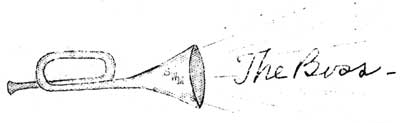
On page 86 of the July, 1938, Supplement, The Boss makes some statements about the life tenacity of uprooted cacti which he appears to have had some difficulty in impressing upon his listeners and, perhaps, upon his readers. Although rarely in need of support for his statements, The Boss may find vindication in the following quotation from pages 376-7 of Weaver and Clements, "Plant Ecology", McGraw-Hill Co., 1929: "The succulent form (of stem xerophytes) is represented by plants with fleshy stems such as Euphorbia, Stapelia, and the Cactaceae. They have decreased water loss by the extreme reduction or loss of leaves and by reducing the stem surface. In the cacti, for example, the leaves are wanting except during the early stages of growth and then they occur only as small scales at the nodes. The stems may remain round and smooth or become fluted by the presence of vertical green ribs, or become flattened in varying degrees, but they are always thick and fleshy. Fluted stems such as those of the giant cactus (Carnegia gigantea) undergo accordian-like expansion during moist and dry periods respectively. The flattened types present a small amount of surface in proportion to the mass of contained tissue; and the surface is further reduced in the thick, cylindrical type, and reaches a minimum in the spherical form. In addition to the decrease in the transpiring surface, they further reduce water loss by means of water-storage tissue with high collodial content (pentosans, etc.). Growth is slow because of the small surface exposed to the light, although the chlorophyll extends much deeper than in most stems and leaves, but some attain the proportions of trees and may have a reserve supply of many tons of water stored in the pulpy interior. Because of their xeric characteristics, which usually include a highly developed cuticle and sunken stomata (pores), the plants lose water so slowly that they may continue to live for several years without an additional water supply. Thorns and spines are also more or less characteristic, although they serve only slightly and incidentally against water loss." ******SWM******
To the most casual visitor, the glaring white exposure of the limey rocks surrounding Montezuma Castle are provocative of questions as to their nature, age, and characteristics. Indeed, to many observant travelers, the entire Verde Valley becomes an impression of chalky cliffs, irregular mesas, and an occasional strip of verdure paralleling such stream courses as occur. It is evident, then, that the geology of the region makes its imprint on visitors' minds and arouses some curiosity, more so perhaps than the more obvious geological development of the area. It thus becomes secondary in interest only to the section's major appeal -- its archeology. By this reasoning, it would appear that the geological story should not be neglected in the educational services extended by our organization at Montezuma Castle; nor has it been. Fortunately the story is neither difficult to grasp nor to tell and, although certain problems exist and await the specialist's study, in general there are no troublesome flaws in an interesting story of the past. The writer feels that this story is of sufficient interest to pass along to those who may not have heard it. It is evident that the Verde Valley is somewhat different from the usual "valley". Viewing it from a considerable height (as from Mingus Mountain near Jerome) it is seen to be of extensive length and of some width, bounded by high "breaks" and apparently floored with a white pavement through which numerous streams have cut canyons and built up low terraces. Examining a map, it is seen that its only drainage is by the Verde River, an interesting stream but of no remarkable volume nor cutting power, which flows out through a low wall in the south end of the basin. Although there is some difference of opinion, geologists would be likely to call a basin of this sort a "graben"; a segment of the earth's crust that has been "cracked" all around and which has thereby sunk to a lower level than its surrounding surfaces. These "cracks" seem to be present and are referred to as faults, and are definitely present on the west side of the basin, one (the Verde Fault) having been of considerable significance to the mineral deposits of the Jerome area. It is probable that such "cracks" are to be found on the east and south edges of the valley as well. So the Verde Valley was not formed by normal stream erosion as much as by structural forces acting within the earth's crust. Although this fact is not essential to the story, it certainly is of sufficient interest to be included in any such discussion. The "pavement" of this valley, when seen at close range, becomes the chalky limestone of which we have spoken. Although cut into by many washes and creeks, it is difficult not to observe that flat-lying nature of the formations and a general accordant level of mesa tops, all suggestive of deposition upon the surface of the valley, and of a certain depth of deposition which was never exceeded. To the geologist, then, such facts suggest that these beds were laid down, not by any existing streams (the limey character of the formations would preclude this interpretation), but by some previously existing large body of water. Investigations have further shown that these particular beds are found only in this Verde Valley. It is not hard to see, then, that a body of water must have at some time filled the valley, and that these limestones were deposited as limey sediments on the bottom of the old lake. A person naturally asks, "why should such a lake have formed?" Generally speaking, any lake must be formed through the formation of some sort of a dam -- beaver, concrete, or natural -- damming that prevents such waters as flow into it from reaching their ultimate destination, the sea. Since the present valley drains to the south through the Verde Canyon, we direct our attention there, for that would be the natural place for a "dam". Nor is it hard to find the evidence of such a dam. From the slopes of mountains surrounding Squaw Peak, and plainly visible from the parapet of Montezuma Castle have occurred great flows of basalt; malpais to many of us. Close examination of these flows serves to show that as the lavas poured forth from various vents and moved down the mountain slopes, certain amounts of this molten rock engulfed the old outlet of the basin effectively plugging up all drainages from the valley. This great, natural dam caused an impounding of all the waters which flowed through the ancient Verde Valley and an inland lake of considerable area and depth was created. On the bottom of this lake, limey sediments were slowly deposited. The point might well be brought out in this regard that, since most lake beds are of silt (as the Dakota prairies -- that bed of former Lake Agassiz), and that most limestone beds have been deposited beneath salt water, is it so evident that the Verde Formation is not of marine origin? The answer to this lies in the type of fossils found in the limestone. Any marine limestone contains numberless remains of various sea organisms. No such remains are found in the Verde beds; on the contrary, such fossils as have been found are of freshwater types of life. Because of the fact that into the waters of this old lake was poured the drainage from the great limestone plateau to the north and east, the concentration of calcium salts in this water was extremely high, so high that, as evaporation ensued, great amounts of lime were precipitated out to build up the thick beds of limey mud on the lake bottom. This mud, dried and consolidated after the lake waters had drained away, now forms the so called Verde Formation. How old is this lake, then, and what took place to bring about its disappearance? Since the present streams have cut into these beds only enough to form rather narrow canyons, it appears that the beds cannot be of great age, geologically speaking. The presence of a few fossils seems to bear out this evidence. Although occurring infrequently, these remains (clams and water snails) suggest that the lake was created and drained only a little earlier than the time of the Ice Age, and certain other evidence leads geologists to refer these formations to the Pliocene, perhaps two million years ago. Old, certainly, compared to our short span (both individually and historically), but extremely youthful as compared to, say, the Triassic of the Painted Desert, perhaps 180 million years old and which is itself underlaid by thousands of feet of formations much older. The conclusion of this story is brief. Either the lake became filled to the brim and water flowed over and across the lava dam gradually cutting away the natural barrier, or certain additional movements along the basin's bounding fault zones permitted overflow. Whatever the cause, the lake spilled over its lava dam and was gradually drained as erosion enlarged this natural "spillway". As we travel through the dry bed of this area now, we see the streams working away the sediments of the ancient lake, and the valley once more becomes a flat, dry area. In view of the past history of the valley, however, the course of Beaver Creek, as it flows past Montezuma Castle, and of the other streams of the region, seem to become less as streams to our minds and more the threads of water left in a somewhat soiled bathtub after the drain plug has been removed and the water has all run out. ******SWM****** REFERENCES Note: Little has been written on the geology of the Verde Lake Beds although the region surrounding the Verde Valley has been worked fairly thoroughly. However, the following two works give considerable more detail and technical discussion than the preceding short article - E.C.A.
******SWM******
(The original of the following report, with illustrations, is available at the Southwestern Monuments Loan Library, Coolidge, Arizona -- Ed.) Hovenweep National Monument is located on both sides of the Colorado-Utah sate line, about 30 miles north of the "Four Corners". The monument, which is chiefly archeological in interest, consists of four isolated groups of unusual types of prehistoric ruins located near the heads of several small canyons. Two of these groups are located in Montezuma County, southeastern Utah, and two groups in San Juan County, southwestern Colorado. This monument, which contains 285 acres, was established in 1923. The name "Hovenweep" means "Deserted Valley". The legal description of the land on which the various groups of ruins are located follows: In San Juan County, Utah: In addition to the ruins of the four groups just named, there are a number of other ruins in the general area. Supervisor Bryant, Wildlife Technician McDougall, and I were conducted to the monument on May 25, 1938, by Assistant Park Naturalist Watson of Mesa Verde National Park. No headquarters have been established at Hovenweep, and there is no custodian. During summer months the monument is attended part of the time by a "roving ranger" under the supervision of Southwestern Monuments headquarters at Coolidge, Arizona. Custodian T.C. Miller of Aztec Ruins National Monument, New Mexico, is normally in charge. The geology of Hovenweep is simple. The general topographic effect is that of a plateau or mesa gently sloping to the south. This mesa is cut by numerous canyons which flow south and empty into McElmo Creek. McElmo Creek rises near Cortez, Colorado, flows west, and joins the San Juan River about 15 miles from the state line and about the same distance northwest of the Four Corners. Two geological formations occur on the mesa and in the canyons at Hovenweep and along McElmo Creek. The upper member is the Dakota Sandstone, of Cretaceous Age, and the lower is the Morrison, the highest formation of the Jurassic. Formerly, the term McElmo Formation was used to describe these rocks exposed along the creek and in this part of Colorado and Utah, but the same Morrison had priority and is now used by the Geological Survey. The Dakota Formation is composed of one, or sometimes two, ledges of heavy massive sandstone, gray to buff, or brown in color. It is exposed in many places on the mesa, and also as steep cliffs forming the upper part of the canyon walls. The sandstone is traversed by a series of joints, or crevices which permit large blocks to break off along the margin of the cliffs and roll or slide down the slope. All the buildings have been constructed of blocks of Dakota. Below the Dakota Sandstone and occurring in the lower parts of the canyons are exposures of the Morrison Formation composed chiefly of light-colored, gray, and maroon shales with thin beds of soft gray sandstone. Often the slopes have been covered with blocks of sandstone and other debris from the Dakota, so that the Morrison may be concealed. Hovenweep is noted for the rather unusual type of towers: mound, oval, and square, which are located sometimes on the rim of the canyon, sometimes on the slope below, and sometimes in the bottom of the canyon. They are of various sizes and shapes. Their origin and use has been a matter of conjecture. The only report on Hovenweep that I have been able to find was prepared by the late J. Walter Fewkes. It is entitled, "The Hovenweep National Monument", and is published in the Smithsonian Report for 1923, pages 465-480 (with 10 plates). The following quotations from this report describe much better than I can the structures which we saw at Ruin Canyon.
At the time of our inspection of the towers at Ruin Canyon, which forms a basis for this report, we were able to verify Fewkes in pratically all points. One statement, however, is evidently in error. Fewkes says on page 472:
As pointed out to us by Park Naturalist Watson, and verified by other members of the party, there is a good spring under the cliff at the head of the canyon. This spring is flanked on all sides by towers. In describing the various ruins, I shall use the names proposed by Fewkes on pages 460 of the report cited. On the cliff to the east is Hovenweep Castle*, to the northwest is Hovenweep House, and in the canyon below is Square Tower*. Surrounded as it was by fortifications, this spring would be safe from attack by enemies. To my mind the most logical explanation of the presence of the Hovenweep Towers was for the protection of the water supply. This explanation was also suggested to us by Park Ranger James W. Brewer who is familiar with conditions at Hovenweep. He finds that throughout the area the springs are always guarded by towers. *Photographs accompany original report. ******SWM******
The closing of the visitor year on September 30 gives us a chance to do a little ruminating on our visitor activities and possibly a little horn tooting on the work we are doing. In the last eight or ten years, I have begun to notice that we have no official horn tooter for the Service as a whole, and if a fellow doesn't toot his own horn now and then it is likely to gether a lot of dust. At the end of the visitor year, we cast up our figures and found that our unit, the Southwestern Monuments, had given 18,725 personally guided field trips and 11,044 museum talks during the previous 12 months. This was over ONE MILLION MINUTES of service and, as we thought we were doing pretty well, we asked the Washington Office what the Park Service, as a whole, had done along these lines. We were told that the figures on the visitor year were not yet compiled, but that for the last fiscal year 36 parks and monuments, exclusive of historic areas and areas not offering interpretational services, the Service as a whole gave 35,630 conducted field trips and 22,080 lectures. While our year doesn't overlap precisely with the above figures, there is an overlap of nine months and a pretty close comparison can be made. And it looks as if we are giving 52 percent of the whole number of conducted field trips, and 50 percent of all the talks that are being given by those 36 parks and monuments. Will you agree that we are entitled to a good-sized toot? While we are giving half of the guided trips and talks, we are by no means talking to half the entire number of people. There are several reasons for this, the main one being that many visitors have never heard of us and our 26 stations and wouldn't come off the paved highways to see us even if we should try, by advertising, to get them to do so. There is, however, a saving grace about the fact that we do not handle such a large number of visitors. Whereas the average number in the parties served by all the parks and monuments mentioned above is 21 on the guided trips; with the stations of our unit, the Southwestern Monuments, the average party is 5.4, or about one fourth as many. Whereas the average number of listeners at a talk in the 36 parks and monuments is 78.8; with us it is 5.5 persons. These figures mean that with us a guided field trip or a museum talk becomes a little personalized visit where the visitor has a chance to ask questions and we have time to go into all the details necessary to insure a satisfactory understanding of the points we are trying to bring out. Unless you have actually experienced it, the difference in visitor interest as shown in a party of 80 or a party of six is much more than you think. The fundamental difference between quality and quantity is well displayed. We would like, also, to pint out that this matter of handling small parties take a different technique. A guide with a platform manner doesn't go over so well with a party of six, and we have been trying to bend our service to the particular needs of the small party. We wish, by the way, that the Washington Office would gather just a few more figures on informational contacts which might cast light on those that it now reports. We see no objection to a park reporting as contacts the entering visitors who stop at the checking stations to ask about hotel facilities etc., if it will segregate them so that we can deduct them, for we do not consider them contacts in the larger sense. Likewise, some parks have a field trip that lasts eight hours or more, some may have trips of four hours, some have trips of less than two hours. Why not show them as No. 1, No. 2, etc. types of field trips and then we can tell them the tabular matter itself about what the personnel is doing. Some units put one person in a museum and then report all visitors who enter the museum as contacts although the attendant may only answer occasional questions, whereas other units may personally conduct visitors through the museum, giving a full explanation and all the discussion that the visitor wants. It seems to us that some fairly standard form of comparison could be worked out. We are not much interested in having the total number of our visitors increase every year, unless this increase comes at the stations where we can handle it and it will do us no harm; but we are interested in seeing our contact percentages go up thereby proving that we are meeting our visitors, answering their questions, and giving them the information that they want. There, again, is a great difference between our work and the work in the scenic areas; our visitors are anxious to join a guide and get information, for they have learned that they can't absorb much knowledge or inspiration by cruising around an historic or prehistoric ruin alone, there is so much that the eyes can't see. And so we feel pretty good as we hang up that record of just under 30,000 guided field and museum trips for last year and start out at once to raise it a few thousand in the current visitor year! And we think we are entitled to a toot, too.
| |||||||||||||||||||||||||||
| <<< Previous | > Contents < | |||
|
http://www.cr.nps.gov/history/online_books/swmon_monthly_report/smmr-1038h.htm Date: 01-Jun-2007 | ||||