PECOS
From Folsom to Fogelson:
The Cultural Resources Inventory Survey of Pecos National Historical Park
|

|
APPENDIX E:
1,100 YEARS OF CONSTRUCTION WOOD USE IN THE UPPER PECOS VALLEY
|
|
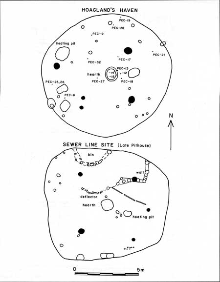
E.1. Early pithouses
excavated at Pecos National Historical Park (click on image for an enlargement in a new window)
|
|
|
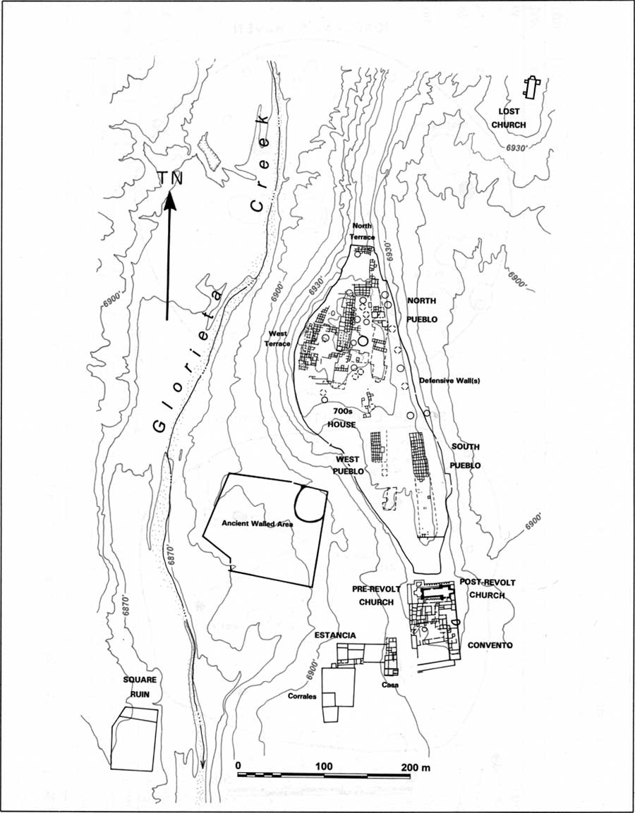
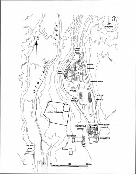
E.2. Layout of Pecos
Pueblo and the associated Spanish structures (click on image for an enlargement in a new window)
|

|
|
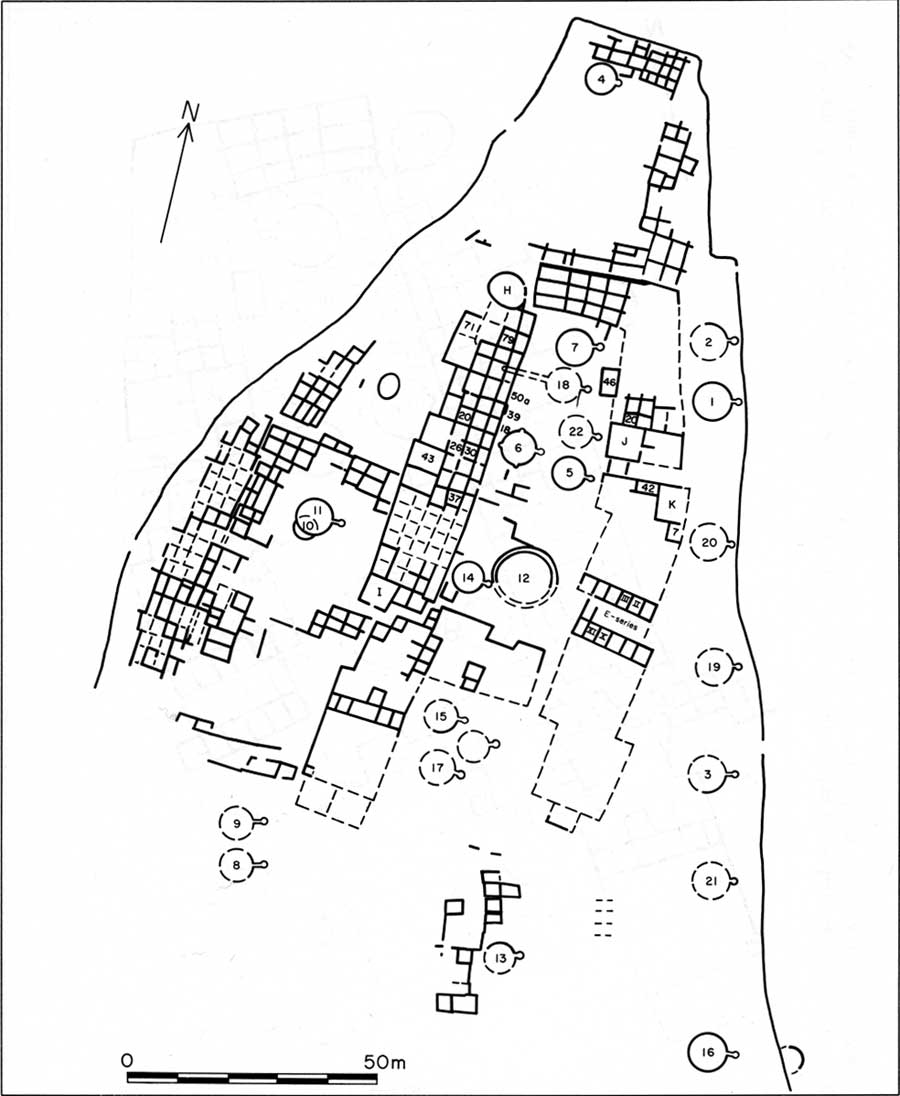
E.3. Plan of the Pecos
North Pueblo and the adjacent earlier structures to the north and
west (click on image for an enlargement in a new window)
|

|
|
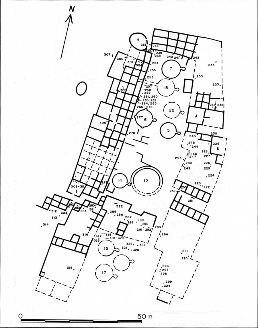
E.4. The North Pueblo and
the location of visible posts (click on image for an enlargement in a new window)
|

|
|
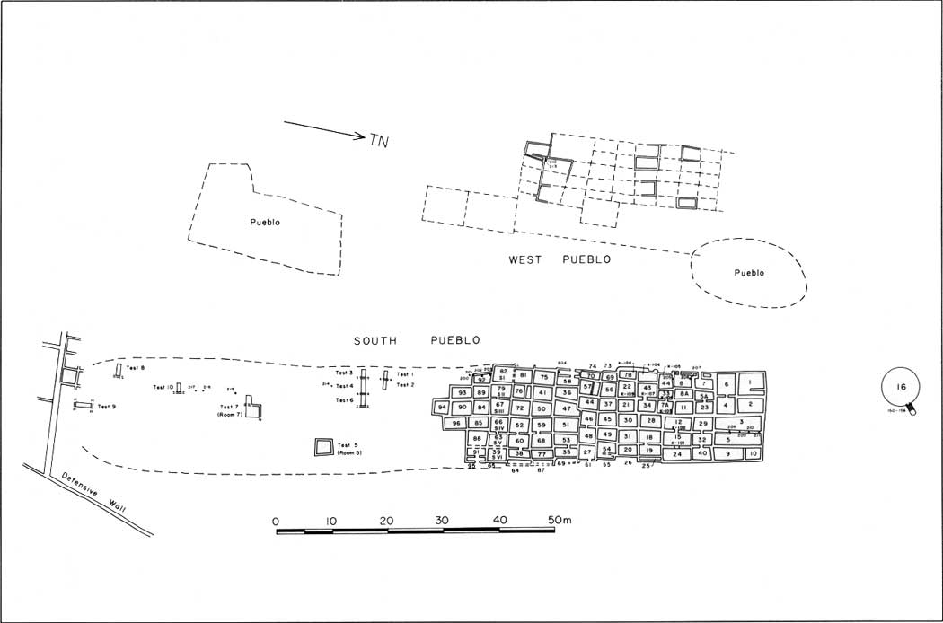
E.5. Plans of the South
and West Pueblos and the location of visible posts (click on image for an enlargement in a new window)
|
|
|
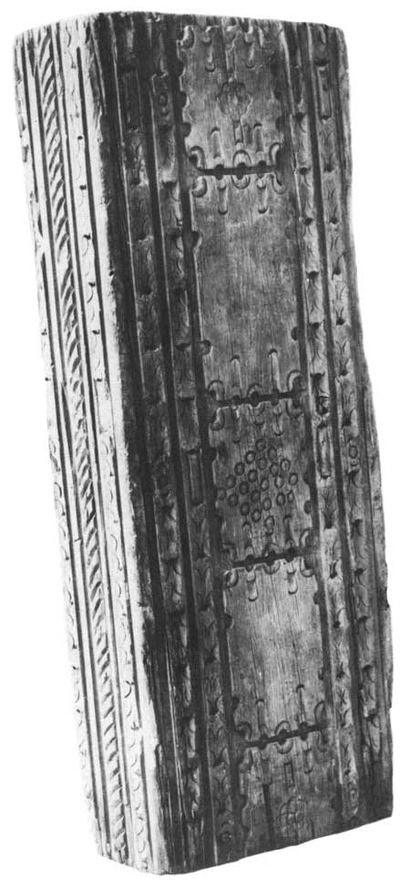
E.6. Section of a Pecos
Mission beam collected by Col. Luddington in 1869 while chief
quartermaster for the New Mexico Military District
|
peco/cris/appe2.htm
Last Updated: 13-Feb-2006
|