OZARK
Historic Resource Study
|

|
CHAPTER 6:
The Ozark Riverways and the "New
South": Hinterland Development and Exploitation, 1870-1920 (continued)
|
|
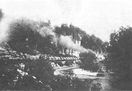
Figure 8. Log train of the Missouri Lumber and Mining Company running
parallel to Jacks Fork in Shannon County, c. 1910. Photographer
unknown. Norlin Library Western History Collection. University of
Colorado.
|
|
|
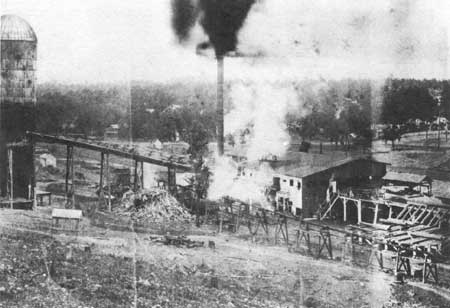
Figure 9. Fishertown mill of Ozark Land and Lumber Company. Photographer
and date of photograph unknown. State Historical Society of Missouri.
|
|
|
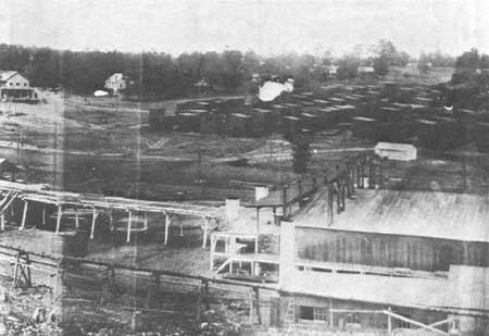
Figure 10. Ozark Land and Lumber Company lumber yard and mill at
Fisthertown. Photographer and date of photograph unknown. State
Historical Society of Missouri.
|

|
|
Figure 11. Interior of Fishertown mill. Photographer and date of
photograph unknown. State Historical Society of Missouri.
|
|
|
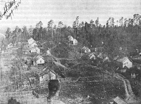
Figure 12. Some of the 475 houses provided by the Missouri Lumber and
Mining Company in Grandin. The houses rented for one dollar per room
per month, c. 1910. Photographer unknown. Ozark National Scenic
Riverways.
|
ozar/hrs/hrs6b.htm
Last Updated: 02-Mar-2005
|