|
OZARK
Historic Resource Study |

|
INTRODUCTION
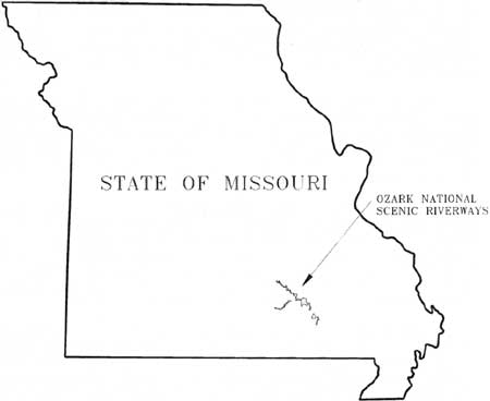
In 1964, the 2nd Session of the 88th Congress enacted and President Lyndon B. Johnson signed into law legislation establishing the Ozark National Scenic Riverways along 134 miles of the Current and Jacks Fork Rivers in southeast Missouri, to be administered by the National Park Service (NPS) of the U. S. Department of the Interior. Proponents of the park, as well as NPS Director George B. Hartzog, Jr., emphasized the recreation and wilderness value of the new area. Development and conservation interests wanted to boost the tourist trade and to preserve the free flow of the Current River and its natural resources. The cultural heritage of the Ozark upland and the many cultural resources of the area were little noticed until the new park began to inventory and to manage the properties. This Historic Resource Study interprets the settlement and development history of the region to aid in the management and interpretation of the cultural resources.
|
| Location of the Ozark National Scenic Riverways |
The Ozark upland stands as a "hilly island" from 500 to 2,000 feet above the plains between the Appalachian and Rocky Mountains. It spans approximately 60,000 square miles in four states: Missouri, Arkansas, Oklahoma, and Kansas. As a geographical region, the Ozarks evolved from a series of at least three crustal uplifts between 100 million and one million years ago. [1]
The Current and Jacks Fork rivers meander through the Courtois Hills, the most rugged landscape in the Missouri Ozarks. The hills rise at a steep grade 500 to 700 feet above the valley floors. Oak trees dominate the forested ridges and chert (flint) covers their limestone and dolomite surface and renders the upland soil infertile. In the Courtois Hills, the rivers and streams have eroded an intricate maze of narrow hollows and valleys between the steep ridges.
Large and small springs feed the swift flowing Current River. Geologists date the origins of the Current to the Cretaceous period some 60 to 120 million years ago. In the beginning, it flowed through an eroded peneplain where its winding channel developed. The Current, like many Ozark streams, maintained a meandering course during the crustal uplifts that created the hills over a long geologic time period. Inside the meander loops, sediment deposited by the river formed "gently inclined slipoff slopes" or terraces that Native American and European descendents favored as settlement sites. [2]
The Current River originates at Montauk Springs at an elevation of 1,000 feet above sea level and drops an average of five feet per mile to 250 feet at its mouth. Hundreds of springs empty into the Current and supply more than 60 percent of its water. They range in volume from a few gallons a day to an average of approximately 279 million gallons a day at Big Spring. A number of other springs daily pump more than 25 million gallons of water into the river. In the 1920s, the state of Missouri established parks at Big Spring and several other large springs, including Montauk, Round, and Alley springs, because of their natural scenic beauty. [3]
Development of the Current River region involved its growth as both a homeland and a hinterland. Homeland describes a place of one's native or longstanding residence. The river strongly influenced the nature of the homeland, for the geography in large part dictated the location of settlements and attracted a fiercely independent people content to live on the fringe of an increasingly complex civilization. The river and hilly landscape restricted settlements to the terraces above the floodplain (slip-off slopes) and hollows. Close-knit communities developed within the deep valleys or hollows, but the terrain, to a degree, isolated the populated hollows from one another. During the early American settlement, Scotch-Irish descendents brought a strong tradition of individualism and economic self-sufficiency to this Ozark river country.
A hinterland refers to an undeveloped area that supplies raw materials for trade or manufacturing in developed areas. For example, at the time of initial European exploration, Native Americans used the Ozark Courtois Hills as a hunting ground. The French and then Americans moved in, extracted lead, and searched for other minerals. In the late nineteenth century, large corporate commercial interests harvested much of the white pine timber. The extraction of the natural resources altered the homeland by increasing the population, introducing new transportation and communication technologies, depleting its resources, and in general reducing the area's isolation.
This study focuses on the enduring frontier character of the Current River homeland and how the hinterland dynamic has altered, but has not extinguished, the Ozark frontier. After a brief summary of the prehistoric occupation of the area and its importance in delineating the cultural landscape of the valley that remained significant throughout human history, the study examines the initial settlement of the Current riverway by white Americans and the subsequent adaptation of the homeland to the major forces of change: federal land policies, transportation innovations, corporate lumber development, and government intervention.
| <<< Previous | <<< Contents >>> | Next >>> |
ozar/hrs/hrs0b.htm
Last Updated: 02-Mar-2005