|
NATIONAL PARKS PORTFOLIO
|
GLACIER NATIONAL PARK
MAKING A NATIONAL PARK
 OW nature, just how many millions of years ago no
man can estimate, made the Glacier National Park is a stirring
story.
OW nature, just how many millions of years ago no
man can estimate, made the Glacier National Park is a stirring
story.
Once this whole region was covered with water, probably the sea. The earthy sediments deposited by this water hardened into rocky strata. If you were in the park to-day you would see broad horizontal streaks of variously colored rock in the mountain masses thousands of feet above you. They are discernible in the photographs in this book. They are the very strata that the waters deposited in their depths in those far-away ages.
How they got from the seas' bottoms to the mountains' tops is the story.
According to one famous theory of creation, the earth has been contracting through unnumbered cycles of time. Just as the squeezed orange bulges in places, so this region may have been forced upward. In fact, this is what must have happened at this particular spot. The geologist learns to accept such theories without question, for, though he cannot realize the vast periods of time and awful forces involved in a movement of this kind, the evidence of it is so plain that it is in contestable.
Under this incalculable pressure from its sides and below, the bottom of the sea gradually rose and became dry land. The pressure continued, and the earth's crust at this point, like the skin of the squeezed orange, bulged in long irregular lines. In time these became mountains.
|
|
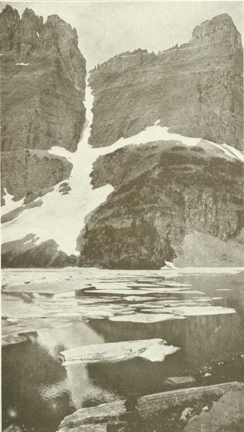
ICEBERG LAKE WHEN FLOES DRIFT IN AUGUST Photograph by Ellis Prentice Cole |
|
|
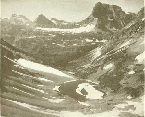
ONE OF THE WILDEST SPOTS ON EARTH IS PTARMIGAN LAKE Photograph by L. D. Lindsley |
Then, when the rocky crust could no longer stand the strain, it cracked.
Gradually the western edge of this great crack was forced upward and over the eastern edge. This relieved the internal pressure and the overlapping edge settled into its present position. Geologists call this process faulting. The edge that was forced over the other edge is called the overthrust.
The edge thus thrust over was four or five thousand feet thick. It crumbled into peaks, precipices, and gorges. It must have afforded a spectacle of sublime ruggedness, but without the transcendental beauty of to-day.
Upon, these mountains and precipices and into these gorges the snows and the rains of uncounted centuries of centuries have since fallen, and the ice and the frost and the rushing waters have carved them into the area of distinguished beauty which is to-day the American Switzerland.
To picture to yourselves this region, imagine a chain of very lofty mountains twisting about like a worm, spotted everywhere with snow fields, and bearing glistening glaciers.
Imagine these mountains crumbled and broken on their east sides into precipices sometimes four thousand feet deep and flanked everywhere by lesser peaks and tumbled mountain masses of smaller size in whose hollows lie the most beautiful lakes you have ever dreamed of.
|
|
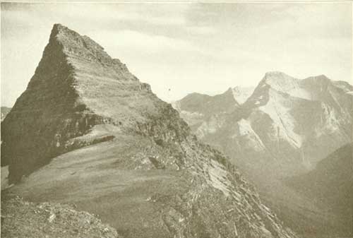
THE PEAK OF BLACKFEET MOUNTAIN IS TYPICAL OF GLACIER SCENERY Photograph by Fred H. Kiser, Portland, Oregon |
|
|
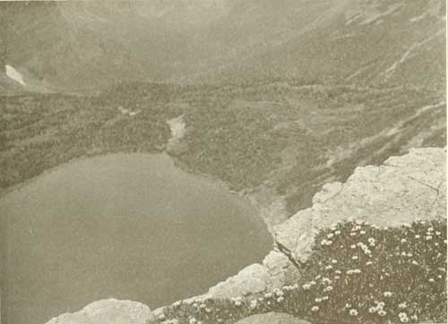
TWO THOUSAND FEET SHEER FROM FLOWERS TO LAKE Unnamed lake on new trail up the Triple Divide Photograph by H. T. Cowling |
|
|
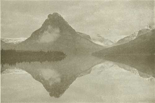
BIRTH OF A CLOUD ON THE SIDE OF MOUNT ROCKWELL Photograph by H. T. Cowling |
|
|
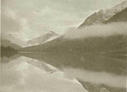
EARLY MORNING CLOUD-EFFECTS AT TWO MEDICE LAKE Romantic Rising-Wolf Mountain is seen in middle distance Photograph by H. T. Cowling |
|
|
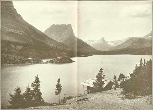
IT IS THE ROMANTIC, ALMOST SENSATIONAL MASSING OF EXTRAORDINARY SCENIC
ELEMENTS WHICH GIVES THE GLACIER NATIONAL PARK ITS MARKED INDIVIDUALITY Beautiful St. Mary Lake with Going-to-the-Sun Camp in the foreground. Citadel Mountain in left center, Fusillade Mountain to their right Photograph by Fred H. Kiser, Portland, Oregon |
| <<< Previous | <<< Contents>>> | Next >>> |
yard1/glac2.htm
Last Updated: 30-Oct-2009