
|
The North Cascades Study Report
|

|
THE NORTH CASCADES IN PICTURES (continued)
|
|
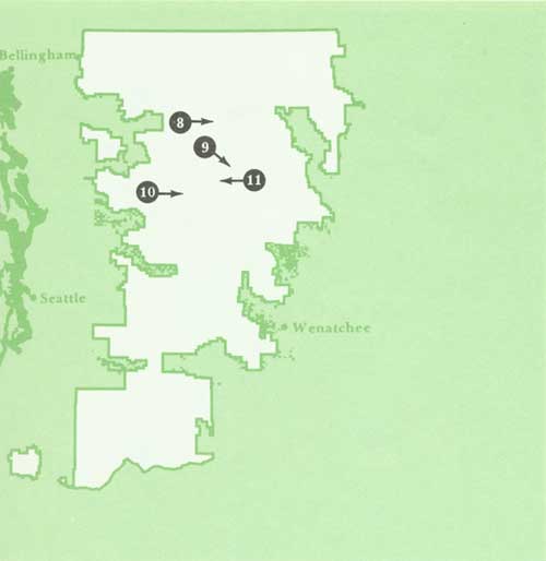
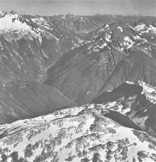
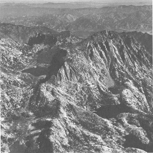
8. North Fork of the Cascade River. Cascade Pass in the V-notch just
above center. Forbidden Peak on the left. Hidden Lake in lower right.
Looking east. (photo FS 64-450)
|
|
|
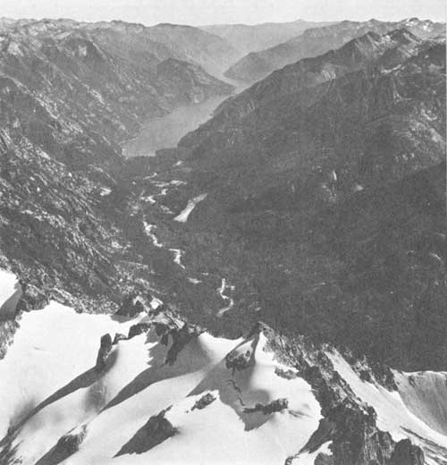
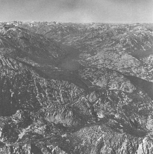
9. Looking southeast down the Stehekin River and Lake Chelan. (photo
FS 64-396)
|
|
|
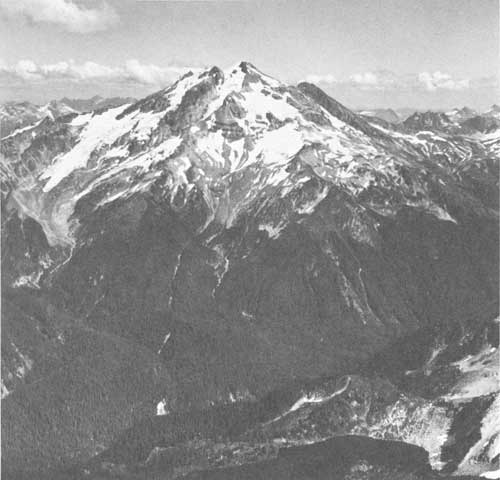
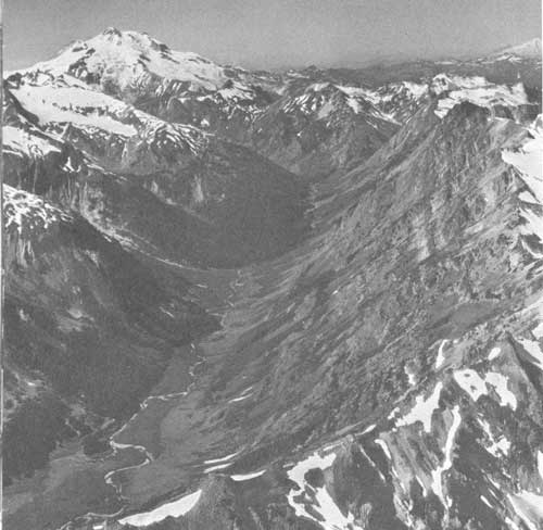
10. Looking east up the White Chuck River drainage to Glacier Peak
and the Glacier Peak Wilderness. (photo NPS 5307-88)
|

|
|
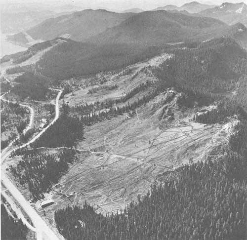
11. Looking west up Railroad Creek. Holden Mine dump in bottom of the
canyon. Glacier Peak Wilderness in the background. (Photo FS 64-383)
|
|
|
12. Looking north up Lake Chelan. Domke Lake is the small lake, center,
near the mouth of Railroad Creek. (photo FS 64-387)
|
|
|
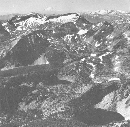
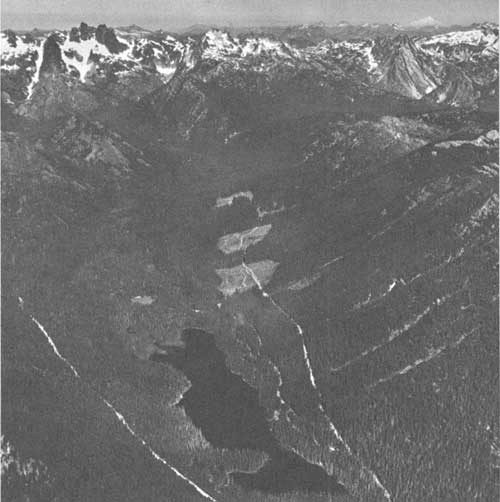
13. Napeequa River. Glacier Peak, center. Glacier Peak Wilderness,
Wenatchee National Forest. Looking northwest. (photo FS 64-375)
|
|
|
14. Eileen, Donald and Chiwaukum Lakes. Chiwaukum Mountains. Mount
Rainier in the distance. Wenatchee National Forest. Looking southwest.
(photo FS 64-363)
|
|
|
15. Enchantment Lakes in the Stuart Range. Temple Mountain, right.
Looking northeast across Wenatchee River Valley. (photo FS 64-310)
|
|
|
16. Cooper Lake on the Cooper River. Chimney Mountains in the background.
Looking northwest. Wenatchee National Forest. Timber harvesting in
irregular patches. (photo FS 64-330)
|
|
|
17. Snoqualmie Pass. Winter sports areas—Ski Acres, foreground, Hyack
Ski Area, distance. Keechelus Lake. Looking south. (FS 64-340)
|
|
|
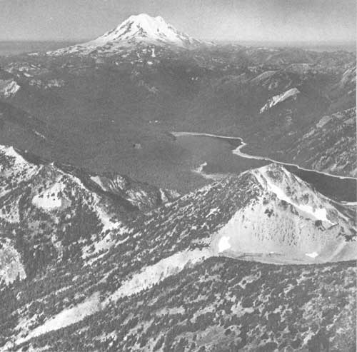
18. Looking west over Bumping River and Upper Bumping Lake to Mount
Rainier. (photo FS 64-457)
|
|
|
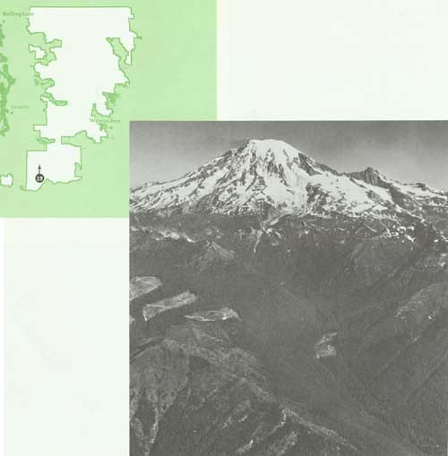
19. Looking north up Butter Creek to Mount Rainier. Dixon Mountain on
the left foreground and the Tatoosh Ranger in the right center. Timber
harvesting in irregular patches. (photo FS 64-466)
|
study_report/photos1.htm
Last Updated: 26-Mar-2010
|